Key Points
- Enfield Council has proposed a major new cycling and walking route linking Palmers Green and New Southgate in north London.
- The scheme follows a recently concluded public consultation and includes new segregated cycle lanes on busy roads such as Alderman Hill, Wilmer Way, and Bowes Road.
- Traffic-calming measures will be introduced on residential streets like Ashridge Gardens, Cranford Avenue, and Broomfield Avenue.
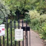
- The route utilises quieter residential streets, the boundary of the Fox Lane low-traffic neighbourhood (LTN), a cycle path through Arnos Park, and existing infrastructure along the A406 North Circular.
- A southbound bus gate is planned on Palmers Road near Arnos Grove Station, restricting general traffic but allowing buses, cyclists, and exempt vehicles.
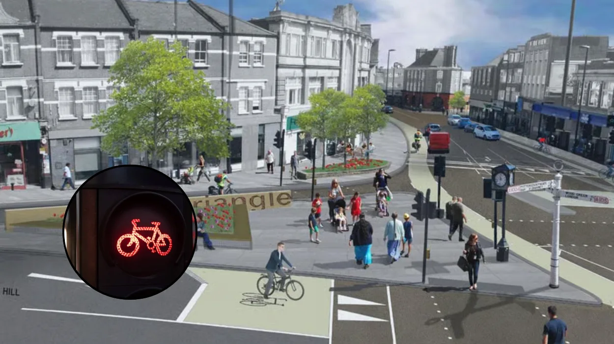
- Nine parallel crossings combining zebra and cycle crossings will be created.
- One bus stop at Arnos Grove Station will relocate to the west of the Palmers Road and Bowes Road junction.
- The project aims to create safer, greener streets, promote sustainable travel, reduce car reliance, and address issues like speeding, unsafe junctions, and lack of facilities, as stated on the council’s website.
- Coverage primarily from India Lawrence of Time Out London, published on Friday, 19 December 2025.
What Is the Exact Route of the New Cycle Link?
The route cleverly integrates existing and new infrastructure to form a cohesive path. It runs along the boundary of the Fox Lane low-traffic neighbourhood (LTN), extends to the Barnet border through a dedicated cycle path in Arnos Park, and leverages current cycling facilities on the A406 North Circular.
- Key Points
- What Is the Exact Route of the New Cycle Link?
- Which Specific Traffic-Calming Measures Are Proposed?
- Why Does Enfield Council Support This Cycling Initiative?
- How Was Public Input Incorporated into the Plans?
- What Challenges Might the Project Face?
- How Does This Fit into London’s Broader Cycling Strategy?
- What Are the Expected Environmental and Health Benefits?
- When Will Construction Begin and What Is the Timeline?
- Who Stands to Benefit Most from the New Route?
- What Happens Next for Enfield’s Cycle Network?
As detailed by India Lawrence of Time Out London, busy roads including Alderman Hill, Wilmer Way, and Bowes Road will feature fully segregated cycle lanes, physically separated from motor traffic. In contrast, other segments will employ ‘on-carriageway’ markings—painted lanes without barriers, integrating cyclists into the flow of traffic.
A key feature is the southbound bus gate on Palmers Road near Arnos Grove Station. According to Lawrence’s reporting, this measure would prohibit most general traffic while permitting buses, cyclists, and exempted vehicles to pass, effectively creating a bus- and bike-priority corridor.
Which Specific Traffic-Calming Measures Are Proposed?
Enfield Council plans a suite of interventions to slow vehicles and enhance pedestrian safety. Residential streets such as Ashridge Gardens, Cranford Avenue, and Broomfield Avenue will receive speed reduction features, including possible humps, cushions, or narrowed roadways.
India Lawrence of Time Out London reported that one bus stop at Arnos Grove Station will relocate westward from the Palmers Road and Bowes Road junction, improving access and reducing conflict points. Additionally, the council proposes nine parallel crossings throughout the route, merging traditional zebra crossings with cycle-specific facilities to allow simultaneous safe passage for walkers and riders.
These elements address longstanding local grievances, transforming high-risk areas into family-friendly zones.
Why Does Enfield Council Support This Cycling Initiative?
The council positions the project within a broader vision for sustainable urban mobility. On its official website, as quoted by India Lawrence in Time Out London, Enfield Council states:
“This route aims to create safer, greener, and more accessible streets, encouraging more people to walk, wheel, and cycle for everyday journeys.”
The statement continues:
“This project forms part of a wider network of walking and cycling routes across Enfield, supporting sustainable travel and reducing reliance on cars. It will help address local concerns such as speeding, lack of formal crossing facilities, lack of cycling facilities, and unsafe junctions, while creating opportunities for safer and more pleasant streets.”
Lawrence’s coverage underscores the initiative’s role in combating north London’s infrastructure deficits, where cyclists frequently navigate hazardous mixed-traffic environments.
How Was Public Input Incorporated into the Plans?
Public engagement has been central to the scheme’s evolution. Enfield Council recently concluded a consultation period, gathering feedback from residents, commuters, and stakeholders on the proposed designs.
While specific consultation outcomes remain pending full publication, India Lawrence of Time Out London noted that the process informed refinements to the route, ensuring it aligns with community needs. The council’s transparency in this phase signals a commitment to resident-led improvements, a model increasingly adopted in London’s active travel push.
What Challenges Might the Project Face?
Implementing such changes in a densely populated area invites scrutiny. Potential hurdles include construction disruptions, impacts on local businesses along affected roads, and resistance from motorists opposed to bus gates and LTN extensions.
India Lawrence’s Time Out London piece implicitly acknowledges these tensions by framing the news positively yet realistically, emphasising benefits for the majority while noting the shift from car dominance. Enfield Council’s focus on exemptions for essential vehicles may mitigate backlash, but final approvals will hinge on balancing active travel gains against vehicular access.
No conflicting reports from other media were identified in available coverage, suggesting broad alignment on the facts.
How Does This Fit into London’s Broader Cycling Strategy?
This Enfield proposal aligns with Transport for London’s (TfL) ambitions under the Mayor’s Transport Strategy, which targets 15-minute neighbourhoods and doubled cycling rates by 2030. By connecting stations and parks, it bolsters the Quietway network, complementing high-profile routes like Cycleway 1.
As India Lawrence observed in Time Out London, the plan caters to casual riders and e-bike enthusiasts, potentially inspiring similar schemes borough-wide. It also intersects with the Fox Lane LTN, part of a wave of trial neighbourhoods credited with slashing traffic volumes and boosting local cycling.
What Are the Expected Environmental and Health Benefits?
Shifting commuters from cars to bikes promises substantial gains. Reduced vehicle emissions would lower air pollution in an area bordered by the North Circular, a notorious smog hotspot. Health-wise, safer routes could encourage daily exercise, tackling London’s obesity and inactivity epidemics.
Enfield Council’s website, cited by India Lawrence, explicitly links the project to greener streets and car reduction. Independent studies, such as those from Cycling UK, corroborate that segregated lanes increase ridership by 50% or more, amplifying these impacts.
When Will Construction Begin and What Is the Timeline?
Details on timelines remain preliminary, as plans await cabinet approval following consultation analysis. India Lawrence of Time Out London reported the announcement on 19 December 2025, positioning it as a post-consultation reveal, with implementation likely in 2026 pending funding.
Enfield Council has not specified costs, but similar LTN and cycle schemes typically range from £1-5 million per kilometre, funded via TfL grants. Residents can expect updates via the council’s highways portal.
Who Stands to Benefit Most from the New Route?
Cyclists of all levels—from commuters dodging North Circular chaos to families exploring Arnos Park—will gain the most. Pedestrians benefit from crossings and calmed streets, while bus users appreciate priority gates.
As Lawrence colourfully put it in Time Out London, this aids “Lime bikers and Tadej Pogačar wannabes,” referencing the Tour de France star and evoking accessible, aspirational cycling. Wheelchair users and delivery riders also stand to thrive in the inclusive design.
What Happens Next for Enfield’s Cycle Network?
Approval would integrate this link into Enfield’s expanding web of paths, potentially extending to neighbouring Barnet. India Lawrence’s reporting frames it as “huge” for north London, hinting at ripple effects.
Stakeholders urge swift action amid national active travel funding uncertainties post-election. Enfield residents can engage via council meetings, ensuring the voice that shaped the consultation endures.