Chipping Barnet, commonly known as Barnet, is an ancient suburban market town in North London with a heritage dating back to the twelfth century. Located 10.5 miles north of Charing Cross, this high-elevation settlement grew at a critical junction of the Great North Road. It is the site of major medieval conflicts, legal assemblies, and early transport infrastructure. Visitors can explore a wealth of preserved landmarks that define the historical landscape of the region.
- Which Historical Sites Can You Visit in Barnet?
- What is the History of the Battle of Barnet Site?
- The Wars of the Roses Context
- The 1471 Campaign and Military Deployment
- Tactical Engagement in the Fog
- Aftermath and Historical Significance
- Where Can You View Historic Architecture in Barnet?
- How Can Visitors Access Barnet’s Heritage Attractions?
- Why is Barnet’s Local History Relevant Today?
Which Historical Sites Can You Visit in Barnet?
You can visit several key historical sites in Barnet, including the iconic Hadley Highstone, the fifteenth-century Monken Hadley Church, the extensive collections at Barnet Museum, the historic Hadley Green, and the ancient St John the Baptist Church.
Hadley Highstone
Hadley Highstone is an eighteenth-century stone monument erected to mark the traditional site of the Battle of Barnet. Sir Jeremy Sambrook erected the obelisk in 1740 to commemorate the historic clash that occurred on Easter Sunday, 14 April 1471. The monument stands at the junction of the A1000 Great North Road and Dury Road, signifying the northernmost limits of the core conflict zone.
The stone pillar serves as a permanent physical reminder of the Wars of the Roses, a thirty-year civil conflict between the royal Houses of York and Lancaster. The inscription on the monument details the death of Richard Neville, Earl of Warwick, who was known historically as the “Kingmaker”. Travelers can easily view the monument from the public footpath, making it an ideal starting point for a self-guided heritage walk through Monken Hadley.
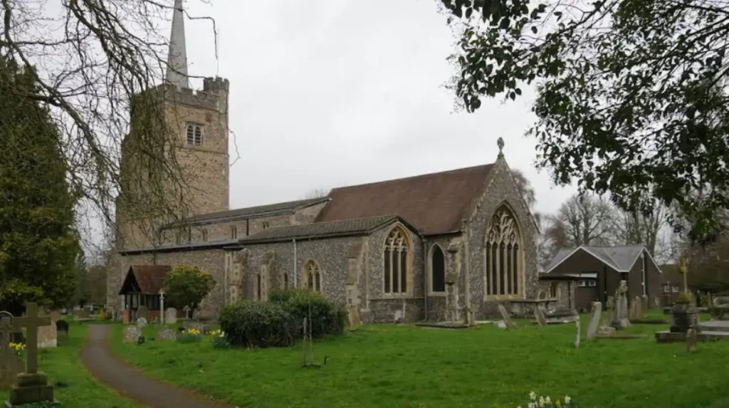
Monken Hadley Church
Monken Hadley Church, formally known as the Church of St Mary the Virgin, is a Grade II* listed medieval parish church built in its current flint-stone structure during the late fifteenth century. A small chapel existed on the site as early as 1307, matching the dimensions of the modern chancel. The main structure visible today features the date 1494 carved in Arabic numerals above the west door.
The church architecture represents the Late Perpendicular Gothic style. Its prominent Western tower contains an ironstone stair turret topped by an authentic copper fire beacon, or cresset. This beacon was historically lit to guide travelers navigating the dangerous, unlit expanses of Enfield Chase and the Great North Road. Famed Victorian architect George Edmund Street undertook a major internal restoration of the building between 1848 and 1850, raising the chancel floors.
Barnet Museum
Barnet Museum is a local history repository located at 31 Wood Street within the designated Wood Street conservation area. The museum occupies an early Georgian terraced house and has operated since March 1938. It was established by the Barnet Record Society to preserve the social, industrial, and military archaeology of Chipping Barnet, East Barnet, New Barnet, Hadley, and Arkley.
The permanent collections cover artifacts spanning from the Bronze Age through the mid-twentieth century. Key exhibits focus on the 1471 Battle of Barnet, featuring medieval weaponry displays, historical banners, and topographical maps of the battlefield. The museum also houses specialized archives, including the original nineteenth-century diaries of Benjamin Woodcock, the master of the Barnet Union Workhouse from 1836 to 1838.
Hadley Green
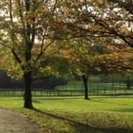
Hadley Green is a triangular expanse of common land situated roughly one mile north of Chipping Barnet town centre. The green remains largely intact from its medieval boundaries and is framed by traditional Georgian residential architecture. English Heritage identifies this plateau as a primary tactical deployment zone during the Wars of the Roses.
The open heathland of Hadley Green provided the stage for the early morning engagements of the Battle of Barnet. King Edward IV deployed his Yorkist forces along the southern edge of the green, directly opposing the Lancastrian lines positioned across the northern ridge near Monken Hadley Church. Today, the green is freely accessible to the public, offering walking paths that trace the evolutionary landscape of the ancient battlefield.
St John the Baptist Church
St John the Baptist Church is an iconic ecclesiastical landmark positioned prominently at the highest geographic point of Barnet High Street. The current structure dates primarily to a comprehensive rebuild in the fifteenth century, though historical records confirm a church stood on the site in the twelfth century. The building features a distinctive grey flint and stone exterior with a large square tower overlooking the historic market square.
The church played a central role in the daily life of the medieval market town, acting as a sanctuary and meeting place. During the Battle of Barnet, the churchyard and its immediate surroundings sat directly behind the advancing Yorkist rear guards. Architect William Butterfield executed an extensive expansion and restoration of the nave and aisles in 1875, ensuring the structural preservation of its medieval core while accommodating a growing Victorian congregation.
What is the History of the Battle of Barnet Site?
The history of the Battle of Barnet site centers on the decisive Wars of the Roses battle fought on 14 April 1471, where King Edward IV secured a major Yorkist victory and eliminated the powerful rebel leader Richard Neville.
The Wars of the Roses Context
The Battle of Barnet was a critical turning point in the Wars of the Roses, a dynastic civil conflict lasting from 1455 to 1485. The war pitted the House of York, represented by the white rose emblem, against the House of Lancaster, represented by the red rose. The conflict emerged from a systemic breakdown of royal authority under the Lancastrian King Henry VI, leading to violent competing claims for the English crown.
Richard Neville, Earl of Warwick, originally served as the principal military strategist for the Yorkist faction. He successfully helped his cousin, Edward IV, seize the throne from Henry VI in 1461. However, strategic disagreements over foreign policy—specifically Edward’s preference for a Burgundian alliance over Warwick’s proposed French alliance—fractured their political relationship. Warwick defected to the Lancastrians in 1470, driving Edward IV into temporary European exile and restoring Henry VI to power.
The 1471 Campaign and Military Deployment
Edward IV returned to England in March 1471, landing at Spurn Head in Yorkshire with a force of roughly two thousand men. He marched rapidly south to reclaim London, where he successfully captured Henry VI and held him hostage inside the Tower of London. Warwick marched his own forces south from Coventry to intercept the King, utilizing the Great North Road as his main logistical highway.
The two armies converged on the high ground north of Barnet village on the evening of 13 April 1471. Warwick deployed a force of 13,000 to 15,000 men along a ridge stretching from Monken Hadley Church westward across what is now the Old Ford Manor Golf Course. Edward IV arrived under the cover of darkness with 10,000 to 13,000 troops, positioning them dangerously close to the Lancastrian lines to minimize the effectiveness of Warwick’s heavy artillery overnight.
Tactical Engagement in the Fog
The battle commenced at approximately 5:00 AM on Easter Sunday, 14 April 1471, under a dense, blinding morning fog that severely restricted battlefield visibility. Because the armies had deployed in the dark, their lines were misaligned. The Lancastrian right flank, commanded by the Earl of Oxford, completely outflanked the Yorkist left, causing the Yorkist soldiers to break and flee south toward Chipping Barnet town center.
Concurrently, the Yorkist right flank, commanded by the King’s brother Richard, Duke of Gloucester (later King Richard III), successfully outflanked the Lancastrian left. The fog caused complete tactical confusion. When the Earl of Oxford’s victorious troops returned to the center of the battlefield from their pursuit, their own Lancastrian allies mistook Oxford’s “Star with Streams” heraldic badge for Edward IV’s “Sun in Splendour” emblem. The Lancastrians opened fire on their own men, triggering cries of treason and causing a total collapse of the Lancastrian lines.
Aftermath and Historical Significance
The Battle of Barnet lasted roughly four hours and resulted in an estimated 1,000 casualties. The Earl of Warwick was killed while attempting to flee the battlefield toward his horses in the local woods. His brother, Lord Montagu, also perished during the chaotic retreat. The bodies of both Neville brothers were subsequently displayed publicly at St Paul’s Cathedral in London to confirm their deaths to the populace.
The Yorkist victory at Barnet permanently broke the power of the “Kingmaker” and directly paved the way for Edward IV’s final decisive triumph at the Battle of Tewkesbury a few weeks later. As you explore the modern site, you are crossing land with a deep heritage. Read about the full [Battle of Barnet 1471 Historic Conflict] to understand its origins. Today, it remains the only officially registered historic battlefield located within the boundaries of Greater London.
Where Can You View Historic Architecture in Barnet?
You can view historic architecture along Wood Street and Barnet High Street, featuring a preserved collection of early Georgian residential terraces, medieval church flintwork, timber-framed coach inns, and nineteenth-century civic infrastructure.
The Wood Street Conservation Area
The Wood Street conservation area contains one of the highest concentrations of Grade II listed historic buildings in North London. Running west from the main High Street intersection, Wood Street retains its traditional linear eighteenth-century layout. The architecture is dominated by red-brick Georgian facades featuring multi-pane sash windows, timber door cases, and parapet rooflines.
Notable structures include the home of the Barnet Museum at 31 Wood Street, an excellent example of mid-eighteenth-century domestic architecture. Further down the street sit the historic Church House and the architectural remains of the local almshouses founded in the seventeenth century. These structures highlight the transition of Barnet from an agrarian settlement into a prosperous residential enclave for London merchants.
High Street Coaching Inns and Commercial Buildings
Barnet High Street showcases unique structural elements derived from its history as the first major coaching stop on the Great North Road. During the seventeenth and eighteenth centuries, up to 150 stagecoaches passed through the town daily, requiring vast stables and hospitality infrastructure. Several commercial premises still retain the carriage archways and long timber-framed rear yards characteristic of coaching inns.
Buildings such as the Mitre Inn, located just off the high street, display architectural roots dating back to the Tudor period. The structural layout features low-ceilinged timber framing covered by later brick skins added during the Georgian modernization campaigns. This architectural layer illustrates the economic boom generated by the transit trade and the famous Barnet Horse Fair, chartered by King King Henry II in 1188.
How Can Visitors Access Barnet’s Heritage Attractions?
Visitors can access Barnet’s heritage attractions using the London Underground Northern Line to High Barnet Station, traveling via local Transport for London bus networks, or walking along public footpaths from Chipping Barnet town centre.
Public Transport Connections
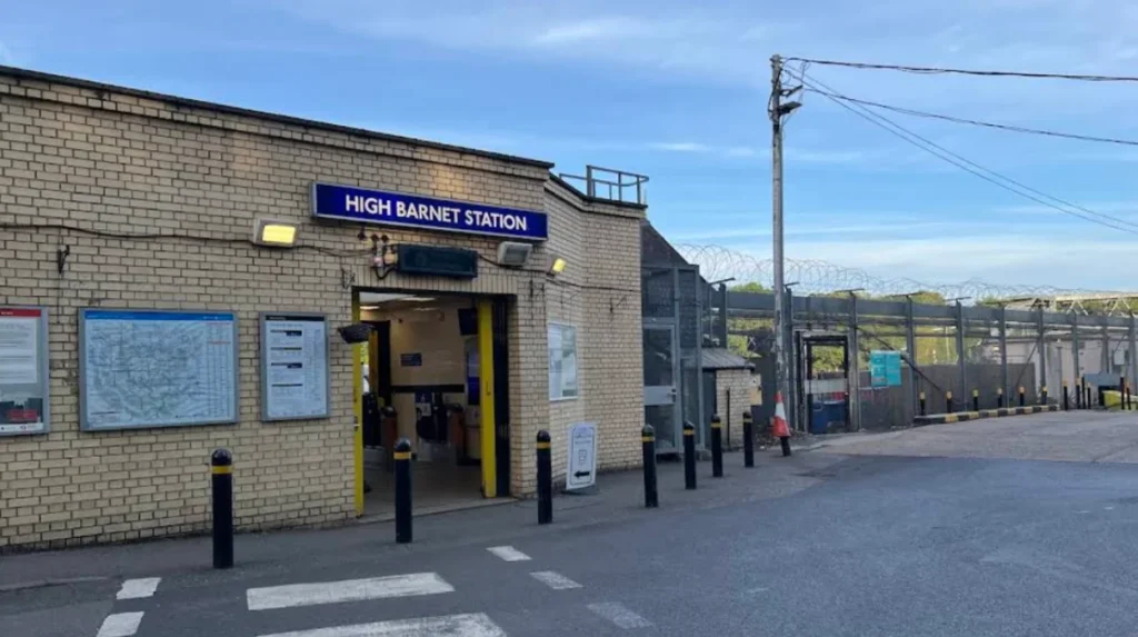
High Barnet Station serves as the northern terminus of the High Barnet branch of the Northern Line (Zone 5). The station sits at the bottom of Barnet Hill, approximately a 10-minute uphill walk from St John the Baptist Church and the main town centre. Trains run directly to and from Central London stations, including King’s Cross St Pancras and Bank, at intervals of 3 to 6 minutes throughout the day.
For secondary transit, Transport for London operates several bus routes directly through the historic corridor. Routes 34, 84, 107, 184, 234, 263, and 307 stop along Barnet High Street and provide direct links to outlying historic sites. Route 34 connect eastward to New Barnet, while Route 84 runs north past Hadley Green and the Hadley Highstone monument.
Pedestrian and Self-Guided Walking Routes
The majority of Barnet’s historical landmarks are situated within a compact, pedestrian-friendly geographic zone. A continuous 1.5-mile heritage walking trail connects the central town sites to the northern battlefield boundaries. The route begins at St John the Baptist Church, moves west along Wood Street to visit the Barnet Museum, and then tracks north through the tree-lined avenues of Hadley Green.
Pedestrians can safely navigate this trail via paved footpaths that are fully accessible to families, leisure travelers, and business commuters maximizing downtime. Public maps and interpretive information boards are maintained by local historical societies at key locations across Hadley Green and the Monken Hadley parish boundaries.
Why is Barnet’s Local History Relevant Today?
Barnet’s local history is relevant today because it preserves England’s medieval military legacy, shapes North London’s urban layout, protects critical green belt conservation areas, and drives regional educational tourism.
Conservation of the Green Belt and Urban Boundary
The historical geography of the Battle of Barnet and the surrounding common lands directly influenced modern spatial planning laws. Hadley Green, Monken Hadley Common, and the Old Ford Manor lands were historically protected from enclosure by ancient agricultural grazing charters. This historic legal status ensured their integration into the metropolitan green belt system during the twentieth century.
These protections prevent urban sprawl from consuming the unique landscape of the northern border of Greater London. The open topography mentioned in fifteenth-century military logs remains recognizable to modern historians and surveyors. This environmental preservation guarantees that residents and digital nomads have permanent access to preserved ecological spaces alongside historical architecture.
Educational and Community Extraction Value
The dense concentration of documented archives at the Barnet Museum serves as a vital benchmark for academic research and family lineage tracking. Local volunteer groups regularly update historical databases, digitizing records from the historic Barnet Workhouse and ancient market courts. This work provides educational materials for schools across the London Borough of Barnet.
The preservation of these physical sites supports an active schedule of reenactments, heritage walks, and commemorative events. By maintaining clear, tangible connections to foundational national events like the Wars of the Roses, Barnet reinforces its community identity. It transitions from a simple transit suburb into an authoritative hub for domestic historical tourism.
What are the most important historical sites in Barnet?
The most important historical sites in Barnet include Hadley Highstone, Monken Hadley Church, Barnet Museum, Hadley Green, and St John the Baptist Church. These landmarks preserve the area’s medieval, religious, and military heritage.