Barnet offers 10+ outstanding walking routes and nature trails, including the 10-mile Dollis Valley Greenwalk, 413-acre Trent Country Park, and ancient woodland Coppetts Wood. Tourists and residents enjoy scenic countryside routes, wildlife-rich nature reserves, and long-distance walks like the London Loop and upcoming 17-mile Barnet Loop.
- What Is the Dollis Valley Greenwalk and How Do You Walk It?
- Key Sections and Distances
- Trail Features and Accessibility
- Wildlife and Natural Features
- Where Is Trent Country Park and What Walking Routes Does It Offer?
- Walking Routes Within the Park
- Adjacent Walking Opportunities
- Access and Facilities
- What Are the Best Nature Reserves for Wildlife Walking in Barnet?
- Coppetts Wood Nature Reserve
- Hadley Green
- Totteridge Fields
- How Do You Walk the London Loop Through Barnet?
- What Is the Barnet Loop and When Will It Open?
- Which Short Walking Routes Are Best for Families and Quick Outings?
- Where Can Digital Nomads and Business Travellers Find Work-Friendly Walking Hubs?
- What Are the Best Walking Routes for Wildlife Photographers?
- How Do I Access Barnet’s Walking Trails by Public Transport?
- What Safety and Preparation Tips Should Walkers Follow?
Barnet is London’s largest borough by green space, covering 8,700 hectares with over 300 parks and open spaces. The borough contains 22 nature reserves, 16 woodlands, and multiple long-distance walking trails. This comprehensive guide covers every major walking route and nature trail, with exact distances, accessibility details, wildlife information, and practical visitor tips for tourists, residents, digital nomads, and business travellers.
What Is the Dollis Valley Greenwalk and How Do You Walk It?
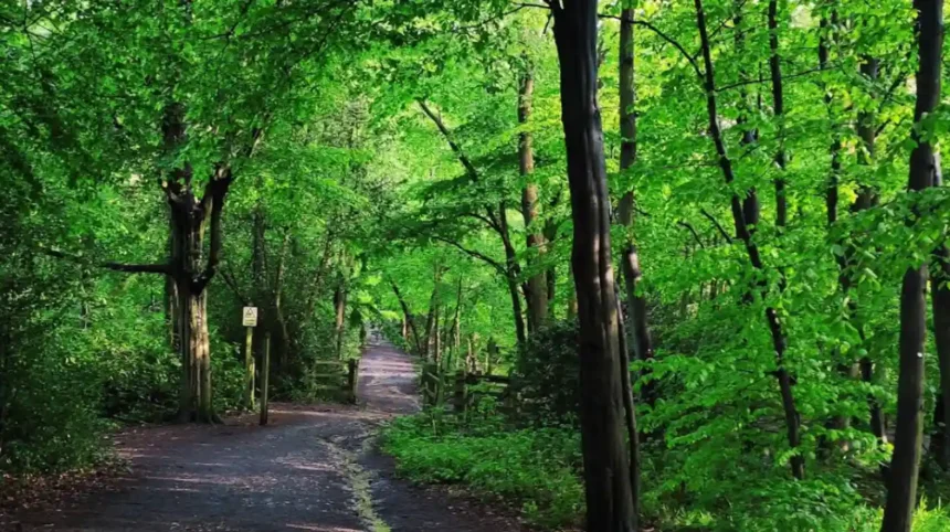
The Dollis Valley Greenwalk is a 10-mile (16 km) riverside trail from Mill Hill Broadway to Hampstead Heath, taking 3–6 hours depending on pace. It follows the Dollis Brook through ancient woodlands, nature reserves, and open countryside, with sections suitable for cycling.
The Dollis Valley Greenwalk spans the full breadth of Barnet’s northern countryside. The trail begins at Mill Hill Broadway (near Waitrose, N12 8NR) and terminates at the northern fringes of Hampstead Heath in Camden. The route rises near Arkley, where the Dollis Brook originates, then meanders southwards through distinct habitats before reaching Welsh Harp (Brent Reservoir).
Key Sections and Distances
The full walk divides into eight manageable sections. The southern section from Mill Hill to North Finchley Town Centre takes 10 minutes walking from the town centre. The complete 10-mile journey takes up to 6 hours for steady walkers.
Section 1: Mill Hill to North Finchley (2 miles, 45 minutes)
Starts at Mill Hill Broadway, passes through open spaces near the town centre, and reaches North Finchley. This section features surfaced paths suitable for cycling.
Section 2: North Finchley to Totteridge Fields (3 miles, 1.5 hours)
Crosses the Dollis Valley Green Walk past Old Boys sports club, enters Totteridge Fields via double gates, and follows the brook alongside plank bridges. The path runs through Darlands Nature Reserve.
Section 3: Totteridge Fields to Moat Mount (3 miles, 1.5 hours)
Passes Barnet Gate Wood (one of the main Dollis Brook sources), crosses farmland near Mote End Farm, and emerges at Moat Mount Open Space with wide views. The final stretch traverses historic Moat Mount estate woods with rhododendrons and giant redwoods.
Section 4: Moat Mount to Hampstead Heath (2 miles, 1 hour)
Continues through historic Moat Mount estate woods, passes overgrown ornamental gardens, and reaches Hampstead Heath’s northern fringes.
Trail Features and Accessibility
The trail covers 7.2 miles (moderate hike) with 889 ft elevation gain between Dollis Valley and West Finchley, taking 3–3.5 hours. Most sections between Mill Hill and Whetstone feature surfaced paths suitable for cycling. The route west toward Moat Mount passes through fields and countryside with unpaved sections.
The main entrance to Moat Mount Open Space is at the permanently closed Moat Mount car park on Barnet Way (A1, NW7 4HJ), one mile south of Stirling Corner. Additional entrances exist from Mill Hill County High School back, Barnet Road near Stirling Corner, Hendon Wood Lane along the Greenwalk and London Loop, and Bedford Road.
Wildlife and Natural Features
The Dollis Brook rises near Arkley and meanders gently southwards, subjected to great changes by human activities over time. Barnet Gate Wood at Hendon Wood Lane, Arkley (NW7 4HT) is a 4.09-hectare woodland remnant and one of the main Dollis Brook sources. The woodland winds around the borough to reach Welsh Harp (Brent Reservoir).
Totteridge Fields covers approximately 97 hectares (240 football fields) and is a Site of Metropolitan Importance for Nature Conservation (SINC). About seven hectares is a Local Nature Reserve owned by Barnet Council and managed by London Wildlife Trust. The area features traditional English countryside with old hedgerows, grassland, and teeming bee life in spring and summer.
Moat Mount woodland grew from ornamental woods planted over two centuries ago for Moat Mount House. Native species include exotic conifers such as swamp cypress and giant redwood—two of the biggest species in the world. A tree trail around the open space takes 45 minutes to complete. The site features a large ornamental pond called the ‘Leg of Mutton’, well known for freshwater mussel size.
Where Is Trent Country Park and What Walking Routes Does It Offer?
Trent Country Park spans 413 acres (167 hectares) with varied woodlands, lakes, meadows, and habitats, offering red and yellow marked walking routes. The park draws over 1 million visitors annually and includes a cafe, wildlife rescue centre, museum, tea rooms, and Go Ape North London.
Trent Country Park is a scenic, well-kept former estate in Cockfosters, North London, within the M25. The park comprises 413 acres of varied woodlands, lakes, meadows, and other habitats with a heritage landscape. It draws over a million visitors yearly.
Walking Routes Within the Park
Follow the red or yellow walking route, marked by posts in the park, to see less-busy parts of the beautiful park. The 3.3-mile (5.4 km) walking route near Cockfosters has 246 ft elevation gain and is rated easy, taking approximately 2 hours 1 minute.
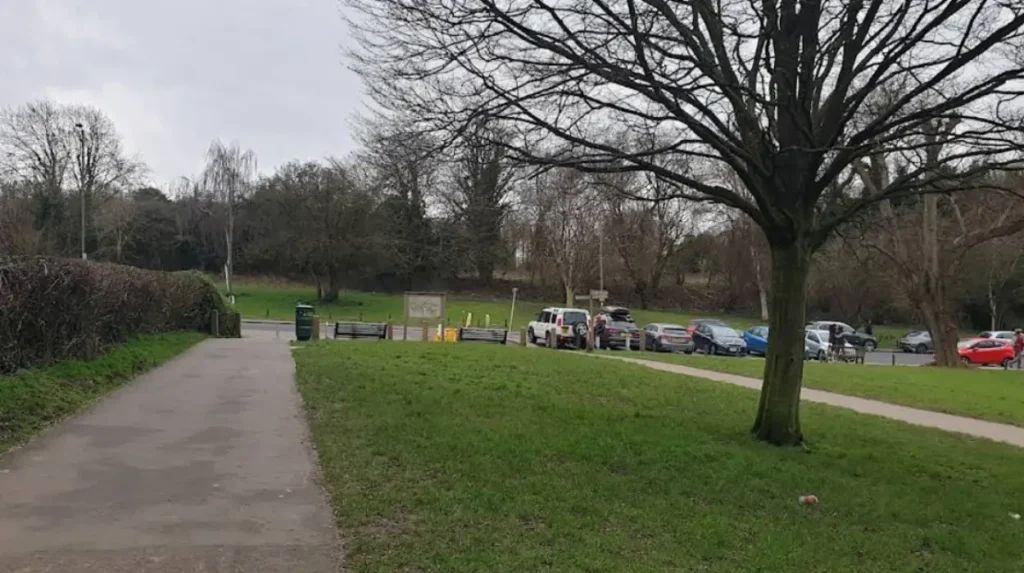
Paved paths exist particularly from the main entrance to the mansion and from Snakes Lane. Most walking occurs through open pasture and woods. Car parks and toilets are available.
Opening times: Trent Country Park is open every day from 08:00 am Monday to Saturday and 08:30 am on Sunday. Closing times vary according to seasons.
Adjacent Walking Opportunities
The Enfield Society produced two leaflets describing walks likely of interest to Trent Park users. The Merryhills Way provides a walk through beautiful countryside at Vicarage Farm into Trent Park, passing through a historic WWII anti-airbook gunsite and large wildlife site.
From the Ridgeway at Fairview Road, this footpath combines with paths through Trent Park valley, returning via the ‘Enfield Chase Restoration Project’ at Salmons Brook in a satisfying 5–6 mile walk dubbed ‘The Three Valleys Walk’. These leaflets download for printing from the Enfield Society website.
Access and Facilities
Parking is available near the three road entrances. The park is easily accessible from Oakwood or Cockfosters Stations and by bus, bike, or foot. The park includes a cafe, wildlife rescue centre with museum, tea rooms, and Go Ape North London activities.
What Are the Best Nature Reserves for Wildlife Walking in Barnet?
Barnet contains 22 nature reserves including Coppetts Wood (14.5 hectares, ancient woodland), Hadley Green (10 hectares, acid grassland), and Totteridge Fields (97 hectares, SINC), each offering easy nature trails, bird activity, and diverse plant species.
The London Borough of Barnet, on London’s northern outskirts, is mainly residential but has large areas of green space and farmland. The borough contains 22 nature reserves with varied habitats.
Coppetts Wood Nature Reserve
Coppetts Wood Nature Reserve is an ancient woodland with rich flower diversity and a wide range of tree species and ages. Plenty of bird activity and easy nature trails exist throughout. The reserve is located at Porters Way, London, N12 0RF.
Coppetts Wood and Scrublands is a 14.5-hectare (36-acre) Site of Borough Importance for Nature Conservation, Grade I, between Muswell Hill and Friern Barnet. The site was declared a Local Nature Reserve in 1997. Access is free from Colney Hatch Lane and the North Circular Road.
Coppett’s Wood is secondary woodland with a canopy dominated by pedunculate oak and hornbeam, with smaller quantities of other trees. The shrub layer consists of hazel, hawthorn, holly, elder, and elm. A small pond exists in the northwest corner.
An east-west track divides Coppetts Wood into north and south wood. The North Wood is more open and makes the perfect site for the popular annual festival. Some plants, insects, and animals have not been recorded anywhere else in Barnet or anywhere else in London north of the Thames River.
The organisation with legal responsibility for Coppetts Wood Nature Reserve is Barnet Greenspaces, Barnet council.
Hadley Green
Hadley Green is a 10-hectare (25-acre) Site of Metropolitan Importance for Nature Conservation in Hadley. The reserve straddles the Great North Road between Hadley Green Road and Fold Lane.
It is an area of acid grassland interspersed with trees, with several ponds. The acid grassland, ditches, and ponds have several regionally rare plant species. The invertebrate fauna include eleven species of dragonflies and damselflies.
Hadley Green is reputedly the site of a decisive battle in the Wars of the Roses, the Battle of Barnet in 1471. The land is a traditional village common grazed by villagers’ animals for hundreds of years until the 20th century. It was secured for the people of Hadley parish as public open space in 1818.
The London Loop long-distance walk goes through the reserve, and it adjoins King George’s Fields.
Totteridge Fields
Totteridge Fields is loved by bees and teems with life every spring and summer. Part of one of London’s last remaining tracts of traditional English countryside within London’s leafy northern fringe, the area is a beautiful place for spring or summer walks.
Best time to visit: April to July. Opening times: open at all times. The site is part of a Site of Metropolitan Importance for Nature Conservation, Metropolitan Green Belt, and Local Nature Reserve.
Two popular walking paths—the Dollis Valley Greenwalk and the London Loop—cross right through Totteridge Fields. This means visitors enjoy beautiful scenery while exercising. It’s a perfect spot for nature walks with friends or family.
You can find the entrance on Hendon Wood Lane, near Arkley.
How Do You Walk the London Loop Through Barnet?
The London LOOP is a 150-mile (242 km) circular walk around London, made up of 24 mostly flat or gently sloping sections. Section 17 (Cockfosters to Enfield Lock) passes through Barnet, combining beautiful open spaces with historic buildings.
Taking the London LOOP is a great way to get to know London better. The route combines beautiful open spaces like Hainault Forest Country Park and Bushy Park with historic buildings including Hall Place and Black Jack’s Lock & Mill.
Detailed walk guidance for all sections, including maps, is on the Ramblers’ ‘Walking the LOOP’ web page. The route is also available on the Go Jauntly app.
Section 17 runs from Cockfosters to Enfield Lock, passing through Barnet’s countryside. The trail takes you through Hadley Wood and across Monken Hadley Common, the site of the decisive Battle of Barnet in 1471 during the Wars of the Roses.
What Is the Barnet Loop and When Will It Open?
The Barnet Loop is a planned 17-mile (27 km) circular trail around the borough for recreational walking, running, cycling, and wheeling. The loop will pass through numerous parks and green spaces, connecting urban areas with town centres.
The Barnet Loop will be 17 miles long, used for cycling, running, and walking with key links to green spaces and town centres. The first stage is public engagement from 18 July to 30 August. Drop-in events and stakeholder route ride/walk sessions are available. All information is on the Barnet Loop hub on the ‘Engage Barnet’ webpage at engage.barnet.gov.uk.
Walkers and cyclists are encouraged to take part in preparing plans to strengthen and complete the 17-mile loop of footpaths and cycleways circling the London Borough of Barnet. Residents in and around High Barnet can already take advantage of the northern section along the established Dollis Valley Green Walk and the London Loop.
Much of the Dollis Valley Walk, where it leads south to Whetstone, is along surfaced paths. The route west towards Moat Mount passes through fields and countryside.
The aim of the loop is to connect urban areas of Hendon, Colindale, and Edgware with Barnet, Totteridge, and Whetstone via existing paths. This will link green spaces, town centres, schools, community amenities, and residential areas within the borough and help promote active travel.
By dividing the Barnet Loop into eight segments, the council hopes to engage effectively with residents and phase in delivery when funding becomes available. Design of the loop will start later in 2024, and after consultation, is due for completion in 2025–2026.
High Barnet residents are already well-placed to enjoy footpaths to be linked to form the Barnet Loop around the borough.
Which Short Walking Routes Are Best for Families and Quick Outings?
Family-friendly short routes include Oak Hill Park – Arnos Park Viaduct loop (12.1 km, 1 hour 15 minutes), Hadley Wood Circular (4.1 miles, 1.5–2 hours), and New Barnet and Hadley Wood Circular (3.2 miles, 1–1.5 hours), all with easy access and minimal elevation.
The Oak Hill Park – Arnos Park Viaduct loop from Oakleigh Park covers 12.1 km in 1 hour 15 minutes with 70m elevation. Routes like this 7.5-mile loop are popular for day walks.
Hadley Wood Circular is a loop trail covering 4.1 miles with 541 ft elevation gain, taking about 1.5–2 hours to complete. The trail has 113 reviews on AllTrails.
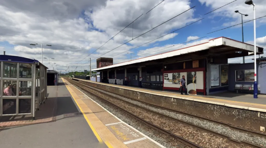
New Barnet and Hadley Wood Circular is a loop trail covering 3.2 miles with 423 ft elevation gain, taking about 1–1.5 hours to complete. This walk starts at Hadley Wood rail station, turning right between the estate agent and station to follow the path uphill beside the railway.
The pleasant walk through fields and woodland in the Hadley Wood area takes 1 hour 15 minutes for 4.9 km. This is an Enfield Society walk.
Hampstead Heath Extension is a 2.7-mile (4.3 km) route near Frognal with 95.1 ft elevation gain, rated easy and taking 6,000 steps.
Trent Country Park in England offers a 3.3-mile (5.4 km) walking route near Cockfosters with 246 ft elevation gain, rated easy.
Where Can Digital Nomads and Business Travellers Find Work-Friendly Walking Hubs?
Digital nomads and business travellers should visit North Finchley Town Centre (10 minutes from Dollis Valley Greenwalk, with Waitrose cafe), Cockfosters Station (near Trent Country Park with tea rooms and cafe), and Mill Hill Broadway (Greenwalk start point with Waitrose and transport links).
North Finchley Town Centre is only a 10-minute walk from the Dollis Valley Greenwalk. The Town Centre features Waitrose with cafe facilities at Ballard’s Lane N12 8NR, perfect for digital nomads needing work hubs between walks.
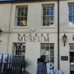
Trent Country Park includes a cafe, wildlife rescue centre with museum, and tea rooms. The park is easily accessible from Oakwood or Cockfosters Stations, making it ideal for business travellers maximising downtime.
Mill Hill Broadway is the Dollis Valley Greenwalk starting point, located near Waitrose. The area offers transport links and cafe facilities for visitors needing work-friendly local hubs.
As you explore the modern walking routes and nature trails, you are crossing land with deep heritage dating back to the 1471 Battle of Barnet. Read about the full [Battle of Barnet 1471: Hadley Green Heritage History] to understand its origins and the borough’s Wars of the Roses significance.
What Are the Best Walking Routes for Wildlife Photographers?
Wildlife photographers should prioritise Hadley Green (11 dragonfly and damselfly species, regionally rare plants), Coppetts Wood (unrecorded plants/insects in North London, bird activity), and Totteridge Fields (bee diversity, spring/summer wildlife teeming), visiting April–July for peak activity.
Hadley Green’s acid grassland, ditches, and ponds have several regionally rare plant species. The invertebrate fauna include eleven species of dragonflies and damselflies, making it ideal for amphibious insect photography.
Coppetts Wood contains some plants, insects, and animals not recorded anywhere else in Barnet or anywhere else in London north of the Thames River. The reserve has plenty of bird activity throughout.
Totteridge Fields is loved by bees and teems with life every spring and summer. The best time to visit is April to July for peak wildlife activity. The area features traditional English countryside with old hedgerows and grassland.
Moat Mount woodland features exotic conifers including swamp cypress and giant redwood—two of the biggest species in the world. The large ornamental pond ‘Leg of Mutton’ is well known for freshwater mussel size, offering unique macro photography opportunities.
How Do I Access Barnet’s Walking Trails by Public Transport?
Major trail access points include Mill Hill Broadway Station (Dollis Valley Greenwalk start), Cockfosters Station (Trent Country Park), Hadley Wood Station (Hadley Wood Circular), North Finchley Bus Station (near Greenwalk), and Oakwood Station (Trent Park alternative entrance), with 292 bus serving Moat Mount.
The main entrance to Moat Mount Open Space has the 292 bus stopping just south of the entrance on Barnet Way, NW7 4HJ.
Trent Country Park is easily accessible from Oakwood or Cockfosters Stations and by bus, bike, or foot. Parking is available near the three road entrances.
Hadley Wood Circular walk starts at Hadley Wood rail station. Turn right between the estate agent and station to follow the path uphill beside the railway.
Dollis Valley Greenwalk starts at Mill Hill Broadway, Borough of Barnet, reaching Hampstead Heath, Borough of Camden. The trail is a 10-mile (16 km) long route.
Only a 10-minute walk from North Finchley Town Centre is the Dollis Valley Greenwalk. Start from Waitrose in Ballard’s Lane N12 8NR, turn down Alexandra Grove towards Argyle Road, and follow the short pathway.
What Safety and Preparation Tips Should Walkers Follow?
Bring waterproof clothing for unpaved sections, carry water for 6-hour walks, use marked posts on Trent Park routes, keep dogs on leads in Totteridge Fields and bridle paths, and check seasonal closing times for Trent Country Park.
The full Dollis Valley Greenwalk can take up to 6 hours. If you don’t have 6 hours free, the walk is separated into smaller sections, some suitable for cycling.
Remember to keep dogs under control and on lead through Totteridge Fields. Be aware of horses on bridle paths and keep dogs on lead for safety.
Trent Country Park closing times vary according to seasons. The park is open every day from 08:00 am Monday to Saturday and 08:30 am on Sunday.
Most sections between Mill Hill and Whetstone are along surfaced paths, but the route west towards Moat Mount passes through fields and countryside with unpaved terrain. Pack waterproof clothing for these sections.
Hadley Wood Circular has 541 ft elevation gain over 4.1 miles, requiring moderate fitness. New Barnet and Hadley Wood Circular has 423 ft elevation gain over 3.2 miles.
What are the best walking routes in Barnet?
The best walking routes in Barnet include the Dollis Valley Greenwalk, Trent Country Park trails, Hadley Wood Circular, London Loop, Totteridge Fields paths, and Coppetts Wood nature trails. These routes offer a mix of countryside scenery, woodland walks, and wildlife experiences.