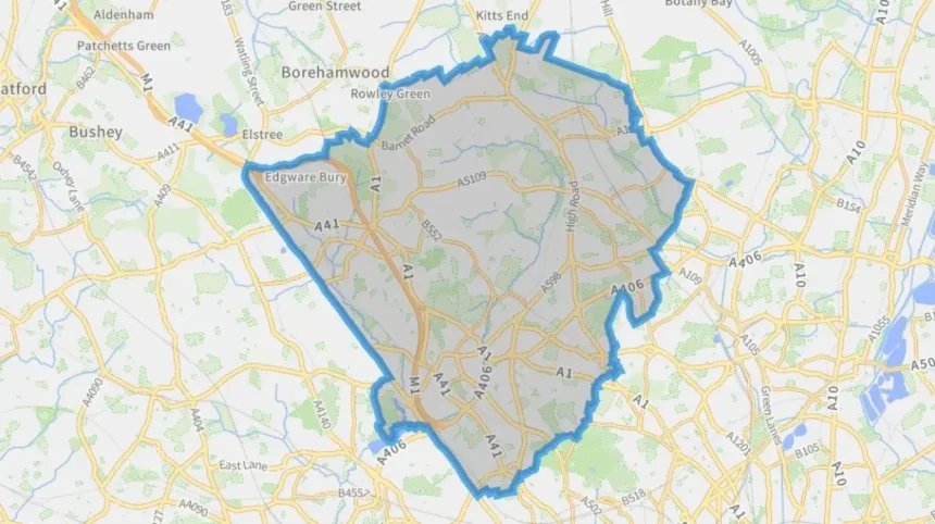
Barnet is a large outer London borough covering 86.7 square kilometres in north-west London. Its administrative boundary touches five London boroughs—Enfield, Haringey, Camden, Brent and Harrow—and Hertsmere in Hertfordshire to the north.
- Where does Barnet officially begin and end?
- Which areas border Barnet?
- Does Barnet end at High Barnet?
- Where is Barnet’s northern boundary?
- Where does Barnet meet Hertfordshire?
- Where does Barnet meet Camden, Haringey and Enfield?
- Where does Barnet meet Brent and Harrow?
- Which districts are inside the London Borough of Barnet?
- Why does Barnet’s boundary look different from its historic boundaries?
- How can you tell when you have left Barnet?
- Does Barnet’s size affect how visitors experience the borough?
- Why is knowing Barnet’s boundary useful for visitors?
- What is the simplest way to understand where Barnet begins and ends?
For visitors, residents and anyone researching North London, understanding where Barnet begins and ends requires more than identifying the centre called Barnet. The borough contains a wide collection of districts, town centres and neighbourhoods, including High Barnet, Finchley, Hendon, Edgware, Mill Hill, Golders Green, Whetstone and Colindale.
The key distinction is between Barnet the town and Barnet the London borough. Barnet town is one locality within the much larger administrative area known as the London Borough of Barnet.
Where does Barnet officially begin and end?
Barnet officially extends across a large part of north-west London, from its southern boundary near Camden to its northern edge at Hertfordshire. Its administrative neighbours are Enfield, Haringey, Camden, Brent, Harrow and Hertsmere, forming the borough’s recognised local-government boundaries.
The London Borough of Barnet is an administrative local authority area. Its boundary determines which council provides services such as planning, waste collection, libraries, local roads, parks and council services.
The borough occupies 86.7 square kilometres, making it one of London’s largest boroughs by physical area. Barnet’s geography changes noticeably from south to north. Southern areas have a stronger urban character, while northern districts contain more suburban streets, open land and Green Belt.
The borough’s official boundary is different from the informal area people describe as “Barnet”. A person travelling north through Finchley, Whetstone and High Barnet remains within the London Borough of Barnet, even though the local identity and town-centre names change.
The northern boundary eventually reaches Hertfordshire. This is also the point where Greater London’s administrative area ends. Barnet Council identifies Hertsmere District in Hertfordshire as its northern neighbour.
The southern edge reaches the London Borough of Camden. The western boundary meets Brent and Harrow, while Enfield and Haringey form much of the eastern side. This gives Barnet a strategic position between inner London, outer London and Hertfordshire.
Which areas border Barnet?
Barnet borders five London boroughs—Enfield, Haringey, Camden, Brent and Harrow—and Hertsmere District in Hertfordshire. These authorities surround Barnet on its eastern, southern, western and northern sides and define the borough’s administrative limits.
The neighbouring authorities help explain why Barnet can feel connected to several different parts of the capital.
To the east and north-east, Barnet meets Enfield. This boundary connects districts such as East Barnet and surrounding northern neighbourhoods with areas under Enfield Council.
To the south-east, Barnet borders Haringey. The boundary becomes relevant around parts of East Finchley and neighbouring northern London districts.
To the south, Barnet meets Camden. This creates a transition between Barnet’s suburban districts and the more centrally positioned areas of north London.
To the south-west, the borough borders Brent. This relationship is particularly important around areas associated with Brent Cross, Hendon and the wider north-west London transport network.
To the west, Barnet borders Harrow. The A5 forms an important section of the administrative boundary between the two boroughs. Barnet and Harrow planning documents identify the A5 as the boundary in parts of the Edgware and Burnt Oak area.
To the north, Barnet borders Hertsmere District in Hertfordshire rather than another London borough. This is significant because the boundary also represents the northern edge of Greater London.
Barnet Council’s planning evidence specifically identifies these six neighbouring authorities.
Does Barnet end at High Barnet?
No. High Barnet is only one district within the London Borough of Barnet. The borough continues well beyond High Barnet, incorporating areas including East Barnet, Whetstone, Mill Hill, Finchley, Hendon, Edgware, Colindale, Golders Green and Cricklewood.
This is one of the most important points for understanding Barnet geography.
High Barnet is often associated with the name “Barnet” because it is a historic town and a prominent northern centre. However, the administrative borough is considerably larger.
Barnet Council’s current electoral structure contains 24 wards. Examples include Barnet Vale, East Barnet, High Barnet, Whetstone, Mill Hill, Edgware, Hendon, Golders Green, Cricklewood, Colindale North and Colindale South.
These wards demonstrate the geographical scale of the borough. High Barnet is therefore a component of Barnet rather than its northern or administrative endpoint.
A traveller visiting High Barnet and then continuing towards Whetstone, Totteridge or Mill Hill remains inside the London Borough of Barnet. Travelling further north eventually brings the journey towards the Hertfordshire boundary.
This distinction is especially useful when searching for accommodation, attractions, transport information or local services. A result described as being “in Barnet” can refer to a location several miles away from High Barnet.
Where is Barnet’s northern boundary?
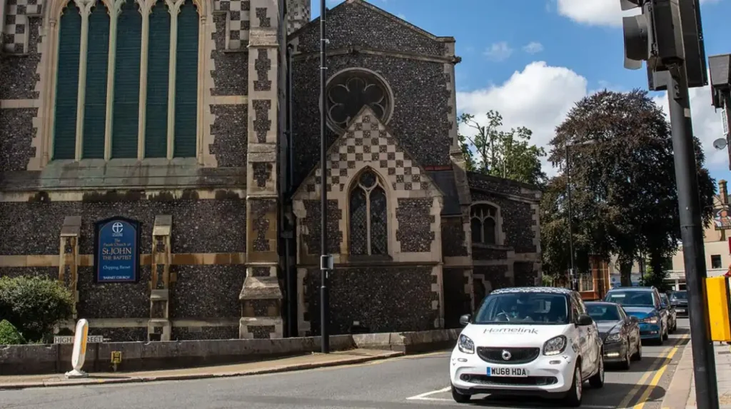
Barnet’s northern boundary meets Hertsmere District in Hertfordshire. This boundary separates the London Borough of Barnet from areas outside Greater London, including settlements such as Potters Bar and South Mimms, while High Barnet and other northern Barnet districts remain within London.
The northern edge is important because Greater London does not continue indefinitely into Hertfordshire.
Hertsmere is a district in Hertfordshire. It includes Potters Bar and other settlements north of London’s administrative boundary. Potters Bar developed historically as a settlement on the edge of Enfield Chase and expanded significantly after the railway arrived in 1850.
This creates a clear geographical transition. A journey north from Barnet eventually moves from an outer London borough into Hertfordshire.
The boundary does not mean that communities on opposite sides are disconnected. Residents, workers and visitors cross it regularly. Transport routes, employment patterns, shopping destinations and housing markets operate across administrative boundaries.
The distinction is primarily administrative. Barnet Council is responsible for land within the London Borough of Barnet, while Hertsmere Borough Council is responsible for its own area.
The Greater London boundary is therefore an important reference point when answering the question of where Barnet ends.
Where does Barnet meet Hertfordshire?
Barnet meets Hertfordshire along its northern edge, with Hertsmere District forming the principal neighbouring local authority outside Greater London. The boundary creates a transition from London’s administrative area to Hertfordshire while maintaining strong transport and economic links between both regions.
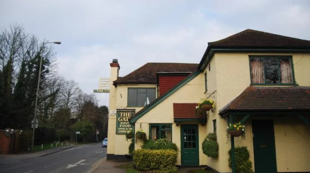
The northern boundary is particularly relevant around the areas surrounding High Barnet, Totteridge, Barnet Gate and the wider northern edge of the borough.
Barnet’s northern landscape contains more open land than its southern sections. The borough becomes increasingly suburban towards the north, with Green Belt land contributing to this character. Barnet Council’s open-space assessment describes this northward transition and identifies the Green Belt as an important geographical feature.
The boundary with Hertfordshire is therefore both administrative and geographical. It marks the end of the London Borough of Barnet and the Greater London administrative area.
For visitors, this distinction matters when planning journeys. A location described as “near Barnet” can sit in Hertfordshire rather than London. Checking the local authority is therefore more accurate than relying solely on a place name.
This is particularly relevant for accommodation searches, transport planning, parking regulations, council services and property research.
Where does Barnet meet Camden, Haringey and Enfield?
Barnet meets Camden to the south, Haringey to the south-east and Enfield to the east and north-east. These boundaries create transitions between northern Barnet neighbourhoods and adjoining parts of inner and outer north London.
The southern and eastern boundaries are heavily influenced by continuous urban development. Unlike the northern boundary, there is no dramatic change from London to a different county across most of these edges.
The boundary with Camden connects Barnet to a borough closer to central London. Areas such as Hampstead and Highgate sit within Camden, while neighbouring Barnet districts include Golders Green and parts of the Finchley area.
The boundary with Haringey lies further east. This relationship connects Barnet with districts such as Muswell Hill and other northern parts of Haringey.
The boundary with Enfield extends along Barnet’s eastern and north-eastern side. East Barnet and surrounding neighbourhoods provide an important transition between the two boroughs.
These boundaries are administrative rather than barriers. Roads, railways, bus routes, shopping areas and residential neighbourhoods often continue across them.
For local searches, postcode information and council websites provide more precision than relying on district names alone.
Where does Barnet meet Brent and Harrow?
Barnet meets Brent along its south-western side and Harrow along its western side. The A5 is a particularly important boundary corridor, with Edgware and Burnt Oak forming connected urban areas where administrative boundaries do not always match everyday neighbourhood identities.
The western side of Barnet has a distinctive urban structure because several important centres sit close to administrative boundaries.
The relationship with Harrow is especially clear around Edgware. Barnet and Harrow’s planning evidence states that the A5 runs north to south as an administrative boundary in this area. The two boroughs therefore share a close relationship around Edgware and Burnt Oak.
Burnt Oak is an example of why local geography can become complicated. The built-up area crosses administrative boundaries, with parts associated with Barnet and Brent as well as nearby Harrow.
The relationship with Brent is also important around Brent Cross and Cricklewood. These areas form part of a major regeneration and transport corridor.
Barnet Council identifies the western part of the borough as a major growth area. It contains significant development opportunities, visitor destinations and transport investment, including Brent Cross West station.
For visitors, the practical lesson is simple: a neighbourhood name does not always identify the council area. Administrative boundaries need to be checked separately.
Which districts are inside the London Borough of Barnet?
The London Borough of Barnet includes 24 electoral wards covering districts and neighbourhoods such as High Barnet, East Barnet, Finchley, Hendon, Edgware, Mill Hill, Whetstone, Golders Green, Cricklewood, Colindale and West Finchley.
The current ward structure provides an official framework for understanding the borough’s internal geography.
Barnet Council lists wards including Barnet Vale, Brunswick Park, Burnt Oak, Childs Hill, Colindale North, Colindale South, Cricklewood, East Barnet, East Finchley, Edgware, Edgwarebury, Finchley Church End, Friern Barnet, Garden Suburb, Golders Green, Hendon, High Barnet, Mill Hill, Totteridge Woodside, Underhill, West Finchley, West Hendon, Whetstone and Woodhouse.
These are administrative wards rather than a definitive list of every neighbourhood.
Some familiar place names overlap administrative boundaries or have wider historical meanings. Edgware is a particularly clear example because the wider urban area crosses the Barnet-Harrow boundary.
The current ward arrangement came into effect on 5 May 2022. Barnet now has 63 councillors, with 15 three-councillor wards and nine two-councillor wards.
The ward system can change over time even when the borough boundary itself remains unchanged. This distinction is important when using older maps or historical documents.
As you explore the modern borough, you are crossing land with a deep heritage. Read about the full to understand how Barnet developed from earlier settlements and historic local authorities into the modern London borough.
Why does Barnet’s boundary look different from its historic boundaries?
Modern Barnet was created in 1965 as part of Greater London, combining areas that previously belonged to different counties and local authorities. Barnet and East Barnet were historically associated with Hertfordshire, while Finchley, Friern Barnet and Hendon were associated with Middlesex.
The modern boundary makes more sense when viewed through this historical change.
Before the creation of Greater London, the present borough area was divided among different administrative arrangements. Barnet Council’s archive records show that Barnet and East Barnet were part of Hertfordshire County Council, while Finchley, Friern Barnet and Hendon were part of Middlesex County Council.
The London Government Act 1963 established the framework for the new Greater London system, which came into operation in 1965. The London Borough of Barnet was created as part of that reorganisation.
Barnet Council marked the borough’s 60th anniversary in 2025 with a “Birth of a Borough” exhibition explaining its formation in 1965.
This explains why modern Barnet contains communities with distinct historical identities. High Barnet, Finchley, Hendon and East Barnet developed through different local government histories before becoming part of one London borough.
The boundary therefore represents a modern administrative arrangement rather than an ancient geographical unit.
How can you tell when you have left Barnet?
You have left the London Borough of Barnet when a road, property, neighbourhood or open space crosses into one of its neighbouring authorities: Enfield, Haringey, Camden, Brent, Harrow or Hertsmere. Official boundary maps and council geographic information provide the most reliable confirmation.
Place names alone are not always sufficient.
Barnet Council operates a Barnet WebMap, an online geographic information system that displays borough-related geographical information. The council describes it as a map-based resource for understanding the London Borough of Barnet and its geographic information.
The Greater London Authority also maintains official London borough boundary data based on Ordnance Survey information. The London Datastore states that borough boundary information is updated twice a year through the Boundary-Line system.
For precise research, these official sources are more dependable than a general online map or a travel article.
This distinction becomes important when identifying council responsibilities. Waste collection, planning applications, parking controls, libraries and other local services are administered according to legal boundaries.
A street that feels like part of Barnet can therefore sit just across the boundary in another authority.
Does Barnet’s size affect how visitors experience the borough?
Barnet’s 86.7-square-kilometre area creates substantial geographical variety, from dense southern neighbourhoods to greener northern districts. Its size also produces multiple town centres, transport corridors and visitor destinations rather than one single central Barnet district.
Barnet’s physical size is central to understanding its identity.
The borough contains suburban residential areas, commercial centres, transport hubs, parks, open spaces and major redevelopment zones. Barnet Council identifies the western part of the borough as a major focus for growth, with Brent Cross, Colindale and other locations receiving significant investment.
The borough also has a substantial population. The 2021 Census recorded 389,300 residents, representing a 9.2% increase from approximately 356,400 in 2011.
Barnet’s population density is not uniform. The council’s 2024 population overview records particularly high density in Grahame Park and substantially lower density around Totteridge and Barnet Gate.
This variation explains the changing character across the borough.
Southern and western areas contain more intensive urban development, while northern districts contain larger areas of open land and lower-density suburban development. The physical landscape therefore reinforces the administrative geography.
For tourists, this means Barnet is better understood as a collection of connected destinations than as a single compact town.
Explore More Area Guide
Main Districts of Barnet: High Barnet, Finchley and More
How Barnet Market Shaped Local History and North London
Why is knowing Barnet’s boundary useful for visitors?
Knowing Barnet’s boundary helps visitors choose the correct transport information, council services, attractions and neighbourhoods. It also prevents confusion between Barnet town and the wider borough, especially around Edgware, Burnt Oak, High Barnet, Brent Cross and the Hertfordshire border.
A visitor planning a day in Barnet can easily confuse a district with the borough itself.
Someone searching for “things to do in Barnet” can encounter attractions across a large geographical area. High Barnet, Hendon, Finchley, Edgware and Brent Cross are all within the borough, but they offer different environments and transport connections.
The distinction is also useful for accommodation. A hotel described as being in Barnet can be closer to Hendon or Edgware than to High Barnet.
Transport planning benefits from the same distinction. Barnet contains stations and transport connections serving different parts of the borough, while routes also cross into Camden, Brent, Enfield, Haringey, Harrow and Hertfordshire.
Digital nomads and business travellers also benefit from identifying the exact district. A work-friendly location in Hendon is geographically different from one in High Barnet, even though both sit within the same borough.
For local research, the most accurate approach is to identify the specific neighbourhood first, then confirm its council area.
What is the simplest way to understand where Barnet begins and ends?
The simplest definition is that Barnet is an outer London borough stretching from Camden and other inner northern boundaries in the south to Hertfordshire in the north. It borders five London boroughs and Hertsmere, with 24 wards inside its boundary.
Barnet does not begin and end at the town called Barnet.
The modern London Borough of Barnet is a broad administrative area created in 1965. Its boundary includes many established districts and neighbourhoods, while its northern edge meets Hertfordshire.
The six neighbouring authorities provide the clearest geographical framework:
Camden lies to the south.
Haringey lies to the south-east.
Enfield lies to the east and north-east.
Brent lies to the south-west.
Harrow lies to the west.
Hertsmere in Hertfordshire lies to the north.
Within those boundaries are 24 electoral wards and a wide range of recognised districts.
The borough’s geography also explains its varied character. Its southern areas connect strongly with the continuous London urban area, while its northern edge forms a transition towards Hertfordshire and contains significant Green Belt and open land.
For anyone researching North London, the most accurate definition is therefore administrative: Barnet begins and ends at the legal boundary of the London Borough of Barnet, not at the settlement known as Barnet.
Where does the London Borough of Barnet begin and end?
The London Borough of Barnet stretches across north-west London from its southern boundary with Camden to its northern boundary with Hertfordshire. Its other boundaries meet Haringey, Enfield, Brent and Harrow.