Barnet is one of London’s most varied boroughs for elevated landscapes and long-distance views. Its northern and western areas sit across the Barnet Plateau, while open countryside, ridges, commons, parks and river valleys create changing viewpoints across the borough.
- Where are the highest viewpoints in Barnet?
- Can you get wide views from Barnet Hill?
- What can you see from Hadley Ridge?
- Which views can you find around Monken Hadley?
- Where can you enjoy countryside views in Totteridge?
- Does Mill Hill have some of the best elevated views in Barnet?
- What views are available from Bittacy Hill?
- Where can you find open views around Edgwarebury?
- Can Scratchwood and Barnet Gate provide natural viewpoints?
- Which Barnet viewpoints are best for walking?
- When is the best time to see views across Barnet?
- How can visitors explore Barnet’s best views responsibly?
- Why does Barnet have so many places with long views?
The landscape is important to understanding why Barnet has so many places where visitors can look beyond nearby streets and buildings. High Barnet reaches about 134 metres above sea level, making it one of the highest points on the Barnet Plateau. The plateau forms part of the higher land around the north-western edge of the London Basin.
Barnet Council records a large network of parks, open spaces, Green Belt land, river valleys and countryside. Its parks directory currently lists 160 parks and open spaces, demonstrating the scale of publicly accessible green infrastructure across the borough.
For visitors looking for the best views across Barnet, the most useful locations include Barnet Hill, Hadley Ridge, Monken Hadley, Totteridge, Mill Hill, Bittacy Hill, Edgwarebury Park, Moat Mount and the Dollis Valley. Each provides a different combination of elevation, open land, woodland, historic buildings or long-distance landscape.
Where are the highest viewpoints in Barnet?
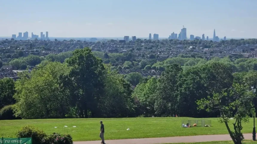
The highest viewpoints are concentrated around the Barnet Plateau, with High Barnet reaching about 134 metres above sea level. Barnet Hill, Hadley Ridge, Wood Street and nearby open spaces provide elevated ground with long views across surrounding suburbs, countryside and parts of north London.
The Barnet Plateau is the most important geographical feature when identifying elevated viewpoints. It occupies higher ground around the north-western edge of the London Basin and extends through parts of northern Barnet.
High Barnet stands at approximately 134 metres above sea level. This elevation does not create a mountain-style panorama, but it produces a noticeable change in perspective across the surrounding landscape.
The higher ground is particularly useful because Barnet combines urban development with open countryside. Fields, hedgerows, woodland and valleys interrupt the built environment.
The borough’s landscape study identifies wooded ridges, high ground, streams and brooks as important components of the local landscape. The Dollis Brook, Silk Stream and River Brent form part of the wider drainage network.
This geography explains why the best Barnet views are not restricted to formal viewing platforms. Roads, commons, park edges and public footpaths often provide the elevation needed for a wider outlook.
For visitors, the High Barnet area provides the clearest starting point for exploring elevated viewpoints.
Can you get wide views from Barnet Hill?
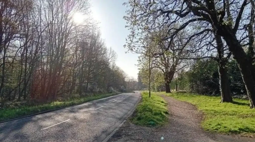
Barnet Hill provides one of the clearest elevated viewpoints in High Barnet because the road climbs towards the historic town centre and reaches the higher Barnet Plateau. The surrounding open spaces and ridge provide changing views across nearby neighbourhoods and northern London.
Barnet Hill is part of the A1000 corridor through High Barnet. The road climbs towards the historic centre and reaches the area around St John the Baptist Church.
The elevation is significant because the historic Wood Street Conservation Area begins at the junction with the Great North Road at the top of Barnet Hill and continues east to west along the ridge towards Arkley. Barnet Council designated the conservation area in 1969 and extended it in 1979.
The physical gradient also shaped the area’s history. Barnet Council’s historical appraisal records that the slope of Barnet Hill was re-graded in 1827 by engineer Thomas Telford.
For visitors, the important feature is the relationship between the hill and the ridge. Looking away from the denser town centre reveals how High Barnet sits above lower surrounding areas.
Barnet Hill is also useful for combining views with heritage. St John the Baptist Church, the historic High Street and Wood Street all sit within the wider historic landscape.
As you explore the modern viewpoint around High Barnet, you are crossing land shaped by centuries of settlement and transport. Read about the full to understand its origins.
The best experience comes from walking rather than simply stopping at one point. The changing elevation provides different sightlines along the hill and ridge.
What can you see from Hadley Ridge?
Hadley Ridge is an elevated public open space in High Barnet positioned within the borough’s higher northern landscape. Its ridge setting provides an open-air viewpoint while connecting naturally with Hadley, High Barnet and nearby green spaces.
Hadley Ridge is officially listed by Barnet Council as a park in High Barnet. Its address is Hadley Ridge, High Barnet, EN5.
The site’s importance comes from its position rather than from a formal viewing structure. It sits within an area where the terrain rises above surrounding neighbourhoods.
Hadley Ridge also connects with the wider network of High Barnet open spaces. Barnet Council’s park directory lists Hadley Ridge, Greenhill Gardens, Highlands Gardens, Jubilee Gardens and Barnet Hill open space among public green areas in the High Barnet area.
This creates opportunities for visitors to explore several elevated locations during one walk.
The ridge is particularly useful for visitors who want an open landscape without travelling far from High Barnet town centre. It also works as part of a wider walking itinerary that includes Hadley Green and Monken Hadley.
The terrain is more important than the presence of a specific viewing platform. Trees and buildings affect individual sightlines, so the most open sections provide the broadest outlook.
Which views can you find around Monken Hadley?
Monken Hadley combines elevated ground, historic buildings, mature trees and open common land. Views around St Mary the Virgin, Hadley Green and the surrounding conservation area reveal the rural character of northern Barnet and its transition into Hertfordshire countryside.
Monken Hadley lies in the north-east of Barnet beside the boundary with Hertfordshire and the London Borough of Enfield.
The area is designated as a conservation area because of its historic and architectural character. Barnet Council identifies winding lanes, native trees, common land and scattered historic buildings as important features.
St Mary the Virgin is the focal point of Monken Hadley. Barnet Council states that views from this location reveal much of the area’s character.
The setting is different from an urban rooftop or dedicated observation deck. The view is created by the combination of open land, mature vegetation, historic buildings and gently elevated terrain.
Hadley Green is another important part of the landscape. The Great North Road historically passed through Chipping Barnet, Hadley Green and Hadley Highstone before continuing north.
The area therefore provides both visual and historical context. Visitors can see why the northern edge of London developed differently from denser central districts.
Monken Hadley is particularly suitable for walking-based sightseeing. Its roads and paths allow visitors to move between open spaces rather than remaining at one fixed viewpoint.
Where can you enjoy countryside views in Totteridge?
Totteridge provides countryside views through its commons, fields, woodland and gently rising ground. Totteridge Common and Totteridge Fields form part of a rural landscape around the Dollis Brook, with hedgerows and open fields creating long, unobstructed views.
Totteridge is one of Barnet’s strongest locations for countryside scenery. The area retains a rural character despite being within Greater London.
Barnet Council’s Totteridge Fields nature reserve consists of more than 30 fields north of Totteridge Common. The area extends between Hendon Wood Lane and Grange Avenue, with the Dollis Brook flowing through the site.
The fields rise gently on either side of the valley. Mature hedgerows divide sections of the landscape.
This combination creates a different type of viewpoint from High Barnet. The emphasis is on fields, vegetation and valley scenery rather than an urban skyline.
Barnet Council’s Totteridge Walk is a circular countryside route through Totteridge Common, woodland and fields. The council states that much of the route is on unpaved and sometimes uneven ground.
Visitors should therefore choose footwear suited to outdoor walking, particularly after wet weather.
Totteridge works well for travellers seeking landscape views without leaving London. The area demonstrates how preserved countryside can survive within a metropolitan borough.
The Dollis Brook valley also provides a natural visual corridor. The surrounding slopes give walkers changing perspectives as they move between fields and woodland.
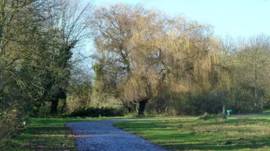
Does Mill Hill have some of the best elevated views in Barnet?
Mill Hill has several elevated parks and open spaces that provide broad landscape views, particularly around its higher ground, fields and countryside. Moat Mount, Mill Hill Park, The Mill Field and nearby open spaces create different perspectives across western and central Barnet.
Mill Hill occupies an important position within Barnet’s landscape. The borough’s Green Belt study identifies agricultural land extending from Mill Hill towards the northern edge of Barnet and the wider countryside of South Hertfordshire.
The area therefore provides access to both urban and rural scenery.
Mill Hill Park is listed by Barnet Council at Daws Lane. The Mill Field is another open space on The Ridgeway. Moat Mount open space lies near Barnet Way.
Moat Mount is particularly relevant to the borough’s long-distance walking network because the Dollis Valley Greenwalk begins there.
The Dollis Valley Greenwalk is a 10-mile route connecting green spaces from Moat Mount through Barnet and towards Hampstead Heath. Barnet Council states that the route can take up to six hours to walk and is mostly flat with hard surfaces.
The route demonstrates that Barnet’s best views are not isolated locations. They form part of a connected landscape.
Mill Hill is also useful for visitors who want to combine elevated scenery with a longer walking route. The open spaces provide opportunities to stop, observe the landscape and continue through the valley system.
What views are available from Bittacy Hill?
Bittacy Hill Park is a public park on elevated ground in Mill Hill East. The site covers about 2.72 hectares and contains grassland, mature trees, a playground and tennis courts, giving visitors an elevated green-space perspective within a built-up part of Barnet.
Bittacy Hill Park is located on Sanders Lane in Mill Hill East.
A Barnet planning document describes the park as a 2.72-hectare public park set on a hill. It consists mainly of grass with mature tree planting.
The site’s elevation makes it useful for visitors looking for a smaller viewpoint rather than a long countryside walk.
Its facilities include gardens, sports courts, play areas and tennis courts.
The mature trees influence the precise view from different parts of the park. Open grass areas provide more visual space than wooded edges.
Bittacy Hill also illustrates an important characteristic of Barnet’s viewpoints. Elevation does not always mean a large open panorama. Some elevated locations offer a mixture of neighbourhood views, tree cover and local green space.
For digital nomads or business travellers with limited free time, a small elevated park can provide a quick outdoor break without requiring a lengthy countryside journey.
Where can you find open views around Edgwarebury?
Edgwarebury Park provides open green space in north-west Barnet, with large areas of grassland and access from Edgwarebury Lane. Its position near the borough’s countryside gives visitors an alternative viewpoint away from the denser central parts of Barnet.
Edgwarebury Park is located on Edgwarebury Lane in Edgware.
Barnet Council lists the park among its public green spaces and identifies it as one of the sites within its parks network.
The park’s setting is important because Edgwarebury sits towards the north-western edge of Barnet. The surrounding landscape becomes less intensely urban than central London.
The wider Edgwarebury and Scratchwood area contains open land, woodland and ecological sites. Barnet’s biodiversity programme includes Scratchwood within its grassland management programme.
Visitors seeking views should focus on open sections rather than enclosed woodland. Open ground gives the best opportunity to see across neighbouring landscape.
Edgwarebury Park is also suitable for combining scenery with a broader exploration of north-west Barnet. Its position makes it useful for visitors staying around Edgware or travelling through the area.
Can Scratchwood and Barnet Gate provide natural viewpoints?
Scratchwood and Barnet Gate provide natural viewpoints through woodland edges, open countryside and higher ground rather than formal observation platforms. These sites are especially useful for visitors seeking rural scenery, tree-lined horizons and quieter landscapes near Barnet’s north-western boundary.
Barnet Gate Wood is listed by Barnet Council on Hendon Wood Lane at Barnet Gate. Scratchwood is another significant green space close to the borough’s north-western edge.
These locations are part of the broader landscape connection between Mill Hill, Barnet Gate and the countryside towards Hertfordshire.
The views are primarily landscape-based. Visitors should not expect a conventional skyline platform.
Woodland edges create visual openings across fields and surrounding green areas. Seasonal changes also affect visibility. Leafless trees provide different sightlines from those available during dense summer foliage.
The wider landscape is important ecologically as well as visually. Barnet’s landscape studies identify ancient woodland, remnant heathland and agricultural fields as components of the borough’s remaining countryside.
For walkers, these locations work best as part of a route rather than as isolated destinations.
Which Barnet viewpoints are best for walking?
The best viewpoints for walking include the Barnet and Hadley area, Totteridge Common, Totteridge Fields and the Dollis Valley Greenwalk. These routes combine elevation with open spaces, countryside, heritage features and connected footpaths across different parts of Barnet.
Walking is one of the most effective ways to experience Barnet’s viewpoints because the borough’s elevation changes gradually.
Barnet Council provides several Healthy Heritage Walks, including routes between Hendon and Mill Hill, through Totteridge, around Barnet and Hadley, and between East Finchley and New Southgate.
The Barnet and Hadley Walk contains more than 10 heritage points of interest, linking the landscape with the history of High Barnet and Hadley Green.
The Dollis Valley Greenwalk covers 10 miles and connects Moat Mount, Barnet and Hampstead Heath.
These routes provide a practical framework for visitors who want to discover multiple views during one trip.
The terrain varies between routes. Totteridge includes unpaved and uneven sections, while the Dollis Valley Greenwalk is mostly flat and uses hard surfaces.
Visitors should therefore choose routes according to walking ability, footwear and weather conditions.
When is the best time to see views across Barnet?
The best time depends on the type of landscape view required. Clear winter days provide stronger long-distance visibility through reduced foliage, while spring and summer emphasise fields and greenery. Early morning and late afternoon provide changing light across Barnet’s hills, valleys and open spaces.
Weather has a direct effect on visibility.
Clear conditions provide the longest sightlines. Haze reduces the distance at which buildings, ridges and countryside features remain visible.
Season also changes the character of the views. Trees in full leaf create dense green landscapes but reduce visibility through woodland. Winter exposes more branches and opens some sightlines.
Open fields remain more consistent throughout the year.
Sun position also affects viewpoints. A location facing towards the low sun produces different visual conditions from one facing away from it. Visitors interested in photography should check the day’s sunrise and sunset direction before setting out.
The physical geography remains constant. The Barnet Plateau, ridges and valleys continue to determine the underlying viewpoints regardless of season.
Explore More Area Guide
Best Sunset Spots in Barnet | North London Guide
Barnet vs Central London: Key Differences Explained
How can visitors explore Barnet’s best views responsibly?
Visitors should use public paths, respect conservation areas, follow park rules and protect grassland, woodland and wildlife. Many Barnet viewpoints are shared public spaces rather than dedicated tourist attractions, so responsible access helps preserve the landscape for residents and future visitors.
Barnet contains formal parks, nature reserves, Green Belt land, commons and conservation areas.
The council states that parks and open spaces include formal gardens, wild landscapes, extensive Green Belt areas and leafy river valleys.
Different sites therefore have different management requirements.
Totteridge Fields contains sensitive grassland and hedgerows. Woodland sites provide habitat for wildlife. Conservation areas such as Monken Hadley and Wood Street contain historic buildings and protected trees.
Visitors should remain on designated paths where appropriate and avoid damaging planted areas or wildlife habitats.
Weather also affects conditions. Barnet Council notes that sections of its walking routes can become muddy or icy.
Checking current park information before travelling is useful because maintenance work, events and access arrangements can change.
The most sustainable approach is simple: walk where permitted, keep public spaces clean and treat residential and historic areas as shared environments.
Why does Barnet have so many places with long views?
Barnet has extensive viewpoints because its landscape combines the elevated Barnet Plateau with ridges, valleys, commons, farmland, woodland and open spaces. High Barnet reaches about 134 metres above sea level, while lower valleys create strong changes in elevation across the borough.
The geography explains the distribution of viewpoints.
High Barnet occupies high ground on the Barnet Plateau. Totteridge sits around the Dollis Brook valley. Mill Hill contains elevated ground alongside agricultural land and open countryside. Monken Hadley retains common land and historic rural features.
This combination creates visual diversity within a relatively compact part of London.
Barnet Council’s landscape study describes the plateau as having a field and farmland character, with traditional countryside, ancient woodland and remnant heathland retained in parts of the borough.
The borough also contains a substantial network of parks and open spaces. Barnet Council’s current parks directory lists 160 sites.
The result is a landscape where visitors can move from an urban high street to an elevated common, from a historic ridge to a countryside footpath, or from a park to a river valley within a relatively short journey.
For anyone searching for the best views across Barnet, the strongest approach is therefore to explore the borough’s high ground rather than search for one single viewing platform.
High Barnet and Hadley provide elevated urban and historic scenery. Totteridge provides countryside and valley views. Mill Hill provides access to open landscapes and long walking routes. Bittacy Hill offers a smaller elevated park setting. Edgwarebury and Barnet Gate provide greener north-western landscapes.
Together, these locations demonstrate why Barnet is one of north London’s most varied areas for elevated outdoor views.
Where can you find the best views across Barnet?
The best views across Barnet can be found around High Barnet, Barnet Hill, Hadley Ridge, Monken Hadley, Totteridge, Mill Hill, Bittacy Hill, Edgwarebury Park and Moat Mount. These locations combine elevated ground with parks, countryside, woodland and open landscapes.