Regent’s Canal is one of the most important historic waterways in North London. It transformed Islington’s industrial landscape, connected London’s commercial districts with the River Thames and provided a new route for transporting coal, timber, food and building materials. Opened fully in 1820, the canal became a major part of London’s nineteenth-century transport network.
- What Is Regent’s Canal and Why Was It Built?
- Who Proposed Regent’s Canal and When Did Construction Begin?
- How Did Regent’s Canal Construction Affect Islington?
- Why Was the Islington Tunnel Important to Regent’s Canal?
- How Did City Road Basin Become an Important Commercial Centre?
- What Was the Role of Battlebridge Basin in Islington’s Canal History?
- What Goods Were Transported Along Regent’s Canal in Islington?
- How Much Commercial Traffic Did Regent’s Canal Carry?
- How Did Regent’s Canal Influence Industrial Development in Islington?
- Why Did Commercial Activity on Regent’s Canal Decline?
- How Has Regent’s Canal Changed Since Its Industrial Decline?
- Which Historic Places Can Visitors Explore Along Regent’s Canal in Islington?
- How Can Visitors Explore the Historical Regent’s Canal Route?
- How Is Regent’s Canal Protected as a Historic Heritage Site?
- Why Does Regent’s Canal Remain Important to Islington Today?
- What Is the Future of Regent’s Canal as a Heritage Destination?
- How Did Regent’s Canal Shape Islington’s History?
Today, Regent’s Canal runs through Islington as a historic waterway, recreational route and urban heritage destination. Its towpaths, bridges, basins, warehouses and tunnel entrances preserve evidence of the area’s industrial development. Locations such as City Road Basin, Battlebridge Basin and the Islington Tunnel demonstrate how canal construction influenced local employment, trade, housing and urban expansion.
Understanding the history of Regent’s Canal provides insight into how Islington developed from a district on the northern edge of London into a connected urban borough. It also explains why the canal remains an important part of North London’s cultural and architectural identity.
What Is Regent’s Canal and Why Was It Built?
Regent’s Canal is an approximately 13.8-kilometre waterway connecting Paddington in West London with Limehouse in East London. It was built to connect the Grand Junction Canal with the River Thames, creating an inland freight route for London’s growing commercial economy.
The canal forms part of London’s historic inland waterway network. It begins at the Paddington Basin, connects with the Grand Junction Canal network and travels through North London before reaching Limehouse Basin, where it meets the River Thames.
The waterway was developed during a period of rapid population growth and industrial expansion. London required increasingly large quantities of coal, timber, food, construction materials and manufactured goods. Existing roads carried much of this trade, but road transport was expensive and inefficient for heavy freight.
Canals provided a practical alternative. Horse-drawn barges transported substantial loads using relatively little energy. Businesses gained access to a dependable transport route that connected warehouses, markets, factories and docks.
Regent’s Canal addressed the need for a direct connection between London’s western canal network and its eastern shipping facilities.
The project also supported the development of new commercial districts. Its route created opportunities for warehouses, wharves, manufacturing premises and transport businesses along the northern side of central London.
The main geographical connections included:
- Paddington Basin: The western connection with the Grand Junction Canal.
- Regent’s Park: The canal route passes along the northern boundary of this major London park.
- Camden: An important historic commercial and transport district.
- Islington: The location of the Islington Tunnel and City Road Basin.
- Limehouse Basin: The eastern terminus connecting canal traffic with the Thames.
The canal opened a new commercial corridor across London and established a transport connection that remained important for approximately 150 years.
Who Proposed Regent’s Canal and When Did Construction Begin?
Thomas Homer proposed Regent’s Canal in the early nineteenth century to connect Paddington with Limehouse. Architect John Nash supported the project, while engineer James Morgan directed its construction. Work officially began in October 1812 following parliamentary authorisation.
The original proposal emerged from London’s growing demand for more efficient freight transportation. Thomas Homer, a businessman and canal promoter, recognised the commercial value of connecting the Grand Junction Canal with the River Thames.
The idea received support from John Nash, the architect responsible for major developments including Regent’s Park and Regent Street. Nash became a director of the Regent’s Canal Company and helped secure royal support for the project.
The canal was named after George, Prince Regent, who later became King George IV.
The Regent’s Canal Act received royal assent in July 1812. This legislation authorised the company to construct and operate the waterway. It established the legal framework for acquiring land, raising capital and developing the route.
James Morgan was appointed as the project’s engineer. His responsibilities included overseeing construction, surveying the route and addressing technical challenges involving tunnels, locks and water management.
Construction officially started on 7 October 1812 in Regent’s Park.
However, the project experienced serious financial and engineering difficulties.
Thomas Homer was convicted of embezzling company funds in 1815. His financial misconduct contributed to a shortage of capital and interrupted construction.
Land acquisition also created problems. Negotiations with landowners increased project expenses and delayed work along sections of the route.
Despite these difficulties, construction continued after additional funding became available.
The first section, connecting Paddington with Camden, opened in 1816. The remaining section, including the Islington Tunnel, was completed before the entire canal officially opened on 1 August 1820.
According to the London Museum, construction cost approximately £772,000, around twice the original estimate.
This investment created one of London’s most important nineteenth-century transport connections.
How Did Regent’s Canal Construction Affect Islington?
Regent’s Canal changed Islington by introducing a major commercial transport route through the district. Its construction encouraged warehouse development, supported industrial employment, improved access to goods and established new trading locations around City Road Basin and Battlebridge.
Before the canal opened, Islington contained a mixture of residential settlements, agricultural land, commercial premises and expanding urban neighbourhoods. Its position north of the City of London made it an important area for London’s outward expansion.
The canal introduced a different form of economic activity.
Businesses gained access to a waterway that connected local industrial premises with major markets, ports and manufacturing centres. Heavy materials became easier to transport, reducing dependence on horse-drawn road vehicles.
Canalside land acquired commercial importance because businesses needed direct access to loading and unloading facilities.
Warehouses appeared near suitable stretches of the waterway. Industrial premises used the canal to receive raw materials and distribute finished products.
The arrival of canal transport also created employment opportunities. Workers were needed to operate barges, maintain boats, load cargo, manage warehouses and support the movement of goods.
City Road Basin became particularly important to Islington’s commercial development.
The canal also influenced the surrounding urban landscape. Roads, bridges, industrial buildings and residential streets developed around the waterway.
Its economic influence extended beyond individual businesses. The canal strengthened connections between Islington and other parts of London, particularly the eastern docks and western canal network.
The waterway therefore became an important element of the district’s nineteenth-century economic infrastructure.
Today, surviving industrial buildings and redeveloped waterfront properties provide evidence of this transformation. The canal’s historic alignment also explains the location of several modern pedestrian routes and commercial developments.
Why Was the Islington Tunnel Important to Regent’s Canal?
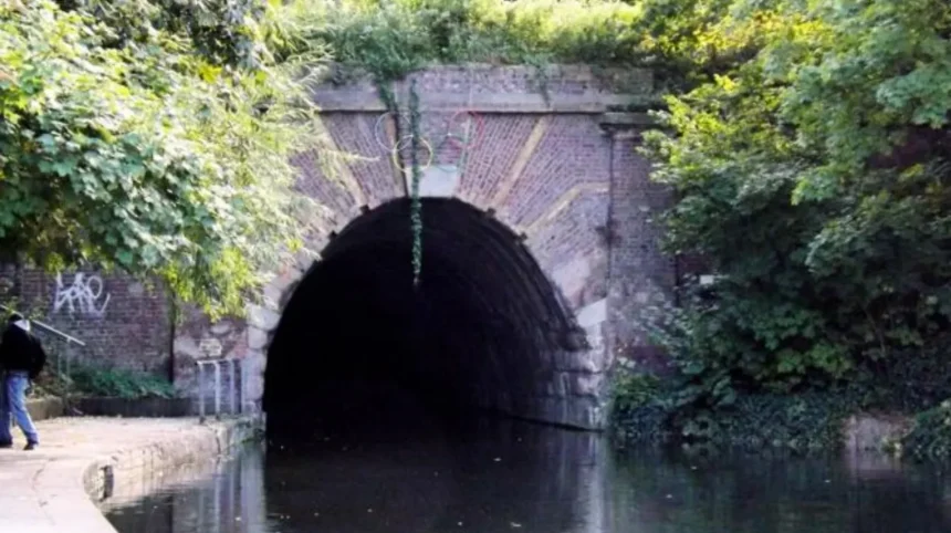
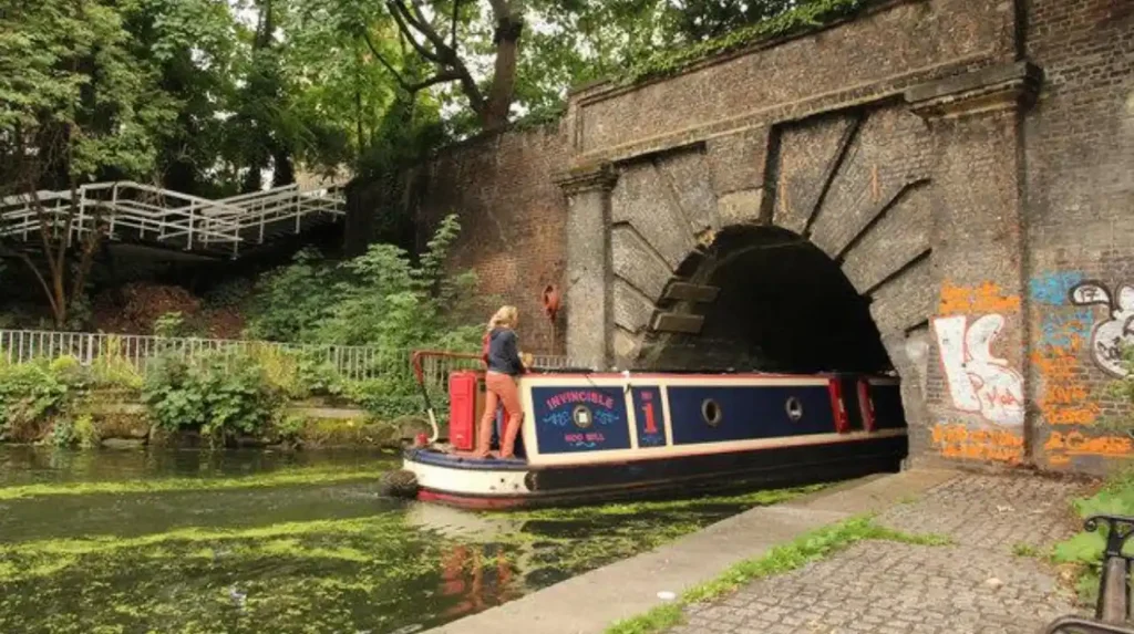
The Islington Tunnel was essential because it allowed Regent’s Canal to pass beneath the densely developed Islington landscape. Designed by engineer James Morgan, the tunnel measures approximately 886 metres and remains one of London’s most significant historic canal engineering structures.
The construction of the Islington Tunnel represented one of the project’s most demanding engineering challenges.
The surrounding landscape contained established roads, buildings and landholdings. Constructing an open canal through the area would have required extensive disruption to existing development.
A tunnel provided a solution by allowing the waterway to continue underground.
James Morgan designed and engineered the structure as part of the canal’s eastern construction phase.
The tunnel extends beneath Islington between the Angel area and the King’s Cross side of the canal. Its original construction involved considerable excavation and engineering work.
The tunnel was completed in 1819, before the full canal opened in 1820.
Unlike some canal tunnels, the Islington Tunnel does not have a continuous towpath through it. Traditional canal horses could not walk alongside the barges underground.
Boatmen therefore used a technique known as legging.
This involved lying on their backs on the boat and pushing against the tunnel walls with their feet to move the vessel forward.
The technique required physical effort and made navigation through the tunnel slower.
In 1826, a steam chain tug was introduced to improve the movement of boats through the tunnel and reduce congestion.
The tunnel remains an important example of early nineteenth-century civil engineering. Its entrances provide visible evidence of the infrastructure required to establish Regent’s Canal through an expanding urban district.
The structure also demonstrates how engineering solutions influenced the physical development of Islington.
How Did City Road Basin Become an Important Commercial Centre?
City Road Basin became one of Regent’s Canal’s most important commercial centres because it provided direct access to inland freight arriving from Britain’s canal network. It supported warehouses, coal yards, timber merchants, manufacturing businesses and distribution operations serving London.
City Road Basin was constructed as part of the canal’s commercial infrastructure. It occupied land around City Road and provided space for boats to load, unload and store goods.
The basin covered approximately four acres and extended on both sides of City Road. Its location provided convenient access to central London and nearby commercial districts.
Its importance increased because businesses required reliable facilities for handling heavy goods. The basin connected canal transport with local warehouses and distribution businesses.
Coal was among the most important commodities. London households, factories and commercial premises depended on coal for heating, industrial production and energy.
Other goods included:
- Timber: Used by construction companies, furniture manufacturers and building suppliers.
- Bricks and cement: Supplied to London’s expanding building industry.
- Grain: Transported for food production and commercial distribution.
- China and manufactured goods: Delivered from manufacturing centres such as Stoke-on-Trent.
- Chemicals: Supplied to industrial and pharmaceutical businesses.
The transport company Pickfords became closely associated with the basin. Its canal operations helped move freight between London and other parts of the country.
City Road Basin also attracted manufacturing businesses. One significant example was British Drug Houses, which established its first building there in 1909. The company became involved in pharmaceutical manufacturing and scientific products.
The basin’s industrial activity demonstrates how canal transport encouraged the development of specialised commercial districts within Islington.
Historic England identifies City Road Basin, Battlebridge Basin and the associated canal wharves as an Archaeological Priority Area because of their industrial remains and historic warehouses.
These surviving archaeological features help explain the commercial importance of Regent’s Canal in nineteenth-century Islington.
What Was the Role of Battlebridge Basin in Islington’s Canal History?
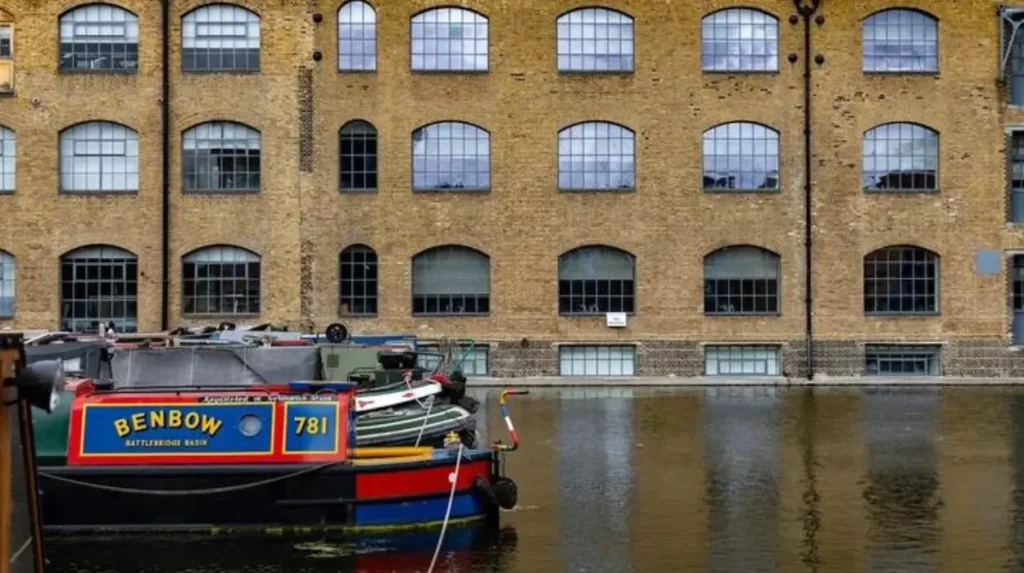
Battlebridge Basin was an important nineteenth-century commercial basin connected to Regent’s Canal near King’s Cross. Originally called Horsfall Basin, it supported timber yards, coal merchants, flour mills, warehouses and the storage of imported Norwegian ice.
Battlebridge Basin developed as an important loading and unloading location near the western entrance of the Islington Tunnel.
The basin was originally known as Horsfall Basin after William Horsfall, the landowner associated with its development. It later became known as Battlebridge Basin, reflecting the historic name of the surrounding King’s Cross area.
The basin opened in 1822 and attracted businesses that depended on canal transportation.
Its commercial activities included timber storage, building materials, flour production and general warehousing.
One particularly important industry was the ice trade.
Before modern refrigeration became widespread, imported natural ice provided a method of preserving food and cooling commercial products.
Swiss-Italian entrepreneur Carlo Gatti became associated with the ice trade in London. He imported natural ice from Norway and used deep ice wells around Battlebridge Basin to store it.
The ice was transported through Regent’s Canal and distributed to businesses and customers across London.
The former ice-storage buildings are now associated with the London Canal Museum.
The museum preserves evidence of the canal’s industrial history and explains how boats, warehouses and ice storage supported nineteenth-century commerce.
Battlebridge Basin also supported other manufacturing businesses during the twentieth century. These included paper suppliers, bottling operations, engineering businesses and food manufacturers.
The Guinness bottling operation was another notable example. Beer transported from Dublin through Limehouse reached the basin by canal before being distributed to customers.
The basin’s commercial role declined as road and rail transport replaced much of the canal’s freight business.
Today, its historic buildings and waterside setting preserve an important part of Islington’s industrial heritage.
What Goods Were Transported Along Regent’s Canal in Islington?
Regent’s Canal transported essential goods into and out of Islington, including coal, timber, bricks, sand, grain, food, chemicals and imported ice. Horse-drawn barges initially carried much of this freight between London docks, industrial premises, warehouses and inland markets.
The canal’s commercial value depended on its ability to move heavy goods efficiently.
London’s population and industrial economy expanded throughout the nineteenth century. This increased demand for construction materials, household fuel, food supplies and manufactured products.
Regent’s Canal provided a direct connection between these markets and the wider inland waterway network.
Coal was a particularly important cargo. It supplied domestic heating, gas production and industrial operations.
Timber arrived for construction and manufacturing businesses. Bricks, sand and cement supported the expansion of residential and commercial buildings.
Food products also travelled along the waterway. Grain, flour, cheese and other provisions supplied London’s markets and food businesses.
Imported goods entered the canal system through Limehouse. Ships delivered cargo from overseas before canal boats transported it to inland distribution centres.
The movement of ice from Norway demonstrates how the canal supported specialised international trade.
The transportation process generally involved several stages:
- Ships unloaded imported cargo at Limehouse.
- Canal barges collected goods from the docks.
- Boats travelled along Regent’s Canal towards Islington and other distribution centres.
- Workers unloaded cargo at wharves and commercial basins.
- Warehouses stored products before onward distribution by road or local transport.
Horse-drawn boats initially dominated canal operations. Horses walked along the towpath while pulling barges using ropes attached to the vessels.
Tugs and mechanical assistance later improved certain sections of the waterway.
The canal’s freight operations connected local businesses with regional and international supply networks. This connection was a major reason for the growth of industrial activity around Islington’s basins and wharves.
How Much Commercial Traffic Did Regent’s Canal Carry?
Regent’s Canal became a major freight route during the nineteenth century. Historical records indicate that annual goods traffic increased from approximately 500,000 tons in 1830 to 1.4 million tons in 1876, demonstrating its importance to London’s industrial economy.
The canal’s commercial success developed during the decades following its opening.
In 1820, approximately 120,000 tons of cargo travelled along the newly completed waterway during its first year.
As businesses established themselves along the route, freight volumes increased considerably.
Historical figures recorded in the Regent’s Canal conservation area appraisal provide the following estimates:
- 1830: Approximately 500,000 tons of goods annually.
- 1850: Approximately 1 million tons annually.
- 1876: Approximately 1.4 million tons annually.
- 1927: Approximately 700,000 tons annually.
The increase reflected growing demand for coal, construction materials, food supplies and manufactured products.
Pickfords was among the major canal carriers before transferring its entire carrying business to the railways in 1847.
Other important operators included the Grand Junction Canal Company’s Carrying Establishment and Fellows, Morton and Clayton.
The canal continued carrying substantial commercial freight into the twentieth century.
Its annual traffic remained around one million tons between the 1880s and the First World War, according to the historical conservation appraisal.
However, competition from railways and road transport gradually reduced its commercial importance.
The figures demonstrate that Regent’s Canal was not simply a local waterway. It formed part of a much larger transport system connecting London with industrial regions across England.
Its freight operations also explain why Islington became an important location for warehousing, manufacturing and distribution.
How Did Regent’s Canal Influence Industrial Development in Islington?
Regent’s Canal encouraged Islington’s industrial development by providing businesses with affordable access to freight transportation. Coal yards, timber merchants, chemical manufacturers, mills, warehouses and engineering companies established operations around its basins and commercial wharves.
The canal changed the economic geography of Islington.
Industrial businesses needed access to raw materials and reliable distribution routes. Canal-side premises offered both advantages.
Warehouses developed near loading points because businesses could transfer goods directly between barges and storage buildings.
Manufacturers also benefited from access to coal and construction materials.
The industrial landscape around Battlebridge Basin and City Road Basin included several different types of businesses.
Important examples included:
- Timber yards: Supplied wood to construction businesses and manufacturers.
- Flour mills: Processed grain delivered through the canal network.
- Paper businesses: Received large quantities of paper and other manufacturing materials.
- Chemical manufacturers: Used canal transport for industrial supplies.
- Engineering works: Produced and maintained machinery and industrial equipment.
- Food businesses: Stored and distributed imported and locally manufactured products.
British Drug Houses became a particularly notable industrial presence around City Road Basin.
Its manufacturing activities included pharmaceutical and scientific products. The company demonstrated that canal-side industrial development continued to evolve beyond traditional coal and timber businesses.
The canal also supported employment.
Boat operators, warehouse workers, engineers, labourers, merchants and factory employees depended directly or indirectly on the waterway.
Residential neighbourhoods developed around these commercial areas as Islington became increasingly urbanised.
The canal therefore influenced more than freight movement. It helped shape employment patterns, land use, building development and the economic identity of the district.
Historic England’s archaeological research identifies surviving industrial structures around the canal as important evidence of this development.
Why Did Commercial Activity on Regent’s Canal Decline?
Commercial activity declined because railways and road transport offered increasingly competitive alternatives to canal freight. Changes in industrial distribution, post-war economic conditions and modern cargo-handling methods further reduced the canal’s traditional role in London’s transport system.
The railway network expanded rapidly during the nineteenth century.
Railways offered faster connections between industrial centres, ports and major commercial markets. Businesses increasingly selected railway services for goods requiring quicker delivery.
Pickfords’ transfer of its canal carrying business to the railways in 1847 demonstrated this changing transport market.
Road transport introduced further competition during the twentieth century.
Motor vehicles provided greater flexibility for businesses that needed deliveries directly to factories, shops and warehouses.
Regent’s Canal nevertheless retained an important role in freight transportation for many decades.
The canal’s commercial traffic began declining more significantly during the twentieth century. Historic England records the beginning of this decline in the 1920s, with many wharves becoming neglected or derelict by the 1950s.
Nationalisation in 1948 transferred the canal into public ownership as part of the wider nationalisation of Britain’s inland waterways.
Another important turning point was the winter of 1962–63.
Severe freezing disrupted canal operations, preventing cargo boats from moving for extended periods. Much of the remaining freight business transferred permanently to road transport.
By the late 1960s, commercial traffic had almost disappeared.
The decline changed the function of the waterway.
Warehouses lost their original transport-related purpose. Some industrial sites became vacant, while others were adapted for different commercial and residential uses.
The reduction in freight activity eventually created opportunities for regeneration.
The canal moved from being primarily an industrial transport route towards becoming a public recreational and heritage destination.
How Has Regent’s Canal Changed Since Its Industrial Decline?
Since commercial freight declined, Regent’s Canal has developed into a recreational waterway and urban heritage corridor. Its historic basins, former warehouses, towpaths and industrial buildings now support walking, cycling, boating, residential development and cultural activities.
The transformation of Regent’s Canal reflects wider changes in London’s industrial landscape.
Former warehouses and factories around Islington gradually acquired new uses.
Some buildings became residential properties, offices, cultural venues and commercial premises.
The waterfront also became an important part of urban regeneration.
City Road Basin demonstrates this change particularly clearly. Its historic industrial surroundings have been transformed through modern development, while the basin itself remains an identifiable feature of Islington’s canal heritage.
Battlebridge Basin also retains its historic relationship with the waterway.
The London Canal Museum provides an educational connection to the area’s commercial past. Its collections explain canal transportation, working boats, cargo handling and the historic ice trade.
The wider canal environment now serves several purposes:
- Recreation: Walking and cycling along the towpath.
- Tourism: Exploring historic bridges, tunnels and basins.
- Education: Learning about industrial history at the London Canal Museum.
- Residential development: Living in converted warehouses and modern waterside properties.
- Boating: Using the canal for leisure navigation and residential moorings.
Research published in the Planning Perspectives journal examines the changing role of Regent’s Canal as an urban landscape. It identifies the relationship between historic transport infrastructure, environmental value, recreation and waterfront regeneration.
This transformation has also increased the importance of preserving historic buildings and industrial remains.
The canal now contributes to Islington’s public spaces, local identity and cultural heritage.
Which Historic Places Can Visitors Explore Along Regent’s Canal in Islington?
Visitors can explore several locations that reveal Regent’s Canal’s industrial history, including Islington Tunnel, City Road Basin, Battlebridge Basin and the London Canal Museum. These places preserve historic structures and demonstrate how the waterway influenced North London’s development.
Exploring the canal provides an opportunity to understand Islington’s historical development through its surviving buildings and infrastructure.
The following locations are particularly relevant to its history.
1. Islington Tunnel
The Islington Tunnel is one of the canal’s most important engineering structures. Its entrances demonstrate how nineteenth-century engineers constructed waterways beneath developed land.
Visitors can explore the surrounding towpath and identify the tunnel’s historic entrances.
2. City Road Basin
City Road Basin illustrates the canal’s former commercial importance. Its location reflects the relationship between freight transportation, warehouses and industrial development.
Modern buildings surround the basin, creating a visible contrast between its historic trading function and contemporary urban use.
3. Battlebridge Basin
Battlebridge Basin preserves the character of an important historic loading and storage location.
Its connection with the former ice trade and industrial warehouses makes it an important destination for understanding Islington’s commercial past.
4. London Canal Museum
The London Canal Museum offers visitors a closer understanding of Britain’s inland waterways.
Its exhibitions explain canal engineering, historic cargo transportation, working boats and the ice trade.
5. Regent’s Canal Towpath
The towpath provides a continuous pedestrian connection along sections of the canal.
Visitors can observe historic bridges, waterside buildings, moored boats and changing urban landscapes.
These locations collectively explain how the canal developed from commercial infrastructure into an important recreational destination.
How Can Visitors Explore the Historical Regent’s Canal Route?
Visitors can explore Regent’s Canal through walking routes, cycling sections, museum visits and guided boat trips. The Islington stretch provides access to historic basins, tunnel entrances and former industrial areas within North London’s canal network.
The towpath is one of the most accessible ways to experience the canal.
Walking allows visitors to examine historic infrastructure at a slower pace and understand the relationship between the waterway and surrounding neighbourhoods.
The Angel area provides a useful starting point for exploring Islington’s canal heritage.
Visitors can follow the towpath towards City Road Basin and Battlebridge Basin, observing the changes in architecture and land use along the route.
A practical historical exploration can include:
- Starting near the Angel and Islington Tunnel area.
- Following the towpath towards City Road Basin.
- Exploring the historic commercial surroundings.
- Continuing towards Battlebridge Basin.
- Visiting the London Canal Museum.
- Observing the former warehouse and industrial landscape around King’s Cross.
Cycling provides another way to explore suitable towpath sections. Visitors should follow the relevant Canal and River Trust access rules and give pedestrians priority.
Boat trips operate on selected sections of Regent’s Canal, particularly around Camden and Little Venice. Availability and routes depend on the operator and season.
For visitors interested in the wider history of the surrounding neighbourhood, the canal also provides a useful connection to Islington’s architectural and urban development.
As you explore the modern waterfront, you are crossing land shaped by centuries of change. Read about the full [Historical Development of Islington From a Rural Village to an Urban Borough] to understand the area’s wider origins.
The route therefore connects industrial heritage with the modern cultural and recreational identity of North London.
How Is Regent’s Canal Protected as a Historic Heritage Site?
Regent’s Canal retains historical importance because its tunnels, bridges, basins, wharves and industrial remains document London’s nineteenth-century transport development. Heritage protection, archaeological research and conservation planning help preserve these structures for future generations.
The canal contains structures that illustrate the engineering and commercial systems of the industrial period.
Historic England recognises the archaeological importance of the Regent’s Canal and associated industrial remains in Islington.
Its Archaeological Priority Area includes the canal, City Road Basin, Battlebridge Basin and historic wharves.
The Islington Tunnel entrances and tunnel structure also have Grade II listed status.
Listed status is a form of legal protection under the Planning (Listed Buildings and Conservation Areas) Act 1990. It recognises buildings and structures of special architectural or historic interest.
Conservation planning also considers the relationship between historic structures and their surroundings.
Important heritage features include:
- Original canal walls and engineering structures.
- Historic bridges and tunnel entrances.
- Former loading areas and wharves.
- Industrial warehouses and manufacturing buildings.
- Archaeological remains associated with freight transportation.
Preserving these features is important because the canal’s history is not limited to the waterway itself.
Its commercial development influenced the surrounding urban landscape. Historic buildings, industrial foundations and former loading areas provide evidence of how the district operated.
Modern redevelopment therefore needs to consider the historical character of the canal environment.
The Canal and River Trust manages the waterway and supports its continued use for navigation and public enjoyment.
Historic England and local heritage organisations contribute to the understanding and protection of the canal’s historical significance.
Together, these organisations help maintain the relationship between the waterway’s industrial past and its contemporary public use.
Why Does Regent’s Canal Remain Important to Islington Today?
Regent’s Canal remains important because it preserves Islington’s industrial heritage while providing recreational space, environmental value and connections between neighbourhoods. Its historic infrastructure continues to influence local identity, waterfront development, tourism and public access.
The canal’s importance has changed considerably since its opening in 1820.
During the nineteenth century, its main purpose was commercial transportation. It connected Islington businesses with London’s docks and the wider inland waterway network.
Today, its significance extends beyond transportation.
The waterway provides a green corridor through an increasingly developed urban environment. Its towpaths connect residential areas with commercial districts and cultural attractions.
It also supports urban biodiversity. Water, vegetation and waterside habitats provide environments for birds, aquatic life and other wildlife.
The canal contributes to local tourism by connecting visitors with historic sites and museums.
Its former warehouses and industrial structures also provide opportunities for understanding London’s architectural development.
The importance of Regent’s Canal can be understood through four continuing functions.
Industrial heritage: Its basins, bridges and tunnel preserve evidence of nineteenth-century engineering and trade.
Public recreation: Its towpaths support walking, cycling and access to waterside spaces.
Cultural tourism: Historic buildings and museums provide opportunities for learning about London’s canal history.
Urban regeneration: Former industrial sites demonstrate how historic infrastructure can remain part of modern neighbourhood development.
The canal’s continued presence also explains the historical relationship between Islington and London’s wider economic growth.
Its transformation from a commercial waterway into a recreational and heritage destination represents an important stage in North London’s urban development.
Explore More Area Guide
How Islington Grew from Rural Village to Urban Borough
What Are Islington’s Main Neighbourhoods and Districts?
What Is the Future of Regent’s Canal as a Heritage Destination?
Regent’s Canal’s future depends on balancing heritage conservation, public access, environmental protection and urban regeneration. Its historic infrastructure provides a lasting connection to London’s industrial past while supporting recreation and sustainable urban development.
The canal remains an important part of North London’s historic environment.
Future development around the waterway needs to recognise its architectural, archaeological and environmental value.
Several priorities influence its continued importance.
Heritage conservation: Historic bridges, tunnel entrances, warehouses and industrial structures require appropriate maintenance and protection.
Public accessibility: Safe and accessible towpaths support walking, cycling and local recreation.
Environmental management: Water quality, wildlife habitats and vegetation contribute to the canal’s environmental value.
Responsible regeneration: New residential and commercial developments need to respect the historic character of the waterway.
Historical education: Museums, heritage exhibitions and local historical research help communicate the canal’s importance to future generations.
The canal also provides opportunities for connecting historical tourism with contemporary urban experiences.
Visitors can explore the industrial history of Islington while enjoying its modern restaurants, residential developments and public spaces.
The transformation of Regent’s Canal demonstrates how historic infrastructure can remain relevant after its original economic purpose disappears.
How Did Regent’s Canal Shape Islington’s History?
Regent’s Canal played a significant role in transforming Islington’s economic and physical landscape. Its construction began in 1812, and the complete waterway opened on 1 August 1820.
The canal connected London’s western inland waterway network with the River Thames at Limehouse. It provided an important route for transporting coal, timber, construction materials, food and manufactured products.
Within Islington, City Road Basin and Battlebridge Basin became important commercial locations. Their warehouses, wharves and industrial businesses supported the movement and storage of goods.
The Islington Tunnel demonstrated the engineering achievements required to construct the waterway beneath an established urban landscape.
Although railway and road competition eventually reduced commercial traffic, the canal retained its historical and geographical importance.
Today, Regent’s Canal provides recreational routes, heritage attractions, environmental value and opportunities for urban regeneration.
Its history explains how industrial transport infrastructure helped shape modern Islington and why the waterway remains an important part of North London’s identity.
When was Regent’s Canal built in Islington?
Construction of Regent’s Canal began on 7 October 1812. The complete canal officially opened on 1 August 1820, connecting Paddington with Limehouse and the River Thames.