Islington, in North London, developed from a small rural settlement into one of London’s most established urban boroughs through centuries of population growth, transport improvements, industrial expansion and residential development. Its transformation began with medieval villages and agricultural land before accelerating during the Georgian and Victorian periods. The arrival of canals, railways and new roads connected Islington to central London, attracting businesses, workers and growing communities.
- What Was Islington Like Before It Became an Urban Borough?
- How Did Islington’s Location Influence Its Early Development?
- When Did Islington Begin Changing From a Village Into a Suburb?
- How Did the New River Change Islington’s Growth?
- What Role Did Agriculture and Livestock Markets Play in Islington’s Economy?
- How Did the Regent’s Canal Contribute to Islington’s Urbanisation?
- Why Did Railways Transform Islington During the Victorian Period?
- How Did Railway Development Affect Housing?
- Why Did Industrial Development Concentrate Near Transport Routes?
- How Did Victorian Housing Change Islington’s Population and Architecture?
- How Did Industrialisation and Migration Shape Islington’s Urban Communities?
- When Did Islington Become an Official Urban Borough?
- How Did the Twentieth Century Reshape Islington’s Urban Landscape?
- Which Historic Places Show Islington’s Transformation From Village to City?
- How Has Islington Preserved Its Historical Identity While Continuing to Develop?
- What Is Islington Like Today Compared With Its Rural Past?
- Why Is Islington’s Transformation Important to London’s Wider History?
- What Can Islington’s History Tell Us About Its Future Development?
Today, the London Borough of Islington combines historic streets, Georgian terraces, Victorian architecture, modern housing developments and busy commercial districts. Areas such as Angel, Highbury, Holloway, Barnsbury and Clerkenwell reflect different stages of its urban development.
Understanding Islington’s history explains how a rural settlement became a densely populated part of the capital. It also helps visitors recognise the historical significance of its streets, public spaces, transport routes and surviving buildings.
What Was Islington Like Before It Became an Urban Borough?
Before urbanisation, Islington was a rural settlement in Middlesex, surrounded by agricultural fields, grazing land, woodland and small village communities. Its position north of the City of London made it an important stopping point for travellers, farmers and traders travelling along historic routes.
Islington’s recorded history extends back to the Anglo-Saxon period. Its original name appeared in different forms, including Giseldone and Gislandune. The name is generally interpreted as meaning Gisla’s hill, combining an Old English personal name with a word meaning hill.
The settlement was recorded in the Domesday Book of 1086 as Isendone. The Domesday Book was a nationwide survey commissioned by William the Conqueror to record land ownership, resources and taxable property across England.
During the medieval period, Islington remained largely agricultural. Its landscape consisted of open fields, pastureland, farms and scattered houses. Farming supported local households and supplied food to the expanding population of London.
The settlement developed around the historic route that later became Upper Street and Holloway Road. These roads connected Islington with northern settlements and provided access to the City of London.
Its proximity to London was important. Residents could supply fresh produce, livestock and other agricultural goods to the capital without living within its crowded streets.
Historical records also identify Islington as a popular rural destination for London residents. People travelled outside the city to enjoy country air, public houses, refreshments and outdoor recreation.
The area therefore occupied an important position between the countryside and the expanding capital. It retained its village character for centuries while gradually developing stronger commercial and transport connections.
How Did Islington’s Location Influence Its Early Development?
Islington’s location north of the City of London shaped its development by connecting rural communities with major commercial routes. Its elevated position, access to water and proximity to London encouraged agriculture, roadside businesses, livestock trading and gradual residential expansion.
Geography played a central role in Islington’s transformation. The historic settlement occupied higher ground north of the River Thames valley, making it a convenient location for people travelling between London and northern England.
The Great North Road was particularly important. This historic route connected London with destinations further north and passed through Islington. Its modern route is associated with the A1 corridor.
Roadside development encouraged the growth of inns, shops, workshops and residential buildings. Upper Street became one of the principal commercial streets because it served travellers and local communities.
The surrounding countryside also supported livestock production. Farmers used nearby pastures to raise animals before transporting them towards London’s markets.
Islington’s position near the City of London created an early relationship between rural production and urban consumption. Agricultural businesses supplied the capital, while London’s growing population generated demand for transport, accommodation and commercial services.
Several settlements gradually developed along important roads. These included Islington village, Holloway, Highbury and Barnsbury. Each retained distinctive characteristics as the wider area expanded.
The geographical advantages that supported medieval agriculture eventually helped Islington become an attractive location for suburban housing and commercial development.
When Did Islington Begin Changing From a Village Into a Suburb?
Islington’s transition towards suburban development became increasingly visible during the seventeenth and eighteenth centuries. Wealthier London residents moved northwards, country houses appeared around established villages, and new roads and residential buildings gradually replaced agricultural land.
The seventeenth century marked an important period in Islington’s development. London was expanding, and wealthier residents increasingly sought homes outside the crowded central districts.
Islington offered access to the capital while retaining a quieter environment. Its open spaces, relatively healthy location and established road connections attracted merchants, professionals and affluent households.
The growth of residential properties changed the settlement’s social structure. Country houses and larger properties appeared around areas such as Canonbury and Highbury.
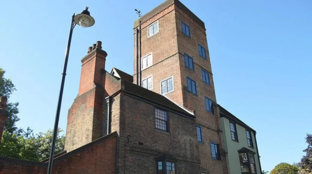
Canonbury Tower became an important surviving reminder of the area’s earlier development. The medieval tower formed part of the historic Canonbury estate and remains a recognised heritage landmark.
The eighteenth century brought further suburban expansion. Georgian houses, terraces and planned residential streets appeared around Angel, Barnsbury and Islington Green.
The Georgian architectural period, generally associated with the reigns of George I to George IV, influenced residential design across London. Buildings from this period commonly featured symmetrical façades, sash windows and carefully proportioned streets.
Islington’s growing residential population increased demand for local services. Shops, churches, schools, public houses and commercial premises became more important to everyday life.
However, the transition was gradual. Agricultural fields and undeveloped land continued to exist alongside newer residential streets.
The result was a developing suburb rather than a fully urbanised district. Islington was increasingly connected to London but still retained substantial elements of its rural past.
How Did the New River Change Islington’s Growth?
The New River transformed Islington by providing a reliable water supply to London from Hertfordshire. Opened in 1613, this major engineering project supported population growth, improved water infrastructure and established an important feature of the area’s physical and historical landscape.
The New River was one of the most significant infrastructure developments in Islington’s history.
Completed in 1613, it was an artificial watercourse designed to transport fresh water from the River Lea catchment in Hertfordshire towards London.
The project was developed under the direction of Hugh Myddelton, a Welsh merchant and entrepreneur. Its purpose was to address the capital’s increasing demand for clean water.
Before the project, London relied on several sources, including wells, springs and the River Thames. Population growth placed increasing pressure on these supplies.
The New River provided a more organised water distribution system. Its route passed through northern London, including Islington, before reaching its original distribution facilities.
The watercourse remained important for approximately four centuries. It supported London’s development and became part of the infrastructure that enabled the capital to expand.
The New River also influenced Islington’s local geography. Its route created a distinctive landscape feature and encouraged the development of surrounding areas.
Today, sections of the historic New River route remain associated with green spaces and heritage landscapes.
For visitors, the New River provides an opportunity to understand how water infrastructure contributed to London’s urban growth. Its history also connects Islington with the wider story of public health, engineering and urban planning.
What Role Did Agriculture and Livestock Markets Play in Islington’s Economy?
Agriculture and livestock trading helped establish Islington as an important commercial centre before industrialisation. Its grazing fields supported London’s food supply, while roads connecting northern England with the capital brought livestock traders, farmers, transport workers and related businesses into the area.
Islington’s agricultural economy depended on its relationship with London’s growing food market. Farmers used the surrounding countryside for grazing and transported livestock towards Smithfield and other commercial markets.
The area’s open fields provided space for cattle and sheep. Livestock movement created employment for drovers, stable workers, butchers, carriers and public house owners.
Cattle and sheep were transported along established roads, including routes through Upper Street and Holloway. These connections made Islington an important part of London’s wider livestock distribution network.
The expansion of livestock trading also created pressure on existing market facilities. London’s population increased, and the demand for meat continued to grow.
In June 1855, Prince Albert opened the Metropolitan Cattle Market at Copenhagen Fields in Islington. The market occupied approximately 30 acres and provided facilities for more than 7,000 cattle and 42,000 sheep.
Its establishment represented an important stage in the area’s commercial development. Livestock trading became more organised, and the market attracted workers and businesses associated with the meat industry.
The market continued operating until 1939. Its history demonstrates how agricultural activities contributed to Islington’s economic development before the area became predominantly residential and commercial.
The former market site is now associated with Caledonian Park. The surrounding landscape preserves part of Islington’s industrial and agricultural heritage.
How Did the Regent’s Canal Contribute to Islington’s Urbanisation?
The Regent’s Canal accelerated Islington’s commercial and industrial development by connecting the district with London’s wider waterway network. Opened in 1820, it supported the movement of construction materials, coal, timber and other goods, encouraging warehouses, factories and employment.
The Regent’s Canal was constructed during a period of rapid economic expansion in London. It connected the Paddington Canal with the Limehouse area, providing a navigable route between western and eastern parts of the capital.
The canal reached Islington in the early nineteenth century and became an important transport connection.
Its construction changed the area’s economic geography. Before the canal, transporting heavy goods over roads was expensive and inefficient. Water transport provided an alternative for businesses handling large quantities of materials.
The canal supported industries that depended on regular deliveries of coal, timber, bricks and other commodities.
One particularly important development was the construction of the Islington Tunnel. The tunnel allowed the canal to pass beneath the densely developing district rather than following a lengthy surface route.
City Road Basin became an important commercial location. Goods arriving by canal were unloaded, stored and distributed to nearby businesses and construction sites.
The basin supported warehouses and commercial premises. Its surrounding area developed into an important centre for industrial activity.
The canal also influenced residential growth. Industrial expansion attracted workers who needed accommodation close to employment.
Although road transport and railways eventually reduced the canal’s commercial importance, its physical presence remains part of Islington’s urban landscape.
Today, the Regent’s Canal provides a walking route through historic industrial surroundings. Visitors can explore the canal environment around City Road Basin and understand how nineteenth-century infrastructure supported the district’s growth.
Why Did Railways Transform Islington During the Victorian Period?
Railways transformed Islington during the nineteenth century by improving connections with central London and surrounding districts. Their arrival encouraged rapid residential construction, industrial activity and population growth, turning large areas of former countryside into connected urban neighbourhoods.
Railway development represented a major turning point in Islington’s history.
During the mid-nineteenth century, London’s population expanded rapidly. Rail transport made it easier for workers to travel between residential districts, commercial centres and industrial employment areas.
Islington experienced a significant change during the 1850s as railway infrastructure expanded across the borough’s surrounding districts.
Railway stations and goods facilities strengthened connections with other parts of London. Businesses gained access to faster transport, while residents gained more convenient journeys.
The railways also influenced the pattern of property development. Builders constructed long rows of terraced houses to accommodate workers and their families.
Industrial and warehouse development became particularly important around railway goods yards and transport corridors.
The combination of railways, canals and established roads created a connected urban economy. Islington was no longer simply a rural settlement serving London’s food requirements. It became part of the capital’s expanding residential and industrial network.
How Did Railway Development Affect Housing?
Railway expansion increased demand for affordable housing near employment centres. Builders developed terraced properties in areas such as Holloway, Lower Holloway and parts of Islington.
Victorian terraces commonly featured repeated architectural designs, narrow frontages and multiple storeys. Their construction allowed developers to accommodate more households within limited urban space.
The development of railway connections also made suburban living more practical for middle-class residents. Families could live further from central London while maintaining access to employment and commercial facilities.
Why Did Industrial Development Concentrate Near Transport Routes?
Factories, warehouses and distribution businesses benefited from locations near railway lines, canals and major roads.
Transport connections reduced the cost of moving goods and materials. They also provided access to larger markets and wider labour pools.
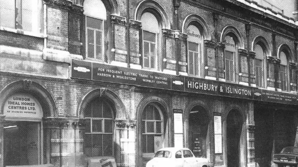
The southern part of the historic parish, particularly around King’s Cross and Pentonville, became associated with industry, working-class housing and large institutions.
This pattern of development established the mixed urban character that remains visible across parts of Islington.
How Did Victorian Housing Change Islington’s Population and Architecture?
Victorian housing transformed Islington’s landscape by replacing agricultural land with residential streets, terraces and larger suburban properties. Population growth created demand for homes, schools, shops and public services, establishing neighbourhoods that remain central to the borough’s identity.
The Victorian period was the most significant phase of Islington’s nineteenth-century urban expansion.
London’s industrial economy attracted people from surrounding counties and other parts of Britain. Islington provided housing close to central employment areas and transport connections.
Developers constructed different types of residential properties to accommodate different income groups.
Working-class households commonly occupied smaller terraced houses. Middle-class residents settled in larger properties around Barnsbury, Highbury and Canonbury.
The distinction between residential areas reflected the social structure of Victorian London.
Barnsbury became particularly associated with planned Georgian and Victorian residential development. Its squares and terraces demonstrate the influence of formal urban planning.
Highbury also experienced substantial residential growth. Large houses and villas appeared alongside established roads, creating an increasingly suburban environment.
Holloway developed through a combination of housing, commercial activity and transport infrastructure. Its position along Holloway Road encouraged shops and local businesses.
Residential expansion also increased pressure on public facilities. Churches, schools, markets and other community institutions developed to serve the growing population.
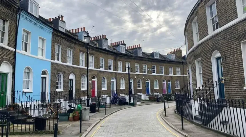
The architectural legacy of this period remains visible across the borough. Georgian terraces, Victorian houses and historic commercial buildings provide evidence of different stages of urbanisation.
These buildings also explain why Islington contains numerous conservation areas. Conservation areas are designated locations where the character and appearance of historically significant buildings and streets receive additional planning protection.
For visitors, exploring Barnsbury, Canonbury and Highbury provides an opportunity to observe how nineteenth-century suburban development shaped modern North London.
How Did Industrialisation and Migration Shape Islington’s Urban Communities?
Industrialisation and migration reshaped Islington by attracting workers, merchants and families from different backgrounds. Manufacturing, construction, transport and service industries supported employment, while successive migration waves influenced housing, local businesses, religious institutions and neighbourhood identities.
Islington’s urban expansion was not only a physical transformation. It also changed the people who lived and worked in the area.
Industrialisation created employment opportunities across transport, construction, manufacturing and commercial services. These industries attracted workers who needed affordable accommodation close to their workplaces.
The growth of railway facilities, warehouses and markets increased demand for manual labour. Local residents worked in loading, transportation, building trades, food distribution and other occupations.
Population growth also increased demand for shops, schools, public houses and religious buildings.
During the nineteenth and twentieth centuries, migration further influenced the area’s identity. People arrived from different parts of Britain, Ireland and overseas.
The development of local communities reflected wider changes in London’s population. Different groups established businesses, places of worship and community organisations.
Clerkenwell, in the southern part of the present borough, developed a particularly distinctive industrial and commercial identity.
Its historical associations include printing, watchmaking, craft industries and metalworking. These activities contributed to the area’s employment and architectural development.
The wider borough also developed strong political and cultural connections. Religious reformers, writers, artists and political activists contributed to its intellectual history.
Today, Islington remains a culturally diverse borough. According to Islington Council’s account of the 2021 Census, approximately 248,000 people lived in the borough, and 40% of residents were born outside the United Kingdom.
These figures demonstrate how migration continues to shape the area long after its transformation from a rural settlement.
When Did Islington Become an Official Urban Borough?
Islington’s administrative transformation followed its physical urbanisation. Local government initially operated through historic parish vestries before metropolitan boroughs were established in 1900. The present London Borough of Islington officially came into existence in 1965 through local government reorganisation.
Before the twentieth century, Islington’s administration was divided between three historic civil parishes:
- St Mary Islington, covering the northern and central areas.
- St James Clerkenwell, covering the south-western area.
- St Luke Old Street, covering the south-eastern area.
A civil parish was a historic administrative and ecclesiastical division responsible for local community matters.
Parish vestries gradually became responsible for a wider range of local services. These included poor relief, public health administration, local roads and other community responsibilities.
However, London’s rapid population growth created challenges that traditional parish administration struggled to manage.
In 1900, the historic administrative structure changed. Two metropolitan boroughs were established:
The Metropolitan Borough of Islington: This covered the former St Mary Islington parish.
The Metropolitan Borough of Finsbury: This combined the former Clerkenwell and St Luke areas.
These boroughs operated as local government authorities within the County of London.
A further administrative change took place in 1965. The London Government Act 1963 reorganised London’s local government structure, establishing new London boroughs.
On 1 April 1965, the Metropolitan Boroughs of Islington and Finsbury merged to form the present London Borough of Islington.
The new borough became part of Greater London. Its boundaries brought together communities with different historical, architectural and commercial identities.
This administrative merger established the modern borough that visitors and residents recognise today.
How Did the Twentieth Century Reshape Islington’s Urban Landscape?
Twentieth-century development reshaped Islington through population changes, housing programmes, wartime destruction, infrastructure investment and urban regeneration. The construction of council housing and post-war estates changed residential patterns while preserving the borough’s established network of streets.
The twentieth century introduced new challenges for Islington.
The borough entered the century as an established urban district with Victorian housing, industrial premises and busy commercial streets.
However, housing conditions became an increasingly important concern. Some older properties suffered from overcrowding, poor sanitation and inadequate facilities.
Local authorities responded through housing improvement programmes and the construction of council housing.
Council housing refers to residential properties owned or managed by local authorities to provide accommodation at regulated rents.
The development of social housing became an important part of Islington’s twentieth-century history.
What Was the Impact of the Second World War?
The Second World War caused further changes to the borough’s built environment.
German bombing damaged residential properties, commercial buildings and infrastructure across London, including parts of Islington.
Bomb-damaged sites created opportunities for post-war reconstruction. Local authorities subsequently developed new housing estates and modern residential buildings.
These developments changed the architectural appearance of several neighbourhoods.
Post-war housing estates became particularly important in areas where older properties had been damaged or cleared.
How Did Urban Regeneration Influence Islington?
From the 1960s onwards, housing refurbishment and urban regeneration influenced the borough’s development.
Urban regeneration involves improving existing buildings, infrastructure, public spaces and economic opportunities within established neighbourhoods.
Some historic residential properties were renovated, while commercial and industrial buildings received new uses.
The redevelopment of former industrial areas also contributed to changes in the local economy.
During the later twentieth century, parts of Islington experienced rising property demand and gentrification.
Gentrification describes a process in which investment and higher-income residents change the economic and social character of an established neighbourhood.
This process affected areas such as Barnsbury, Canonbury and Clerkenwell. Property renovation and commercial investment increased the attractiveness of these locations.
However, regeneration also created concerns about affordability and displacement.
These changes established many of the social and architectural contrasts visible across Islington today.
Which Historic Places Show Islington’s Transformation From Village to City?
Several surviving landmarks demonstrate Islington’s development from agricultural settlement to urban borough. Historic buildings, former transport infrastructure, market sites and Georgian streets provide physical evidence of its changing economy, architecture and population.
Visitors can explore several locations to understand the borough’s historical development.
Canonbury Tower
Canonbury Tower is one of Islington’s important surviving medieval structures.
It is associated with the historic Canonbury estate and provides evidence of the area’s development before large-scale suburban expansion.
The surrounding Canonbury neighbourhood contains historic residential buildings and streets that reflect later Georgian and Victorian growth.
Islington Green
Islington Green occupies a historic position near Upper Street and Angel.
The surrounding area developed as an important commercial and residential centre.
Its location demonstrates the relationship between historic village settlements and the development of modern retail and entertainment districts.
The Regent’s Canal and City Road Basin
The Regent’s Canal and City Road Basin illustrate the importance of nineteenth-century industrial transport.
Visitors can explore the canal environment and understand how waterways supported commercial development.
The basin also provides evidence of the relationship between transport infrastructure, warehouses and industrial employment.
Caledonian Park
Caledonian Park preserves the history of the Metropolitan Cattle Market.
The market opened in 1855 and became an important centre for London’s livestock trade.
Its surviving clock tower and surrounding landscape provide a connection with Islington’s agricultural and commercial past.
Clerkenwell
Clerkenwell represents another important part of the borough’s history.
Its historic streets contain buildings associated with religious institutions, manufacturing, printing and traditional crafts.
The area’s architectural character reflects centuries of development rather than a single period of urban expansion.
Visitors interested in understanding the wider historical development of the area should also explore the [Insert Anchor Text for Islington’s Historical Landmarks and Heritage Sites Here]. This provides a useful connection between the borough’s surviving historic buildings and its transformation into a modern urban destination.
How Has Islington Preserved Its Historical Identity While Continuing to Develop?
Islington has preserved its historical identity through conservation areas, listed buildings, heritage protection and the reuse of historic structures. These measures help retain architectural character while allowing housing, commercial development, transport improvements and public spaces to evolve.
Urban development did not remove every trace of Islington’s rural and Victorian past.
Many historic streets, buildings and public spaces remain part of the modern borough.
Historic England identifies substantial heritage resources across Islington, including medieval buildings, post-medieval structures and twentieth-century landmarks.
Conservation areas protect locations with special architectural or historic interest. Planning controls help manage changes to buildings and their surroundings.
Listed buildings receive statutory protection because of their architectural or historic significance.
Islington’s Georgian and Victorian streets are particularly important to its architectural identity.
The borough also contains examples of twentieth-century public housing, former industrial buildings and modern developments.
The relationship between historic preservation and new construction remains an important planning consideration.
The borough must accommodate housing demand, commercial activity and infrastructure improvements while maintaining the character of established neighbourhoods.
This balance is particularly visible around Angel, Clerkenwell, Highbury and Barnsbury.
For visitors, the result is an urban environment in which different historical periods remain visible within relatively short distances.
What Is Islington Like Today Compared With Its Rural Past?
Modern Islington is a densely developed inner-London borough with residential neighbourhoods, cultural attractions, commercial centres and historic landmarks. Its contemporary identity reflects centuries of urban expansion, transport development, migration and architectural change.
The London Borough of Islington covers approximately 14.86 square kilometres and stretches from areas around Highgate in the north towards Clerkenwell and the City of London boundary in the south.
It is now one of London’s smaller local authorities by geographical area, but it has a substantial population and an established economic and cultural role.
The 2021 Census recorded approximately 248,000 residents. This represents a significant contrast with the rural settlement described in medieval and early modern records.
Modern Islington contains several recognisable neighbourhoods.
Angel is a commercial and cultural centre with restaurants, independent shops, theatres and established residential streets.
Highbury combines residential architecture, green spaces and sporting heritage. Highbury Fields is an important public green space, while the former Highbury Stadium site preserves a connection with Arsenal Football Club’s history.
Holloway has developed into a busy residential and commercial district. Its location along Holloway Road reflects the importance of historic transport routes in shaping the borough.
Barnsbury retains a distinctive architectural character through its Georgian squares, Victorian terraces and residential streets.
Clerkenwell combines historic buildings, creative businesses, restaurants and commercial developments. Its industrial heritage remains visible in its architecture and street layout.
These neighbourhoods demonstrate how different historical periods contributed to the borough’s current identity.
The contrast between historic buildings and modern developments also makes Islington an important destination for visitors interested in London’s architectural and social history.
Explore More Area Guide
What Are Islington’s Main Neighbourhoods and Districts?
Angel vs Highbury: Differences Between Two North London Neighbourhoods
Why Is Islington’s Transformation Important to London’s Wider History?
Islington’s development demonstrates how London’s expansion transformed surrounding villages into connected urban communities. Its history illustrates the influence of agriculture, water infrastructure, industrial transport, migration, housing policy and local government on metropolitan growth.
Islington’s transformation was part of a much wider process that affected London between the medieval period and the twentieth century.
As the capital expanded, settlements outside its original urban boundaries became increasingly connected to its economy.
Islington provides a particularly clear example because its development involved several major stages.
First, agriculture and livestock trading established its relationship with London’s food supply.
Second, the New River strengthened the capital’s water infrastructure and demonstrated the importance of large-scale engineering.
Third, the Regent’s Canal and railways encouraged industrial expansion and improved transport connections.
Fourth, Georgian and Victorian residential development transformed agricultural land into suburban neighbourhoods.
Finally, twentieth-century housing programmes, local government reform and urban regeneration established the modern borough.
These developments explain why Islington contains such varied architecture and neighbourhood identities.
Its history also demonstrates that urbanisation involves more than constructing buildings. It includes changes in employment, transport, public services, population, land ownership and local administration.
For tourists and leisure travellers, understanding these historical connections makes exploring Islington more meaningful. The borough’s streets, parks, canal routes and heritage buildings provide evidence of the processes that shaped North London.
For residents and local businesses, this history explains the importance of protecting established neighbourhood character while accommodating future development.
What Can Islington’s History Tell Us About Its Future Development?
Islington’s future development will continue to balance housing requirements, transport improvements, heritage protection and commercial activity. Its historic urban structure provides an important foundation for planning sustainable neighbourhoods and maintaining the borough’s architectural identity.
Islington faces challenges associated with its position within densely populated Inner London.
Housing affordability, pressure on public infrastructure, environmental improvements and the protection of historic buildings remain important planning considerations.
The borough’s historical development provides useful context for addressing these challenges.
Its narrow streets and established residential neighbourhoods reflect centuries of gradual urban expansion. New development must respond to this existing urban structure.
Heritage protection also remains important. Historic buildings and conservation areas contribute to the borough’s architectural identity and provide a connection with earlier generations.
Former industrial sites and transport infrastructure offer opportunities for redevelopment and adaptive reuse.
Adaptive reuse means converting an existing building to serve a different purpose while retaining important elements of its original structure.
This approach supports the continued use of historic buildings and reduces the need for unnecessary demolition.
Green spaces, including Highbury Fields and Caledonian Park, also contribute to the quality of the urban environment.
The future of Islington therefore depends on maintaining a balance between modern requirements and historical preservation.
Its transformation from a rural settlement into an established London borough demonstrates how infrastructure, economic activity and residential growth shape urban communities over time.
Was Islington originally a rural village?
Yes. Islington originally developed as a rural settlement surrounded by agricultural fields, grazing land and farms. Its proximity to the City of London gradually encouraged trade, residential growth and urban expansion.