Barnet is one of North London’s largest and most varied boroughs. Its visitor experience combines historic town centres, high streets, parks, museums, conservation areas, railway stations, Underground stations and long-distance walking routes.
- How walkable is Barnet for first-time visitors?
- Which Barnet attractions can visitors explore on foot?
- What walking routes are available in Barnet?
- How easy is it to walk between Barnet town centres?
- Is Barnet suitable for visitors who prefer walking and public transport?
- Are Barnet’s streets and walking routes accessible for different visitors?
- What is the best way to explore Barnet on foot?
- Does Barnet’s walkability make it a good destination for a day out?
- What should visitors know before walking around Barnet?
The key point for visitors is that Barnet is walkable at a local level, but the entire borough is too geographically spread out to explore comfortably on foot in one trip. The best experience comes from choosing one town centre or neighbourhood as a walking base and then using public transport when travelling between distant attractions.
Barnet Council identifies 30 town centres across the borough, including seven main town centres such as Chipping Barnet, Edgware, Finchley Central, Golders Green and North Finchley. It also identifies district and local centres, demonstrating the borough’s decentralised structure.
For visitors interested in walking, this structure is important. Chipping Barnet offers a concentrated historic environment. Finchley Central combines shops, gardens and green space. Edgware provides a large commercial centre and transport connections. Other areas provide access to parks, heritage sites and walking trails.
Barnet also has an established public rights-of-way network. The council manages 37 kilometres of public rights of way, complemented by permissive paths and promoted routes. The borough also contains 36 kilometres of urban footpaths linking residential areas with shops, schools and public transport hubs.
This means visitors have two distinct walking experiences. The first is urban exploration between attractions within a compact area. The second is recreational walking through parks, green spaces and designated trails.
How walkable is Barnet for first-time visitors?
Barnet is highly walkable within individual visitor districts, particularly Chipping Barnet and Finchley Central, but its attractions are distributed across a large borough, so longer journeys require public transport.
The most useful way to assess Barnet’s walkability is to separate local walkability from borough-wide walkability.
Local walkability describes how easily a visitor can walk between attractions, shops, cafés, public spaces and transport stations within one neighbourhood. Barnet performs well in several established centres.
Borough-wide walkability is different. Barnet stretches across a substantial area of North London, with attractions separated by busy roads, residential neighbourhoods, railway infrastructure and large green spaces. Walking from one side of the borough to another is not an efficient sightseeing strategy.
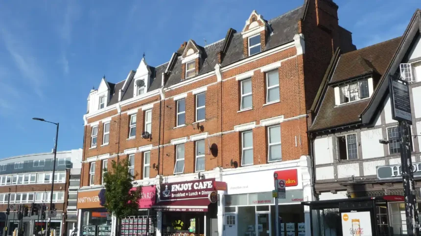
Chipping Barnet is particularly suitable for visitors who want a traditional walking day. The historic centre contains High Barnet’s commercial streets, historic buildings, local shops, places of worship and heritage attractions. Barnet Museum is located at 31 Wood Street in the centre of Chipping Barnet.
The museum provides a useful starting point for understanding the local area. It is a free local history museum covering Chipping Barnet, East Barnet, New Barnet, Hadley and surrounding districts. Its collection spans periods from the Bronze Age to the present day.
Visitors can therefore combine museum time with a walking circuit through the surrounding streets.
Finchley Central is another strong walking base. Barnet Council describes it as an area containing historic character, recreational attractions, independent shops and restaurants. Stephens House and Garden provides landscaped gardens and wooded walking areas, while Victoria Park is located a short distance from the Underground station.
The result is a practical visitor pattern: arrive by public transport, explore locally on foot, then use public transport for the next district.
That approach reduces unnecessary walking along major roads and gives visitors more time for attractions.
Which Barnet attractions can visitors explore on foot?
Visitors can walk between several attractions in the same Barnet district, including Barnet Museum, historic Chipping Barnet streets, local shops, parks and heritage locations, while separate attractions in Finchley, Edgware and Mill Hill require additional transport planning.
Chipping Barnet provides one of the clearest examples of a walkable visitor district.
Barnet Museum is an important cultural stop. The museum opened in March 1938 and occupies an early Georgian house within the Wood Street conservation area. Its collections cover local history, archaeology, domestic life, sport, religion, health, wars and the Battle of Barnet.
The museum is therefore more than an isolated attraction. Its location allows visitors to connect museum exhibits with the surrounding historic streets.
Barnet Physic Well is another heritage feature associated with the museum. The spring was associated with therapeutic mineral water and became popular from the late seventeenth century through the eighteenth century. The museum manages public openings of the site.
Visitors exploring the historic centre can also investigate the wider Battle of Barnet heritage. The Battle of Barnet was fought in 1471 during the Wars of the Roses. Its historical significance forms an important part of the identity of the modern town.
As you explore the modern town centre, you are crossing land with a deep heritage. Read about the full [Insert Anchor Text for History Article Here] to understand its origins.
Chipping Barnet also works well for visitors interested in independent shopping, cafés and local services because these uses are concentrated around the town centre.
Finchley Central offers a different walking experience. Its attractions include Finchley Central Underground station, Stephens House and Garden, Victoria Park, Finchley Central Library and a substantial retail area. Barnet Council records more than 33,410 square metres of retail space in the centre.
Stephens House is a Grade II listed building. Its grounds include landscaped gardens and wooded areas, creating a walking environment that differs from the commercial high street.
Edgware also provides a substantial pedestrian destination. The town centre contains more than 43,930 square metres of independent retail space, together with restaurants, cafés, bars and local services. Edgware Library is another community facility.
However, these districts should be treated as separate walking destinations rather than one continuous sightseeing circuit.
What walking routes are available in Barnet?
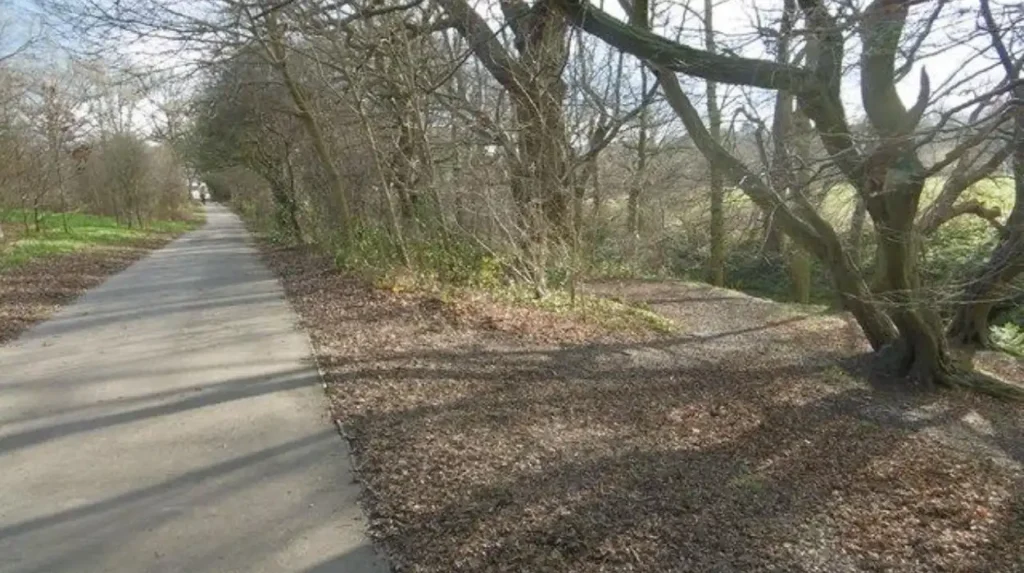
Barnet has an extensive walking network that includes 37 kilometres of public rights of way, 36 kilometres of urban footpaths and promoted routes such as the London Loop, Dollis Valley Greenwalk and Pymmes Brook Trail.
Barnet’s walking infrastructure extends well beyond pavements beside high streets.
A public right of way is a legally recognised route over which the public has a right to pass and repass. Barnet Council identifies four categories: footpaths, bridleways, restricted byways and byways open to all traffic.
Footpaths are intended for walkers, including wheelchair users and people pushing prams. Bridleways additionally permit cycling and horse riding. Restricted byways provide additional rights, while byways open to all traffic permit mechanically propelled vehicles under the relevant rules.
Barnet manages 37 kilometres of public rights of way across its towns, parks and green spaces. These routes are complemented by permissive paths and promoted walking networks.
The London Loop is one of the major long-distance walking routes associated with the borough. It forms part of a wider circular route around Greater London.
The Dollis Valley Greenwalk provides another important recreational route. It follows green corridors through North London and connects urban areas with open spaces.
The Pymmes Brook Trail is another promoted route. It provides a linear walking connection associated with the Pymmes Brook watercourse.
Barnet Council also identifies the Capital Ring as an additional 31 kilometres of paths within its walking network.
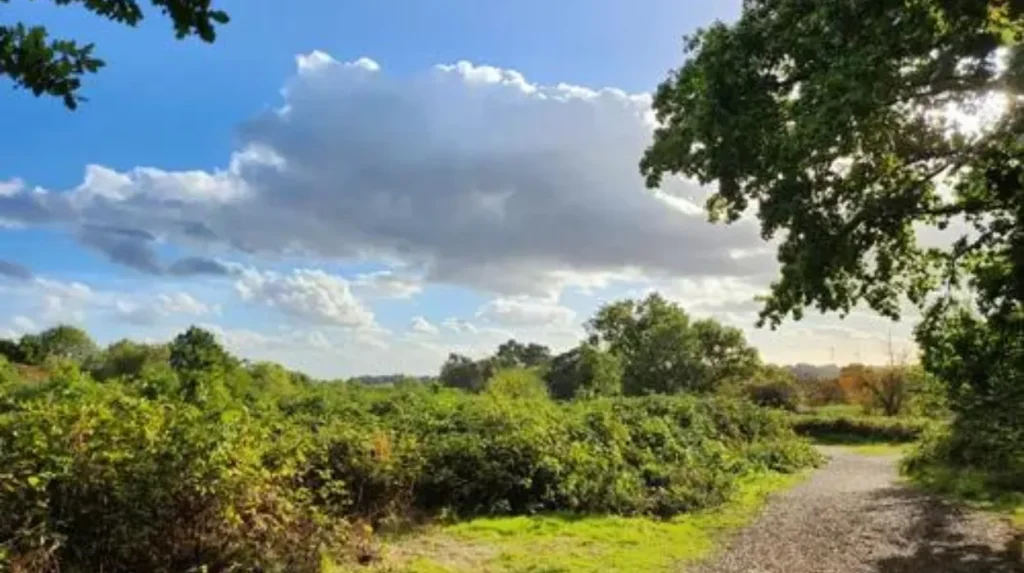
These routes change the meaning of walkability. A visitor does not need to walk between every major attraction to benefit from Barnet’s pedestrian environment. Walking itself is a visitor activity.
The council promotes Health Walks, Healthy Heritage Walks and Active Trails, providing structured ways to explore the borough on foot.
For leisure travellers, the most effective strategy is to choose a route based on the desired experience. Historic walks suit visitors interested in buildings and local history. Green routes suit visitors seeking parks, waterways and open spaces. Urban routes suit visitors combining shopping, food and cultural attractions.
How easy is it to walk between Barnet town centres?
Walking between neighbouring attractions inside a town centre is practical, while walking between Barnet’s separate town centres is less efficient because the borough contains 30 centres distributed across a large geographical area and separated by major roads and transport corridors.
Barnet’s town-centre structure explains why visitors often receive different answers about its walkability.
The council identifies 30 town centres across the borough. These are divided into seven main town centres, eight district town centres and 15 local or neighbourhood centres.
The seven main town centres are Burnt Oak, Chipping Barnet, Cricklewood, Edgware, Finchley Central, Golders Green and North Finchley. The district centres include Brent Street, Colindale/The Hyde, East Finchley, Hendon Central, Mill Hill, New Barnet, Temple Fortune and Whetstone.
This network is useful for local walking because each centre contains everyday facilities.
It is less suitable for a single borough-wide walking itinerary.
A visitor staying in Chipping Barnet can spend several hours exploring the historic centre without needing a vehicle. A visitor staying in Finchley Central can combine the Underground station, Stephens House and Garden, Victoria Park, shops and restaurants within a local itinerary.
A visitor attempting to walk from Chipping Barnet to Edgware, Finchley Central or Golders Green faces a different journey. Distance becomes a larger factor, while major roads and transport infrastructure affect route quality.
New Barnet illustrates this challenge. A council framework identified a significant walk-in catchment but also recorded weaknesses in pedestrian connections around the town centre, including links between the railway station and commercial areas and connections towards Victoria Park.
This distinction matters because a place can have strong pedestrian infrastructure while still being unsuitable for completely car-free sightseeing across its entire geographical area.
Barnet’s walkability is therefore best described as polycentric. Polycentric means that activity is distributed among several distinct centres rather than concentrated in one central area.
For visitors, the practical implication is simple. Select one centre for walking exploration, then use rail, Underground or buses to reach another centre.
Is Barnet suitable for visitors who prefer walking and public transport?
Barnet suits visitors who combine walking with public transport because Underground, rail and bus connections provide access to separate districts, while local streets, parks and footpaths support exploration after arrival at each destination.
A mixed walking and public transport itinerary is the most efficient way to explore Barnet.
Finchley Central has an Underground station that provides direct access towards central London. The surrounding centre contains shops, restaurants, Stephens House and Garden and Victoria Park.
Edgware is also a major transport hub. Barnet Council identifies the area as one of the borough’s busiest transport locations and notes its connection to the Northern Line.
Colindale has an Underground station on the Northern line, and Barnet Council states that its Colindale office is approximately a five-to-eight-minute walk from the station.
These connections support a simple sightseeing mechanism:
travel to a suitable station → walk through the local centre → visit attractions → continue on foot through nearby green space → return to the station or local bus network.
This approach is particularly useful for visitors with limited time.
Digital nomads and business travellers also benefit from this structure. A visitor staying near a transport hub can use walking for short leisure periods between work commitments. A nearby town centre provides cafés, restaurants, shops and parks without requiring a long journey.
Barnet Council actively promotes walking as a form of active travel. Its guidance includes walking or cycling to shops, schools and workplaces, as well as walking in parks, streets and playgrounds.
Public transport also reduces the need to cover long distances on foot.
The council’s wider growth strategy recognises that accessibility and connectivity remain challenges in some parts of the borough. It identifies improved walking, cycling and public transport links as priorities, particularly around major destinations and east-west connections.
This demonstrates that walkability is an ongoing planning issue rather than a fixed characteristic.
Explore more Area Guide
How to Explore Barnet Like a Local: Authentic North London Guide
What Is Barnet Famous For? History, Landmarks and Highlights
Are Barnet’s streets and walking routes accessible for different visitors?
Barnet provides formal footpaths, urban pavements, crossings and green routes, but accessibility varies by location, terrain, road design and route type, so visitors should select routes according to mobility needs and current local conditions.
Accessibility involves more than the existence of pavements.
Barnet Council defines footpaths within the public rights-of-way system as routes for walkers, including wheelchair users and people pushing prams.
The borough also has approximately 36 kilometres of urban footpaths. These routes provide connections to shops, schools and public transport hubs.
Road-crossing design is another important part of pedestrian accessibility. Barnet Council describes several crossing measures, including zebra crossings, central reservation crossings and tactile paving. Tactile paving provides additional guidance for visually impaired pedestrians.
However, accessibility varies between individual streets.
Historic streets can have narrower pavements. Major roads can create longer crossing distances. Railway bridges and junctions can create physical separation between destinations.
New Barnet provides an example. Earlier council planning documentation identified pedestrian challenges around the railway station, East Barnet Road and the connections towards Victoria Park.
Visitors using wheelchairs, mobility aids or prams should therefore distinguish between accessible destinations and accessible routes between destinations.
Green walking routes also require route-specific consideration. A public right of way provides a legal right of passage, but the surface, gradients, weather conditions and surrounding environment differ between routes.
Urban pavements generally provide a more predictable surface than rural or semi-rural paths.
Barnet Council also advises people attending organised walks to consider weather conditions and suitable clothing and footwear.
For visitors, route planning should therefore include the starting station, pavement conditions, crossing points, attraction entrances and the return journey.
What is the best way to explore Barnet on foot?
The best walking strategy is to choose a compact visitor base, explore its attractions and green spaces on foot, then use public transport to move to another district rather than attempting to cross the entire borough on foot.
A practical walking itinerary starts with the visitor’s main interest.
For history, Chipping Barnet is the strongest starting point. Barnet Museum provides local historical context, while Wood Street and the surrounding conservation area provide a physical setting for exploring the town’s heritage.
For gardens and local leisure, Finchley Central provides a strong combination of urban facilities and green space. Stephens House and Garden offers landscaped grounds and wooded areas, while Victoria Park provides another nearby outdoor destination.
For shopping and food, Edgware provides a substantial town-centre environment with independent shops, restaurants, cafés, bars and local services.
For longer recreational walks, visitors should use Barnet’s designated and promoted routes. The London Loop, Dollis Valley Greenwalk, Pymmes Brook Trail and Capital Ring provide options beyond conventional high-street walking.
The most efficient itinerary structure is therefore:
one transport hub + one town centre + several nearby attractions + one green space or heritage route.
This prevents excessive time being spent walking between geographically separated areas.
Visitors should also check attraction opening times before setting out. Barnet Museum, for example, operates specific opening periods rather than remaining open continuously throughout the day.
The same principle applies to seasonal walks, public rights of way and outdoor attractions. Route conditions and access arrangements should be checked before departure.
Does Barnet’s walkability make it a good destination for a day out?
Barnet works well for walking-focused day trips because individual districts combine heritage, shopping, food, parks and transport connections, while the wider borough offers long-distance trails and green spaces for visitors seeking more extensive walking.
Barnet’s main strength is variety within distinct local areas.
A visitor does not need to cover the entire borough to experience its walking environment. Chipping Barnet provides historic streets and museum access. Finchley Central provides gardens, parks and commercial amenities. Edgware provides a large shopping and dining centre. Other districts provide additional parks, cultural venues and walking connections.
The borough also has significant green-space coverage. Barnet Council states that 41% of the borough has green-space coverage, with a park or open space within one mile of many homes.
This green infrastructure supports both residents and visitors.
For tourists, it creates opportunities to combine urban attractions with outdoor recreation. A morning museum visit can be followed by a local heritage walk. A shopping trip can be combined with a park visit. A business traveller can use nearby walking routes during a short break.
The borough’s planning strategy also identifies public open spaces, biodiversity areas and ancient woodland as important components of Barnet’s identity.
This provides long-term relevance for walking tourism.
Barnet’s future development strategy also places emphasis on improved transport, walking and cycling connections. The council identifies accessibility and connectivity as challenges in parts of the borough and sets out investment priorities around transport interchanges and east-west connections.
The implication is clear: Barnet’s walkability is not based solely on a traditional pedestrian town centre. It is supported by a wider network of urban paths, parks, heritage routes and public transport links.
What should visitors know before walking around Barnet?
Visitors should plan around one local district at a time, wear suitable footwear, check attraction opening arrangements, identify safe road crossings and use public transport for longer inter-district journeys across Barnet.
The first consideration is distance.
Barnet contains 30 town centres, so a walking itinerary covering multiple centres requires careful route planning.
The second consideration is route type.
Urban footpaths are suitable for ordinary movement between town-centre destinations. Public rights of way provide additional walking opportunities through parks and green areas. Promoted routes such as the London Loop and Dollis Valley Greenwalk support longer recreational journeys.
The third consideration is road safety.
Visitors should use designated crossings where available and take particular care around major junctions and busy roads. Barnet Council’s road-safety guidance identifies zebra crossings, pedestrian refuge islands, tactile paving and other pedestrian-protection measures across the borough.
The fourth consideration is weather.
Outdoor routes require appropriate footwear and clothing. Conditions can affect paths, parks and longer walks, particularly during periods of heavy rain or cold weather. Barnet Council specifically advises walkers to consider conditions and suitable footwear when attending walking activities.
The fifth consideration is opening access.
Historic buildings, museums and managed attractions have their own opening arrangements. Barnet Museum, for example, publishes specific weekly opening times.
The sixth consideration is accessibility.
Visitors with mobility requirements should examine the complete route rather than only the destination. A venue can be accessible while the connecting street, crossing or footpath presents a separate challenge.
Overall, Barnet is best understood as a network of walkable visitor districts rather than one uniformly walkable destination.
Its strongest walking experiences combine concentrated town centres with green spaces, historic sites and public transport. Visitors who plan around these clusters can explore substantial parts of Barnet without relying on a car.
For a first visit, Chipping Barnet offers the clearest heritage-focused walking experience. Finchley Central provides a strong combination of transport, shopping, gardens and parks. Edgware provides a larger commercial environment. Longer-distance walkers can use Barnet’s extensive public-rights-of-way and promoted-route network.
Barnet Council’s walking infrastructure, including 37 kilometres of public rights of way and 36 kilometres of urban footpaths, provides a substantial foundation for pedestrian exploration.
Is Barnet easy to explore on foot?
Yes. Barnet is easy to explore on foot within individual neighbourhoods and town centres. Chipping Barnet, Finchley Central and Edgware each have attractions, shops, parks and services within practical walking distance. The entire borough is too geographically spread out for one walking itinerary.