The London Borough of Barnet contains eight statutory Local Nature Reserves (LNRs) and 67 Sites of Importance for Nature Conservation (SINCs). Situated on the northern edge of Greater London, Barnet spans 8,663 hectares, with 2,466 hectares designated as metropolitan Green Belt and 690 hectares categorized as Metropolitan Open Land. These protected natural spaces comprise ancient oak woodlands, relic clay meadows, freshwater streams, and wetland ecosystems. Visitors, residents, remote workers, and leisure travellers can access these public spaces to observe protected flora and fauna, study urban ecology, and experience preserved historical landscapes.
- What Are the Designated Local Nature Reserves in the London Borough of Barnet?
- How Does the Statutory Green Belt Designation Protect Wildlife Habitats in Barnet?
- What Ecological Features Define the Scratchwood and Moat Mount Nature Reserves?
- How Does Darlands Lake Nature Reserve Support Aquatic and Wetland Biodiversity?
- What Wildlife Species Inhabit the Woodland and Grassland Habitats of Coppetts Wood?
- Which Additional Protected Open Spaces and Sites of Conservation Importance Exist in Barnet?
- How Can Visitors Access and Transport to Barnet Nature Reserves for Sustainable Tourism?
- What Are the Environmental Management Practices and Future Biodiversity Plans for Barnet Reserves?
What Are the Designated Local Nature Reserves in the London Borough of Barnet?
The London Borough of Barnet features eight statutory Local Nature Reserves officially designated under Section 21 of the National Parks and Access to the Countryside Act 1949. These reserves protect 320 hectares of ancient woodland, neutral grassland, and wetland ecological habitats.
Section 21 of the National Parks and Access to the Countryside Act 1949 grants local authorities the legal power to establish Local Nature Reserves (LNRs). LNRs are sites of high natural interest that offer special opportunities for study, research, and public enjoyment of wildlife.
The Eight Statutory Local Nature Reserves
Barnet Council manages or co-manages eight designated LNR sites. These sites include:
- Scratchwood (57 hectares)
- Moat Mount Open Space (27 hectares)
- Coppetts Wood and Scrublands (14.5 hectares)
- Darlands Lake Nature Reserve (32 hectares)
- Glebelands Local Nature Reserve (6 hectares)
- Rowley Green Common (11 hectares)
- Totteridge Fields (11 hectares)
- Mill Hill Old Railway Nature Reserve (2.3 hectares)
Legal Frameworks and Site Classifications
Natural England serves as the statutory advisory body that validates LNR declarations. The London Ecology Unit designated 67 Sites of Importance for Nature Conservation (SINCs) across Barnet in 1997. SINCs are divided into three tier classifications: Sites of Metropolitan Importance, Sites of Borough Importance (Grade I and Grade II), and Sites of Local Importance.
Sites of Metropolitan Importance possess high ecological significance for the whole of Greater London. Scratchwood and Rowley Green Common hold Metropolitan Importance status due to their rare ancient woodland structures and peat bog habitats.
How Does the Statutory Green Belt Designation Protect Wildlife Habitats in Barnet?
The statutory Green Belt protects 2,466 hectares of open countryside in Barnet from urban sprawl, industrial development, and habitat fragmentation. Established under the Town and Country Planning Act 1947, this spatial policy preserves biodiversity and essential ecological corridors.
Post-World War II planning legislation created the Metropolitan Green Belt to halt post-war suburban development into the Middlesex countryside. Approximately 28 percent of Barnet’s total area remains protected Green Belt land.
Geological Foundations and Soil Types
The primary geological substrate across Barnet is London Clay. London Clay consists of dense, poorly draining marine sediment laid down during the Eocene epoch approximately 50 million years ago. Heavy clay soils impede subterranean agricultural drainage, which historically discouraged intensive arable farming. As a result, farmers used the land for low-intensity cattle grazing, horse pasturage, and timber production.
As you explore the modern site, you are crossing land with a deep heritage. Read about the full [History of the Middlesex Forest and Barnet Green Belt] to understand its origins.
Biodiversity Preservation via Ecological Connectivity
Green Belt protection prevents land fragmentation, allowing wildlife species to migrate along connected habitat corridors. Three major river corridors cross Barnet’s Green Belt land:
- The Dollis Brook
- The Silk Stream
- The Pymmes Brook
These riparian corridors allow semi-aquatic mammals, amphibian species, and aquatic insects to travel between separate nature reserves without encountering urban barriers.
What Ecological Features Define the Scratchwood and Moat Mount Nature Reserves?
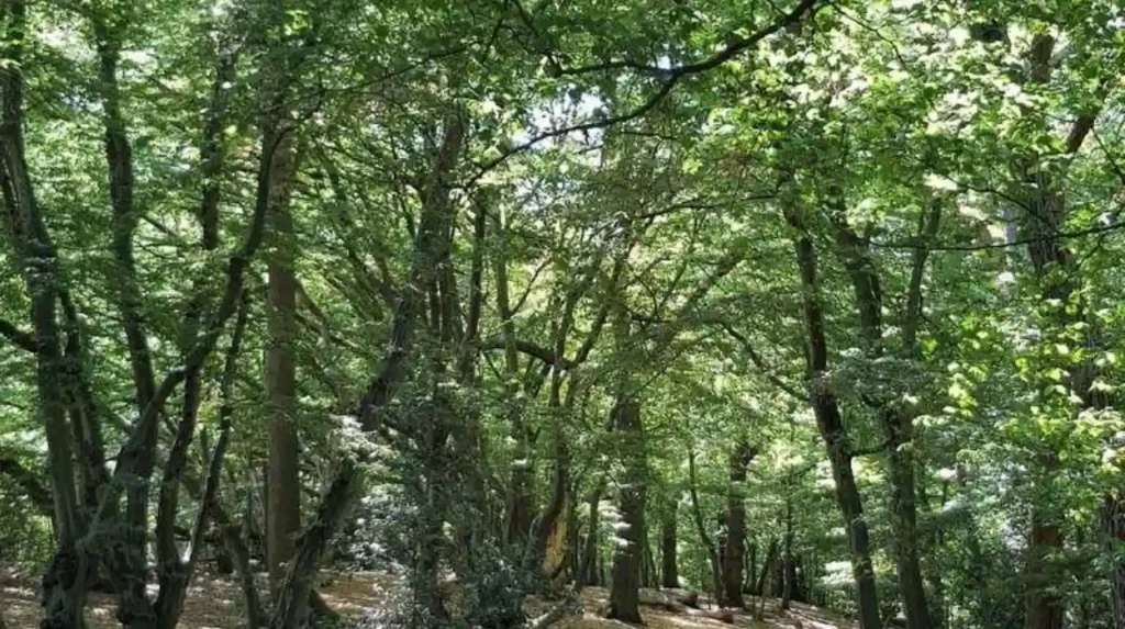
Scratchwood and Moat Mount cover 84 contiguous hectares of ancient hornbeam woodland, secondary forest, and open parkland in Mill Hill. Scratchwood contains the largest remnant of the ancient Middlesex Forest in Barnet, hosting ancient oak and hornbeam trees.
Scratchwood represents an ancient woodland site where continuous forest cover has existed since at least 1600 AD. The reserve sits on high ground at an elevation of 112 metres above sea level.
Ancient Coppice-with-Standards Woodland Structure
Scratchwood displays a traditional coppice-with-standards management framework. Sessile oak (Quercus petraea) and pedunculate oak (Quercus robur) form the upper canopy standards, while hornbeam (Carpinus betulus) forms the coppiced understory layer. Hornbeam trees undergo rotational cutting at ground level every 15 to 25 years, inducing dense shoot regeneration that provides nesting cover for woodland birds.
Understory species include three prominent shrubs:
- Common hazel (Corylus avellana)
- Hawthorn (Crataegus monogyna)
- Blackthorn (Prunus spinosa)
Flora and Fauna Profiles
The woodland floor supports three ancient woodland indicator plant species:
- Common bluebell (Hyacinthoides non-scripta)
- Wood anemone (Anemone nemorosa)
- Wood sorrel (Oxalis acetosella)
Avian species residing in Scratchwood include three species of woodpecker:
- Great spotted woodpecker (Dendrocopos major)
- Lesser spotted woodpecker (Dryobates minor)
- European green woodpecker (Picus viridis)
Additional woodland birds include the Eurasian nuthatch (Sitta europaea) and Eurasian treecreeper (Certhia familiaris). Invertebrate populations include the stag beetle (Lucanus cervus), a legally protected species under Schedule 5 of the Wildlife and Countryside Act 1981.
How Does Darlands Lake Nature Reserve Support Aquatic and Wetland Biodiversity?
Darlands Lake Nature Reserve spans 32 hectares within the Totteridge Valley, combining open water, marshland, ancient woodland, and neutral grassland. The 3-hectare central lake provides critical breeding habitat for amphibians, aquatic wildfowl, and odonata species.
Darlands Lake Nature Reserve sits between the residential villages of Totteridge and Mill Hill. The site was originally created between 1780 and 1800 as an ornamental lake for the Copped Hall estate, designed with landscape advice from designer Humphry Repton.
Wetland Succession and Habitat Dynamics
The reserve contains four distinct ecological habitat types:
- Open standing freshwater
- Alder carr wetland woodland
- Unimproved hay meadows
- Ancient damp oak-hornbeam woodland
Natural ecological succession causes silt and organic matter to accumulate in the lake basin. The Darlands Conservation Trust undertook extensive desilting works in 2023 and 2024, restoring water depth and preventing the lake from converting entirely into marshland.
Species Diversity at Darlands Lake
The aquatic ecosystem supports three native amphibian species:
- Common toad (Bufo bufo)
- Common frog (Rana temporaria)
- Smooth newt (Lissotriton vulgaris)
Bird populations include breeding populations of water rail (Rallus aquaticus), grey heron (Ardea cinerea), Eurasian coot (Fulica atra), and common moorhen (Gallinula chloropus). Over 20 species of dragonflies and damselflies inhabit the shoreline, including two notable odonata species:
- Migrant hawker (Aeshna mixta)
- Emperor dragonfly (Anax imperator)
What Wildlife Species Inhabit the Woodland and Grassland Habitats of Coppetts Wood?
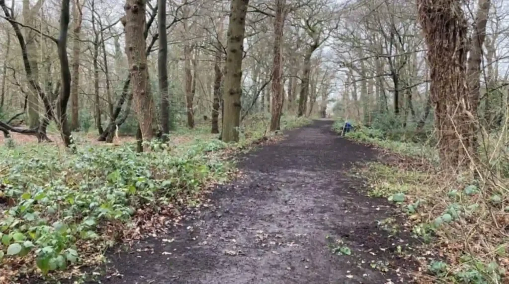
Coppetts Wood and Scrublands contains 14.5 hectares of oak woodland, secondary scrub, and acid grassland in East Finchley. The reserve shelters over 300 plant species, 80 bird species, and diverse mammalian populations including foxes, badgers, and bats.
Coppetts Wood forms part of the former Finchley Common, an expansive tract of waste land cleared for grazing and fuel gathering during the medieval era. The site is managed by Barnet Council alongside the Coppetts Wood Conservation Group.
Grassland Diversity and Soil Chemistry
The reserve features two distinct soil environments:
- Poorly draining clay soils supporting neutral grassland
- Gravel deposits supporting localized damp acid grassland
Neutral grassland areas contain three flowering plant species:
- Bird’s-foot trefoil (Lotus corniculatus)
- Common knapweed (Centaurea nigra)
- Meadow vetchling (Lathyrus pratensis)
Acidic patches feature soft rush (Juncus effusus) and sheep’s sorrel (Rumex acetosella). These herb-rich communities attract three common butterfly species:
- Meadow brown (Maniola jurtina)
- Gatekeeper (Pyronia tithonus)
- Speckled wood (Pararge aegeria)
Mammal and Avian Populations
Mammal species recorded at Coppetts Wood include four mammal species:
- European badger (Meles meles)
- Red fox (Vulpes vulpes)
- Wood mouse (Apodemus sylvaticus)
- Common pipistrelle bat (Pipistrellus pipistrellus)
The insectivorous bat populations forage along woodland edge habitats, consuming nocturnal flying insects such as moths and midges.
Which Additional Protected Open Spaces and Sites of Conservation Importance Exist in Barnet?
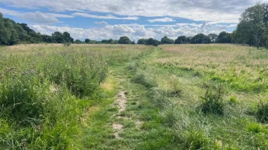
Barnet contains key open spaces including Rowley Green Common, Totteridge Fields, Glebelands, and Mill Hill Old Railway. These protected sites feature rare peat bog wetlands, unimproved neutral hay meadows, and isolated wildlife corridors.
In addition to Scratchwood and Darlands Lake, several smaller LNRs preserve rare micro-habitats across the borough.
Rowley Green Common LNR
Rowley Green Common spans 11 hectares near Arkley. It contains the only surviving lowland peat bog habitat in Greater London. The bog formed in a depression within Glacial Pebble Gravel deposits laid down during the Pleistocene epoch.
Rowley Green Common supports three bog plant species:
- Sphagnum moss (Sphagnum palustre)
- Purple moor-grass (Molinia caerulea)
- Common cotton-grass (Eriophorum angustifolium)
Totteridge Fields LNR
Totteridge Fields spans 11 hectares of ancient unimproved hay meadows. The reserve retains historical ridge-and-furrow earthwork patterns created by medieval ox-drawn ploughing.
Because these fields never received modern chemical fertilizers or selective herbicides, they retain rich botanical diversity. The fields contain three wild herb species:
- Common cowslip (Primula veris)
- Yellow rattle (Rhinanthus minor)
- Adder’s-tongue fern (Ophioglossum vulgatum)
Yellow rattle acts as a semi-parasitic plant on coarse meadow grasses, reducing grass dominance and allowing delicate wildflowers to flourish.
Glebelands LNR and Mill Hill Old Railway LNR
Glebelands LNR covers 6 hectares of woodland and damp meadow along the Pymmes Brook in Finchley. The site features mature alder trees (Alnus glutinosa) that stabilize the riverbank and reduce urban storm run-off velocity.
Mill Hill Old Railway LNR covers 2.3 hectares along a disused branch line of the Great Northern Railway closed in 1964. The linear site forms an undisturbed ecological corridor dominated by secondary birch and sycamore scrub, creating protected nesting habitat for song thrushes (Turdus philomelos) and bullfinches (Pyrrhula pyrrhula).
Explore More Area Guide
How Safe Is Barnet for Tourists and Families? North London Guide
What Is Barnet Best Known For Today? Discover Top North London Landmarks
How Can Visitors Access and Transport to Barnet Nature Reserves for Sustainable Tourism?
Visitors can reach Barnet nature reserves using London Underground lines, TfL bus routes, National Rail services, and dedicated cycling paths. Public transport connections reduce carbon emissions and prevent vehicle congestion around sensitive biological sites.
Sustainable travel infrastructure connects central London directly to Barnet’s northern green boundaries.
Transport Options by Reserve
Public transport routes access all primary LNR locations in Barnet:
Scratchwood and Moat Mount
Take the London Underground Northern Line to Edgware Station, then catch TfL Bus Route 107 toward New Barnet. Alight at Stirling Corner or Barnet Way. Car parking is available via the northbound A1 dual carriageway.
Darlands Lake Nature Reserve
Take the Northern Line (High Barnet branch) to Totteridge & Whetstone Station. Walk west along Totteridge Lane for 1.2 kilometres, entering via public footpaths off Woodside Avenue or Darlands Drive.
Coppetts Wood
Take the Northern Line to High Barnet or East Finchley Station, connecting with TfL Bus Route 234 or 43. Alight on Colney Hatch Lane adjacent to the reserve entrance.
Rowley Green Common
Take the Northern Line to High Barnet Station, then board TfL Bus Route 107 toward Edgware. Alight at Arkley Hotel and walk 500 metres north along Rowley Lane.
Facilities for Remote Workers and Business Travellers
Digital nomads and business travellers seeking quiet work environments near natural settings can utilize cafes equipped with public Wi-Fi in adjacent suburban hubs:
- High Barnet
- Whetstone
- Mill Hill
The Capital Ring and London LOOP (London Outer Orbit Path) long-distance walking paths intersect these reserves, offering pedestrian routes complete with clear waypoint signage.
What Are the Environmental Management Practices and Future Biodiversity Plans for Barnet Reserves?
Environmental management in Barnet relies on conservation grazing, invasive species control, woodland coppicing, and habitat restoration. The Barnet Biodiversity Action Plan coordinates public councils, environmental charities, and volunteer groups to enhance habitat resilience.
Climate change, urbanization, and invasive non-native species present ongoing operational challenges to urban nature reserves.
Habitat Management Techniques
Conservation management in Barnet employs four key practices:
- Rotational coppicing of hornbeam and hazel to vary light levels on the forest floor
- Annual late-summer hay cutting on neutral meadows to lower soil nitrogen levels
- Desilting and bank re-profiling of ponds and lakes to prevent aquatic eutrophication
- Manual eradication of invasive plants such as Himalayan balsam (Impatiens glandulifera) and Japanese knotweed (Reynoutria japonica)
Community Conservation and Future Policies
The Environment Act 2021 mandates that future development projects deliver a minimum 10 percent Biodiversity Net Gain (BNG). Barnet Council uses BNG funding contributions from construction projects to finance local habitat restoration initiatives.
Local volunteer groups perform vital maintenance work across the borough’s reserves. Three prominent active conservation organizations include:
- The Darlands Conservation Trust
- The Coppetts Wood Conservation Group
- The Hertfordshire and Middlesex Wildlife Trust
These organizations monitor populations of protected indicator species, construct dead hedges to protect sensitive ground-nesting birds from disturbance, and maintain public footpaths to prevent soil compaction in sensitive botanical zones.
How many Local Nature Reserves are there in Barnet?
The London Borough of Barnet contains eight statutory Local Nature Reserves (LNRs). These protected sites conserve important habitats including ancient woodland, wetlands, meadows, grasslands, and wildlife corridors. The eight reserves are Scratchwood, Moat Mount Open Space, Coppetts Wood and Scrublands, Darlands Lake, Glebelands, Rowley Green Common, Totteridge Fields, and Mill Hill Old Railway Nature Reserve.