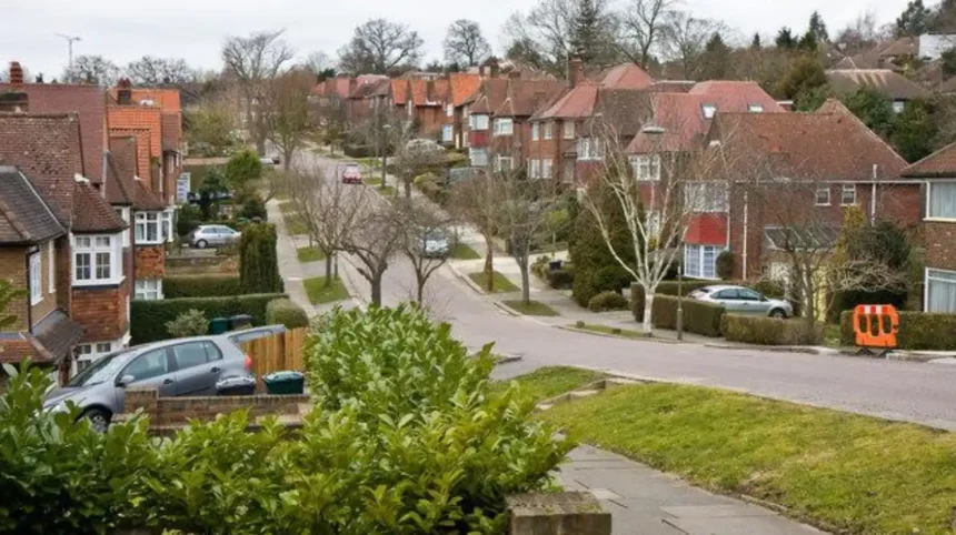
Barnet is widely regarded as a suburban part of London because its built environment combines established residential neighbourhoods, town centres, railway and Underground connections, extensive green space, lower-density development and historic villages within Greater London. Its present character reflects centuries of settlement followed by major transport-led suburban expansion.
- What does suburban mean in the context of Barnet?
- How did Barnet develop from rural settlements into a London suburb?
- Why did railways and the Underground make Barnet more suburban?
- Which parts of Barnet show its suburban character most clearly?
- How much green space contributes to Barnet’s suburban identity?
- Why does Barnet have a lower-density appearance than central London?
- How do planning policies preserve Barnet’s suburban character?
- How does Barnet’s population support its suburban role within London?
- Why is Barnet still considered suburban despite being inside London?
- What makes Barnet’s suburban identity important today?
The London Borough of Barnet occupies a large area in north London. It contains established places including High Barnet, East Barnet, Finchley, Hendon, Mill Hill, Golders Green, Whetstone and Totteridge. These areas have different histories and physical characters, but together they form a predominantly suburban borough.
Barnet’s suburban identity is not based simply on distance from central London. It results from the way land was developed, connected and planned. Historic villages became connected to London through roads, railways, trams and the Underground. Housing expanded around these transport routes while substantial areas of farmland, woodland, parks and protected open land remained.
The borough therefore provides a useful example of how London’s outer urban areas developed. It shows the transition from rural settlements to a connected metropolitan suburb without becoming dominated by continuous high-density central-city development.
What does suburban mean in the context of Barnet?
Barnet is suburban because its neighbourhoods combine residential streets, local town centres, transport links, schools, parks and open land within Greater London, creating a lower-density urban environment distinct from central London’s more intensely developed commercial and residential districts.
A suburb is an urban area located outside a central city core but integrated into the wider metropolitan system. In London, suburban areas remain part of the capital while having different physical characteristics from central districts.
Barnet fits this definition closely. The borough contains extensive residential areas rather than a single dominant central business district. Its town centres provide shops, services, restaurants and community facilities, while surrounding streets contain houses, flats, schools and local amenities.
Barnet Council itself describes parts of the borough as having a distinct suburban identity. Its planning evidence also describes Barnet as having developed from a series of small villages into a unified, polycentric suburb of Greater London.
The term polycentric means that an area has several centres rather than one dominant centre. Barnet demonstrates this through places such as High Barnet, Finchley, Hendon, Golders Green and Mill Hill.
This structure is important. Barnet does not operate as one uniform settlement. It consists of several established communities connected through roads and public transport.
For visitors, this explains why travelling around Barnet feels different from travelling through central London. The borough contains local high streets, residential neighbourhoods, parks, woodland and historic settlements alongside major transport corridors.
How did Barnet develop from rural settlements into a London suburb?
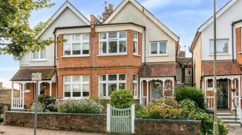
Barnet developed from villages and rural settlements into a London suburb through improvements in roads, railways, trams and Underground services, followed by large-scale residential construction during the late nineteenth and twentieth centuries as London expanded northwards.
Barnet’s suburban character has deep historical roots. Barnet existed before the Norman Conquest, although it does not appear in the Domesday Survey. An important route from London towards St Albans passed through the area by the 11th century, encouraging settlement and trade.
High Barnet subsequently became an important market and coaching location. Barnet’s market existed in various forms and locations from at least the 12th century. The High Road became a turnpike in 1712, strengthening its role as a transport route.
This early development created the foundations for a town rather than a purely agricultural settlement. However, the area remained substantially rural outside established settlements for much of its history.
The major transformation came with modern transport.
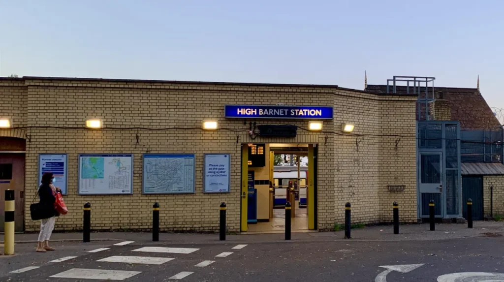
Barnet Station opened in 1850 and was later renamed New Barnet. High Barnet and Totteridge and Whetstone stations opened in 1872. Railway development encouraged suburban roads and housing, particularly around New Barnet and Brunswick Park.
The relationship between transport and housing is central to understanding Barnet. Better connections reduced the practical separation between northern settlements and London’s central districts. Developers gained access to larger areas of land for residential construction, while commuters gained transport connections into the wider city.
The process accelerated during the twentieth century. A tramline from Archway reached Barnet in 1907. Subsequent Underground expansion further supported suburban development. The Northern Line eventually reached High Barnet between 1935 and 1940.
As you explore modern Barnet, you are crossing land with a deep heritage. Read about the full to understand its origins.
Why did railways and the Underground make Barnet more suburban?
Railways, trams and the Underground made Barnet more suburban by improving access between northern settlements and central London, supporting commuter travel and making residential development farther from the historic centre economically practical during the nineteenth and twentieth centuries.
Transport infrastructure changed Barnet’s geography.
Before modern rail transport, travelling from northern settlements into central London took longer and relied heavily on roads, coaches and other slower forms of transport. Barnet developed partly because it stood on an important route north from London, but its later expansion depended on much faster connections.
The railway arrived in stages. New Barnet’s railway connection encouraged suburban housing, while High Barnet gained a railway station in 1872. However, Barnet Council’s local history records that railway fares were initially expensive, limiting the pace of development in some areas. East Barnet, Arkley and Mays Lane retained rural characteristics for longer.
This demonstrates that transport alone did not immediately transform the entire borough.
The Underground produced another major change. The Northern Line developed from earlier railway companies, including the City & South London Railway and the Charing Cross, Euston & Hampstead Railway. The Northern Line’s northern branches eventually reached High Barnet and Edgware.
Underground stations acted as focal points for development. Golders Green provides an important example. When the Underground reached the then-rural area in 1907, the new station helped stimulate rapid development and the area quickly became a suburb.
Transport therefore created a mechanism for suburbanisation. A station connected housing to employment opportunities elsewhere in London. Developers could construct residential streets beyond the historic urban core while maintaining access to central employment districts.
This transport-led growth remains visible today. Barnet contains several railway and Underground corridors alongside major roads. Its suburban structure continues to depend on movement between neighbourhoods, town centres and other parts of London.
Which parts of Barnet show its suburban character most clearly?
Barnet’s suburban character is particularly visible in High Barnet, New Barnet, East Barnet, Finchley, Mill Hill, Totteridge, Whetstone, Hendon and Golders Green, where residential streets, local centres, transport corridors, parks and historic buildings create distinct suburban neighbourhoods.
Barnet’s geography is diverse. Different neighbourhoods demonstrate different stages and styles of suburban development.
High Barnet combines historic market-town characteristics with later residential growth. Its historic importance comes from its position on the route towards St Albans and its long-established market. Modern residential areas surround the older centre.
New Barnet demonstrates the importance of railway-led suburbanisation. The arrival of the railway encouraged new roads and housing, creating a recognisable residential district.
East Barnet retained more of its village character for longer. Its development illustrates how older settlements were absorbed into the expanding metropolitan area rather than being replaced completely by a single modern urban form.
Finchley contains several distinct neighbourhoods and town centres. Its development reflects both road and public transport growth. Finchley also contains conservation areas and established residential districts.
Mill Hill combines residential development with large areas of open land. Barnet Council’s historical material records substantial suburban development around Mill Hill Broadway during the early twentieth century.
Totteridge provides another clear example of the contrast between London’s metropolitan status and its remaining historic landscape. The area contains historic buildings, established residential roads and substantial open surroundings.
Golders Green demonstrates how Underground expansion helped transform previously less-developed land. Its suburban identity also connects with the nearby Hampstead Garden Suburb, founded in 1907.
These areas show that suburban Barnet is not synonymous with identical housing estates. Its built environment includes Victorian terraces, Edwardian housing, inter-war development, later estates, flats, detached houses, town centres and historic buildings.
How much green space contributes to Barnet’s suburban identity?
Green space is a major part of Barnet’s suburban identity because parks, woodland, countryside, Green Belt and Metropolitan Open Land occupy substantial areas of the borough, separating neighbourhoods and preserving a less intensively urban landscape.
Barnet is one of London’s greener boroughs. Barnet Council states that 28% of its land, equivalent to 2,466 hectares, is Green Belt. A further 690 hectares, representing 8%, is identified as Metropolitan Open Land.
The council also states that approximately one third of the borough’s total area is classified as green space. This includes different habitats such as ancient woodland, traditional hay meadow and watercourses.
These figures help explain why Barnet has a suburban appearance.
Green Belt is land protected through planning policy to prevent unrestricted urban sprawl and preserve openness. Metropolitan Open Land is a London planning designation that protects strategically important open land within the capital.
Barnet’s open areas create physical separation between settlements. They also preserve landscapes associated with older villages and historic communities.
The Green Belt therefore has an important geographical relationship with suburban development. Housing and commercial development is concentrated in established urban areas, while protected land limits continuous outward construction.
Barnet’s planning framework identifies Green Belt, Metropolitan Open Land, conservation areas, employment areas, town centres and open spaces as important components of its development structure.
For tourists, this creates a distinctive combination of urban and semi-rural environments. A visitor can move between a busy high street, residential streets and large open landscapes without leaving the borough.
The green structure also supports recreation. Barnet has parks, walking routes, sports facilities, woodland and open countryside. These features contribute directly to the borough’s suburban quality.
Why does Barnet have a lower-density appearance than central London?
Barnet has a lower-density appearance because much of its built environment consists of residential streets, houses, gardens, local centres and open spaces rather than continuous high-rise commercial development, although parts of the borough contain denser housing and major regeneration areas.
Density describes how many people, homes or buildings occupy a defined area. Barnet is not uniformly low density, but its overall physical form differs from central London.
The 2021 Census recorded approximately 389,300 residents in Barnet, an increase of 9.2% from around 356,400 in 2011. The Office for National Statistics reported that Barnet was the eighth least densely populated of London’s 33 local authority areas in 2021.
This does not mean Barnet is sparsely populated. It is a substantial London borough with a large population. Instead, its population is distributed across a large geographical area containing residential neighbourhoods and significant green space.
Housing form explains part of this pattern.
Many suburban areas contain terraced houses, semi-detached houses and detached houses with gardens. Other neighbourhoods contain purpose-built flats and denser apartment developments. Local centres often have shops and services at ground-floor level with homes above or behind them.
Central London contains much greater concentrations of major offices, high-rise residential buildings, large cultural institutions, transport interchanges and intensive commercial land uses.
Barnet has important employment and commercial locations, including Brent Cross and Hendon, but its dominant land-use pattern remains mixed residential and local-centre development.
This physical pattern is a key reason the borough is described as suburban.
How do planning policies preserve Barnet’s suburban character?
Barnet’s suburban character is shaped by planning policies that manage housing growth, protect Green Belt and open land, conserve historic areas, guide town-centre development and control the relationship between buildings, transport infrastructure and established neighbourhoods.
Planning determines how London’s limited land is used.
Barnet’s current Local Plan covers the period from 2021 to 2036. It works alongside the Mayor of London’s London Plan and other planning documents to form the borough’s Development Plan.
The planning framework identifies different land designations. These include Green Belt, Metropolitan Open Land, conservation areas, employment areas, town centres and open spaces.
Conservation areas are particularly important for historic suburban character. Barnet Council lists conservation areas including Finchley Church End, Finchley Garden Village, Golders Green, Hampstead Garden Suburb, Hendon Church End, Hendon The Burroughs, Mill Hill, Monken Hadley, Totteridge, Railway Terraces and Wood Street.
A conservation area is a place recognised for special architectural or historic interest. Special planning controls help protect its character.
Barnet’s planning approach therefore manages two competing requirements: accommodating a growing London population and retaining established environmental and historic characteristics.
This process does not freeze Barnet in its historic form. New homes, workplaces, infrastructure and regeneration projects continue to shape the borough.
Instead, planning determines where and how growth occurs.
The result is a layered suburban environment. Historic streets can sit close to modern developments. Transport corridors can connect older settlements with new residential districts. Green spaces can remain between built-up neighbourhoods.
That combination explains why Barnet remains recognisably suburban while continuing to change as part of Greater London.
How does Barnet’s population support its suburban role within London?
Barnet’s population demonstrates that suburban areas are integral parts of London’s metropolitan structure rather than detached communities, with nearly 390,000 residents recorded in the 2021 Census across established neighbourhoods connected to wider employment and transport networks.
Barnet’s population reached approximately 389,300 in 2021, according to the Office for National Statistics. The borough recorded a 9.2% population increase between 2011 and 2021. London’s overall population increased by 7.7% during the same period.
This growth reinforces Barnet’s role as an active part of Greater London.
Suburbs are often associated with commuting, but Barnet’s population performs many different economic and social functions. Residents work locally, travel to other London boroughs, study nearby, operate businesses and use services within their own neighbourhoods.
Barnet therefore functions as more than a residential extension of central London.
Its town centres provide everyday services. Schools and community facilities support local populations. Parks and sports facilities provide recreation. Employment areas provide workplaces.
The borough’s population is also distributed among many distinct neighbourhoods. This reinforces its polycentric structure.
Population growth creates continuing pressure for housing, transport, schools, healthcare, open space and other infrastructure. Barnet’s Local Plan provides a framework for managing this growth through 2036.
For visitors, population size also affects the experience of the borough. Barnet offers a substantial range of local services without having the same concentration of major attractions found in central London.
Its visitor appeal therefore often relates to neighbourhood character, parks, historic buildings, local shopping areas and access to wider north London destinations.
Explore More Area Guide
What Is Everyday Life Like in Barnet, North London?
Barnet for Hertfordshire Trips | North London Travel Guide
Why is Barnet still considered suburban despite being inside London?
Barnet remains suburban because London is a metropolitan city containing different urban forms, and Barnet’s residential neighbourhoods, historic settlements, open landscapes, local centres and transport connections create a suburban structure within the administrative boundary of Greater London.
Being part of London does not mean every district has the same physical character.
Greater London contains central urban districts, inner-city neighbourhoods, established suburbs, former villages, industrial areas, major town centres and extensive open spaces.
Barnet represents one of the capital’s major suburban areas.
Its historical development explains this position. Older villages and market settlements existed before modern London expanded into northern Middlesex. Transport infrastructure later connected these settlements to the metropolitan economy. Housing development filled spaces between established communities while Green Belt and other protected land preserved open areas.
Barnet Council’s evidence explicitly describes the borough as having evolved from small villages in the countryside around London into a unified, polycentric suburb of Greater London.
The borough’s modern planning system continues to reflect this structure.
Its town centres provide local urban functions. Its residential streets provide housing. Its transport network connects residents with other parts of London. Its Green Belt and open spaces provide separation and environmental functions.
The result is a metropolitan suburb rather than a separate town outside London.
This distinction matters when understanding Barnet geographically. Calling Barnet suburban does not mean it is disconnected from London. The opposite is true. Its suburban identity exists because the area is strongly integrated into the wider London metropolitan system.
What makes Barnet’s suburban identity important today?
Barnet’s suburban identity remains important because it shapes housing, transport, green-space protection, heritage conservation, local services and future development, while connecting established communities to London’s wider economy and allowing the borough to accommodate continued population and infrastructure change.
Barnet’s suburban form has practical consequences.
First, its large residential areas create continuing demand for housing and community infrastructure. The borough’s Local Plan provides a framework for accommodating growth while protecting important environmental and historic assets.
Second, transport remains fundamental. Railways, Underground services, buses and major roads connect Barnet’s neighbourhoods with the wider capital.
Third, green space remains central to the borough’s environmental structure. Barnet Council identifies parks, woodland, open spaces and habitats as important for biodiversity, recreation, cooling and flood management.
Fourth, heritage continues to influence local character. Conservation areas protect historic environments, while older settlements such as High Barnet, Monken Hadley and Totteridge retain visible evidence of earlier development.
Finally, suburbanisation is not a completed historical process. Barnet continues to change.
New housing, transport improvements, town-centre investment and regeneration reshape parts of the borough. At the same time, planning policies seek to retain valued green and historic assets.
Barnet’s future therefore involves managing the relationship between growth and established suburban character.
For tourists and leisure travellers, this creates a different way to understand north London. Barnet offers historic market-town features, transport-led suburban neighbourhoods, large green spaces, conservation areas and modern London development within one borough.
For residents and digital nomads, the same structure provides local town centres, cafés, services, transport connections, parks and community facilities distributed across multiple neighbourhoods.
For domestic business travellers, Barnet’s transport connections provide access to wider north London while its suburban environment offers a different setting from the central commercial districts.
Barnet is considered a suburban part of London because its geography and development reflect the classic structure of metropolitan suburbanisation. Historic villages and market settlements became connected to London through roads, railways, trams and the Underground. Residential development expanded around these connections, while extensive green spaces and protected land remained.
The evidence is particularly clear in Barnet’s planning structure and historical record. The borough developed from a collection of settlements into a polycentric suburb of Greater London. Its 2021 population was approximately 389,300, while 28% of its land was recorded as Green Belt and a further 8% as Metropolitan Open Land.
Its suburban identity therefore comes from several connected characteristics rather than one feature. Residential neighbourhoods, local town centres, transport infrastructure, historic settlements, parks, woodland, Green Belt and conservation areas all contribute.
Barnet is consequently not separate from London. It is an important example of how London extends beyond its central urban core while retaining multiple layers of historic and suburban character.
Why is Barnet considered a suburban part of London?
Barnet is considered suburban because it has predominantly residential neighbourhoods, local town centres, extensive green spaces, historic settlements and lower-density development while remaining well connected to central London by Underground, rail, bus and road networks.