Barnet’s railway history transformed the area from a predominantly rural settlement and coaching centre into a connected suburban district within the London region. The most important changes began with the arrival of the Great Northern Railway and the opening of Barnet Station in 1850, followed by the opening of the High Barnet branch in 1872.
- When did the railway first arrive in Barnet?
- How did the railway create New Barnet?
- Why was the High Barnet railway branch important?
- How did railway stations influence housing development?
- Did the railway change Barnet’s economy?
- How did the railway change commuting between Barnet and London?
- How did the railway affect streets, shops and public services?
- Why did railway development not immediately urbanise all of Barnet?
- How did trams and the Underground extend the railway’s impact?
- Which railway heritage can visitors still see in Barnet?
- What does Barnet’s railway history tell us about modern North London?
- Why is the railway important to Barnet’s heritage today?
The railway changed where people lived, how they travelled, how land was developed and how local businesses operated. It also created entirely new neighbourhoods. New Barnet developed directly from railway-related land purchases and housing schemes, while stations at High Barnet, Woodside Park and Totteridge and Whetstone strengthened connections between established settlements and London.
The railway therefore did more than provide transport. It created a framework for suburban expansion that continued through the tram and Underground eras.
When did the railway first arrive in Barnet?
Railway services reached Barnet in 1850, when the Great Northern Railway opened Barnet Station, later renamed New Barnet. A second major railway development followed in 1872, when the High Barnet branch opened, strengthening direct connections with London.
The first railway station serving Barnet opened in 1850. It was initially called Barnet Station and was later renamed New Barnet. The station formed part of the expanding Great Northern Railway network.
This was a major change because Barnet had previously depended heavily on road transport. The town stood on the historic Great North Road, which supported coaching inns, travellers, horse traffic and associated trades.
Barnet Council records that the High Road became a turnpike in 1712. By 1756, Barnet had 25 inns serving coaches and travellers. This established Barnet as an important stopping point before railway transport changed the local economy.
The railway introduced a faster form of long-distance passenger movement. It connected Barnet with the wider railway system leading towards London and northern England.
The arrival of the railway also changed the geography of development. Railway companies required land for tracks, stations, approaches, yards and associated infrastructure. Developers then used nearby land for housing.
This process became particularly significant in New Barnet.
How did the railway create New Barnet?
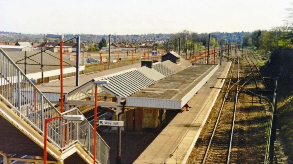
New Barnet did not exist as a developed settlement before the railway. The Great Northern Railway acquired land for its route, including the Lyonsdown estate, and later development companies used surplus railway-related land to create roads, houses and services.
New Barnet provides the clearest example of railway-led urban development in the area.
Before the railway, there was no established settlement known as New Barnet. The Great Northern Railway needed land from several farms and estates to construct its route. One important property was the Lyonsdown estate.
The owner required the railway company to purchase the whole estate rather than only the fields needed for the railway. The Great Northern Railway subsequently sold the unused portion of the Lyonsdown estate to the British Land Company in 1850.
This created a direct relationship between railway construction and speculative residential development.
Roads were laid out around the new station. Lyonsdown Road and Station Road became important parts of the emerging neighbourhood. The British Land Company began selling houses on New Barnet Road by 1857.
Development continued gradually rather than appearing immediately. By 1860, roads including Leicester Road, Lytton Road and Lyonsdown Road had been established.
Several Victorian streets were named after people and events associated with the Battle of Barnet, reflecting the area’s wider historical identity.
The population of the new Lyonsdown parish also increased. Barnet Council records 2,340 people in 1871 and approximately 4,230 in 1881. By the 1890s, New Barnet had become an important administrative and political centre within East Barnet parish.
The railway therefore influenced not only transportation but also land ownership, street planning, housing supply and local administration.
As you explore modern New Barnet, you are crossing land with a deep heritage. Read the full to understand its origins.
Why was the High Barnet railway branch important?
The High Barnet branch opened on 1 April 1872 and connected Barnet directly with the Great Northern Railway system through Finchley. Its stations supported suburban expansion and eventually became part of the London Underground Northern line network.
The 1872 railway expansion was particularly important because it brought rail transport closer to the historic centre of Barnet.
The High Barnet branch was developed by the Edgware, Highgate and London Railway and opened under the Great Northern Railway. The High Barnet station opened on 1 April 1872.
The station was built on the original site of Barnet Fair. The railway company adopted the name High Barnet, a name already associated with the elevated historic settlement.
The branch connected with the railway at Finchley and provided a direct route towards London.
The route also included stations that influenced development elsewhere in the modern London Borough of Barnet. Woodside Park opened in 1872, while Totteridge and Whetstone also formed part of the original branch infrastructure.
Barnet Council records that the railway stations opened in 1872 contributed to the development of suburban roads, particularly in New Barnet and Brunswick Park. However, railway fares were initially expensive. This restricted the immediate spread of suburban housing into some surrounding areas.
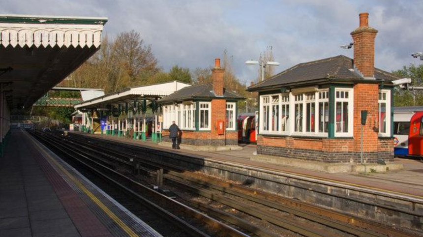
High Barnet station retains significant historic railway character. Barnet Council’s local heritage documentation identifies Victorian station buildings, early platform structures, waiting rooms, a footbridge and canopy supports. The station buildings remain important examples of Victorian railway architecture.
The railway therefore became both a transport facility and a physical landmark within Barnet’s urban landscape.
How did railway stations influence housing development?
Railway stations encouraged housing growth by making daily movement between Barnet and London easier. New roads appeared around stations, land was subdivided for residential use and developers marketed suburban homes to households seeking improved access to employment and services.
Railway-led housing development followed a recognisable pattern.
First, a railway company acquired land for the route and station. Second, roads were laid out around the station. Third, private developers purchased land and constructed houses. Finally, shops, schools, churches and public services followed the growing population.
New Barnet demonstrates this process clearly.
The British Land Company became involved in developing land left over from the railway’s acquisition of the Lyonsdown estate. Roads were created and houses began appearing during the 1850s and 1860s. By the 1880s, New Barnet had shops and an expanding collection of civic facilities.
The pattern was not limited to New Barnet.
The opening of Woodside Park station in 1872 coincided with the development of Torrington Park. Barnet Council records that 45 acres of the Woodside estate were sold as Torrington Park in June 1872, shortly after the station opened.
This relationship between railway access and residential land was fundamental to the growth of suburban North London.
Railway access also changed the attractiveness of commuting. Workers could live further from their workplaces while maintaining practical access to central London and other employment districts.
Barnet’s suburban expansion therefore formed part of a wider Victorian transformation across London. Railway infrastructure enabled the outward growth of residential districts beyond the traditional urban core.
Did the railway change Barnet’s economy?
The railway shifted Barnet’s economy from traditional coaching and agricultural activity towards commuting, construction, retail, services and railway-related employment. It also reduced the importance of long-distance coaching while increasing demand for housing, shops and local institutions.
Before railway expansion, Barnet benefited from its position on the Great North Road.
Coaching inns served travellers. Stables accommodated horses. Trades supplied food, accommodation, repairs and transport services. The Mitre and Red Lion were among the historic coaching establishments serving the travelling population.
Railway transport weakened this traditional economic model.
Barnet Council records that coaching was already declining before the High Barnet station opened in 1872. The turnpike toll on the High Road was removed in 1862, reflecting the broader decline of the traditional coaching system.
The railway replaced some forms of long-distance passenger movement while creating new economic activity.
Construction workers were required to build railway infrastructure. Station staff maintained passenger services. Developers purchased land for housing. Builders constructed homes and commercial premises. Shops then supplied expanding residential populations.
Historical Barnet records show the wider demographic effect of improved transport. A Barnet Council historical publication records population growth in the Finchley area from 4,937 in 1861 to 7,146 in 1871, an increase of almost 70 per cent. The publication connects part of this increase with railway employment and the development of Finchley as a residential area serving London’s industrial and commercial economy.
The economic effect therefore operated through several connected mechanisms: transport, employment, land development, population growth and consumer demand.
Railway expansion helped move Barnet towards the metropolitan economy that characterises North London today.
How did the railway change commuting between Barnet and London?
The railway made regular travel between Barnet and London faster and more practical than traditional road transport. This encouraged residential development outside central London and strengthened Barnet’s role as a suburban community connected to London’s employment and commercial districts.
Commuting was one of the railway’s most important long-term effects.
Before railways, travelling into London from Barnet relied primarily on coaches and road transport. Journey times depended on road conditions, traffic, horse changes and weather.
Railway services introduced scheduled journeys and greater capacity.
The Great Northern Railway connected Barnet with the wider network around London. The High Barnet branch subsequently provided another route towards Finchley and the capital.
This changed the relationship between home and employment.
People did not need to live immediately beside their workplace. Residential districts could expand along railway corridors. This created the economic foundation for suburbanisation.
Barnet Council’s historical material describes the railway’s arrival as making access to London and movement across the district relatively easy. The same source identifies Finchley as developing as a “dormitory area”, meaning a residential district whose population travelled elsewhere for employment.
This commuting function remains visible in Barnet today.
Modern stations such as High Barnet, New Barnet, Oakleigh Park, Totteridge and Whetstone and Woodside Park serve neighbourhoods that developed through successive phases of railway, tram and Underground investment.
The important historical point is that commuting did not simply follow population growth. Improved transport helped produce the suburban population itself.
How did the railway affect streets, shops and public services?
Railway-led population growth increased demand for roads, schools, churches, shops, public buildings and utilities. New Barnet demonstrates this progression, developing from railway land into a functioning suburb with streets, shops, schools, civic facilities and public services.
Railway stations acted as focal points for new neighbourhoods.
Roads connected stations with surrounding residential areas. Shops followed the movement of residents and passengers. Churches and schools were built to serve growing communities.
New Barnet again provides the strongest example.
A school serving 400 children opened in 1871. Shops had appeared by the 1880s. A police station opened in 1884. A town hall followed in 1892. A permanent fire station was established in 1903.
These developments show how transport infrastructure generated secondary infrastructure.
The railway itself did not build every facility. Instead, improved accessibility encouraged population growth, and population growth created demand for local services.
The effect extended beyond New Barnet.
At Woodside Park, railway development coincided with residential growth around Torrington Park. Barnet Council records that by 1874 there were approximately 350 dwellings within the relevant ecclesiastical parish, alongside new shops and inns on the High Road.
The railway therefore influenced the physical structure of communities.
Modern visitors can still identify this pattern by examining station approaches, Victorian terraces, road layouts and commercial centres near historic railway corridors.
Why did railway development not immediately urbanise all of Barnet?
Railway access did not produce uniform development across Barnet because fares, distance from stations, land ownership and existing settlement patterns affected where housing appeared. Areas such as East Barnet, Arkley and Mays Lane remained relatively rural after the first railway expansion.
The railway transformed Barnet unevenly.
Areas close to stations experienced stronger development pressure. Locations further from stations retained rural characteristics for longer.
Railway fares were an important factor. Barnet Council records that fares between Barnet and London were expensive during the early period of railway development. This limited the immediate suburban impact in some locations.
Land availability also mattered.
Developers needed suitable parcels for housing. Existing farms, estates and open land could delay continuous urban development.
New Barnet illustrates the gradual nature of expansion. Although roads were laid out from the 1850s, some remained only partly developed for decades. Barnet Council records that even by the mid-1890s, several Victorian roads still had empty plots.
New Barnet was not fully built until around the First World War period.
This demonstrates an important point about railway-led urbanisation. A station creates accessibility, but accessibility does not automatically produce immediate high-density development.
Development depends on land prices, investment, housing demand, transport costs and local infrastructure.
How did trams and the Underground extend the railway’s impact?
Trams and Underground services extended the railway’s suburban influence after the Victorian railway era. The 1907 tram connection and later Northern line conversion increased accessibility and helped suburban streets develop more extensively across Barnewt and neighbouring Finchley.
The railway’s influence continued through later transport systems.
Barnet Council records that a tramline from Archway reached the area in March 1907. The council also identifies the conversion of railway routes into Underground services as a major reason why many suburban streets developed.
The High Barnet railway branch eventually became part of the London Underground Northern line.
High Barnet station began Underground services in 1940. The former railway infrastructure became part of the Northern line network, linking the historic railway corridor with London’s electric Underground system.
This represented a second major phase of transport-led urbanisation.
Victorian railways created the initial framework. Electric railways, trams and Underground services increased the capacity and accessibility of that framework.
The effect was especially important in Finchley and surrounding districts.
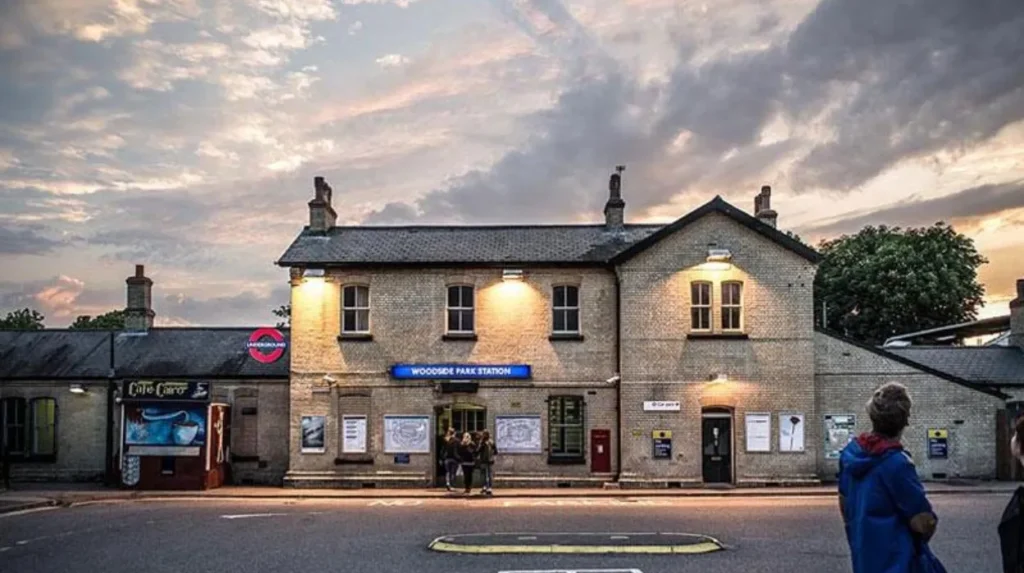
Woodside Park retained its historic Great Northern Railway station architecture while becoming part of London Underground from around 1940. Barnet’s local heritage documentation identifies the survival of the historic station building and signal box.
The transformation from railway to Underground also explains why Barnet’s present transport map contains infrastructure from several historical periods.
Which railway heritage can visitors still see in Barnet?
Visitors can still see Victorian railway architecture at High Barnet and Woodside Park, historic station layouts, surviving railway buildings and neighbourhoods shaped by nineteenth-century transport expansion. New Barnet’s street pattern also preserves evidence of railway-led suburban development.
Barnet retains visible evidence of its railway history.
High Barnet station is particularly important. Barnet Council’s local heritage documentation describes the station as a group of Victorian buildings with yellow brickwork, slate roofs, sash windows and distinctive chimney stacks. Early platform structures also survive.
Woodside Park provides another example.
Its station retains the historic Great Northern Railway design. A former signal box also survives close to the platform area. The station originally opened as Torrington Park on 1 April 1872 before being renamed.
New Barnet provides a different type of railway heritage.
Instead of focusing only on station buildings, visitors can examine the urban landscape created around the railway. Victorian roads, residential streets and civic buildings demonstrate how railway access influenced settlement patterns.
These locations are useful for visitors interested in architectural history, transport history and the development of London suburbs.
They also show why railway history is not restricted to tracks and platforms. The surrounding streets often provide stronger evidence of the railway’s long-term social and economic impact.
Explore More Area Guide
Historic Buildings That Still Survive in Barnet 2026
Black Bear Burger Named UK’s Happiest Workplace North London 2026
What does Barnet’s railway history tell us about modern North London?
Barnet’s railway history explains why its modern neighbourhoods developed around transport corridors. Victorian railway investment established the initial suburban framework, while later trams and Underground services intensified growth and connected Barnet more closely with London’s wider economy.
Modern Barnet remains strongly influenced by the transport decisions made during the nineteenth and early twentieth centuries.
The railway established development corridors. Housing expanded around stations. Commercial areas grew where residents and passengers generated demand. Roads were extended to connect new neighbourhoods with railway facilities.
The same principle continued with trams and the Underground.
Barnet’s current urban geography therefore reflects several generations of transport infrastructure.
The historic railway network also influenced architectural character. Victorian stations, railway approaches, terraced housing and planned roads remain part of the built environment.
For tourists, this creates a practical heritage trail through the borough.
A visit to High Barnet can combine railway architecture with the historic High Street and surviving coaching-era buildings. New Barnet provides evidence of nineteenth-century suburban planning. Woodside Park demonstrates the transition from Great Northern Railway infrastructure to the modern Underground system.
For residents and business travellers, the same history explains the location and character of several established transport hubs.
The railway changed Barnet because it altered accessibility. Accessibility changed land values and development patterns. Development changed population distribution. Population growth created demand for services and commerce. Later transport investment reinforced those changes.
That sequence remains central to understanding Barnet’s urban history.
Why is the railway important to Barnet’s heritage today?
The railway is central to Barnet’s heritage because it transformed transport, land use, housing, employment and settlement patterns. Surviving Victorian stations and railway-shaped neighbourhoods provide physical evidence of the transition from rural settlement to connected London suburb.
Barnet’s railway history is significant because its effects remain visible.
The railway did not simply introduce a new method of travel. It changed the scale and direction of urban growth.
New Barnet demonstrates how railway land acquisition could create an entirely new suburb. High Barnet demonstrates how a railway station could connect an established historic settlement to London’s transport network. Woodside Park demonstrates how station investment and residential development could occur together.
The transition from Great Northern Railway services to London Underground services further extended these historical connections.
Today, railway heritage forms part of Barnet’s wider cultural landscape. Historic station buildings sit alongside modern transport facilities. Victorian roads remain part of established neighbourhoods. Former railway development corridors continue to support residential and commercial activity.
For visitors, understanding this history adds context to Barnet’s streets and stations.
For residents, it explains why different parts of the borough have distinct urban patterns.
For digital nomads and business travellers, it explains why transport accessibility remains a defining feature of Barnet’s relationship with central London.
The railway’s greatest legacy is therefore not simply the survival of old stations. It is the urban structure that grew around them.
Barnet changed from a traditional coaching and agricultural district into a connected suburban part of Greater London because railway infrastructure changed how people, land, businesses and communities interacted.
The railway created the foundation. Later trams and Underground services expanded it. The resulting neighbourhoods remain part of Barnet’s identity today.
When did the railway first arrive in Barnet?
The railway first reached Barnet in 1850, when the Great Northern Railway opened Barnet Station, later renamed New Barnet Station. This connected the area with London’s growing railway network.