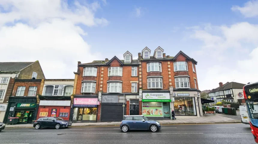
Barnet is a large North London borough made up of numerous established districts, neighbourhoods and town centres rather than one single urban centre. Its best-known areas include High Barnet, Finchley, Hendon, Edgware, Golders Green, Mill Hill, Whetstone, East Finchley, Colindale and Burnt Oak.
- What is the geographic structure of Barnet?
- How did Barnet develop into its present districts?
- What is High Barnet known for?
- What are the main parts of Finchley?
- What is Hendon and which areas are associated with it?
- What makes Edgware a major Barnet district?
- What is Golders Green known for?
- What is Mill Hill like as a Barnet district?
- What are Burnt Oak and Colindale known for?
- What are Whetstone and North Finchley?
- What are East Barnet, New Barnet and Totteridge?
- How do Barnet’s districts differ from its electoral wards?
- Which Barnet districts are most useful for visitors?
- How can visitors understand Barnet’s districts on a map?
- Why does Barnet’s district structure matter today?
The geographic structure of Barnet is important because the borough developed from several older settlements and local authorities. Modern Barnet therefore contains places with distinct identities, transport links, commercial centres, housing patterns and historical backgrounds.
For visitors, understanding these districts makes it easier to plan sightseeing, accommodation, shopping, parks and transport. For residents and business travellers, the district structure helps explain why different parts of Barnet feel and function differently.
Barnet Council currently identifies 7 main town centres, 8 district town centres and 15 local or neighbourhood town centres. These categories are different from the borough’s electoral wards.
What is the geographic structure of Barnet?
Barnet is a North London borough containing multiple historic districts, commercial centres and neighbourhoods, with High Barnet, Finchley, Hendon, Edgware, Golders Green and Mill Hill among its principal areas. Its administrative wards and town-centre hierarchy provide different ways to understand the borough’s geography.
The London Borough of Barnet covers a broad area on the northern edge of Greater London. Its settlements developed at different times and around different roads, railway routes, Underground stations, market areas and historic communities.
This explains why Barnet does not operate like a borough centred around one dominant town. Instead, it has a network of centres.
Barnet Council’s current town-centre framework identifies seven main town centres:
- Burnt Oak
- Chipping Barnet
- Cricklewood
- Edgware
- Finchley Central
- Golders Green
- North Finchley
It also identifies eight district town centres, including Brent Street, Colindale/The Hyde, East Finchley, Hendon Central, Mill Hill, New Barnet, Temple Fortune and Whetstone.
The council additionally identifies 15 local and neighbourhood centres, such as Childs Hill, East Barnet, Friern Barnet, Grahame Park, Hampden Square, New Southgate and West Hendon Broadway.
These classifications describe the commercial and service geography of Barnet. They do not mean that every named place is an official administrative district.
How did Barnet develop into its present districts?
Modern Barnet was created from several older settlements and local authorities, bringing together Barnet, East Barnet, Friern Barnet, Finchley and Hendon in 1965. Their separate histories explain the borough’s present network of districts and town centres.
The modern London Borough of Barnet was established on 1 April 1965 under the London government reorganisation. It combined the former Boroughs of Finchley and Hendon with the Urban Districts of Barnet, East Barnet and Friern Barnet. Contemporary Barnet records describe the five predecessor authorities as the foundations of the new borough.
Before 1965, the communities did not share one local government structure. Barnet and East Barnet were associated with Hertfordshire, while Finchley, Friern Barnet and Hendon were part of Middlesex. Barnet Council’s historical archive records this earlier administrative division.
The area’s history is therefore essential to understanding its geography. explains how individual settlements, roads, markets and institutions developed before becoming part of the modern borough.
Barnet’s historic geography also reflects its position north of central London. Roads heading towards St Albans and other parts of southern England encouraged settlement and commerce. High Barnet developed as an important market town, while Finchley, Hendon, Edgware and other communities developed around their own local centres.
This layered history remains visible in today’s district names.
What is High Barnet known for?
High Barnet is the historic northern town centre commonly associated with Chipping Barnet, an established market town with strong heritage, shopping streets, transport connections and links to the wider Barnet area. It is one of the borough’s most recognisable northern districts.
High Barnet sits towards the northern part of the borough. It is also commonly associated with Chipping Barnet, a name connected with its historic market.
Barnet Council describes High Barnet as the oldest town in Barnet. The town’s market has existed in different forms and locations since at least the 12th century.
The district is particularly important for understanding Barnet’s historical identity. Its position on an established route north from London helped the settlement develop as a market and service centre.
Today, High Barnet combines traditional town-centre activity with residential neighbourhoods. The area provides access to shops, restaurants, local services, parks and heritage locations.
High Barnet is also served by High Barnet Underground station, which is on the Northern line. This gives the district a direct public transport relationship with central London.
Nearby areas include Underhill, Barnet Vale and parts of East Barnet. The modern electoral geography also distinguishes High Barnet, Underhill and Barnet Vale as separate wards.
What are the main parts of Finchley?
Finchley is a major central-eastern part of Barnet containing several distinct areas, including Finchley Central, East Finchley, North Finchley, West Finchley and Finchley Church End. Its town centres combine established residential neighbourhoods, shops, transport links, parks and historic buildings.
Finchley is not one uniform district. It contains several recognisable communities that developed around different roads and centres.
Finchley Central is one of Barnet’s main town centres. It developed around the transport corridor and commercial streets surrounding Finchley Central Underground station.
North Finchley is another major town centre. It is located further north and has a substantial commercial high street serving surrounding residential communities.
East Finchley lies towards the eastern side of Finchley. Its High Road forms a major local commercial corridor, with shops, cafés, restaurants and community facilities.
West Finchley is a predominantly residential area around West Finchley Underground station and surrounding streets.
Finchley Church End represents another historic part of Finchley. The name reflects the settlement around the historic church area.
Barnet Council’s historical material records Finchley’s Saxon origins and explains that the name was recorded by the 13th century. Settlement expanded as woodland was cleared and agriculture developed.
The area later experienced substantial suburban development. Transport improvements played an important role in changing Finchley from rural settlements into an integrated part of metropolitan London.
For visitors, Finchley is particularly useful as a base for exploring northern London because its different centres provide food, shopping, green spaces and Underground connections.
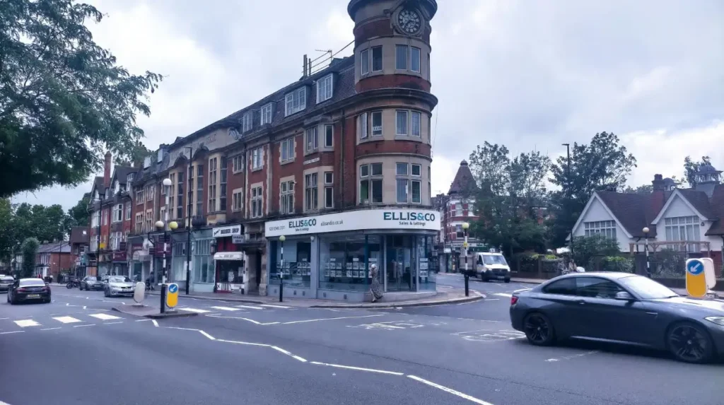
What is Hendon and which areas are associated with it?
Hendon is a major western-central Barnet district with a long history, substantial residential areas and several commercial centres, including Hendon Central and Brent Street. West Hendon and The Hyde form additional communities within the wider Hendon area.
Hendon is one of Barnet’s most important historic settlements. Its origins extend back to the Roman and Saxon periods.
Barnet Council records a Roman settlement in Hendon and identifies the Edgware Road as part of the historic route later associated with Watling Street. The name Hendon is recorded as a Saxon name meaning high hill.
Modern Hendon includes several distinct areas.
Hendon Central is a district town centre and transport hub around Hendon Central Underground station.
Brent Street is another district town centre serving Hendon’s surrounding communities.
West Hendon lies further south-west and includes residential areas around West Hendon Broadway and the Silkstream corridor.
The Hyde is associated with the southern part of Hendon and Colindale. Barnet Council classifies Colindale/The Hyde as a district town centre.
Hendon also has an important institutional role. The area contains major educational, sporting, residential and commercial facilities.
For visitors, Hendon provides a combination of local shopping, green spaces, historic buildings and transport connections. Its location also makes it practical for exploring attractions across north-west London.
What makes Edgware a major Barnet district?
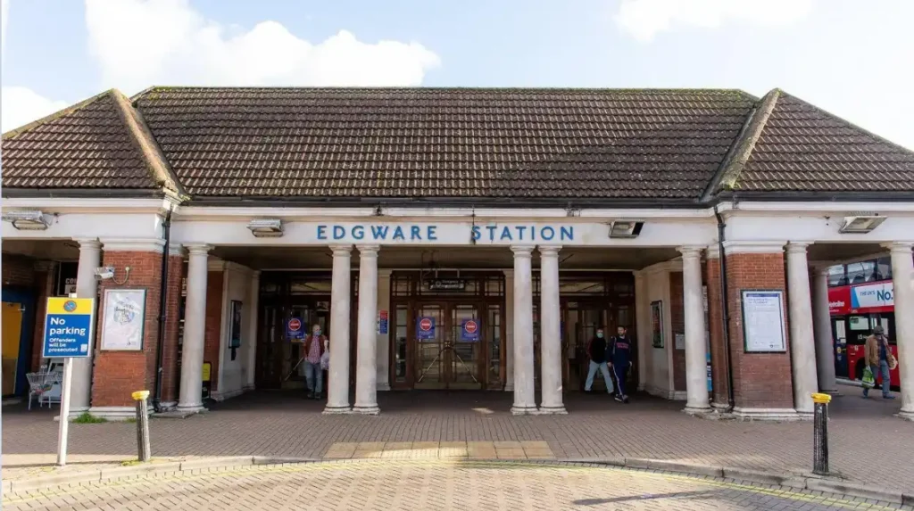
Edgware is a major north-west Barnet centre with a substantial commercial area, residential neighbourhoods and strong transport connections. Edgware and Edgwarebury are separate modern wards, while Edgware itself is recognised by Barnet Council as one of the borough’s principal town centres.
Edgware occupies the north-western part of Barnet. It functions as an important commercial and transport centre for communities in Barnet and neighbouring areas.
Barnet Council classifies Edgware as one of its seven main town centres.
The broader Edgware area includes Edgwarebury, which has its own identity and electoral ward.
The district is served by Edgware Underground station on the Northern line. This transport connection has contributed significantly to Edgware’s role as a commercial and residential centre.
Edgware has a mixture of high-street retail, restaurants, local services and residential streets. Its geographic position also places it close to open spaces and the northern edge of Greater London.
Burnt Oak sits nearby and forms another major centre. The relationship between Edgware and Burnt Oak demonstrates how Barnet’s urban geography contains several centres within relatively short distances.
What is Golders Green known for?
Golders Green is a southern Barnet district recognised for its busy town centre, diverse communities, independent businesses, transport connections and proximity to Hampstead Garden Suburb and Golders Hill Park. It is one of Barnet’s principal town centres and an important southern gateway.
Golders Green occupies the southern part of Barnet. Its location places it relatively close to central London while retaining a strong local commercial identity.
Barnet Council identifies Golders Green as one of the borough’s seven main town centres. The area contains a major Underground and bus interchange, Golders Green Library and extensive retail activity.
The Golders Green conservation area includes the town centre and the railway and bus station. The council records that the area developed rapidly following the arrival of Golders Green Underground station.
Golders Green is also known for its culturally diverse commercial environment. Barnet Council notes businesses and food outlets serving different local communities, including established Jewish and Japanese communities.
The district borders Hampstead Garden Suburb, a major planned residential area. Golders Hill Park is another important nearby green-space destination.
For leisure travellers, Golders Green combines shopping, food, local architecture, parks and transport access. It also provides an efficient starting point for exploring several southern parts of Barnet.
What is Mill Hill like as a Barnet district?
Mill Hill is a large north-western Barnet district characterised by residential neighbourhoods, green spaces, established institutions and a district town centre. Its geography includes Mill Hill Broadway, Mill Hill East and surrounding suburban areas extending towards the borough’s northern boundary.
Mill Hill occupies a substantial part of north-west Barnet.
The area contains several recognisable localities rather than one continuous urban centre. Mill Hill Broadway functions as a significant local shopping and service area, while Mill Hill East has its own residential and transport identity.
Mill Hill is also associated with extensive open land and suburban development. The area’s location gives it a different physical character from more densely developed southern districts.
Barnet Council classifies Mill Hill as a district town centre.
Mill Hill Underground station is on the Northern line’s Edgware branch, while Mill Hill Broadway railway station provides another transport connection.
For visitors, Mill Hill is relevant because it offers access to green spaces, local shopping, cafés and quieter residential streets while remaining connected to the wider London transport network.
What are Burnt Oak and Colindale known for?
Burnt Oak and Colindale form important north-western Barnet communities with major town-centre functions, strong transport connections and significant residential development. Burnt Oak is a main town centre, while Colindale/The Hyde is classified as a district town centre.
Burnt Oak lies near Edgware and the borough’s western boundary. Its high street serves a wide residential catchment and provides shops, restaurants and local services.
Barnet Council places Burnt Oak among its seven main town centres.
Colindale lies further south. It has experienced substantial development and contains a mixture of established neighbourhoods and newer residential communities.
Barnet Council identifies Colindale/The Hyde as a district town centre.
The area also has strong public transport connections, including Colindale Underground station.
Colindale’s changing built environment makes it one of the borough’s important growth areas. New housing, community infrastructure and commercial services have expanded the area’s role within northern London.
The modern district therefore combines historic institutional sites with newer residential development.
What are Whetstone and North Finchley?
Whetstone and North Finchley are neighbouring northern Barnet centres with established high streets, residential communities and transport connections. North Finchley is one of Barnet’s main town centres, while Whetstone is classified as a district town centre.
Whetstone sits along the northern continuation of the Finchley area. Its position around the High Road gives it a strong linear town-centre structure.
Barnet Council classifies Whetstone as a district town centre. North Finchley has the higher main-town-centre classification.
Both areas provide everyday services, retail, restaurants and community facilities.
Whetstone is also close to Totteridge and Woodside, creating a transition between commercial high streets and lower-density residential neighbourhoods.
North Finchley developed around a major section of the A1000 corridor. Its town centre serves a broad residential catchment extending across northern Finchley and neighbouring areas.
Together, the two centres demonstrate the way Barnet’s geography changes gradually between major commercial corridors and residential districts.
What are East Barnet, New Barnet and Totteridge?
East Barnet, New Barnet and Totteridge are established northern and north-eastern communities with distinct local identities. East Barnet has historic village roots, New Barnet developed strongly around rail transport, and Totteridge retains a lower-density suburban and semi-rural character.
East Barnet is historically significant because Barnet Council identifies it as the oldest part of the wider Barnet settlement. The older settlement centre gradually lost prominence as High Barnet developed along the northern route.
Today, East Barnet has a local centre and established residential streets.
New Barnet developed strongly around the railway and is now recognised by Barnet Council as a district town centre.
Totteridge lies towards the northern edge of the Finchley area. It has a distinctive residential landscape and is closely connected with Woodside, forming the modern Totteridge & Woodside ward.
These areas are important for visitors interested in the quieter side of Barnet. They also demonstrate the borough’s varied settlement pattern, where historic villages, railway suburbs and residential districts exist alongside major urban centres.
How do Barnet’s districts differ from its electoral wards?
Barnet’s districts and town centres describe places and commercial communities, while electoral wards define administrative areas for local elections. Barnet currently has 24 electoral wards, so ward boundaries do not provide a complete list of the borough’s neighbourhoods.
This distinction is essential when researching Barnet.
Barnet currently has 24 electoral wards and is represented by 63 councillors. Fifteen wards elect three councillors each, while nine elect two councillors each.
The ward names include High Barnet, East Barnet, Edgware, Edgwarebury, Hendon, Golders Green, Mill Hill, Whetstone, West Finchley and West Hendon. Other wards include Barnet Vale, Brunswick Park, Childs Hill, Colindale North, Colindale South, Cricklewood, East Finchley, Finchley Church End, Friern Barnet, Garden Suburb, Underhill, Totteridge & Woodside and Woodhouse.
A district can therefore cover an area that does not correspond exactly to one ward.
This matters for visitors because accommodation listings, postal addresses, transport information and local businesses often use familiar neighbourhood names rather than electoral boundaries.
Which Barnet districts are most useful for visitors?
The most useful Barnet districts for visitors are those with major town centres, transport connections, parks and cultural or heritage attractions. High Barnet, Finchley, Golders Green, Hendon, Edgware, Mill Hill and Colindale provide strong starting points for exploring different parts of the borough.
High Barnet is particularly relevant for heritage and historic town-centre exploration.
Finchley provides several distinct centres and convenient connections towards central London.
Golders Green combines food, shopping, transport and access to major green spaces.
Hendon offers museums, local facilities, parks and connections through Hendon Central and nearby stations.
Edgware provides a substantial commercial centre in north-west Barnet.
Mill Hill offers a greener suburban environment with local shopping and transport links.
Colindale is useful for visitors interested in newer development, museums, institutional heritage and northern London connections.
The best district depends on the purpose of the visit. A heritage-focused itinerary has different geographic priorities from a shopping trip, a business visit or a day centred on parks.
Explore More Area Guide
How Barnet Market Shaped Local History and North London
Historical Figures Connected With Barnet: Key People
How can visitors understand Barnet’s districts on a map?
Visitors can understand Barnet most effectively by combining the council’s town-centre hierarchy, electoral ward maps and transport network. These layers distinguish commercial centres from administrative boundaries and show how High Barnet, Finchley, Hendon, Edgware and other communities connect.
Barnet Council publishes current ward maps based on Ordnance Survey data. The present warding arrangement took effect on 5 May 2022, providing a reliable administrative reference for the borough.
The council’s town-centre framework provides a different geographic layer. It identifies the commercial hierarchy from main town centres through district centres to local and neighbourhood centres.
Transport provides a third layer.
The Northern line connects several major Barnet areas, including High Barnet, Finchley, Hendon-area stations and Edgware. National Rail services also connect communities such as New Barnet, Mill Hill Broadway and Hendon with the wider London network.
Using these three layers prevents a common mistake: treating every neighbourhood name as an official district or administrative unit.
For travel planning, the practical approach is to identify the neighbourhood first, then check the nearest town centre, station and attractions.
Why does Barnet’s district structure matter today?
Barnet’s district structure remains important because it shapes local shopping, transport, housing, heritage, public services and visitor activity. The borough’s network of centres allows different communities to operate as distinct local destinations while remaining part of one North London authority.
Barnet’s geography is the product of centuries of settlement rather than a single planned urban centre.
Its older communities retain distinct identities. High Barnet reflects the historic market-town tradition. Finchley contains several connected centres. Hendon has deep Roman and medieval roots. Golders Green developed rapidly with transport-led suburban growth. Edgware functions as a major north-western centre. Mill Hill retains substantial suburban and green-space character.
Modern development continues to change parts of the borough, particularly areas such as Colindale.
The council’s current framework recognises a network of 30 town and neighbourhood centres across its seven main, eight district and 15 local/neighbourhood classifications.
For tourists, this network creates multiple bases for sightseeing. For residents, it supports local services close to neighbourhoods. For digital nomads and business travellers, it provides numerous cafés, libraries, transport hubs and commercial areas outside central London.
Understanding these districts therefore gives a more accurate picture of Barnet than treating the borough as one single destination. Its identity comes from the relationship between historic settlements, modern town centres, residential neighbourhoods, green spaces and transport corridors.
What are the main districts of Barnet?
The main districts and well-known areas of Barnet include High Barnet, Finchley, Hendon, Edgware, Golders Green, Mill Hill, Colindale, Burnt Oak, Whetstone, East Barnet and North Finchley. Each has its own town centre, transport links and local character.