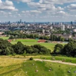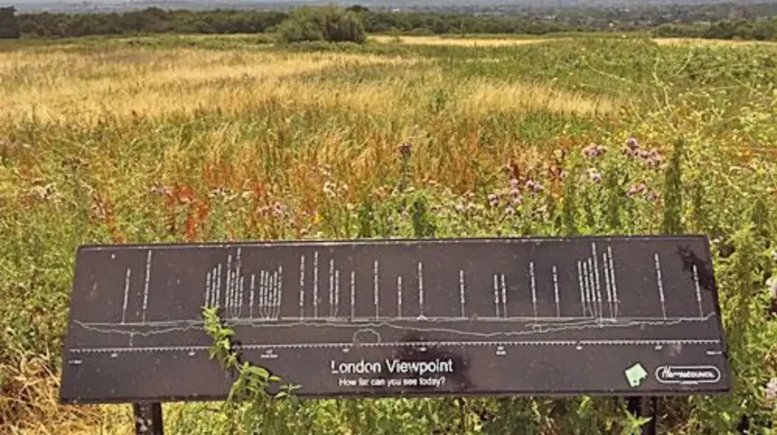
Barnet occupies one of the highest and greenest parts of North London. Its ridges, open fields, valleys, woodland and historic settlements create viewpoints across suburban landscapes and towards the wider London skyline. The borough’s elevated geography makes it particularly suitable for panoramic walks, landscape photography and quiet outdoor visits.
- Where is the highest viewpoint in Barnet?
- Why does Highwood Hill offer some of the best countryside views in North London?
- Which Barnet location gives the best views across the Dollis Valley?
- What can you see from Mill Hill and The Ridgeway?
- Is Moat Mount a good place for panoramic landscape views?
- Where can you find historic views around Monken Hadley?
- How does Hampstead Garden Suburb provide scenic views in Barnet?
- Can you get good views around Totteridge?
- Where can you see the North London skyline from Barnet?
- What is the best viewpoint near Barnet for seeing central London landmarks?
- Which Barnet views are best for photography?
- What is the best way to explore Barnet’s viewpoints in one day?
- Why does Barnet have so many good viewpoints?
- How should visitors choose the best Barnet viewpoint?
The strongest views are concentrated around Woodcock Hill, Highwood Hill, Mill Hill, Totteridge, Monken Hadley, Dollis Valley and Hampstead Garden Suburb. These locations provide different perspectives. Some focus on open countryside. Others reveal long-distance urban views, historic buildings or the changing North London skyline.
Barnet Council identifies Woodcock Hill as the highest point of a chain of rounded hills running through the northern and north-western parts of the borough, at 137 metres. The same chain connects Moat Mount, Mill Hill, Highwood Hill, High Barnet and Monken Hadley.
The best viewpoint therefore depends on what type of scenery you want. Woodcock Hill is particularly important for elevation. Highwood Hill provides countryside character. Mill Hill offers long-distance views from high ground. Monken Hadley combines landscape with historic architecture. Hampstead Garden Suburb provides planned vistas within a distinctive residential landscape.
Where is the highest viewpoint in Barnet?
Woodcock Hill is the highest point in Barnet at 137 metres, forming part of a chain of rounded hills across northern and north-western Barnet. Its elevation gives walkers broad perspectives over surrounding countryside, suburban districts and the wider North London landscape.
Woodcock Hill sits within the elevated landscape around Mill Hill and Highwood Hill. The hill forms part of the wider topographical structure that distinguishes Barnet from much of central London.
Barnet’s landscape rises and falls across several ridges. The northern and north-western hills form a continuous elevated sequence. This includes Moat Mount, Mill Hill, Highwood Hill, High Barnet and Monken Hadley.
Elevation matters because long-distance views depend on both height and unobstructed sightlines. Buildings, woodland and mature trees restrict some views. Open fields and ridges provide clearer outlooks.
Woodcock Hill is therefore an important reference point when comparing Barnet viewpoints. It is not simply a scenic green space. It represents the highest point within the borough’s principal northern hill system.
For visitors, the attraction is the combination of height and rural character. The surrounding landscape contains fields, trees, footpaths and residential areas rather than a continuous city skyline.
The viewpoint is particularly useful for travellers who want to understand Barnet geographically. Looking across the landscape shows how the borough transitions between countryside-style spaces and the dense urban fabric of Greater London.
Why does Highwood Hill offer some of the best countryside views in North London?
Highwood Hill provides long-distance countryside views because it occupies elevated ground within Mill Hill’s rural landscape. Barnet Council describes the area as having attractive distant views, relatively level terrain, bridleways and a countryside setting close to central London.
Highwood Hill is one of Barnet’s most distinctive locations for open landscape scenery. It forms part of the Mill Hill conservation area, where The Ridgeway follows high ground through the district.
The landscape differs from central London. Fields, hedgerows, mature trees and low-density development create a more open visual environment.
Barnet Council describes Mill Hill as a long linear settlement associated with high ground along The Ridgeway. The conservation area includes modest houses, cottages and village-like clusters around Highwood Hill.
The combination of elevation and relatively open land creates long-distance views. These views are especially valuable for visitors who want photographs showing North London’s countryside character rather than dense buildings.
Highwood Hill also demonstrates how geography shaped settlement. Elevated land provided distinctive routes and locations for development while valleys remained comparatively open.
The area works well as part of a walking itinerary. Visitors can combine the viewpoint with The Ridgeway, nearby countryside and other green spaces around Mill Hill.
A landscape view here also provides useful context for understanding Barnet’s position on London’s northern edge. The borough contains extensive green spaces despite being part of Greater London.
Which Barnet location gives the best views across the Dollis Valley?
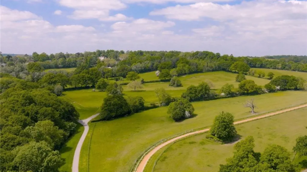
The elevated edges of the Dollis Valley provide broad views across meadows, green spaces and surrounding suburban districts. Barnet Council describes Dollis Valley as occupying a south-facing slope with excellent views across adjacent Green Belt and protected countryside landscapes.
Dollis Valley is one of the most important green corridors in Barnet. It connects several open spaces through the Dollis Brook valley.
The Dollis Valley Greenwalk is 10 miles long and links green spaces from Moat Mount through Barnet towards Hampstead Heath. Barnet Council states that the route can take up to six hours and is mostly flat with hard surfaces.
The valley offers a different type of viewpoint from the hilltops. Instead of looking from the highest possible point, visitors experience views across open valley landscapes and elevated slopes.
The official Dollis Valley Greenwalk guide also identifies panoramic views across farmland along parts of the route.
This makes the area suitable for visitors interested in landscape photography, walking and wildlife. It also provides a useful way to see how streams and valleys influence Barnet’s geography.
Dollis Brook forms the central natural feature. The surrounding meadows and fields create open sightlines that are uncommon in densely developed parts of London.
The valley is particularly useful for visitors who want a longer walking experience rather than a single viewpoint. Its connected route allows the landscape to change gradually from open countryside to suburban green space.
What can you see from Mill Hill and The Ridgeway?
Mill Hill and The Ridgeway provide elevated views across North London through a combination of open countryside, suburban rooftops, wooded areas and distant landscapes. The Ridgeway follows high ground and is central to Mill Hill’s distinctive geography and scenic character.
The Ridgeway is one of the most useful places for understanding Mill Hill’s physical structure. It follows high ground through an area that retains a semi-rural character.
The Mill Hill conservation area contains long-distance views alongside bridleways and relatively level terrain. This combination supports walking routes with repeated changes in perspective.
The area includes historic buildings, cottages, institutional sites and open spaces. These features create layered views rather than a single uninterrupted panorama.
Visitors can also connect Mill Hill’s high ground with nearby open spaces. Moat Mount and Scratchwood are important parts of the wider landscape.
The scenery changes according to direction. Looking towards open land gives a rural perspective. Looking towards built-up areas reveals the scale of North London’s suburban development.
Mill Hill is therefore particularly suitable for travellers who want a balanced view of Barnet. It demonstrates how rural landscapes, residential districts and transport infrastructure coexist within Greater London.
The Ridgeway also provides a useful route for walking photography. Buildings and trees frequently frame the landscape, creating views that differ from the exposed panoramas found on larger open hills.
Is Moat Mount a good place for panoramic landscape views?
Moat Mount is a strong choice for landscape views because it sits within Barnet’s elevated north-western landscape and forms part of the borough’s largest woodland area with Scratchwood. Open spaces around the woodland provide opportunities to experience fields, trees and distant countryside.
Moat Mount lies beside Barnet Way in Mill Hill. It forms part of the wider landscape around Scratchwood and the A1.
Barnet Council identifies Scratchwood and Moat Mount together as the largest area of woodland in Barnet. Scratchwood contains ancient woodland dominated by oak and hornbeam, while Moat Mount includes extensive woodland and former ornamental garden areas.
The visual experience here is more natural than urban. Woodland edges, open areas and wildlife habitats create a varied landscape.
Moat Mount also connects to the wider walking network. It is the starting point of the Dollis Valley Greenwalk, making it particularly useful for visitors who want to combine several landscapes in one trip.
The location also demonstrates how Barnet’s green infrastructure supports recreation. Walking routes connect woodland, fields, valleys and residential areas without requiring a journey into central London.
For photography, woodland clearings and open sections provide different compositions throughout the year. Spring brings woodland flowers, while summer provides fuller vegetation. Autumn changes the colour and structure of the woodland canopy.
Where can you find historic views around Monken Hadley?
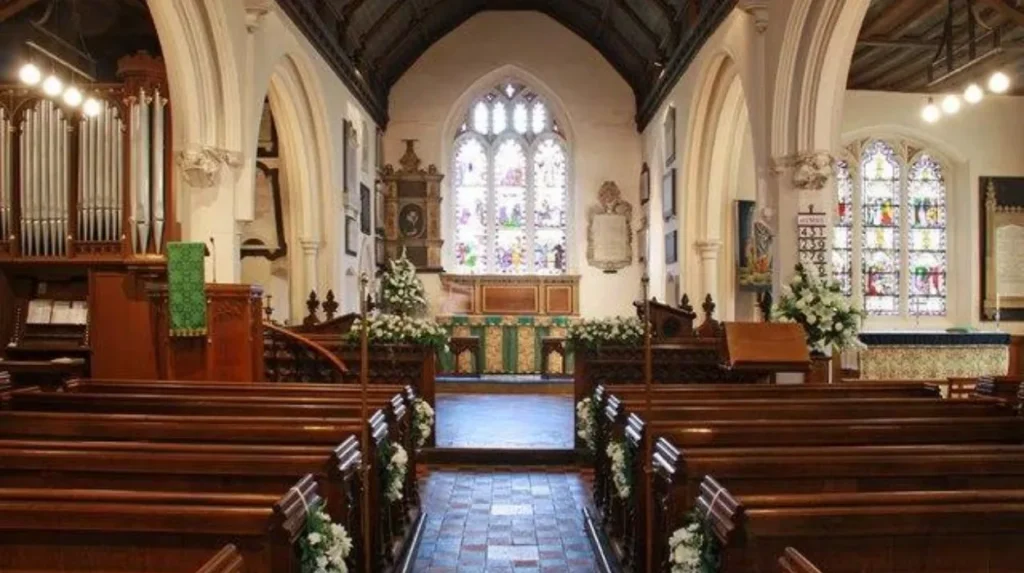
Monken Hadley combines elevated landscape views with historic architecture, mature trees and open common land. Its church, historic roads and surrounding greenery create a distinctive North London viewpoint where scenery and heritage remain closely connected.
Monken Hadley lies in north-east Barnet near the Hertfordshire and Enfield boundaries. The area sits north of Chipping Barnet and retains a strong historic landscape character.
Barnet Council describes the conservation area as having winding lanes, native trees, rough common land and historic buildings. St Mary the Virgin church is the focal point of the settlement.
Views from around the church reveal the character of the historic settlement. The surrounding landscape also connects to the history of the Great North Road.
The Battle of Barnet took place in 1471 during the Wars of the Roses. Barnet Council records that the battle occurred within sight of the church. An obelisk commemorating the battle was erected in 1740.
This historical setting makes Monken Hadley particularly valuable for visitors interested in more than modern skyline photography.
As you explore the modern landscape, you are crossing land shaped by centuries of settlement, transport and conflict. Read about the full to understand its origins.
Monken Hadley’s views are best understood as landscape views rather than conventional city panoramas. The combination of church architecture, trees, common land and historic roads creates a distinctive visual identity.
How does Hampstead Garden Suburb provide scenic views in Barnet?
Hampstead Garden Suburb provides carefully planned vistas through Central Square, the Heath Extension, woodland and residential streets. Its landscape was deliberately designed around long-range views, focal buildings and framed perspectives, creating a distinctive combination of architecture and open space.
Hampstead Garden Suburb occupies the southern part of Barnet. The conservation area covers approximately 1,009 acres, including roughly 136 acres of open space.
The suburb was developed between 1907 and 1938 on a greenfield site. Its planners integrated woodland, open spaces, roads and buildings into a formal landscape design.
The result is different from a natural hilltop viewpoint. Here, views were deliberately incorporated into the design of the neighbourhood.
Barnet’s character appraisal states that the area’s topography was used to create long-range views, focal points and glimpsed views. Central Square’s buildings form important visual landmarks within the planned landscape.
The 178-foot spire of St Jude-on-the-Hill is particularly important. Barnet Council notes that the spire is visible for miles around.
Visitors can therefore explore viewpoints created through streets, open spaces and changes in elevation rather than relying on one summit.
The Heath Extension, woodland areas and gateways into the suburb also contribute to the area’s long-distance views.
Can you get good views around Totteridge?
Totteridge offers attractive landscape views through open fields, mature trees, historic lanes and the Dollis Valley countryside. Its position along Barnet’s northern ridge gives visitors access to a rural landscape that remains within Greater London and connects directly with walking routes.
Totteridge is one of Barnet’s strongest areas for rural scenery. Its landscape includes open fields, wooded areas, traditional lanes and historic buildings.
The area connects with the Dollis Valley landscape and the wider network of green spaces running across Barnet.
Totteridge Fields is particularly significant because it retains the appearance of traditional lowland pastoral landscape. Barnet’s historical material identifies the area as a nature reserve managed by London Wildlife Trust.
Views across fields provide a strong contrast with the urban districts elsewhere in the borough. The landscape contains open grassland, hedgerows, trees and distant buildings.
Totteridge is also useful for walkers. Routes through the countryside allow visitors to experience several viewpoints rather than stopping at a single location.
The area’s historic character adds another visual layer. Buildings, lanes and field boundaries reflect older patterns of settlement and land management.
This combination makes Totteridge particularly suitable for visitors searching for quiet views without travelling outside London.
Where can you see the North London skyline from Barnet?
The clearest skyline perspectives from Barnet come from elevated southern and central areas with open sightlines towards Hampstead, Highgate and central London. Higher ground around Hampstead Garden Suburb, Mill Hill and surrounding ridges provides changing perspectives across London’s built environment.
Barnet does not contain a single official skyline platform comparable with central London’s viewing galleries. Its skyline experience comes from natural elevation and open spaces.
The borough’s southern landscape rises towards Hampstead and Highgate. Its northern ridges provide another elevated system.
Hampstead Garden Suburb is particularly valuable because the area’s planned landscape creates framed views through streets and green spaces. Its character appraisal specifically identifies long-range views as an important feature.
Mill Hill provides a different perspective. Its high ground and countryside setting create longer views across suburban landscapes.
The visibility of specific landmarks depends on trees, buildings, weather and the exact position of the observer. A viewpoint that provides a clear outlook in winter can become partially screened by foliage in summer.
For this reason, visitors should treat Barnet as a network of viewpoints rather than one fixed skyline location.
What is the best viewpoint near Barnet for seeing central London landmarks?
Parliament Hill on Hampstead Heath is the strongest nearby viewpoint for identifying central London landmarks, although it lies outside Barnet. At 98 metres, it provides protected panoramic views towards St Paul’s Cathedral, The Shard, the Gherkin and Westminster.
Parliament Hill is in the London Borough of Camden rather than Barnet, but its position makes it highly relevant to anyone exploring views from North London.
The summit reaches 98 metres above sea level. The City of London Corporation describes it as one of London’s highest natural points and identifies views towards St Paul’s Cathedral, The Shard, the Gherkin and the Palace of Westminster.
The viewpoint also has formal planning protection. Two strategic London panoramas are associated with Hampstead Heath, including one centred on St Paul’s Cathedral and another centred on the Palace of Westminster.
This protected status is important because it preserves the relationship between open landscape and London’s central skyline.
Parliament Hill is also connected to Barnet through the broader geography of North London’s elevated landscape. Hampstead Heath sits south of Barnet’s ridge system and provides a useful comparison with Barnet’s own viewpoints.
The City of London Corporation’s official walking route around Parliament Hill and the Tumulus covers approximately 2.5 kilometres, providing a practical way to combine the viewpoint with other Heath landscapes.
Which Barnet views are best for photography?
The best photography locations depend on the subject. Woodcock Hill and Highwood Hill suit open landscapes; Monken Hadley suits heritage scenes; Hampstead Garden Suburb suits architecture; Dollis Valley suits pastoral landscapes; and elevated Mill Hill locations suit broad North London panoramas.
Photography conditions change throughout the day because sunlight, vegetation and visibility alter the appearance of distant landscapes.
Early morning provides softer light and quieter conditions. Evening creates longer shadows across fields and buildings.
Winter often provides clearer sightlines because deciduous trees carry less foliage. Summer provides greener landscapes but more visual obstruction from vegetation.
Landscape photographers should also consider foreground structure. A view containing only distant buildings lacks depth. Trees, hedges, church towers, field boundaries and paths provide useful visual layers.
Hampstead Garden Suburb is especially suitable for architectural photography because its planned streets and buildings form deliberate visual relationships. The suburb’s historic planning documentation confirms that long-range and framed views were central to its landscape design.
Monken Hadley provides another strong option because its church, lanes and mature trees create historic visual compositions.
The open countryside around Highwood Hill and Totteridge provides stronger landscape compositions.
What is the best way to explore Barnet’s viewpoints in one day?
A full-day Barnet viewpoint itinerary works best by connecting elevated landscapes rather than visiting isolated locations. Start around Mill Hill and Highwood Hill, continue through Totteridge or Dollis Valley, then finish around Monken Hadley or Hampstead Garden Suburb.
A viewpoint-focused itinerary should follow Barnet’s physical geography.
Begin around Mill Hill and Highwood Hill to experience the elevated northern landscape. The Ridgeway provides access to the high ground and long-distance views associated with the conservation area.
Continue towards Moat Mount if woodland and open countryside are priorities. Moat Mount connects directly with the Dollis Valley Greenwalk.
The next section can follow the Dollis Valley, where open meadows and valley scenery provide a different perspective.
Totteridge offers another rural landscape, particularly around its fields and countryside routes.
Finish in Monken Hadley for historic architecture, common land and mature trees. Its conservation area provides a strong conclusion because the landscape combines natural and historic features.
A southern alternative is Hampstead Garden Suburb, where Central Square, the Heath Extension and planned streets provide architectural and landscape views.
Visitors wanting the most recognisable central London skyline can extend the journey to nearby Parliament Hill on Hampstead Heath.
Explore More Area Guide
Best Places to Unwind in North London After Sightseeing
Quiet Sunday in Barnet: Parks, Walks and RAF Museum
Why does Barnet have so many good viewpoints?
Barnet has strong viewpoints because its landscape contains several elevated ridges, valleys and open spaces within Greater London. Woodcock Hill reaches 137 metres, while Mill Hill, Highwood Hill, Totteridge and Hampstead Garden Suburb add further elevated or open landscapes.
The underlying geography explains much of Barnet’s visual character.
Barnet Council’s open-space research identifies a chain of rounded hills across the north and north-west of the borough. This chain connects Moat Mount, Mill Hill, Highwood Hill, High Barnet and Monken Hadley. Woodcock Hill is identified as its highest point at 137 metres.
The landscape is also shaped by geology. Much of Barnet sits on London Clay, with higher areas associated with different geological formations including Claygate Beds.
Valleys provide the second major geographical component. Dollis Brook runs through the Dollis Valley, creating a green corridor between elevated areas.
Urban planning has added another layer. Hampstead Garden Suburb deliberately incorporated long-range views, focal points and open spaces into its design.
This combination of natural topography and planned landscape explains why Barnet contains such varied viewpoints.
How should visitors choose the best Barnet viewpoint?
Choose Woodcock Hill for elevation, Highwood Hill for countryside, Moat Mount for woodland, Dollis Valley for pastoral scenery, Totteridge for open fields, Monken Hadley for heritage and Hampstead Garden Suburb for planned architectural vistas across southern Barnet.
The best viewpoint depends on the visual experience you want.
For the highest elevation, Woodcock Hill is the clear choice at 137 metres.
For countryside scenery, Highwood Hill and Mill Hill provide elevated landscapes with long-distance views.
For woodland, Moat Mount and Scratchwood provide extensive natural landscapes and wildlife habitats.
For valley scenery, the Dollis Valley Greenwalk provides a 10-mile route through connected green spaces.
For historic landscapes, Monken Hadley combines common land, mature trees, historic roads and St Mary the Virgin church.
For planned architecture and vistas, Hampstead Garden Suburb offers long-range views deliberately incorporated into its landscape design.
For the most recognisable central London skyline, nearby Parliament Hill provides the strongest landmark panorama, with views towards St Paul’s Cathedral, The Shard, the Gherkin and Westminster.
Barnet’s viewpoints therefore form a broad visual network rather than a single attraction. The borough’s hills, valleys, fields, woods and historic settlements create multiple ways to see North London. For visitors, the most rewarding approach is to match the location to the type of landscape they want to experience.
What is the highest viewpoint in Barnet?
Woodcock Hill is the highest point in Barnet at approximately 137 metres. It forms part of a chain of elevated hills across northern and north-western Barnet, creating broad views over surrounding countryside and suburban areas.