Barnet is now one of London’s 32 boroughs, but its present identity dates from 1 April 1965. Before that date, the area was divided between Hertfordshire and Middlesex and administered by several separate local authorities. The modern London Borough of Barnet was created through a major reorganisation under the London Government Act 1963.
- What was Barnet before 1965?
- Which parts of modern Barnet were in Hertfordshire?
- Which parts of modern Barnet were in Middlesex?
- How did Barnet develop before the modern London borough existed?
- Why was Barnet divided between Hertfordshire and Middlesex?
- What happened to Barnet during the 1965 London government reorganisation?
- What was life and settlement like in Barnet before 1965?
- Why does Barnet’s pre-1965 history still matter today?
- How can visitors explore Barnet’s pre-1965 history today?
- What is the simplest way to understand Barnet before Greater London?
Understanding Barnet before 1965 requires looking beyond the modern borough boundary. The historic area was not one administrative unit. Barnet Urban District and East Barnet Urban District belonged to Hertfordshire, while Finchley, Friern Barnet and Hendon belonged to Middlesex. Each had its own council, boundaries and civic institutions.
The landscape was also different. Parts of the area retained open land, agricultural fields, commons and village settlements, while suburban development expanded rapidly during the nineteenth and twentieth centuries. New roads, railways, trams and housing transformed communities that had previously been much more rural.
For visitors exploring modern Barnet, this administrative history explains why different neighbourhoods retain distinct identities. High Barnet, East Barnet, Finchley, Friern Barnet and Hendon developed under different local governments before becoming part of one London borough.
What was Barnet before 1965?
Before 1965, Barnet was not one London borough but a collection of separate towns, parishes and local authorities divided between Hertfordshire and Middlesex. Barnet and East Barnet were in Hertfordshire, while Finchley, Friern Barnet and Hendon were in Middlesex.
The word Barnet therefore had several historical meanings. It could refer to the town around High Barnet, the former Barnet Urban District, the wider historic parish or, after 1965, the much larger London borough.
Barnet itself has medieval origins. Barnet Council records that the settlement existed before the Norman Conquest, although it does not appear in the Domesday Survey. By the eleventh century, an important route from London towards St Albans passed through the area and encouraged the growth of a settlement.
High Barnet became the principal historic town. Its market developed over centuries and helped establish the settlement as a commercial centre on the northern route from London.
The medieval importance of Barnet was closely connected with transport and trade. The road towards St Albans and the wider north connected the settlement with surrounding communities. Later, the Great North Road strengthened this role.
Barnet also has a major connection with the Battle of Barnet, fought in 1471 during the Wars of the Roses. The battle took place near Barnet and involved the forces of Edward IV and the Earl of Warwick, known as the Kingmaker.
The historic settlement therefore existed long before the modern administrative concept of Greater London.
For readers interested in the deeper development of the area, Read about the full [history of Barnet and its historic communities] to understand its origins.
Which parts of modern Barnet were in Hertfordshire?
The northern parts of the modern borough associated with Barnet and East Barnet were historically administered within Hertfordshire. Barnet Urban District and East Barnet Urban District continued as Hertfordshire authorities until their abolition on 31 March 1965.
This distinction is important because modern Barnet crosses what was once a county boundary.
The former Barnet Urban District was created in 1894 and lasted until 1965. Its earlier local government history began in 1863, when Barnet became a local government district governed by a local board. It covered the area around the historic Barnet settlement.
By the 1961 Census, the Barnet Urban District had a population of 27,846 and covered approximately 4,290 acres. This was a substantial suburban and urban community, but it was still formally part of Hertfordshire.
East Barnet had a separate administrative history. Its local government district was established in the nineteenth century and became an urban district in 1894. It remained part of Hertfordshire until 1965.
East Barnet Urban District covered approximately 2,644 acres. Its population reached 40,641 in 1961, showing the scale of suburban growth before the creation of the London borough.
The district included communities such as East Barnet, New Barnet, Hadley and Osidge. Its boundaries and wards demonstrate that the pre-1965 administrative map was considerably more fragmented than today’s borough structure.
The Hertfordshire connection remains visible in local heritage. Barnet Council’s historic material records that Barnet and East Barnet were part of Hertfordshire County Council before 1965.
This explains why historic documents, electoral registers and maps from northern Barnet often identify Hertfordshire rather than London.
Which parts of modern Barnet were in Middlesex?
Finchley, Friern Barnet and Hendon were historically part of Middlesex before the 1965 reorganisation. They developed as separate local authorities, with Finchley becoming a municipal borough and Hendon becoming a municipal borough before both entered the new London Borough of Barnet.
Middlesex was an administrative county created in 1889 and abolished in 1965. Its territory covered much of the suburban area immediately north and west of historic London.
The southern and western parts of today’s Barnet therefore had a different administrative history from High Barnet and East Barnet.
Finchley is particularly important. Its local government developed from a local board established in 1878. It became an urban district and then a municipal borough in 1933. It remained an independent borough until 1965.
Finchley grew dramatically during the nineteenth and twentieth centuries. Its population rose from 22,126 in 1901 to 69,370 in 1961. This growth reflected the transformation of the area from a predominantly rural settlement into a substantial London suburb.
Friern Barnet followed a separate path. A local board was established in the nineteenth century and the area became an urban district in 1894. Friern Barnet Urban District belonged to Middlesex until its abolition in 1965.
Its population increased from 11,566 in 1901 to 28,813 in 1961. This growth reflected the wider suburban expansion of northern Middlesex.
Hendon was another major Middlesex authority. It developed from an urban district into a municipal borough and remained a separate local authority until 1965. Historical population records show significant growth during the first half of the twentieth century.
The modern borough therefore combines communities with distinct county identities. A historic document from Barnet Council can show Hertfordshire for one neighbourhood and Middlesex for another, even though both locations are now within the same London borough.
How did Barnet develop before the modern London borough existed?
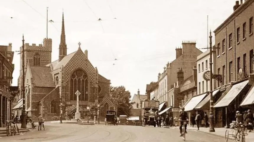
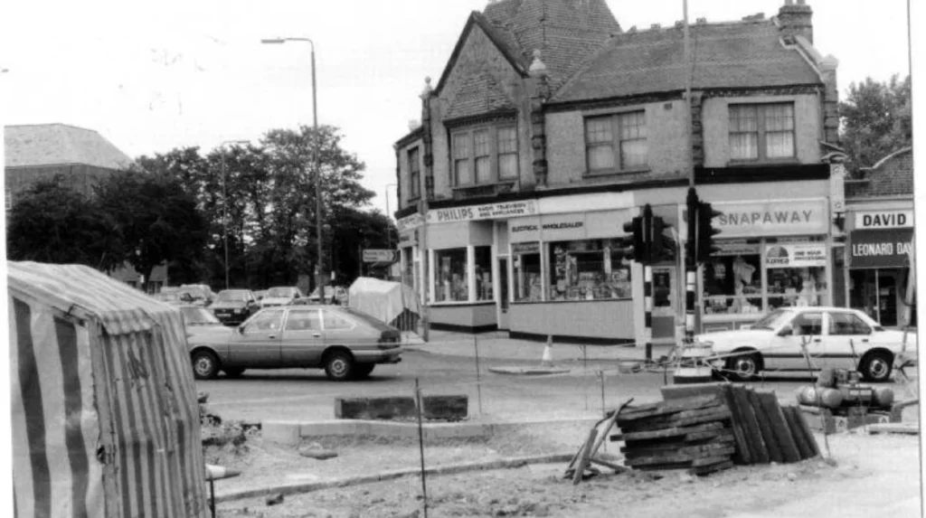
Barnet developed from medieval settlements and rural parishes into a network of market towns and expanding suburbs. Roads, railways, tramways and housing development accelerated population growth, particularly in Finchley, Hendon, Friern Barnet, East Barnet and Barnet during the nineteenth and twentieth centuries.
The earliest development followed geography and transport.
Barnet’s position on an important route north helped establish High Barnet as a market settlement. The market is documented from at least the twelfth century, making it one of the area’s longstanding commercial institutions.
The road network later became even more important. The Great North Road, historically associated with the modern A1 corridor, passed through areas including Finchley, Whetstone, Chipping Barnet and Hadley.
A second major historic route followed the western side of the modern borough. Barnet Council records the Edgware Road, Watling Street and A5 as part of an important Roman route.
These routes connected northern communities with London and other parts of southern England.
Transport then accelerated suburbanisation.
Railways reached northern Middlesex and Hertfordshire communities during the nineteenth century. Stations provided faster connections with central London and encouraged residential development. Friern Barnet, for example, experienced substantial growth as transport links improved.
Electric trams further strengthened suburban connections during the early twentieth century.
The result was a gradual transition from rural settlements to dense residential districts. Fields, farms and open spaces were increasingly surrounded by streets, terraces, villas and later larger suburban housing developments.
The transformation was not uniform. Some communities urbanised earlier than others, which explains the mixture of town centres, historic villages, interwar housing and surviving open land found across modern Barnet.
Why was Barnet divided between Hertfordshire and Middlesex?
Barnet was divided because historic county boundaries and local government districts developed separately over centuries. The modern borough did not replace one existing Barnet authority; it combined five former authorities from Hertfordshire and Middlesex into a single London borough in 1965.
County boundaries in England were historically connected with administration, taxation, courts and other government functions. Local communities also developed their own parish and municipal institutions.
By the nineteenth century, industrialisation and urban growth created pressure for more organised local government.
The Local Government Act 1894 established the framework for urban and rural districts across England and Wales. This helped formalise several of the authorities that later disappeared in 1965.
Barnet Urban District and East Barnet Urban District became part of the Hertfordshire administrative system. Finchley, Friern Barnet and Hendon were incorporated into Middlesex’s administrative structure.
The situation became increasingly difficult as the metropolitan area expanded northwards.
By the twentieth century, the built-up area around London extended well beyond the boundaries of the old County of London. Communities in Hertfordshire, Middlesex, Essex, Kent and Surrey were increasingly integrated into the London urban area.
The administrative map no longer matched the physical growth of the metropolis.
This was one of the main reasons for the major reorganisation that produced Greater London.
What happened to Barnet during the 1965 London government reorganisation?
On 1 April 1965, the London Government Act 1963 created the London Borough of Barnet by combining Barnet, East Barnet, Finchley, Friern Barnet and Hendon. The same reorganisation created Greater London and the Greater London Council.
The 1965 change was a major administrative transformation.
The new London Borough of Barnet was formed from five former authorities:
Barnet Urban District and East Barnet Urban District came from Hertfordshire.
Finchley Municipal Borough, Friern Barnet Urban District and Hendon Municipal Borough came from Middlesex.
Historical GIS records confirm that all five authorities were abolished on 1 April 1965 as the new London borough was created. The recorded areas transferred included 1,736 acres from Barnet Urban District, 1,070 acres from East Barnet, 1,408 acres from Finchley, 543 acres from Friern Barnet and 4,196 acres from Hendon.
The combined area created a large northern London authority.
The reform also created the Greater London Council, commonly abbreviated to GLC. Greater London incorporated the former County of London and large sections of surrounding counties. The new system contained 32 London boroughs, alongside the separate City of London.
The new councils took full responsibility from 1 April 1965. Elections for London borough councillors had already taken place in May 1964, allowing the new authorities to prepare for the transition.
Barnet Council’s historical records describe the new authority as the combination of the boroughs of Finchley and Hendon with the urban districts of Barnet, East Barnet and Friern Barnet.
The change therefore did not simply give Barnet a new name. It created a completely new administrative structure.
What was life and settlement like in Barnet before 1965?
Before 1965, Barnet combined market-town traditions, villages, farmland, open spaces and increasingly dense suburbs. High Barnet retained historic commercial character, while Finchley, Hendon, Friern Barnet and East Barnet experienced substantial residential growth as London expanded northwards.
The physical appearance of the area changed significantly during the nineteenth and twentieth centuries.
High Barnet retained a strong market-town identity. Its position on the historic northern route supported shops, markets, inns and other services.
East Barnet developed around its own town centre and surrounding residential areas. New Barnet also expanded as railway connections encouraged housing growth.
Finchley experienced one of the most dramatic transformations. Barnet Council’s historical population series records a population of 1,503 in 1801, rising to 69,370 by 1961. The increase illustrates the scale of suburbanisation over 160 years.
The character of Finchley changed as houses, roads and transport infrastructure replaced large areas of earlier open land.
Friern Barnet also became increasingly suburban. Its population rose from 974 in 1851 to 28,813 in 1961, demonstrating the long-term shift from a small rural community to an established suburban district.
Hendon developed rapidly as well. Its proximity to London and strong transport connections supported housing, commerce and employment.
The area was therefore not uniformly rural immediately before Greater London was created. By 1965, substantial parts were fully integrated into London’s built-up environment.
However, the modern borough still contained significant open land. Barnet Council records that around one third of the borough’s area is protected by Green Belt designation, reflecting the long-term importance of open land in the northern part of the area.
This mixture of urban and open landscapes remains a defining feature of Barnet.
Why does Barnet’s pre-1965 history still matter today?
Barnet’s pre-1965 history explains the borough’s distinctive neighbourhood identities, historic buildings, transport corridors and county associations. Understanding the former Hertfordshire and Middlesex boundaries also helps visitors interpret why modern Barnet contains several separate historic centres.
The 1965 boundary created administrative unity without erasing earlier identities.
High Barnet remains strongly associated with its historic market-town role. East Barnet retains a separate local character. Finchley contains layers of former municipal-borough development. Friern Barnet reflects its former Middlesex urban-district history. Hendon retains the heritage of a major former municipal borough.
The borough’s current geography is therefore easier to understand when viewed as a merger rather than a single historic settlement.
This distinction also matters to visitors interested in architecture, transport, local history and walking routes.
Historic town centres often follow older roads. Railway corridors explain later residential development. Former civic buildings reveal the locations of previous local authorities. Older churches and parish boundaries show the pre-modern structure of settlement.
Barnet’s archives provide extensive evidence of this evolution. The council’s Local Studies and Archives collection includes historical documents, maps, newspapers, photographs and publications dating from 1600 onwards. Many resources are now digitised.
Electoral registers also help establish the administrative geography of the area. Barnet Council holds historic registers for Barnet, East Barnet, Finchley, Friern Barnet and Hendon, with records showing that Barnet and East Barnet belonged to Hertfordshire while Finchley, Friern Barnet and Hendon belonged to Middlesex.
These records provide a direct way to research historic residents, streets and communities.
The history also explains why the term Greater London should not be applied retrospectively to earlier administrative periods without qualification. The physical London urban area existed before 1965, but the administrative county of Greater London began on 1 April 1965.
That distinction is essential when researching historical documents.
Explore More Area Guide
Historic Buildings That Still Survive in Barnet 2026
Black Bear Burger Named UK’s Happiest Workplace North London 2026
How can visitors explore Barnet’s pre-1965 history today?
Visitors can explore Barnet’s pre-1965 history through historic town centres, former civic areas, churches, transport corridors, market sites, archives and surviving open landscapes. High Barnet, East Barnet, Finchley, Friern Barnet and Hendon each reveal different parts of the former county landscape.
High Barnet is an effective starting point because its history reaches back to the medieval period. The market tradition and historic road network help explain why the settlement became important long before modern London expanded northwards.
East Barnet provides another perspective. Its former urban district developed independently and had its own civic administration before joining the London borough.
Finchley is particularly useful for understanding suburban growth. Its population increase from 1,503 in 1801 to 69,370 in 1961 provides a clear numerical measure of its transformation.
Friern Barnet demonstrates the same process on a smaller scale. Its population increased from fewer than 1,000 people in 1851 to more than 28,000 in 1961.
Hendon provides evidence of the development of large suburban communities within historic Middlesex.
Visitors interested in documentary research can also use Barnet’s Local Studies and Archives collections. The archive includes maps, photographs, newspapers, council records and other historical material covering the area’s different communities.
The Birth of a Borough exhibition created by Barnet Libraries also records the formation of the London Borough of Barnet in 1965 and explains how the new authority was created.
For today’s tourists, the most important point is that Barnet’s history is distributed across the borough. There is no single location that represents the entire pre-1965 story.
The historic landscape is best understood as a collection of former communities that developed separately and were brought together administratively in 1965.
What is the simplest way to understand Barnet before Greater London?
Barnet before Greater London was a collection of distinct Hertfordshire and Middlesex communities rather than one unified London borough. Barnet and East Barnet belonged to Hertfordshire; Finchley, Friern Barnet and Hendon belonged to Middlesex until their merger on 1 April 1965.
The key timeline is straightforward.
Barnet developed as a medieval market settlement on an important northern route. East Barnet developed as a separate community nearby. Finchley, Friern Barnet and Hendon developed within Middlesex.
During the nineteenth century, new forms of local government created urban districts and other municipal authorities. During the twentieth century, railways, trams, roads and housing accelerated suburban growth.
By the middle of the twentieth century, the physical settlement had expanded far beyond the historic boundaries of London.
The London Government Act 1963 responded to this metropolitan expansion. From 1 April 1965, the five former authorities were abolished and replaced by the London Borough of Barnet, while the wider Greater London administration was established.
This is why modern Barnet has such a layered identity.
It is simultaneously a London borough, a collection of former Hertfordshire and Middlesex communities, a historic market-town landscape and a large suburban area shaped by centuries of transport and population change.
For anyone exploring Barnet today, the pre-1965 period is not simply background history. It explains the borough’s boundaries, neighbourhood identities, historic buildings, transport routes and surviving landscape.
The modern borough began in 1965, but the communities within it have much older histories.
Was Barnet part of London before 1965?
No. The modern London Borough of Barnet was created on 1 April 1965. Before then, its constituent areas were divided between the historic counties of Hertfordshire and Middlesex.