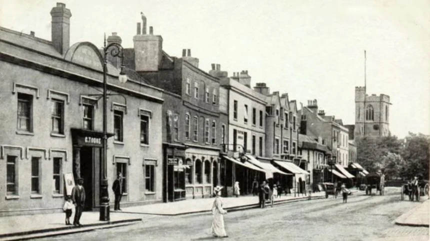
Barnet’s historic roads reveal how North London developed from rural settlements and market centres into a connected part of Greater London. Routes such as High Street, Barnet, the Great North Road, and roads around Chipping Barnet and East Barnet reflect centuries of travel, trade, settlement and urban expansion.
- Why Are Barnet’s Historic Roads Important?
- Which Road in Barnet Has the Strongest Claim to Being the Oldest?
- How Old Is Barnet High Street?
- Why Is the Great North Road Central to Barnet’s History?
- Why Does Wood Street Have Such a Long History?
- Is St Albans Road One of Barnet’s Historic Roads?
- What Is the Historical Importance of Hendon Lane?
- How Did Turnpikes and Stagecoaches Change Barnet’s Roads?
- How Can Visitors Explore Barnet’s Historic Roads Today?
- Why Do Barnet’s Historic Roads Still Matter?
The key to understanding Barnet’s oldest roads is distinguishing ancient routeways from roads documented in medieval records and turnpike roads developed during the eighteenth century. Some roads follow much older travel corridors, while others retain the layout of historic villages and market streets.
Why Are Barnet’s Historic Roads Important?
Barnet’s oldest roads developed around northbound travel, medieval markets and links between neighbouring settlements. The Great North Road connected London with northern England, while Wood Street connected Barnet with routes towards Watford. These roads shaped local trade, settlement patterns and later suburban growth.
The London Borough of Barnet occupies a strategic position on the northern side of the capital. Before modern motorways and railway networks, travellers depended on established roads to reach market towns, religious centres and commercial destinations. Barnet’s elevated land and position along a north–south ridge helped establish it as an important stopping point.
Barnet Council’s historical account identifies a significant route towards St Albans passing through Barnet by the eleventh century. The settlement existed before the Norman Conquest, although it does not appear in the Domesday Survey of 1086. These details establish the antiquity of the settlement without proving the precise construction date of any surviving road.
Road history also requires a distinction between a route and its present street name. An ancient route can survive through successive changes in its surface, alignment, width and name. A modern road name, by contrast, does not automatically demonstrate that the road itself existed in antiquity.
For visitors, the historic street pattern is especially visible around Chipping Barnet, Wood Street and Monken Hadley. These places retain buildings, junctions and conservation areas that help explain how travel shaped the local landscape.
Which Road in Barnet Has the Strongest Claim to Being the Oldest?
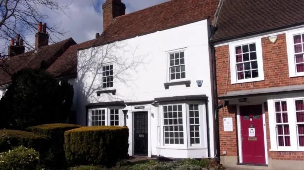
The historic route through Barnet towards St Albans has a documented history reaching back to at least the eleventh century. Today’s High Street preserves part of this important corridor, although the exact age of individual road sections and their original alignments varies.
The northbound route is the strongest starting point for understanding Barnet’s oldest road history. It connected London with St Albans, a settlement with important religious and commercial connections. Over time, the route became associated with the Great North Road, one of the principal historic highways leading out of London.
The road passed through the elevated settlement now known as Chipping Barnet. Its location made it a practical stopping point for people travelling between London and destinations farther north. The route also supported the movement of livestock, agricultural produce, goods and passengers.
Barnet Council’s conservation documentation describes the High Street as part of an important route towards St Albans and Holyhead. Holyhead, on the north-west coast of Wales, served as a departure point for travel to Ireland. The connection demonstrates how a local street formed part of a much larger transport network.
The present High Street has undergone significant changes. Road improvements altered the incline of Barnet Hill during the early nineteenth century, and later developments changed the street frontage and surrounding buildings. The modern carriageway therefore represents an evolved route rather than an untouched medieval road.
There is no reliable basis for assigning one exact construction year to the entire street. Historical evidence supports the age of the corridor, while individual buildings, surviving road surfaces and documented alignments require separate dating.
How Old Is Barnet High Street?
Barnet High Street follows a historic route associated with travel between London and St Albans from the late eleventh or early twelfth century. Its medieval market developed around the church and road junction, while surviving buildings document later Georgian and Victorian changes.
Barnet High Street is the most recognisable historic road in Chipping Barnet. It developed around a market settlement on the northern approach to London. Its history combines long-distance travel with local commerce, religious activity and public life.
The medieval market and the High Street
High Barnet’s market existed in various forms and locations from at least the twelfth century. King John granted a market charter in August 1199. The market originally occupied the area around the junction where Wood Street meets the High Street.
The market made the road an important destination for traders and livestock dealers. During the late Tudor period, Barnet’s market played a major role in supplying London with meat. Buyers travelled from the capital to purchase cattle, which were often kept on nearby farms before being taken into London for sale.
This activity generated demand for places to accommodate merchants, drovers and other visitors. Inns, shops and supporting trades gradually formed an important part of the street’s economy.
The road through the coaching era
By the seventeenth and eighteenth centuries, Barnet High Street had become a significant coaching route. Stagecoaches carried passengers between London and destinations farther north. The earliest time-tabled stagecoach service between London and St Albans travelled through Barnet in 1637, according to research published by Barnet Museum.
The road was not always easy to use. Poor surfaces and steep gradients made wheeled travel difficult. Turnpike trusts introduced toll-funded maintenance, helping improve conditions for stagecoaches and commercial vehicles.
Barnet’s position on the route encouraged the growth of inns and businesses serving travellers. The High Street became both a local shopping centre and a stopping point on longer journeys.
What visitors can see today
Visitors can examine the street alignment, historic shopfronts and older buildings around St John the Baptist Church. The church occupies a prominent position near the historic market area. Some surviving buildings belong to later periods, so the age of the street should not be confused with the age of every property along it.
The Wood Street Conservation Area includes part of the historic town centre and preserves evidence of Barnet’s commercial development. Barnet Council designated the conservation area in 1969 and extended it in 1979.
Why Is the Great North Road Central to Barnet’s History?
The Great North Road was a major historic highway linking London with destinations across northern England. Its route passed through Chipping Barnet, Hadley Green and Hadley Highstone before continuing towards Potters Bar. It supported coaching, trade and the growth of Barnet’s roadside businesses.
The Great North Road is one of the most important historical routes associated with Barnet. It formed part of the transport corridor used by travellers leaving London for towns and cities farther north.
The road’s importance grew during the seventeenth and eighteenth centuries, when stagecoach travel expanded. Its route passed through Barnet’s market centre, where travellers could obtain food, accommodation, fresh horses and other services.
The name Great North Road describes a historic highway rather than one unchanged modern road running continuously from London to Scotland. Successive road improvements, diversions and changes in transport infrastructure altered its course and function.
The Great North Road through Chipping Barnet
The road ran through the High Street and continued north towards Hadley Green. Barnet’s position made it a convenient stopping point for travellers completing a day’s journey from London.
The local market and the road reinforced one another. Traders used the highway to reach Barnet, while the market generated additional traffic. The combination helped sustain the settlement and its commercial buildings.
Hadley Green and Hadley Highstone
North of Chipping Barnet, the historic route passed through Hadley Green and Hadley Highstone in the Monken Hadley area. Barnet Council identifies this corridor in its description of the Monken Hadley Conservation Area.
Hadley Highstone is particularly relevant to the history of the highway. Historic England records listed eighteenth-century buildings on Great North Road near Hadley Green, providing physical evidence of the roadside settlement that developed along the route.
The surrounding landscape retains a more rural character than many built-up parts of North London. This contrast helps visitors understand how the road once connected a market town with open land and smaller settlements.
How the route changed
The Great North Road evolved as traffic increased and road engineering improved. Alterations to the alignment and gradients helped accommodate wheeled vehicles. Later, railways and modern roads reduced the importance of coaching services.
The road’s historic identity nevertheless remains visible in street names, conservation areas and surviving buildings. These features help connect Barnet’s present transport network with its earlier role in national travel.
Why Does Wood Street Have Such a Long History?
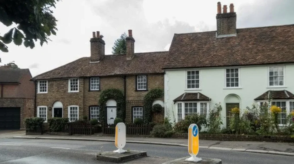
Wood Street is a historic east–west route through Chipping Barnet. It connected the medieval market area with roads towards Watford and Watling Street, while its surviving buildings record later residential and commercial development. Its junction with the High Street remains important to Barnet’s historic layout.
Wood Street provides a different perspective on Barnet’s road history. The Great North Road carried traffic between London and northern destinations, while Wood Street connected the town with routes running westwards.
Barnet Council’s conservation documentation describes Wood Street as extending from the junction with the Great North Road at the top of Barnet Hill towards Arkley. The route follows elevated ground across the surrounding landscape. Its historic connection towards Watford and Watling Street made it part of a wider network of regional roads.
The medieval junction
The junction between Wood Street and Barnet High Street formed the centre of the historic market area. The location brought together local trading activity and through-traffic.
The market’s position influenced the surrounding street pattern. Shops, houses and other buildings developed around the junction, while traffic through the town created demand for services.
The market later became less practical as coaching traffic increased. The narrow road space around the church became a bottleneck for coaches, illustrating how a medieval town layout struggled to accommodate newer transport demands.
Historic buildings along Wood Street
Wood Street contains buildings from different periods. Historic England records No. 74 Wood Street as probably dating from the early nineteenth century. The building appears on an 1818 enclosure award map, while the 1840 tithe map records its later development.
These records demonstrate how maps and building surveys help establish the history of individual properties. They also show why road history involves more than identifying the oldest street name: buildings and land records reveal how a route developed over time.
Why the conservation area matters
The Wood Street Conservation Area protects a distinctive section of Barnet’s historic townscape. It includes historic shops, St John the Baptist Church, Union Street, villas facing Ravenscroft Park and Wood Street itself towards The Whalebones.
The designation helps preserve the character of the area. It also provides visitors with a practical route for exploring historic architecture, market-town development and the relationship between old roads and modern urban life.
Is St Albans Road One of Barnet’s Historic Roads?
St Albans Road is associated with an important nineteenth-century change to Barnet’s road network. A new road created a shortcut towards St Albans in 1828, helping distinguish later road development from the older route through the historic market centre.
St Albans Road illustrates how an old transport corridor can generate newer routes. Its development responded to the practical demands of travel between Barnet and St Albans, while the historic High Street continued to serve the town centre.
The new road was created in 1828, according to Barnet Council’s local history account. Its development followed earlier road improvements and occurred during the period when coaching traffic remained important to Barnet.
The change also affected the relationship between the market and passing traffic. The old market space around the church had become increasingly difficult for coaches to negotiate. A more efficient road network helped travellers move through the district without relying entirely on the older street layout.
For visitors, St Albans Road offers a useful comparison with Barnet High Street. The High Street reflects the older market settlement, whereas St Albans Road demonstrates how nineteenth-century transport improvements altered connections between neighbouring towns.
The distinction is important when assessing which roads have the longest history. A road associated with an ancient destination does not necessarily have an equally ancient alignment. Historical maps and local records provide the evidence needed to distinguish an older route from a later shortcut.
What Is the Historical Importance of Hendon Lane?
Hendon Lane is among the older roads in the Finchley area of the London Borough of Barnet. Historical records identify it as Finchley Hill in 1659, when it connected Hendon with Church End, Finchley, and served communities near the former Finchley Common.
Hendon Lane demonstrates that Barnet’s road history extends beyond Chipping Barnet and the Great North Road. Older local roads linked villages, agricultural land, churches and common land across the wider borough.
Barnet Council identifies Hendon Lane as an old route between Hendon and Church End, Finchley. Its recorded name in 1659 provides a documentary reference point, although the route itself could have existed before that date.
Finchley Common and local travel
Finchley Common was historically an extensive area of open land. Its terrain and vegetation influenced movement across the district. Settlements developed around the common, and local roads connected agricultural communities with nearby centres.
The surrounding economy included livestock and dairy farming. Hay production was particularly important because London’s transport system depended heavily on horses. The relationship between agriculture and roads therefore extended beyond passenger travel: roads also supported the movement of food, fodder and other essential supplies.
From rural road to suburban street
The arrival of railways helped transform Finchley and neighbouring settlements. As transport connections improved, housing expanded into previously rural areas. Roads that once linked villages and farmland became part of an increasingly urban street network.
Hendon Lane remains relevant to local heritage because its history illustrates this transition. It connects the modern suburban landscape with an earlier pattern of village roads, agricultural activity and common land.
How Did Turnpikes and Stagecoaches Change Barnet’s Roads?
Turnpike trusts improved road maintenance by collecting tolls from road users. Barnet’s principal highway became a turnpike in 1712, and improvements during the eighteenth and early nineteenth centuries supported coaching travel, commercial traffic and the expansion of roadside businesses.
A turnpike was a road managed under powers that allowed tolls to fund maintenance and improvements. Before these systems became established, poorly maintained surfaces made long-distance travel slow and uncomfortable.
Barnet benefited from its location on a major northbound route. Once road conditions improved, stagecoaches could carry passengers more reliably, and commercial travellers had greater reason to stop in the town.
Barnet Museum’s historical research records approximately 30 inns on the High Street by the eighteenth century, excluding taverns and alehouses. Barnet Council separately records 25 inns by 1756. These figures refer to different historical accounts and counting descriptions, rather than a single definitive total.
Road improvements also changed the physical landscape. Between 1818 and 1823, the incline of Barnet Hill was reduced through engineering work that included a raised causeway from Underhill. These alterations show how historic roads were repeatedly adapted to meet changing transport requirements.
The toll system eventually lost its importance as transport changed. Barnet Council records that the toll was lifted in 1862. Railways had already begun changing travel patterns, and later suburban development created new demands for roads serving residents rather than long-distance coaches.
Explore More Area Guide
How the 20th Century Transformed Barnet’s Suburbs
Victorian Barnet: History, Architecture and Railway Growth
How Can Visitors Explore Barnet’s Historic Roads Today?
Visitors can explore Barnet’s road history on foot by following the historic High Street, examining Wood Street and continuing towards the conservation areas around Monken Hadley. These locations reveal market-town architecture, historic road junctions and the landscape of the former coaching route.
A walking visit offers a practical way to understand the relationship between Barnet’s streets and its historic settlement pattern. The following locations provide a connected introduction to the area.
Start at Barnet High Street
Begin around the historic market area and St John the Baptist Church. Observe the street alignment, older commercial buildings and the junction with Wood Street. This area explains how the medieval market and northbound highway helped establish Barnet as a trading centre.
Continue along Wood Street
Walk westwards along Wood Street to explore its historic buildings and the wider conservation area. Look for differences in architectural style and building layout. These details reflect successive periods of residential and commercial development.
Explore Monken Hadley
Continue towards Hadley Green and Hadley Highstone to understand the route beyond the market town. The area preserves a more open setting, with historic buildings associated with the old highway. Check current pedestrian access and road conditions before setting out.
Visit Barnet Museum
Barnet Museum, at 31 Wood Street, EN5 4BE, holds collections relating to Chipping Barnet, East Barnet, New Barnet and Hadley. Its archives and local-history resources offer additional context for visitors researching streets, buildings and the development of the town.
Check the museum’s published opening hours before travelling, as visiting times can change.
As you explore the modern streets, you are crossing land shaped by centuries of travel and settlement. Discover the full [Insert Anchor Text for Barnet History Article Here] to understand the wider historical development of the town and its surrounding communities.
Why Do Barnet’s Historic Roads Still Matter?
Barnet’s historic roads preserve evidence of the borough’s development from medieval market settlements to modern London suburbs. Their alignments, buildings and conservation areas explain how trade, coaching, agriculture and railway expansion shaped the district and continue to influence its identity.
Historic roads are valuable because they connect different periods of local history in a visible landscape. Barnet High Street records the relationship between markets and long-distance travel. Wood Street reveals how regional routes met at the market centre. Hendon Lane illustrates the older network linking villages and agricultural land.
These roads also provide a framework for interpreting surviving buildings. A historic inn, church or roadside house gains context when considered alongside the route that brought people and trade to its location.
Conservation areas help protect this relationship between buildings and streets. Their purpose extends beyond preserving individual structures: they also maintain the character of historic places and the legibility of their development.
Barnet’s roads remain useful to residents, commuters and visitors. Their modern functions differ from those of medieval traders and eighteenth-century coach passengers, but the underlying connections between settlements remain significant.
The best-supported conclusion is that the historic northbound route through Barnet has the strongest documented claim to great antiquity, with High Street preserving an important part of that corridor. Wood Street and Hendon Lane provide further evidence of the older network that connected Barnet’s settlements with the wider region.
Which road in Barnet has the longest history?
The historic route through Barnet towards St Albans has a documented history dating back to at least the eleventh century. Barnet High Street preserves part of this important route, although its exact original alignment is uncertain.