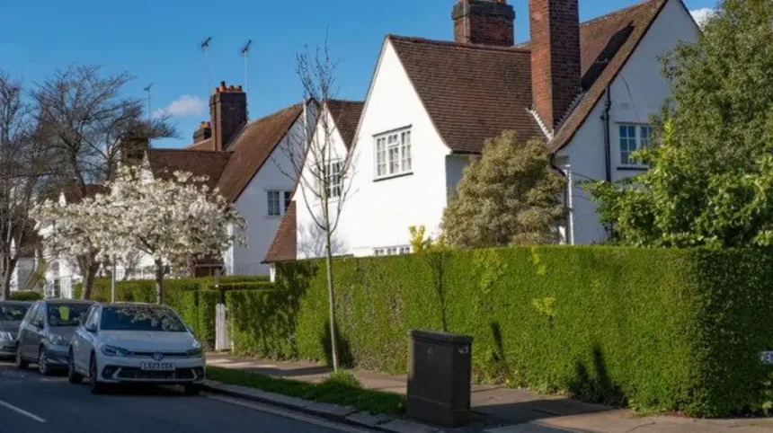
Barnet’s transformation during the 20th century reshaped its landscape, population, housing, transport and local economy. The historic market town and surrounding rural settlements became part of a larger suburban area connected to central London by railways, Underground services and major roads. New housing estates, schools, shopping centres and public services supported this expansion, while historic buildings, green spaces and established town centres retained links to Barnet’s past.
- What Was Barnet Like Before the 20th-Century Transformation?
- How Did Population Growth Transform Barnet During the 20th Century?
- How Did Railways and the London Underground Encourage Barnet’s Suburban Expansion?
- Why Did Interwar Housing Change Barnet’s Landscape So Dramatically?
- How Did the Second World War and Post-War Reconstruction Affect Barnet?
- How Did Hampstead Garden Suburb Influence Modern Barnet?
- How Did Shopping Centres and High Streets Change During the 20th Century?
- How Did Schools, Hospitals and Public Services Modernise Barnet?
- How Did Migration and Cultural Diversity Shape Modern Barnet?
- How Did Green Spaces and Planning Policies Shape Barnet’s Growth?
- Which Buildings and Neighbourhoods Best Reveal Barnet’s 20th-Century Transformation?
- How Did Barnet’s Economy and Working Life Change During the 20th Century?
- How Did Modernisation Affect Barnet’s Historic Identity?
- How Can Visitors Explore the Evidence of Barnet’s 20th-Century Transformation Today?
- What Does Barnet’s 20th-Century Transformation Mean for Its Future?
The story of modern Barnet is not limited to one town. It includes Chipping Barnet, East Barnet, Finchley, Hendon, Edgware and other settlements that developed at different rates. Their growth reflected changes in transport technology, housing demand, local government and London’s expanding urban footprint.
Understanding this transformation helps visitors interpret Barnet’s architecture, neighbourhoods and green spaces today. It also explains why the borough combines historic high streets with interwar houses, post-war estates, busy transport corridors and protected countryside.
What Was Barnet Like Before the 20th-Century Transformation?
Before the 20th century, Barnet consisted of historic market towns, villages, agricultural land and developing residential settlements. Its location north of central London supported trade and travel, while roads, churches, estates and open fields shaped settlement patterns before large-scale suburban growth.
Barnet’s development began long before modern London expanded towards its northern boundaries. Chipping Barnet, also called High Barnet, developed as a market town on an important route between London and northern England. Its historic high street served traders, travellers and local residents.
Other settlements had distinct identities. Finchley developed around established villages and roads, while Hendon retained agricultural and rural characteristics alongside growing residential development. East Barnet also had village origins, with farmland and country estates influencing its early landscape.
The wider area was administratively fragmented. Local parishes and districts managed community affairs before successive local government changes brought neighbouring settlements into larger administrative structures.
The arrival of railways during the 19th century began to change this pattern. Railway stations improved access to London and encouraged residential development around transport routes. However, much of the surrounding land remained undeveloped at the beginning of the 20th century.
This combination of established towns, early railway development and accessible land created the conditions for rapid suburban expansion after 1900.
How Did Population Growth Transform Barnet During the 20th Century?
Population growth transformed Barnet from a collection of relatively separate settlements into a densely connected suburban area. London’s outward expansion, improved transport, new housing and changing household needs attracted residents, while local authorities expanded schools, healthcare, roads and other essential services.
Barnet’s population increased as London grew beyond its traditional central districts. Families seeking more space, commuters travelling to city-centre employment and households moving from older inner-London neighbourhoods contributed to suburban demand.
The scale of change varied between localities. Finchley and Hendon experienced substantial residential growth, while Edgware and areas around Underground stations attracted new housing and commercial activity. Chipping Barnet expanded while retaining the historic market-town centre that distinguished it from newer suburban districts.
Population change also altered daily life. More residents required primary and secondary schools, shops, places of worship, recreation grounds and medical facilities. Residential streets became the foundations of neighbourhood communities, with local parades providing everyday services close to home.
The expansion of private home ownership during parts of the century also influenced the built environment. Semi-detached houses, gardens and family-sized homes became familiar features of many northern London suburbs.
The modern London Borough of Barnet was established in 1965 through local government reorganisation. It brought together areas formerly administered by separate municipal boroughs and urban districts, creating a larger administrative unit for local services and planning.
How Did Railways and the London Underground Encourage Barnet’s Suburban Expansion?
Railways and Underground services made Barnet more accessible to London’s employment centres. Stations connected residential districts with central London, reduced dependence on local employment and encouraged developers to build homes near reliable transport, particularly during the interwar decades.
Transport infrastructure was one of the strongest forces behind Barnet’s 20th-century transformation. Railways had already reached parts of the area in the 19th century, but further Underground expansion and improved suburban services widened access to London.
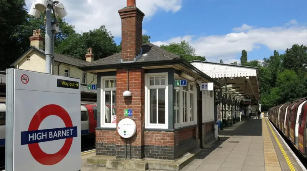
The Northern line became particularly important to districts including Finchley, Hendon and High Barnet. Its extension to High Barnet opened in 1940, following the earlier expansion of Underground services into northern London. The line strengthened connections between residential neighbourhoods and employment centres in the capital.
Edgware also benefited from Underground access. Improved connections made it more attractive to residents who wanted suburban housing while retaining access to central London jobs, shops and cultural institutions.
Transport-led development followed a recognisable pattern. Developers acquired accessible land, constructed housing and marketed properties to commuters. Shops and services then emerged around stations and along established roads, creating neighbourhood centres.
Road transport became increasingly important as car ownership rose. Routes such as the A1 and A41 connected Barnet with London and destinations beyond the capital. These corridors improved regional access but also created traffic, noise and pressure on junctions.
For visitors, stations provide useful starting points for understanding Barnet’s development. The contrast between older town centres and residential streets near railway routes reveals how transport shaped the area’s growth.
Why Did Interwar Housing Change Barnet’s Landscape So Dramatically?
Interwar housing changed Barnet through extensive development of semi-detached houses, terraced properties and planned residential streets. Rising demand for private homes, expanding transport connections and the availability of land helped create suburban neighbourhoods that remain central to Barnet’s architectural identity.
The period between the First and Second World Wars, from 1918 to 1939, was decisive for suburban growth across northern London. Housing construction responded to a growing population, changing household expectations and demand for better living conditions.
Many new homes featured separate living spaces, gardens and access to local schools and shops. Semi-detached houses became particularly prominent because they provided more space than many older urban properties while allowing developers to build at suburban densities.
Architectural styles varied. Some streets featured traditional brick houses with pitched roofs, bay windows and decorative entrances. Others incorporated mock-Tudor details, rendered façades or simplified period designs. These styles reflected contemporary tastes rather than one unified architectural plan.
Finchley, Hendon, Edgware and surrounding districts contain extensive examples of this suburban housing pattern. Their street layouts show how open land was converted into residential neighbourhoods, often through coordinated development rather than isolated building projects.
The consequences extended beyond architecture. Homeowners supported local shops, schools, transport services and recreational facilities. Residential expansion therefore created new local economies as well as new housing.
Interwar development also established a pattern of relatively low-rise suburban living. Gardens, front setbacks and tree-lined streets remain important features of many Barnet neighbourhoods, distinguishing them from denser parts of inner London.
How Did the Second World War and Post-War Reconstruction Affect Barnet?
The Second World War disrupted everyday life in Barnet through air raids, military activity, evacuation and wartime restrictions. After 1945, reconstruction and national housing policies encouraged new homes, improved public services and changes to transport, planning and community infrastructure.
The Second World War affected communities across northern London. Civilian life involved air-raid precautions, rationing, emergency services and the wider pressures of wartime mobilisation. Barnet’s proximity to London meant its communities experienced the consequences of attacks on the capital and surrounding districts.
Wartime damage and housing shortages intensified the need for reconstruction. Returning service personnel, displaced households and families seeking independent homes increased demand for accommodation. Local and national authorities faced pressure to improve housing provision and replace inadequate properties.
Post-war construction included council housing, redevelopment schemes and private residential building. Council housing refers to homes owned or managed by local authorities for eligible residents. These developments formed part of a broader national response to shortages and overcrowding.
Planning policies also sought to manage London’s continued outward expansion. The Metropolitan Green Belt, established through post-war planning policy and reinforced by the 1947 Town and Country Planning Act, helped restrict uncontrolled urban sprawl. It encouraged the protection of open land around London while directing development towards designated urban areas.
The effects were visible in Barnet’s built environment. Established suburbs gained new public facilities, some older areas underwent redevelopment, and open countryside became increasingly significant in debates about housing and conservation.
Post-war change therefore involved two parallel priorities: providing homes for a growing population and controlling development to protect the wider landscape.
How Did Hampstead Garden Suburb Influence Modern Barnet?
Hampstead Garden Suburb demonstrated how planned residential development combined housing, landscaping, community facilities and architectural design. Established in 1907, it became an important example of early 20th-century town planning and helped define the relationship between suburban growth and the preservation of local character.
Hampstead Garden Suburb is one of Barnet’s most significant examples of planned development. The project began in 1907 on land that previously included woodland and agricultural areas. Its development continued through 1938, spanning much of the period when suburban living became increasingly established in northern London.
Social reformer Henrietta Barnett helped establish the project. The development aimed to create a residential environment with attractive homes, green surroundings and shared community facilities. Architects Raymond Unwin and Barry Parker contributed to the wider garden suburb movement, which promoted coordinated planning and a close relationship between buildings and landscape.
The suburb’s design incorporated residential streets, gardens, communal spaces and public buildings. Its architectural character includes Arts and Crafts influences, traditional materials and carefully arranged houses. The result differs from developments built primarily to maximise the number of homes on each plot.
Hampstead Garden Suburb also demonstrates that suburban modernisation was not simply a process of building more houses. Planning decisions shaped street layouts, public spaces and the experience of everyday life.
Today, the area provides a useful case study for visitors interested in architecture, urban planning and local heritage. Its conservation status helps protect the character of a neighbourhood created during Barnet’s period of rapid expansion.
How Did Shopping Centres and High Streets Change During the 20th Century?
Barnet’s commercial landscape evolved from traditional market towns and village high streets into a network of local shopping centres, supermarkets and larger retail developments. Population growth, private car ownership and changing consumer habits altered where residents bought goods and accessed everyday services.
Before mass suburban expansion, commercial activity concentrated around established high streets, markets, railway stations and village centres. Chipping Barnet retained its historic market-town identity, while Finchley, Hendon, Golders Green and Edgware developed their own commercial areas.
As residential neighbourhoods expanded, shops followed new customers. Local parades provided groceries, bakeries, pharmacies, newsagents and other services within walking distance of homes. These businesses supported daily life and helped give individual neighbourhoods a recognisable identity.
The second half of the century brought changes in retail formats. Supermarkets offered wider product ranges and larger shopping trips. Increased car ownership encouraged retailers to provide parking and operate from sites with convenient road access.
Shopping habits also changed as households gained greater access to consumer goods and domestic appliances. Retail centres became more varied, serving commuters, families, office workers and visitors.
These developments did not eliminate traditional high streets. Older commercial centres continued to accommodate independent businesses, restaurants, professional services and community facilities. Their survival depended on local demand, accessibility and their ability to respond to changing shopping patterns.
The result is a mixed retail landscape. Historic high streets sit alongside post-war commercial buildings, modern shops and larger retail destinations, reflecting the successive phases of Barnet’s suburban development.
How Did Schools, Hospitals and Public Services Modernise Barnet?
Barnet’s expanding population increased demand for schools, healthcare, libraries, roads and recreational facilities. Public authorities and institutions developed services to support growing communities, while education and healthcare became increasingly important parts of everyday suburban life during the 20th century.
The expansion of residential areas required more than houses and transport connections. Families needed schools, healthcare, safe streets, public spaces and services that supported different stages of life.
Education changed significantly during the century. New residential developments increased demand for primary and secondary schools, while further education institutions provided technical and vocational opportunities. Hendon’s educational institutions became part of the area’s wider civic and employment landscape.
Healthcare provision also evolved as public health systems developed. The establishment of the National Health Service in 1948 transformed access to healthcare across Britain. Local residents increasingly relied on a national system supported by hospitals, general practices and community services.
Libraries and public buildings contributed to neighbourhood life. They provided access to information, educational resources and organised activities. Parks and recreation grounds offered space for exercise, children’s play and informal social contact.
Local government reorganisation in 1965 created the London Borough of Barnet, consolidating administration across several former districts. This change provided a borough-wide framework for planning, housing, education and local services.
The development of public infrastructure illustrates the relationship between population growth and government responsibility. As Barnet became more urbanised, public services adapted to support a larger and more diverse population.
How Did Migration and Cultural Diversity Shape Modern Barnet?
Migration reshaped Barnet’s communities by bringing residents with different national, linguistic and cultural backgrounds. Housing availability, employment, transport and family connections influenced settlement patterns, while businesses, places of worship, restaurants and community organisations contributed to the borough’s changing identity.
Barnet’s transformation was also social and cultural. During the 20th century, population movement within Britain and migration from overseas contributed to changing neighbourhoods and local institutions.
Golders Green became particularly associated with Jewish community life. Its religious institutions, specialist shops, restaurants and community organisations reflect a history of settlement and cultural continuity. Hampstead Garden Suburb and neighbouring districts also developed distinct social identities.
Other neighbourhoods experienced changing patterns of migration and settlement as London became more internationally connected. Residents established businesses, opened places of worship and formed organisations that supported community activities.
These changes influenced local commerce. Food shops, cafés and restaurants increasingly reflected different culinary traditions. Cultural institutions and religious buildings also became part of the built environment.
Cultural diversity should not be understood as a single borough-wide experience. Each neighbourhood developed through its own combination of migration, housing, employment and social networks.
For visitors, the area’s cultural character is visible through local businesses, community facilities, religious architecture and public events. These features show how Barnet’s modern identity developed through both physical expansion and changes in its population.
How Did Green Spaces and Planning Policies Shape Barnet’s Growth?
Green spaces and planning policies shaped Barnet by limiting development in selected areas and preserving landscapes within an increasingly urban borough. Parks, woodland, historic gardens and Green Belt land provided recreation and environmental value while influencing where new housing and infrastructure were built.
Suburban growth created pressure on open land. As housing expanded, planners and local communities increasingly recognised the need to preserve green spaces and distinguish built-up areas from the surrounding countryside.
The Metropolitan Green Belt became a key planning mechanism. National planning policy following the Second World War encouraged restrictions on urban sprawl around London. Green Belt designation seeks to prevent unrestricted outward expansion, maintain the separation of settlements and protect the character of the countryside.
Within Barnet, green spaces include public parks, playing fields, woodland, landscaped gardens and areas of countryside. Totteridge Valley illustrates the rural character that survives within the wider urban region. Hampstead Garden Suburb demonstrates how green spaces can form part of a planned residential layout rather than remain only at the edge of development.
The borough’s planning framework also protects areas of architectural and historic interest. Barnet Council identifies conservation areas including Finchley Garden Village, Golders Green, Hampstead Garden Suburb, Mill Hill, Monken Hadley, Totteridge and Watling Estate. These designations recognise the collective character of buildings, streets and landscapes.
Protection does not mean that development stops entirely. Planning policies guide changes to buildings, extensions, new housing and public spaces. They seek to balance additional homes and modern facilities with the preservation of significant local features.
For visitors, this balance explains why Barnet contains both dense residential corridors and areas with a distinctly rural appearance. Its modern landscape reflects not only where development occurred but also where planning policies restricted it.
Which Buildings and Neighbourhoods Best Reveal Barnet’s 20th-Century Transformation?
Barnet’s 20th-century development is visible in planned garden suburbs, interwar residential streets, railway-linked neighbourhoods, post-war housing and established commercial centres. Hampstead Garden Suburb, Golders Green, Finchley, Hendon and Edgware each reveal different aspects of this architectural and urban change.
A visitor exploring Barnet can identify several distinct stages of development by comparing neighbourhood layouts and building styles.
Hampstead Garden Suburb
Hampstead Garden Suburb provides one of the clearest examples of planned early 20th-century development. Its houses, landscaped streets and community buildings demonstrate the garden suburb approach. The conservation area appraisal provides information about its development and architectural character.
Golders Green
Golders Green illustrates the relationship between public transport, residential expansion and commercial growth. Its high road, station and surrounding streets reflect the development of a suburban centre serving residents and commuters. The area’s cultural institutions also reveal how population change influenced local identity.
Finchley
Finchley contains residential streets and established centres shaped by successive phases of development. Older buildings, interwar houses and later apartment blocks show how the area changed as London’s suburban footprint expanded.
Finchley Garden Village is particularly relevant to architectural history because its conservation status recognises the distinctive character of its planned residential environment.
Hendon
Hendon demonstrates how residential expansion interacted with education, employment and transport. Its town centre, institutional buildings and surrounding housing reflect changes across the century, while older structures preserve evidence of earlier settlement.
Edgware
Edgware illustrates the influence of transport connections and retail development on suburban growth. Residential areas expanded around established routes and stations, while its commercial centre evolved to serve a wider population.
Together, these places show why Barnet’s transformation cannot be understood through one building or one date. The modern borough developed through layers of residential construction, transport investment, commercial growth and planning decisions.
How Did Barnet’s Economy and Working Life Change During the 20th Century?
Barnet’s economy shifted from a mixture of local trade, agriculture and established industries towards a more service-based suburban economy. Improved transport enabled commuting, while retail, education, healthcare, professional services and local businesses supported expanding residential communities.
At the beginning of the 20th century, employment patterns varied between Barnet’s towns and villages. Traditional trades, shops, small businesses and agricultural activities remained part of the local economy. Hendon and other districts also had industrial and commercial activity linked to London’s wider economy.
As transport connections improved, residents gained access to a wider employment market. Commuting became a defining feature of suburban life. People increasingly travelled to central London and other commercial districts while living in Barnet’s residential neighbourhoods.
Local employment nevertheless remained important. Schools, healthcare facilities, shops, offices, restaurants and public services provided jobs close to home. Commercial centres developed around stations and major roads, supporting both residents and passing customers.
The growth of private housing also influenced the local economy. Construction created demand for builders, architects, tradespeople and suppliers. Established residential areas subsequently supported maintenance businesses, household services and professional firms.
By the end of the century, Barnet functioned as part of London’s interconnected metropolitan economy. Its residents combined local employment with commuting to destinations elsewhere in the capital. This pattern remains important for understanding the borough’s transport demand, town centres and residential character.
How Did Modernisation Affect Barnet’s Historic Identity?
Modernisation changed Barnet’s physical appearance and social structure, but it did not erase its historic identity. Market-town centres, village streets, historic churches, protected landscapes and conservation areas preserve evidence of earlier settlement alongside modern housing, transport infrastructure and commercial development.
Barnet’s development involved the coexistence of different historical periods. Historic high streets continued to operate as commercial centres while newer residential streets expanded around them. Older churches and civic buildings remained landmarks within neighbourhoods that had changed substantially.
Conservation policy became increasingly important as awareness of architectural heritage grew. The Civic Amenities Act 1967 introduced the statutory framework for conservation areas in England. The Planning (Listed Buildings and Conservation Areas) Act 1990 subsequently consolidated important legislation governing listed buildings and conservation areas.
These measures recognised that historic character often depends on groups of buildings and their surroundings, not only individual monuments. A street’s layout, building materials, gardens, trees and relationship with open spaces can all contribute to its significance.
Barnet Council’s conservation areas include both planned suburbs and older settlements. This reflects the range of historical environments found across the borough, from Hampstead Garden Suburb’s carefully designed residential landscape to the established village character of Monken Hadley.
For residents, heritage protection influences how buildings and streets change. For visitors, it provides a way to understand why modern Barnet does not have one uniform architectural style.
The borough’s identity is therefore layered. Its historic roots remain visible, while the transport networks, housing estates and public facilities created during the 20th century define much of its present-day form.
Explore More Area Guide
Victorian Barnet: History, Architecture and Railway Growth
How Barnet’s Population Grew Over Time: History and Census Data
How Can Visitors Explore the Evidence of Barnet’s 20th-Century Transformation Today?
Visitors can explore Barnet’s transformation by combining walks through historic centres, visits to planned residential neighbourhoods, journeys on the Northern line and time in local parks. Comparing architecture, transport access and street layouts reveals how suburban development changed the borough.
A practical visit begins with a historic centre such as Chipping Barnet. Walking along its high street reveals the continuing role of the traditional market town within the modern borough.
A visit to Hampstead Garden Suburb offers a contrasting perspective. Its planned streets, houses and landscaped spaces demonstrate early 20th-century approaches to suburban design. Visitors should respect residential privacy and follow any access restrictions around private buildings and gardens.
Golders Green provides another useful stop. Its station, shops and surrounding housing illustrate the connection between public transport, commercial activity and residential expansion.
Finchley and Hendon offer opportunities to observe the variety of housing and institutional buildings associated with suburban growth. A walk through public streets reveals differences between older settlement patterns, interwar residential development and later redevelopment.
Green spaces add another dimension to the visit. Parks and countryside around the borough demonstrate how open land continues to shape the relationship between residential neighbourhoods and the wider landscape.
Visitors interested in the area’s deeper origins can also explore the full [History of Barnet: From Medieval Market Town to Modern London Borough] to understand the foundations on which 20th-century change developed.
A self-guided itinerary works well when organised around nearby stations and public transport. Allow time to walk through each area rather than relying entirely on travel between landmarks. The contrasts between neighbourhoods provide the clearest evidence of how Barnet developed.
What Does Barnet’s 20th-Century Transformation Mean for Its Future?
Barnet’s 20th-century transformation continues to influence housing, transport, conservation and local services. Future development must respond to population needs while managing pressure on infrastructure, protecting significant historic environments and maintaining access to green spaces across the borough.
The built environment created during the last century remains central to contemporary planning decisions. Interwar houses, post-war estates, railway stations and established high streets continue to accommodate residents and businesses.
Housing demand creates pressure for additional homes and more efficient use of urban land. At the same time, older properties require maintenance, energy improvements and adaptations to changing household needs. These challenges make the quality of design and planning particularly important.
Transport remains another major consideration. Barnet’s connections to central London support employment and economic activity, but busy roads and commuter demand place pressure on infrastructure. Future improvements must consider accessibility, public transport capacity, walking and cycling.
Conservation also remains relevant. Historic England’s research into suburban heritage highlights the architectural and cultural significance of residential areas that are often overlooked in favour of famous monuments.
Green spaces will continue to influence the borough’s character. Parks, gardens and protected countryside provide recreational opportunities and contribute to the quality of the urban environment.
Barnet’s experience demonstrates that suburban development is an ongoing process rather than a completed historical event. The challenge is to accommodate changing needs without losing the features that make individual neighbourhoods distinctive.
The 20th century established the foundations of modern Barnet through transport expansion, mass housing, public services and planning controls. Its legacy remains visible in the borough’s streets, stations, commercial centres and landscapes.
How did the 20th century transform Barnet?
The 20th century transformed Barnet from a collection of market towns, villages and rural landscapes into a major suburban area of North London. Railway expansion, Underground connections, new housing, public services and population growth shaped its modern identity.