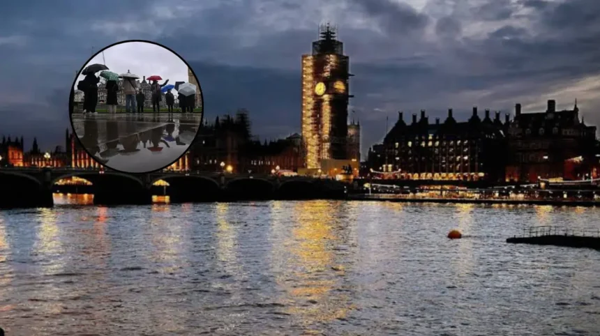
Key Points
- A yellow thunderstorm warning is in effect across Greater London and large parts of East England from 2am to 8am on Thursday.
- A second yellow warning runs from 5am to 10pm, covering north London, the West and East Midlands, north-west England and Wales.
- The Met Office warns of sudden heavy downpours, with 20mm to 30mm of rain possible in less than an hour, along with 1cm to 2cm hail and frequent lightning.
- The storms could disrupt public transport, cause flash flooding in homes and businesses, create difficult driving conditions from standing water and lead to short-term power cuts.
- BBC Weather forecasts thundery showers through Thursday morning, with possible lightning storms between 11am and 1pm and further activity from 3pm to 7pm, followed by wet drizzle overnight.
London, UK (North London News) August 27, 2026 – Fresh yellow thunderstorm warnings came into force across London on Thursday morning as heavy, persistent rain continues to hammer the capital and surrounding regions. The Met Office issued the initial severe weather alert covering all of Greater London and extensive portions of the East of England between 2am and 8am. A concurrent, broader weather warning came into effect at 5am and remains active until 10pm, encompassing parts of north London, the East and West Midlands, north-west England, and the entirety of Wales. Forecasters have cautioned that rapid rain accumulations could lead to swift localized flooding, difficult driving conditions, localized power outages, and potential delays across public transport networks throughout the day.
- Key Points
- What Severe Weather Conditions Are Currently Affecting London?
- How Will the Thunderstorm Warnings Impact Transport and Daily Infrastructure?
- What Is the Timeline for Thunderstorms According to BBC Weather?
- Background of the Particular Development
- Prediction: How This Development Can Affect London Commuters and Urban Residents
What Severe Weather Conditions Are Currently Affecting London?
The Met Office confirmed that a plume of warm, humid air pushing northwards across the United Kingdom has triggered widespread instability, producing localized severe downpours, lightning strikes, and hail across Greater London. Weather patterns recorded early on Thursday morning indicated that heavy rainfall would continue to affect the metropolis for the vast majority of the day.
According to meteorological alerts issued by the Met Office, localized rainfall totals could reach 20mm to 30mm within less than a single hour in the hardest-hit parts of London. In broader regional areas, rainfall levels between 30mm and 40mm over a six-hour window are anticipated, with isolated locations experiencing up to 50mm within three hours. Furthermore, meteorologists warned that thunderstorms may be accompanied by small hail measuring between 1cm and 2cm in diameter, along with sudden, damaging wind gusts.
As reported by media correspondents monitoring national infrastructure, the primary risk associated with these localized torrential bursts is surface water flooding. Low-lying urban areas, drainage networks, and basements face a rapid accumulation of standing water, particularly during periods of concentrated downpours.
How Will the Thunderstorm Warnings Impact Transport and Daily Infrastructure?
The Met Office has warned commuters and residents that severe weather conditions pose a tangible threat to travel and energy services throughout Thursday. Transport for London (TfL) services, commuter rail lines, and bus routes face potential delays or cancellations if drainage systems become overwhelmed by high volume rainfall.
Automobile drivers have been urged to exercise extreme caution on highways and urban roads. The Met Office highlighted that spray, sudden standing water, and falling hail will significantly reduce visibility and create hazardous driving conditions, likely resulting in extended journey times and occasional road closures.
Regarding potential utility disruptions, official guidance indicates a distinct risk of localized power cuts affecting both residential homes and commercial premises. Lightning strikes on electrical infrastructure or localized wind damage to overhead cables remain key factors behind potential power supply losses. The Met Office advised households to take precautionary steps, such as securing essential battery-powered lighting, charging cellular devices, and assembling basic emergency kits in advance.
What Is the Timeline for Thunderstorms According to BBC Weather?
Forecasters at BBC Weather have detailed a multi-stage timeline for the heavy rain and convective storm activity set to sweep through London over the course of Thursday and into Friday night.
BBC Weather predicts that thundery showers will remain a consistent feature throughout Thursday morning, with a heightened probability of direct thunder and lightning occurrences between 11am and 1pm. Following a temporary lull or transition into steady rain, a second potential wave of thundery activity is forecasted to develop between 3pm and 7pm during the evening commute window.
As the convective energy dissipates later in the evening, weather patterns are expected to transition into a drizzly, damp overnight period marked by lighter, persistent rain showers. Despite the unsettled conditions, ambient temperatures are projected to remain warm and muggy, with daily maximum temperatures hovering around 22°C to 26°C across the South East.
Background of the Particular Development
The arrival of severe weather across London and large parts of England follows a distinct meteorological sequence characteristic of late-summer atmospheric transitions in the United Kingdom. During late August, high-pressure systems bringing warm, sub-tropical air from continental Europe frequently collide with cooler maritime air masses moving in from the Atlantic.
This sharp thermal contrast creates significant atmospheric instability. When ground temperatures remain elevated, moist air rises rapidly—a process known as convection—leading to the rapid development of tall cumulonimbus clouds capable of producing localized, severe electrical storms, hail, and extreme rainfall rates.
Prior to these storm warnings, portions of southern England had experienced elevated summer temperatures and warm, humid nights. While periodic summer rainfall provides relief to urban parks and parched terrain, high-volume urban downpours often struggle to absorb into saturated or hardened soil, leading to immediate runoff into municipal stormwater systems. The Met Office routinely deploys Yellow and Amber weather warnings under such conditions to alert civil contingencies units, transport operators, and emergency services to prepare for rapid surface water accumulation and localized infrastructure stress.
Explore More UK News
UK Productivity Rebounds as Output Per Hour Rises, London 2026
London Waterloo Station Introduces Canine Security Team Trial in London 2026
Prediction: How This Development Can Affect London Commuters and Urban Residents
The immediate continuation of heavy rainfall and active thunderstorm warnings is anticipated to directly impact daily routines, transport networks, and commercial operations across Greater London and surrounding commuter belts.
- Impact on Transport and Commuters: Commuters utilizing the London Underground, Overground, and national rail lines into stations such as Waterloo, Victoria, and King’s Cross face potential delays caused by track signal failures, localized station flooding, or speed restrictions implemented for safety. Road commuters and bus passengers will likely experience slower travel speeds, severe congestion on major arteries like the M25 and A40, and localized diversions where surface water accumulates in low-lying underpasses.
- Property and Business Exposure: Homeowners and small business operators—particularly those occupying basement levels or managing properties in known flood-prone boroughs—face an immediate risk of property ingress from overwhelmed street drains. Commercial entities may experience brief operational disruptions or financial losses resulting from localized power outages or delayed staff commutes.
- Precautionary Steps for Residents: In light of ongoing warnings, local authorities and emergency planners advise residents to avoid unnecessary road travel during peak storm windows, secure loose outdoor objects sensitive to wind or hail, verify drainage clearances around private properties, and keep emergency contact numbers accessible until atmospheric conditions stabilize.