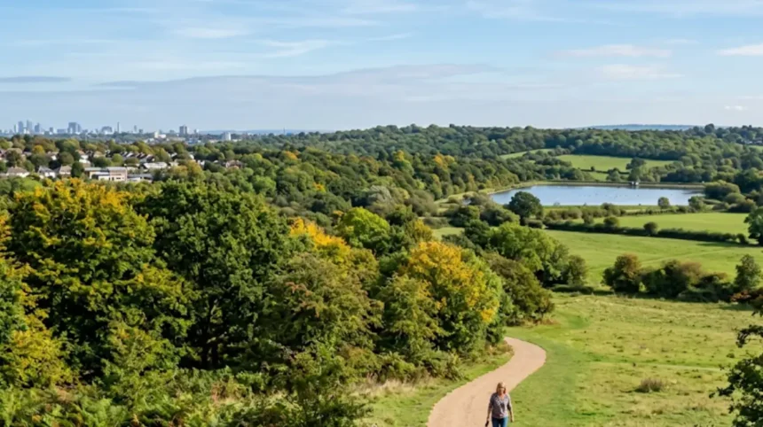
Barnet is one of the greenest areas in North London because it contains 28% Green Belt land, 8% Metropolitan Open Land, 27% tree canopy cover, over 200 parks and open spaces, seven Local Nature Reserves, and 67 Sites of Importance for Nature Conservation. The borough covers 86.74 square kilometres, making it the fourth largest London borough by area, and its extensive green infrastructure includes ancient woodlands, commons, reservoirs, river valleys, and formally managed parks that provide habitat for diverse wildlife while offering recreational space for residents and visitors.
- What Makes Barnet So Green Compared to Other London Boroughs?
- Which Parks and Open Spaces Define Barnet’s Green Character?
- How Do Barnet’s Conservation Areas and Nature Reserves Protect Biodiversity?
- What Environmental Policies and Strategies Sustain Barnet’s Green Status?
- Where Can Visitors Experience Barnet’s Best Green Spaces for Leisure and Recreation?
- How Does Barnet’s Green Infrastructure Benefit Residents and the Environment?
- What Historical Factors Shaped Barnet’s Extensive Green Spaces?
- What Future Challenges and Opportunities Face Barnet’s Green Spaces?
What Makes Barnet So Green Compared to Other London Boroughs?
Barnet ranks among London’s greenest boroughs due to its exceptional proportion of protected green land, with 35.1% of its total area designated as either Green Belt or Metropolitan Open Land, significantly above the London average. This protected status prevents urban development and preserves the borough’s rural character, woodland cover, and open landscapes that distinguish it from more densely built-up inner London areas.
Barnet’s green credentials stem from its unique geographical position at London’s northern edge, where the urban fabric transitions into Hertfordshire’s countryside. The borough contains 2,466 hectares of Green Belt and 690 hectares of Metropolitan Open Land, totalling 3,156 hectares of permanently protected open space. This represents 35.1% of the borough’s 8,674 hectares, placing Barnet well above many other London boroughs in terms of protected green land percentage.
The tree canopy cover in Barnet reaches 27%, exceeding both the London and England averages. This figure comes from the i-Tree Eco Report, which used aerial photography to map all trees over 3 metres in height across the borough. Over 50,000 trees are recorded within Barnet’s 848 hectares of green space and woodland, creating a substantial urban forest that contributes to air quality improvement, carbon sequestration, and biodiversity support.
Barnet’s position as the fourth largest London borough by area at 86.74 square kilometres provides the physical space necessary to maintain extensive green infrastructure. Unlike smaller, more densely populated boroughs, Barnet’s size allows for a network of large parks, commons, woodlands, and green corridors that interconnect to form a coherent green network rather than isolated pockets of vegetation.
Which Parks and Open Spaces Define Barnet’s Green Character?
Barnet contains over 200 parks and open spaces, including major destinations such as Hampstead Heath Extension, Trent Park, Monken Hadley Common, Oak Hill Park, and Brent Reservoir, which collectively provide diverse recreational and ecological functions. These spaces range from formal Victorian parks with manicured gardens to wild commons and ancient woodlands that support rare species.
The borough’s flagship green spaces include several sites of regional and metropolitan importance. Hampstead Heath Extension and Golders Hill Park represent the Barnet portion of Hampstead Heath, one of London’s most celebrated open spaces, offering heathland, woodlands, and swimming ponds that attract millions of visitors annually. Trent Park in Cockfosters provides 318 acres of parkland with formal gardens, woodlands, and a country park atmosphere that serves north-east Barnet residents.
Monken Hadley Common preserves a medieval common with grazing rights, ancient trees, and unimproved grassland that supports invertebrates and ground-nesting birds. Oak Hill Park in East Barnet stands as one of the borough’s Premier Parks, featuring sweeping grassland areas, mature trees, and managed meadows that enhance butterfly populations through cut-and-lift management.
Brent Reservoir, known locally as the Welsh Harp, holds dual designation as both a Local Nature Reserve and a Site of Special Scientific Interest. This 69-hectare reservoir supports over 160 bird species and functions as a crucial wetland habitat within the urban environment, demonstrating how Barnet’s green spaces serve both recreational and conservation purposes.
Smaller but significant spaces include King George’s Fields in Monken Hadley, which combines formal parkland with natural habitats, and the Dollis Valley Greenwalk, a continuous green corridor following Dollis Brook through multiple neighbourhoods. Barnet Gate Wood, part of the Watling Chase Community Forest, provides ancient woodland habitat with bluebell displays in spring and connects to the broader regional forest network.
How Do Barnet’s Conservation Areas and Nature Reserves Protect Biodiversity?
Barnet maintains seven Local Nature Reserves, 67 Sites of Importance for Nature Conservation, and one Site of Special Scientific Interest, creating a comprehensive network that protects habitats ranging from ancient woodland to wetlands and grassland. These designations provide legal protection and management frameworks that ensure biodiversity conservation alongside public access.
The seven Local Nature Reserves represent the borough’s most ecologically valuable sites. Big Wood and Little Wood in Hampstead Garden Suburb preserve ancient semi-natural woodland with bluebells, wood anemones, and mature oaks that support birds such as nuthatches and treecreepers. Oak Hill Wood in East Barnet combines woodland with grassland management that benefits butterflies and other invertebrates.
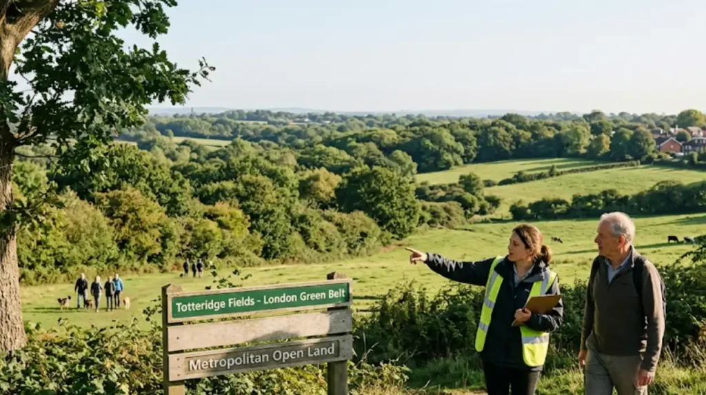
Scratchwood and Moat Mount open space in Mill Hill provides heathland, grassland, and woodland mosaics that support rare invertebrates and ground-nesting birds. Coppetts Wood and Glebelands in Colney Hatch offers ancient woodland with mature trees and a diverse ground flora. Rowley Green Common in Arkley maintains traditional common land with unimproved grassland and scattered trees. Totteridge Fields in Totteridge protects chalk grassland, a nationally rare habitat that supports orchids and specialist butterflies.
The 67 Sites of Importance for Nature Conservation extend protection to additional valuable habitats across the borough. These include Arrandene Open Space and Featherstone Hill in Mill Hill, which provides grassland and scrub habitat; Darland’s Lake Nature Reserve in Totteridge, a small but significant wetland site; and Stoneyfields Park in Edgware, which combines formal parkland with natural areas.
Brent Reservoir’s Site of Special Scientific Interest designation recognises its national importance for wetland birds and aquatic ecology. The reservoir supports wintering wildfowl, breeding waterbirds, and serves as a stepping stone for migratory species moving along the River Brent corridor. Management focuses on maintaining water quality, controlling invasive species, and providing undisturbed areas for sensitive wildlife.
What Environmental Policies and Strategies Sustain Barnet’s Green Status?
Barnet Council operates under the BarNET ZERO sustainability programme, targeting net zero for council operations by 2030 and for the whole borough by 2042, with specific commitments to tree planting, green infrastructure investment, and biodiversity enhancement. These policies provide the strategic framework that maintains and expands the borough’s green assets.
The Sustainability Action Plan sets out concrete measures including a commitment to plant 5,000 trees by 2028, building on the 2,000 trees already planted. The Barnet Tree Policy 2023-28 provides the operational framework for tree management, protection, and planting across public and private land. This policy recognises trees as critical infrastructure that delivers carbon sequestration, air quality improvement, flood mitigation, and biodiversity benefits.
The council invested £15 million in upgrading waste vehicles to Ultra Low Emission Zone compliant standards, reducing emissions from council operations. Street lighting conversion to LED technology cut energy usage by up to 66%, demonstrating how infrastructure modernisation supports environmental goals. Over 150 electric vehicle charge points have been installed across the borough, supporting the transition to low-emission transport.
Brent Cross Town, a major development within Barnet, committed to achieving net zero carbon by 2030, setting a benchmark for sustainable urban development. Solar panels, LED lighting, and air source heat pumps have been installed across 36 Barnet schools, delivering annual savings of 1,040 tonnes of CO2.
The Green Infrastructure Supplementary Planning Document provides the policy framework for protecting and enhancing green spaces through the planning system. This document recognises that Barnet’s 28% Green Belt and 8% Metropolitan Open Land require active management to maintain their ecological and recreational value. The Local Plan Key Facts Evidence Paper provides the data foundation for green infrastructure decisions, ensuring that development pressures do not erode the borough’s green character.
Where Can Visitors Experience Barnet’s Best Green Spaces for Leisure and Recreation?
Tourists and leisure travellers can access Barnet’s green spaces through well-connected public transport, with major sites including Trent Park, Monken Hadley Common, Hampstead Heath Extension, and the Dollis Valley Greenwalk offering walking, cycling, wildlife watching, and picnic facilities. These destinations provide authentic experiences of North London’s natural environment within easy reach of central London.
Trent Park in Cockfosters offers one of Barnet’s most accessible green experiences, reachable via the Piccadilly Line to Cockfosters station. The park features formal gardens, open grassland, woodland walks, and a café, making it suitable for families and visitors seeking a full day out. The 318-acre site provides ample space for walking, running, and informal sports without the crowds found at more central London parks.
Monken Hadley Common presents a different experience, with its medieval common land character, ancient trees, and unimproved grassland. The common connects to Hadley Green and offers walking routes that extend into the surrounding countryside, providing a sense of rural England within London’s boundaries. The site supports wildlife including birds, insects, and small mammals that visitors can observe along the network of footpaths.
Hampstead Heath Extension and Golders Hill Park in Golders Green provide access to the heath’s famous landscapes, including swimming ponds, wooded areas, and open heathland with panoramic views across London. The area reaches via the Northern Line to Golders Green or Hampstead, offering convenient access for visitors staying in central London who want to experience one of the capital’s premier green spaces.
The Dollis Valley Greenwalk follows Dollis Brook from Hampstead Heath to the Thames, passing through multiple Barnet neighbourhoods and green spaces. This 10-mile route provides a continuous green corridor for walking and cycling, connecting Quints Open Space, Whitings Hill Open Space, and other local parks. Visitors can access sections of the Greenwalk at multiple points, creating flexible itineraries based on time and interest.
Oak Hill Park in East Barnet offers one of the borough’s Premier Parks experiences, with sweeping views across the park towards the Theological College on the hill. The park’s meadows, managed to enhance butterfly populations, provide educational opportunities for visitors interested in urban ecology and conservation.
How Does Barnet’s Green Infrastructure Benefit Residents and the Environment?
Barnet’s green infrastructure delivers measurable environmental benefits including carbon sequestration, air quality improvement, flood mitigation, urban cooling, and biodiversity support, while providing residents with recreational space that improves physical and mental health. The 27% tree canopy cover alone contributes significantly to these ecosystem services.
Trees and green spaces sequester carbon dioxide, with Barnet’s 50,000+ recorded trees contributing to the borough’s progress toward its 2042 net zero target. The i-Tree Eco Report methodology used to calculate Barnet’s canopy cover also estimates the carbon storage and air pollution removal services provided by the urban forest, demonstrating quantifiable environmental returns on green infrastructure investment.
Air quality improvement occurs through trees filtering particulate matter and absorbing pollutants such as nitrogen dioxide and ozone. Barnet’s extensive tree cover, particularly along major roads and in residential areas, reduces exposure to traffic-related air pollution for residents. This benefit has particular significance for public health, as air pollution contributes to respiratory and cardiovascular diseases.
Flood mitigation occurs through green spaces absorbing rainfall and slowing surface water runoff. Barnet’s river valleys, including the Dollis Brook, Pymmes Brook, and Salmons Brook corridors, provide natural flood management that reduces flood risk to properties and infrastructure. The borough’s Brooks Strategy recognises these waterways as green infrastructure assets that require protection and enhancement.
Urban cooling reduces the urban heat island effect, with trees and green spaces lowering ambient temperatures during heatwaves. This benefit becomes increasingly important as climate change intensifies heat events in London. Barnet’s 27% canopy cover provides substantial cooling compared to more densely built boroughs with lower tree cover.
Biodiversity support extends beyond the designated nature reserves and Sites of Importance for Nature Conservation. The network of parks, gardens, woodlands, and green corridors creates habitat connectivity that allows species to move across the landscape, find food, and reproduce. This connectivity supports populations of birds, mammals, insects, and plants that would otherwise struggle to survive in urban environments.
Explore More Area Guide
Most Beautiful Places to Visit in Barnet for Scenic Days Out
How to Explore Barnet Like a Local: Authentic North London Guide
What Historical Factors Shaped Barnet’s Extensive Green Spaces?
Barnet’s green character stems from its historical development as a market town on the edge of London, with medieval commons, ancient woodlands, and Victorian park acquisitions that preserved open land before urban expansion reached the area. The borough’s position on the northern fringe of London allowed it to retain rural landscapes that inner London boroughs lost to development.
Monken Hadley Common dates to medieval times when common land supported grazing rights for local residents. These rights persist today, maintaining the common’s unimproved grassland character and preventing the intensive management that would reduce its ecological value. The common represents a direct link to pre-urban land use patterns that shaped Barnet’s landscape.
Ancient woodlands such as Big Wood, Little Wood, and Barnet Gate Wood survived because their timber and coppice products held economic value through centuries of continuous management. These woodlands contain species compositions and structures that reflect centuries of human interaction with the forest ecosystem, creating habitats that support specialised wildlife unable to colonise newer plantings.
The Victorian era saw deliberate acquisition of land for public parks as Barnet transitioned from rural to suburban character. Oak Hill Park and other formal parks emerged from this period, providing recreational space for growing populations while preserving green character within the urban fabric. These acquisitions created the framework for Barnet’s contemporary park network.
As you explore the modern site, you are crossing land with a deep heritage. Read about the full history of Barnet’s market town and common land development to understand its origins. The medieval market town of Barnet, established along the Great North Road, developed with open fields and commons surrounding the built-up area, creating the pattern of green space interspersed with development that persists today.
The twentieth century brought additional protection through Green Belt designation, which prevented further urbanisation and preserved the borough’s rural edges. Metropolitan Open Land designations protected important open spaces within the urban area, ensuring that parks, commons, and other green spaces remained available for public use and biodiversity conservation.
What Future Challenges and Opportunities Face Barnet’s Green Spaces?
Barnet faces challenges from development pressure, climate change impacts on tree health, and funding constraints for park maintenance, while opportunities exist through the BarNET ZERO programme, tree planting targets, and enhanced biodiversity management to strengthen the borough’s green infrastructure. Balancing growth with green space protection remains the central planning challenge.
Development pressure continues to threaten green spaces, particularly sites that lack formal protection designations. The Local Plan process requires careful assessment of development proposals to ensure they do not erode the borough’s green character. The Green Infrastructure Supplementary Planning Document provides policy tools to resist inappropriate development on valuable open land.
Climate change poses risks to tree health through increased drought stress, pest outbreaks, and disease. The Barnet Tree Policy 2023-28 recognises these challenges and sets out approaches for building climate resilience into the urban forest. Species diversification, improved soil management, and targeted watering during droughts form part of the adaptation strategy.
Funding constraints affect park maintenance and improvement, with council budgets under pressure from multiple demands. The Sustainability Action Plan recognises the need for innovative funding approaches, including partnerships with community groups, businesses, and grant funding to maintain green space quality.
The BarNET ZERO programme creates opportunities to integrate green infrastructure with climate action. Tree planting targets of 5,000 trees by 2028 will expand canopy cover and associated ecosystem services. Solar installations on council buildings and schools demonstrate how renewable energy and green space can coexist within the sustainability strategy.
Biodiversity enhancement opportunities exist through improved management of existing green spaces. The 67 Sites of Importance for Nature Conservation and seven Local Nature Reserves provide the framework for targeted conservation investment, while the broader park network can support biodiversity through wildlife-friendly management practices such as reduced mowing, wildflower meadows, and habitat creation.
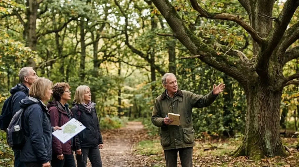
Community engagement strengthens green space stewardship through volunteer groups, friends of parks organisations, and citizen science initiatives. These groups provide additional capacity for conservation work, monitoring, and advocacy that complements council resources and builds local ownership of green infrastructure.
Why is Barnet considered one of the greenest boroughs in North London?
Barnet is considered one of North London’s greenest boroughs because around 35% of its land is protected as Green Belt or Metropolitan Open Land. The borough also has over 200 parks and open spaces, a 27% tree canopy cover, seven Local Nature Reserves, and 67 Sites of Importance for Nature Conservation.