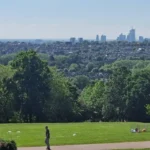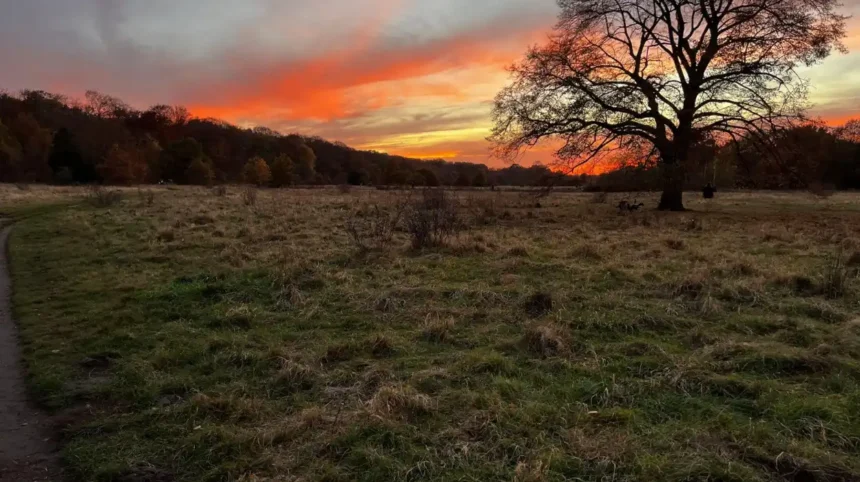
Barnet is one of north London’s greenest boroughs, with more than 250 parks and open spaces covering over 1,200 hectares, alongside 2,466 hectares of Green Belt land. This extensive landscape creates many locations where visitors can watch the evening sky away from dense central London development.
- Where can visitors watch the sunset in Barnet?
- Why is Totteridge Fields a good place for sunset views?
- Does Barnet Hill Open Space provide elevated sunset views?
- Can visitors watch the sunset around Monken Hadley Green?
- Which Barnet open spaces work well for a quieter sunset?
- How does the Dollis Valley Greenwalk work for sunset watching?
- What should visitors consider when choosing a Barnet sunset location?
- Which Barnet sunset locations suit different types of visitors?
- When is the best time to arrive for sunset in Barnet?
- Why does Barnet have so many good sunset locations?
Sunset viewing in Barnet works best from open fields, elevated ground, commons and valley landscapes. Locations such as Totteridge Fields, Barnet Hill Open Space, Arrandene Open Space, Monken Hadley Green and the Dollis Valley provide different viewing environments. Some offer broad horizons, while others combine open countryside with historic buildings, woodland or mature hedgerows.
The best location also depends on the type of sunset experience required. Visitors seeking an open western horizon need fields and elevated ground. People looking for a quieter setting can use nature reserves and commons. Walkers can combine sunset viewing with sections of the Dollis Valley Greenwalk.
Sunset time changes throughout the year. Summer evenings provide much later viewing opportunities, while winter sunsets occur earlier. Checking the exact sunset time before travelling helps visitors arrive at the viewing location before the sun reaches the horizon.
Where can visitors watch the sunset in Barnet?
Visitors can watch sunsets across Barnet from open spaces including Totteridge Fields, Barnet Hill Open Space, Arrandene Open Space, Monken Hadley Green and Dollis Valley routes, where open landscapes provide wider views than surrounding residential streets.
Barnet Council describes the borough as containing formal parks and gardens, wild landscapes, extensive Green Belt and leafy river valleys. These different landscape types create several useful sunset environments.
Totteridge Fields is particularly suited to visitors who want a countryside setting. The nature reserve contains more than thirty fields north of Totteridge Common. The site extends between Hendon Wood Lane and Grange Avenue and follows the Dollis Brook valley. Fields rise gently on both sides of the watercourse, with mature hedgerows dividing sections of the landscape.
Barnet Hill Open Space provides another option in High Barnet. The site appears in Barnet Council’s official parks directory at Barnet Hill on the A1000. Its elevated position within High Barnet makes it useful for visitors seeking a location away from enclosed woodland.
Arrandene Open Space is located on Wise Lane in Mill Hill. Barnet Council identifies wildlife interest at the site, making it suitable for visitors who want an open-space setting rather than a formal urban park.
Monken Hadley Green provides a different sunset environment. The green sits within a historic landscape containing St Mary the Virgin Church, Hadley Common and historic routes through north London. Views around the area reveal the rural character that has remained important to Monken Hadley.
The Dollis Valley Greenwalk adds a longer walking option. The official route covers approximately 10 miles between Moat Mount in Mill Hill and Hampstead Heath, linking green spaces through the Dollis Valley.
Visitors should distinguish between a sunset location and a dedicated viewpoint. Barnet has numerous places where the sunset is visible, but not every park has a formal viewing platform or uninterrupted horizon.
Why is Totteridge Fields a good place for sunset views?
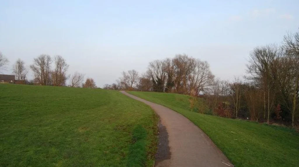
Totteridge Fields offers a rural sunset setting because its more than thirty fields, gently rising valley sides, mature hedgerows and Dollis Brook create open sections where visitors can experience evening light across Barnet’s countryside landscape.
Totteridge Fields is a nature reserve in the Whetstone area. The site stretches between Hendon Wood Lane and Grange Avenue, north of Totteridge Common. The Dollis Brook flows west to east through the landscape.
The physical structure of the reserve is important for sunset viewing. The fields do not form one large uninterrupted meadow. Instead, mature hedgerows and field boundaries create a sequence of open areas. Visitors therefore need to choose their position according to the direction of the evening light.
The gently rising land is another useful feature. Sunset visibility depends on both the position of the sun and local obstructions. A field with slightly higher ground provides a clearer line towards the horizon than a lower point surrounded by trees.
Totteridge Fields also provides a strong connection between sunset viewing and nature. Barnet Council records wildflowers including common knapweed, tufted vetch, selfheal and creeping thistles during summer. One field is managed by the London Wildlife Trust.
The site is therefore relevant to several visitor types. Leisure travellers can combine sunset watching with a countryside walk. Residents can use it for an evening outdoor activity. Photographers can use the changing light across fields and hedgerows. Digital nomads and business travellers can visit after daytime commitments if they are staying nearby.
Visitors should remain on permitted paths and respect nature-reserve management. The landscape contains wildlife habitats, so sunset viewing should not involve entering sensitive areas or disturbing vegetation.
Does Barnet Hill Open Space provide elevated sunset views?
Barnet Hill Open Space provides an elevated High Barnet setting that is useful for sunset watching, particularly for visitors who want open public space close to the historic centre rather than a long countryside walk or heavily wooded environment.
Barnet Hill Open Space is listed by Barnet Council at Barnet Hill, A1000, High Barnet, EN5. It forms part of the borough’s extensive network of parks and open spaces.
Its location is significant because High Barnet occupies higher ground than many parts of the surrounding borough. Elevated terrain helps sunset viewers because nearby buildings and vegetation are less likely to dominate the western horizon from suitable open positions.
The area also connects sunset viewing with Barnet’s historic urban landscape. High Barnet developed around an important northward route from London. Barnet Council records the town as the oldest town in the modern borough and notes that the market has existed in different forms and locations since at least the 12th century.
This makes High Barnet useful for visitors who want to combine outdoor scenery with local heritage. A sunset visit can form part of a wider walking itinerary around the town rather than functioning as a standalone activity.
The surrounding landscape also demonstrates why Barnet has retained a strong green character despite its position within Greater London. The council’s current parks strategy records more than 1,200 hectares of parks and open spaces and a further 2,466 hectares of Green Belt.
For sunset photography, visitors should arrive before the scheduled sunset. This allows time to identify an unobstructed position rather than arriving when the sun is already close to the horizon.
Weather conditions also affect visibility. Clear western skies provide longer-distance views, while cloud cover can create stronger colour contrasts around the horizon. The exact appearance varies by season and atmospheric conditions.
Can visitors watch the sunset around Monken Hadley Green?
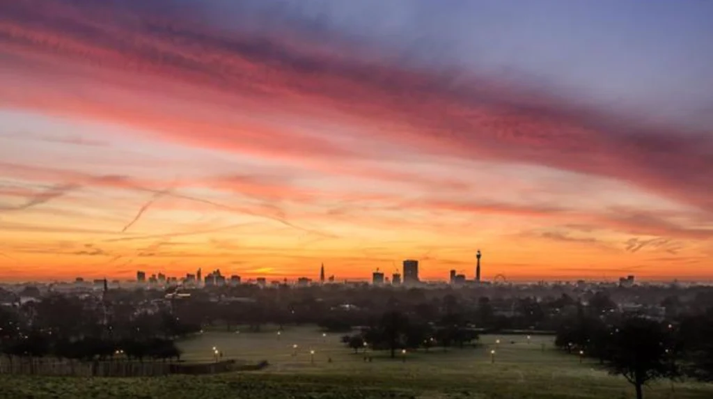
Monken Hadley Green combines open green space, historic buildings, mature trees and long-established rural character, making it suitable for visitors who want a sunset setting with heritage features rather than a purely modern parkland environment.
Monken Hadley is one of Barnet’s most historically distinctive landscapes. The conservation area lies in the north-east of the borough, close to the Hertfordshire and Enfield boundaries. Chipping Barnet lies to the south.
Hadley Green sits close to St Mary the Virgin Church, which is the focal point of Monken Hadley. The surrounding area contains winding lanes, native trees, historic buildings and common land. Barnet Council states that views from the church area reveal much of the character of the conservation area.
The history is substantial. Hadley was mentioned in a description of the boundary of the manor of Barnet in 1005. The name refers to a heath-like clearing in a wood. The monastic association behind the name Monken dates to the medieval period.
As you explore the modern site, you are crossing land with a deep heritage. Read about the full to understand its origins.
Monken Hadley also has a direct connection with the Battle of Barnet in 1471, fought during the Wars of the Roses. Barnet Council records that the battle took place within sight of St Mary the Virgin Church. An obelisk commemorating the battle was erected in 1740.
This historic context changes the character of sunset viewing. The experience is not limited to looking towards the horizon. Visitors can also observe the relationship between the green, church, mature trees and historic road network.
Hadley Common adds another landscape layer. It was once part of Enfield Chase, a large hunting landscape associated with Tudor monarchs. After the enclosure of Enfield Chase in 1777, approximately 240 acres in the parish of Monken Hadley became Hadley Common.
Visitors should treat the conservation area and common as working heritage landscapes. Paths, access arrangements and private property boundaries should be respected.
Which Barnet open spaces work well for a quieter sunset?
Arrandene Open Space, Mill Hill, and other wildlife-focused green spaces provide quieter alternatives to busy central locations, giving visitors more natural surroundings for sunset watching while remaining within Barnet’s extensive network of public parks and open spaces.
Barnet contains a large network of green spaces beyond its major named parks. The council’s parks directory includes 160 listed parks and open spaces, covering locations across Mill Hill, High Barnet, Whetstone, East Barnet, Edgware and other neighbourhoods.
Arrandene Open Space is one of the relevant Mill Hill locations. It is situated on Wise Lane and is officially recorded as having wildlife interest.
Its open-space character makes it relevant to visitors who prefer natural surroundings. The site is not presented by Barnet Council as a formal panoramic viewpoint, so visitors should choose positions where vegetation and surrounding buildings leave sufficient visibility towards the evening sky.
Sunny Hill Park is another option in Mill Hill. It is located on Watford Way and includes a marked and measured 2.5-kilometre walking route, gardens, sports facilities, a café and wildlife interest.
Sunny Hill Park is particularly useful when sunset viewing forms part of an evening walk. The marked route provides a structured way to explore the park before settling in an appropriate open area.
Mill Hill Park provides a more formal park environment. It is located on Daws Lane and includes gardens, sports facilities, a café, tennis courts, an outdoor gym and wildlife interest. It also has car parking and links to Mill Hill Broadway via public transport.
Mill Hill Park has an established history. It formed part of Daws Farm and was acquired by Hendon Urban District Council in 1923 before opening to the public in 1924. Barnet Council has continued managing it since the London Borough of Barnet was formed in 1965.
These locations illustrate an important point about sunset planning. A good sunset location does not always need to be a famous viewpoint. An open lawn, field edge or elevated path with a clear western aspect can provide useful visibility.
How does the Dollis Valley Greenwalk work for sunset watching?
The Dollis Valley Greenwalk is a 10-mile route through Barnet’s green spaces, running from Moat Mount through the Dollis Valley towards Hampstead Heath, making selected sections useful for sunset walks without requiring visitors to complete the entire trail.
The Dollis Valley Greenwalk links a chain of open spaces through Barnet. Barnet Council describes the full route as approximately 10 miles and states that it can take up to six hours to walk. Much of the route is relatively flat and uses hard surfaces.
The route begins at Moat Mount in Mill Hill and continues through the borough towards Hampstead Heath. It follows the Dollis Valley and connects several green areas along the way.
This makes the trail particularly useful for visitors who want sunset viewing combined with exercise. There is no requirement to walk the entire 10-mile route. Visitors can select a shorter section and time their walk around sunset.
The route also has wider walking significance. Barnet Council’s published route guide states that the Dollis Valley Greenwalk was developed in 1992 and forms part of the Walk London network, with links to the London LOOP and Capital Ring.
The landscape changes along the route. Some sections pass through more open fields, while others follow wooded or suburban stretches. Sunset visibility therefore varies considerably between points.
For sunset purposes, walkers should identify their intended stopping point before starting. A route that looks attractive on a map can contain trees, buildings or changes in direction that restrict the western view.
Weather also affects walking conditions. Barnet Council states that sections of the Greenwalk can become muddy or icy depending on weather conditions.
The council also notes that some sections permit cycling, with signs identifying where cycling is allowed. Walkers should therefore follow local signage and share the route appropriately.
The Greenwalk is particularly suitable for visitors staying in north London who want a longer outdoor experience rather than a short stop at a single viewpoint.
What should visitors consider when choosing a Barnet sunset location?
Visitors should consider sunset direction, horizon visibility, seasonal sunset times, park access, walking conditions, public transport and weather before choosing a Barnet location, because each factor affects how long the view remains visible and how safely visitors can leave afterwards.
The first consideration is direction. Sunset occurs towards the western part of the sky, although its exact position shifts north and south through the year. A location with an open western or north-western aspect therefore provides a different view from one enclosed by tall trees.
The second consideration is elevation. Higher ground can improve the horizon line. Barnet’s elevated areas, including parts of High Barnet, provide different viewing conditions from valley locations such as the Dollis Valley.
The third consideration is vegetation. Trees provide attractive silhouettes but can also block the horizon. Open fields often provide longer sightlines than woodland.
The fourth consideration is access. Barnet Council publishes information on park locations, facilities and access arrangements through its parks directory. Visitors should check the current information for the individual site before travelling.
The fifth consideration is season. Sunset times change significantly between winter and summer. A location that works for a late summer evening can require a substantially earlier visit during winter.
The sixth consideration is surface conditions. Grass, woodland paths and valley routes respond differently to rain and frost. The Dollis Valley Greenwalk, for example, can become muddy or icy in certain weather.
The seventh consideration is transport. Mill Hill Park has bus connections and Mill Hill Broadway provides a Thameslink connection. Sunny Hill Park is served by local transport routes around Watford Way.
Visitors should also check park opening and locking arrangements. Barnet Council provides information about locking times for parks and open spaces, so visitors should not assume that every location remains accessible throughout the night.
For photography, arriving 20 to 30 minutes before sunset provides time to select a viewpoint, check the western horizon and prepare equipment. The period immediately after sunset also provides changing light across the sky, but visitors should ensure that they can leave safely before access restrictions apply.
Which Barnet sunset locations suit different types of visitors?
Totteridge Fields suits countryside-focused visitors, Barnet Hill suits elevated urban views, Monken Hadley suits heritage-focused walks, Arrandene suits nature-oriented visits, and the Dollis Valley Greenwalk suits longer evening walks through Barnet’s connected green landscape.
Tourists seeking a rural landscape can focus on Totteridge Fields. Its field system, hedgerows, Dollis Brook and wildlife interest provide a countryside setting within Greater London.
Visitors seeking history alongside sunset scenery can choose Monken Hadley. The conservation area combines green space with St Mary the Virgin Church, historic routes and connections to the Battle of Barnet.
Visitors wanting an elevated urban setting can consider Barnet Hill Open Space. Its High Barnet location provides access to open space close to the historic town centre.
People looking for nature and a quieter environment can consider Arrandene Open Space. Barnet Council records wildlife interest at the Mill Hill site.
Visitors who want a sunset walk rather than a single viewpoint can use a section of the Dollis Valley Greenwalk. The route connects green spaces across Barnet and provides options for shorter or longer evening walks.
Families can also consider formal parks such as Mill Hill Park and Sunny Hill Park because they provide established facilities and defined walking areas. Mill Hill Park has gardens, a café, sports facilities and play areas, while Sunny Hill Park has a measured walking route and recreational facilities.
Digital nomads and business travellers with limited free time can select a location close to their daytime itinerary. A shorter visit to a nearby open space is more practical than committing to a long-distance walk.
The broader lesson is that Barnet’s sunset opportunities come from its geography rather than from a single official sunset viewpoint. The borough’s combination of Green Belt, parks, commons, valleys and nature reserves creates multiple viewing environments. Barnet Council’s 2026–2036 parks strategy confirms the scale of this green infrastructure, with more than 250 parks and open spaces and extensive additional Green Belt.
Explore More Area Guide
Barnet vs Central London: Key Differences Explained
Barnet Languages and Cultures: Exploring North London’s Diversity
When is the best time to arrive for sunset in Barnet?
The best arrival time depends on the date, but visitors should reach their chosen Barnet location before the published sunset time, allowing extra time for walking, finding an unobstructed western view, checking access conditions and preparing for the darker period after sunset.
Sunset is not a fixed daily time. It changes according to the season and date. Summer evenings provide later sunset times, while winter evenings become dark much earlier.
Visitors should therefore check the sunset time for the specific date rather than relying on a general seasonal estimate.
Arrival time should also reflect the size of the location. Totteridge Fields and the Dollis Valley Greenwalk contain multiple paths and viewing positions. A visitor arriving immediately before sunset has less time to identify the clearest horizon.
Monken Hadley also rewards an early arrival because the area contains several connected landscape features, including the green, church and historic roads.
Photographers should consider the wider period around sunset. The sky often changes after the sun has disappeared below the horizon. Remaining for a short period after sunset therefore provides additional opportunities, provided the location remains open and safe.
The most important practical rule is to avoid treating sunset as the moment to arrive. Sunset is the endpoint of the viewing period. Arriving earlier gives visitors access to the changing light before the sun reaches the horizon.
Barnet’s extensive network of parks and open spaces means visitors can choose locations according to their available time. The borough officially provides park information, walking routes and active trails that support outdoor recreation across different neighbourhoods.
Why does Barnet have so many good sunset locations?
Barnet has many sunset locations because its landscape combines elevated ground, Green Belt, open fields, commons, river valleys, nature reserves and formal parks, creating numerous places where evening light reaches open land away from dense central London development.
Barnet’s green infrastructure is the main reason sunset viewing is widely available. The borough’s current parks strategy records more than 250 parks and open spaces, covering over 1,200 hectares. It also identifies 2,466 hectares of Green Belt land, equivalent to 28% of the borough, alongside 690 hectares of Metropolitan Land.
These figures explain why visitors do not need to rely on a single landmark viewpoint. The landscape contains multiple types of open space.
Fields provide wide horizons. Commons provide open areas mixed with mature vegetation. Valley landscapes create long linear views. Parks provide managed lawns and paths. Nature reserves provide less formal surroundings.
Barnet’s geography also changes from neighbourhood to neighbourhood. High Barnet contains elevated land and historic urban landscapes. Totteridge and Whetstone contain fields and the Dollis Valley. Mill Hill contains extensive open spaces and parks. Monken Hadley combines common land with historic buildings and mature vegetation.
The Dollis Brook is particularly important to the borough’s green landscape. Its valley forms the basis of the Dollis Valley Greenwalk and creates a continuous green corridor through parts of Barnet.
Historic land management has also shaped today’s sunset environments. Hadley Common originated from the former Enfield Chase landscape, while Totteridge Fields retains a field-based landscape associated with the Dollis Valley.
This combination of geography and land management gives Barnet a distinctive relationship between urban development and open land. Visitors can move from busy roads and residential districts into fields, commons and nature reserves within a relatively short distance.
For sunset visitors, the result is a broad choice of settings rather than one fixed attraction. The appropriate location depends on the desired horizon, walking distance, heritage context, facilities and transport connection.
Barnet’s parks strategy for 2026–2036 also demonstrates that these green spaces remain an important part of the borough’s long-term planning. The strategy addresses the condition, management, biodiversity and recreational role of parks and open spaces.
Barnet therefore offers sunset viewing as part of its wider landscape network. The strongest options are locations where open land, elevation or a clear western aspect combine with safe and practical access. For visitors, that makes sunset watching easy to incorporate into an evening walk, heritage visit or wider north London itinerary.
What are the best places to watch the sunset in Barnet?
Some of the best sunset locations in Barnet include Totteridge Fields, Barnet Hill Open Space, Monken Hadley Green, Arrandene Open Space and the Dollis Valley Greenwalk. Each offers a different combination of open views, greenery and local character.