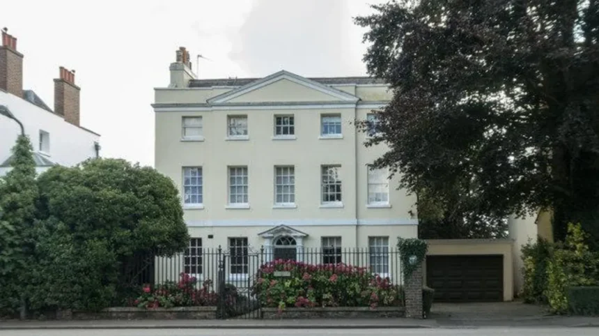
Barnet has some of North London’s most distinctive streetscapes, combining historic buildings, mature trees, village greens, conservation areas and views towards open countryside. The most scenic streets are concentrated around Monken Hadley, Totteridge, Mill Hill, Chipping Barnet and Hampstead Garden Suburb.
- Which parts of Barnet have the most scenic streets?
- Why is Monken Hadley one of Barnet’s most scenic street areas?
- What makes Totteridge streets visually distinctive?
- Where can you find scenic streets around Mill Hill?
- Which Chipping Barnet streets have the strongest historic character?
- Where are the most attractive streets in Hampstead Garden Suburb?
- Why are conservation areas important when exploring scenic Barnet streets?
- How can you explore Barnet’s scenic streets on foot?
- When is the best time to explore Barnet’s scenic streets?
- Which scenic Barnet streets suit architecture enthusiasts?
- How do Barnet’s scenic streets connect architecture with green space?
- What makes Barnet’s scenic streets different from ordinary residential roads?
- How can visitors plan a scenic Barnet street itinerary?
- What is the lasting significance of Barnet’s scenic streets?
Barnet Council identifies a substantial network of conservation areas across the borough, including Monken Hadley, Totteridge, Mill Hill, Wood Street, Hampstead Garden Suburb, Finchley Garden Village and Hendon Church End. Conservation areas are places recognised for special architectural or historic interest.
For visitors, these areas provide a different experience from central London. Streets become part of the attraction itself. Historic road layouts, landscaped front gardens, mature trees, cottages, villas and open spaces create distinctive views. For residents and local explorers, these streets also provide accessible walking routes close to shops, parks and public transport.
Which parts of Barnet have the most scenic streets?
The most scenic parts of Barnet include Monken Hadley, Totteridge, Mill Hill, Wood Street and Hampstead Garden Suburb. These areas combine historic architecture, mature vegetation, village greens, conservation landscapes and views towards open land. Their streets provide distinct examples of Barnet’s architectural and landscape character.
Barnet does not have one single scenic street district. Its attractive streets are distributed across different parts of the borough. The strongest concentrations occur where historic settlements survived alongside open land.
Monken Hadley is particularly notable for winding lanes, historic buildings, mature trees and Hadley Green. Totteridge has a rural village character with open fields and long-distance views. Mill Hill provides elevated streets along The Ridgeway and surrounding roads.
Wood Street offers a different setting. Its historic townscape includes shops, churches, villas and public spaces. Hampstead Garden Suburb provides planned residential streets, landscaped spaces and distinctive Arts and Crafts-influenced architecture.
Barnet currently has numerous conservation areas, each protected because of its architectural or historic character.
The borough’s scenic streets therefore fall into several broad categories. Examples include historic village streets, planned garden-suburb roads, elevated countryside-facing routes and traditional town-centre streets.
For visitors, this variety makes Barnet suitable for walking-based exploration. A short route can move from a historic village environment to open green space without travelling far.
Why is Monken Hadley one of Barnet’s most scenic street areas?
Monken Hadley is one of Barnet’s strongest historic streetscapes because it combines winding roads, mature trees, historic buildings, Hadley Green and Monken Hadley Common. The conservation area preserves a rural character that reflects centuries of settlement and changing transport routes.
Monken Hadley lies in the north-east of Barnet near the boundary with Hertfordshire and the London Borough of Enfield. Chipping Barnet lies immediately to the south. Barnet Council describes the area as having winding lanes, native trees, historic buildings and open common land.
The area developed around ancient routes. The medieval Great North Road passed through Chipping Barnet, Hadley Green and Hadley Highstone before continuing northwards towards Potters Bar. This historic road network helps explain the irregular shape and alignment of several local streets.
Which Monken Hadley streets are worth exploring?
Hadley Green Road, Kitts End Road, Monken Hadley Common and streets around St Mary the Virgin Church provide some of the strongest scenic views. Their combination of mature vegetation, historic buildings, open green space and traditional road layouts creates a cohesive village landscape.
Hadley Green is central to the area’s visual identity. The green provides open space between buildings and roads, while mature trees frame views across the historic settlement.
Kitts End Road provides another important connection. The road forms part of the historic landscape around Hadley Highstone and the former Great North Road route. An obelisk commemorating the 1471 Battle of Barnet stands near the historic junction. Barnet Council records that the monument was erected in 1740.
St Mary the Virgin Church provides another visual landmark. The church stands close to the crossing of ancient roads and acts as a focal point within the conservation area.
As you explore the modern streets, you are crossing land with a deep heritage. Read about the full to understand its origins.
Monken Hadley Common adds another landscape layer. Barnet Council records that the common covers about 240 acres and remained largely wooded after the former Enfield Chase was divided in the late eighteenth century.
This combination makes Monken Hadley particularly suitable for slow walking and architectural photography.
What makes Totteridge streets visually distinctive?
Totteridge streets are visually distinctive because the settlement sits along a gravel ridge surrounded by open land. Totteridge Lane, Totteridge Village, Totteridge Common and nearby residential roads combine historic buildings, mature trees, countryside views and a relatively secluded village character.
Totteridge occupies higher ground in northern Barnet. The conservation area follows a ridge running broadly west to east. Open land surrounds much of the settlement, with slopes towards Dollis Brook and Folly Brook.
This geography directly influences the streetscape. Roads follow the higher ground while fields and open spaces create visual breaks between groups of buildings.
Barnet Council records approximately 450 properties within the Totteridge conservation area based on its conservation-area information. The 2001 Census recorded around 1,700 residents in the area.
Which Totteridge roads offer attractive views?
Totteridge Village, Totteridge Common, Totteridge Lane and nearby roads around Totteridge Green provide attractive views of historic buildings, mature trees and open land. Grange Road and Northcliffe Drive also have the quiet residential character associated with the wider conservation landscape.
Totteridge Village and Totteridge Common form important parts of the historic settlement. The village green provides open space around buildings and community facilities.
Totteridge Lane is a major route rather than a quiet lane. Barnet Council notes that it carries significant commuter traffic, particularly during rush hours. Visitors therefore need to distinguish between the visual character of the road and the experience of walking beside it.
The quieter residential streets provide a different experience. Grange Road and Northcliffe Drive have a more secluded character, while the surrounding fields reinforce the rural setting.
Barnet Council’s Healthy Heritage Walk programme also includes a Totteridge route through Totteridge Common, woodland and fields. The council describes it as a countryside walk close to suburban London.
This makes Totteridge particularly relevant for visitors seeking scenic streets connected with open countryside.
Where can you find scenic streets around Mill Hill?
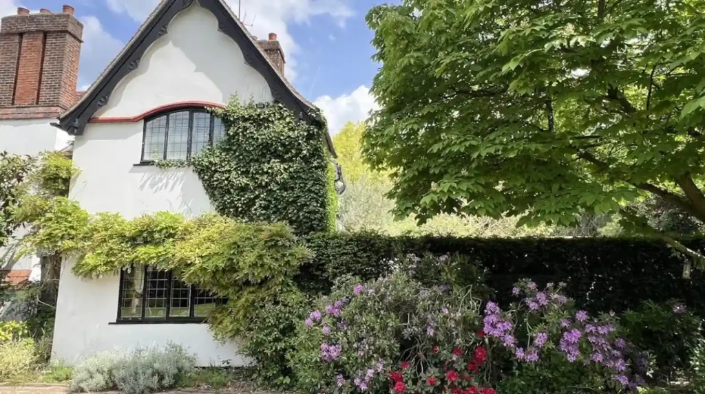
Mill Hill’s most scenic streets are concentrated around The Ridgeway, Highwood Hill, Hammers Lane and nearby roads. The elevated landscape provides long-distance views across green spaces, while cottages, institutional buildings, mature trees and historic properties create a village-like streetscape.
The Mill Hill conservation area covers approximately 152 hectares. It extends along high ground in north-west Barnet and includes buildings and houses arranged along The Ridgeway.
The Ridgeway is the defining route. Its elevated position provides views towards green-belt countryside on both sides. The conservation area extends visually towards Burtonhole Lane and Marsh Lane.
The area contains approximately 260 houses according to Barnet Council’s conservation-area description. Many are brick or weatherboarded cottages associated with the historic character of rural Middlesex.
Why is The Ridgeway important for scenic walks?
The Ridgeway is important because it follows high ground through Mill Hill and combines historic buildings with countryside views. Its elevated position, surrounding green belt and connected bridleways create a distinctive landscape within London.
The road’s physical geography is central to its appearance. Mill Hill developed along gravel-capped higher ground because the surrounding heavy clay soils were difficult to drain. Historic development therefore concentrated along ridge routes.
The conservation area contains clusters of smaller houses and cottages near The Ridgeway, Hammers Lane and High Street. Barnet Council describes these groups as having a country-village quality.
The landscape also supports walking and horse riding. The council identifies bridleways and long-distance views as important characteristics of the area.
For visitors, The Ridgeway works particularly well as part of a longer Mill Hill walking route. The surrounding streets provide architectural interest while nearby open land provides wider views.
Which Chipping Barnet streets have the strongest historic character?
Wood Street, Barnet Hill and Union Street provide some of Chipping Barnet’s strongest historic streetscapes. Their character comes from historic shops, St John the Baptist Church, traditional villas, public spaces and the surviving alignment of Barnet’s historic town centre.
Wood Street forms part of a conservation area extending east to west from the Great North Road junction at the top of Barnet Hill towards Arkley. Barnet Council designated the conservation area in 1969 and extended it in 1979.
The conservation area includes historic shops around Barnet Hill and St John’s Church. Union Street lies to the north, while villas face Ravenscroft Park. Wood Street continues westwards towards The Whalebones.
What should visitors look for around Wood Street?
Visitors should look for St John the Baptist Church, historic shopfronts, villas facing Ravenscroft Park, Wood Street’s traditional buildings and the public spaces around the historic town centre. These features show how Chipping Barnet developed as both a market settlement and residential community.
The area combines commercial and residential architecture. Small independent shops contribute to the town-centre character, while cafés, restaurants, public houses and other services provide active uses at street level.
Ravenscroft Park provides an important green setting. Courthouse Recreation Gardens also contribute open space at the eastern end of the conservation area.
The combination of buildings and open spaces makes this area useful for visitors who prefer streets with both architectural and everyday activity.
It also provides a contrast with Monken Hadley and Totteridge. Those areas emphasise village and countryside character. Wood Street presents a more urban historic streetscape.
Where are the most attractive streets in Hampstead Garden Suburb?
Hampstead Garden Suburb contains attractive streets around Central Square, Hampstead Way, Willifield Way, Temple Fortune Lane, Northway, Southway, Wildwood Road and other planned residential roads. Mature trees, landscaped gardens and architectural consistency define the area.
Hampstead Garden Suburb occupies the southern part of Barnet. Its conservation area extends around the Heath Extension and northwards towards East End Road. The eastern boundary includes The Bishops Avenue, while Finchley Road forms much of the western boundary.
The suburb was developed between 1907 and 1938 on a greenfield site. Its designers incorporated existing woodland and agricultural landscape into the plan. The conservation area now covers about 1,009 acres, including approximately 136 acres of open space.
Which Hampstead Garden Suburb streets are notable?
Central Square, Hampstead Way, Willifield Way, Temple Fortune Lane, Wildwood Road, Northway and Southway are notable because they demonstrate the planned character of Hampstead Garden Suburb. Each area combines residential architecture, landscaped surroundings and deliberate street design.
The suburb was founded by Henrietta Barnett in 1907. Architects including Raymond Unwin contributed to its design. The planning approach integrated houses, green spaces, trees and community facilities.
Central Square is one of the best-known spaces. St Jude-on-the-Hill, designed by Edwin Lutyens, provides a major architectural landmark. Its spire rises 178 feet and is visible from surrounding areas.
The council’s conservation documentation divides the suburb into character areas. These include Central Square, the Artisans Quarter, Temple Fortune Lane and Willifield Way, Meadway and the Great Wall, Rotherwick Road and Hampstead Way, Wildwood Road and its closes, and Northway, Middleway and Southway.
This planned structure makes Hampstead Garden Suburb particularly valuable for visitors interested in architecture and urban design.
Why are conservation areas important when exploring scenic Barnet streets?
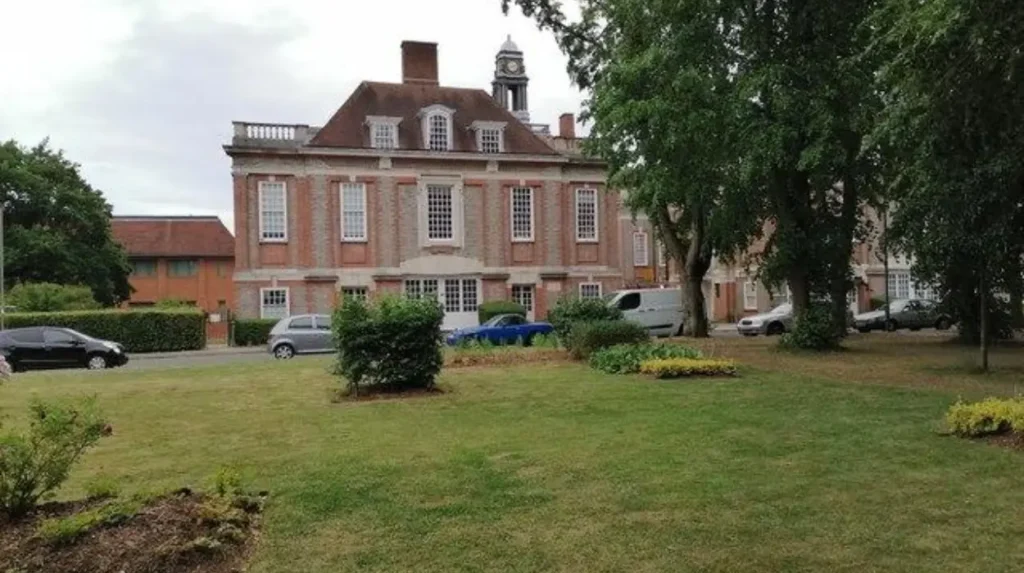
Conservation areas protect places with special architectural or historic interest. In Barnet, they help retain distinctive buildings, street layouts, trees, boundaries and landscape features that contribute to the character of places such as Monken Hadley, Totteridge, Mill Hill and Wood Street.
Barnet Council identifies conservation areas as locations with special architectural or historic interest. The borough has numerous designated areas covering different architectural and landscape environments.
Conservation-area status does not mean every building is listed. It instead protects the character and appearance of the wider area through planning controls.
Some Barnet conservation areas also have Article 4 Directions. An Article 4 Direction removes specified permitted development rights, meaning certain works require planning permission. Barnet Council states that ten conservation areas have Article 4 Directions in force.
This matters to visitors because the streets retain coherent visual features. Traditional windows, walls, roofs, fences, trees and building proportions form part of the overall streetscape.
For residents, the controls have a practical planning role. They regulate certain external alterations and help maintain the characteristics that define the area.
How can you explore Barnet’s scenic streets on foot?
The most effective approach is to combine historic streets with nearby greens and heritage routes. Monken Hadley, Totteridge, Mill Hill and Chipping Barnet each support walking opportunities where architecture, public space and landscape can be explored within connected local areas.
Barnet Council provides Healthy Heritage Walks linking heritage, landscape and walking. The programme includes a Barnet and Hadley route with more than ten heritage points of interest. It also provides a Totteridge route through woodland and fields.
A Monken Hadley walk can focus on Hadley Green, St Mary the Virgin Church, Kitts End Road and the surrounding historic streets. Open spaces provide natural stopping points.
A Chipping Barnet route can connect Barnet Hill, St John the Baptist Church, Wood Street, Union Street and Ravenscroft Park.
A Mill Hill route can follow The Ridgeway and connect with surrounding roads and open land.
A Hampstead Garden Suburb route can concentrate on Central Square, Hampstead Way and the planned residential streets surrounding the central area.
These routes provide different types of scenery. Historic villages emphasise age and irregular street patterns. Garden suburbs emphasise planned design. Ridge settlements emphasise elevation and countryside views.
When is the best time to explore Barnet’s scenic streets?
Morning and late afternoon provide strong conditions for exploring Barnet’s scenic streets because pedestrian activity is generally lower outside peak commuting periods. Seasonal changes also alter the appearance of mature trees, gardens, greens and surrounding countryside.
Spring highlights blossom, fresh foliage and landscaped gardens. Summer provides dense tree cover and longer daylight hours. Autumn brings changes in leaf colour across areas such as Monken Hadley, Totteridge and Mill Hill. Winter exposes building details that dense vegetation can obscure during warmer months.
Time of day also matters. Totteridge Lane and other major commuter routes experience heavier traffic during rush hours. Barnet Council specifically notes busy traffic conditions on Totteridge’s principal roads.
Quiet residential streets should still be treated as living neighbourhoods. Visitors should remain on public footways and respect residents, private property and access points.
For photography, public viewpoints, greens and pavements provide appropriate locations. Private gardens and driveways should not be entered.
Which scenic Barnet streets suit architecture enthusiasts?
Architecture enthusiasts should explore Hampstead Garden Suburb, Monken Hadley, Wood Street and Mill Hill because these areas demonstrate different periods and planning traditions. Examples include Arts and Crafts-influenced suburban design, historic cottages, market-town buildings and institutional architecture.
Hampstead Garden Suburb demonstrates early twentieth-century planned development. The design integrates residential buildings with green spaces and community facilities.
Monken Hadley represents a much older settlement pattern. Its roads reflect historic routes, village development and surviving open spaces.
Wood Street represents the historic market-town environment of Chipping Barnet. Shops, churches, villas and public spaces remain important elements of the conservation area.
Mill Hill provides a linear ridge settlement with cottages, institutional buildings and views over surrounding green land.
Barnet’s Local Heritage List provides another resource for architectural exploration. The council states that its list was approved in 2020, with additional entries approved in 2022. Its documents include a street index that allows users to search for individual streets.
This provides a useful way to investigate individual buildings while walking through the borough.
How do Barnet’s scenic streets connect architecture with green space?
Barnet’s scenic streets are closely connected with parks, commons, fields and landscaped open spaces. Hadley Green, Monken Hadley Common, Totteridge Common, Ravenscroft Park and Hampstead Garden Suburb’s open spaces demonstrate this relationship between streets and landscape.
This relationship is one of Barnet’s defining characteristics.
Monken Hadley combines streets with common land and Hadley Green. Its conservation appraisal identifies open spaces, trees and woodland as important components of local character.
Totteridge combines residential streets with agricultural land, common areas and countryside views. The surrounding open land forms part of London’s Green Belt.
Mill Hill combines The Ridgeway with green-belt countryside and bridleways. Its elevated location produces long-distance views beyond the immediate streetscape.
Hampstead Garden Suburb incorporates substantial open space into its planned layout. The conservation area covers approximately 1,009 acres, including about 136 acres of open space.
Wood Street provides a more compact urban example. Ravenscroft Park and Courthouse Recreation Gardens create green spaces within the historic townscape.
What makes Barnet’s scenic streets different from ordinary residential roads?
Barnet’s scenic streets combine several identifiable characteristics rather than relying on individual attractive buildings. Historic layouts, mature trees, architectural consistency, open spaces, elevation, village greens and protected heritage features create a wider streetscape that remains recognisable across generations.
A scenic street is therefore best understood as part of a wider landscape.
A road beside a historic building becomes more visually distinctive when mature trees, traditional boundaries and open space frame the building. A rural-looking road becomes more significant when its alignment follows an historic route.
Barnet’s conservation areas demonstrate this principle. The council’s designations cover areas rather than isolated buildings because the relationship between architecture and surroundings contributes to historic character.
The borough’s Local Heritage List adds another layer by identifying buildings and features of local importance.
For visitors, this means the best experience comes from walking through a neighbourhood rather than stopping at one landmark.
Explore More Area Guide
Best Places to Relax in Barnet: Parks, Gardens & Green Spaces
Where to Escape the Crowds in Barnet: Quiet Places
How can visitors plan a scenic Barnet street itinerary?
A practical Barnet scenic-street itinerary can focus on one character area at a time. Monken Hadley suits historic village scenery, Totteridge suits countryside views, Mill Hill suits ridge landscapes, Wood Street suits town heritage, and Hampstead Garden Suburb suits planned architecture.
A Monken Hadley visit can centre on Hadley Green and St Mary the Virgin Church before continuing towards Kitts End Road and the common.
A Totteridge visit can focus on Totteridge Green, Totteridge Village and surrounding roads, with open countryside forming part of the route.
A Mill Hill visit can concentrate on The Ridgeway, Hammers Lane and Highwood Hill, using the elevated landscape for wider views.
A Chipping Barnet visit can follow Barnet Hill, St John the Baptist Church, Union Street and Wood Street, with Ravenscroft Park providing open space.
A Hampstead Garden Suburb visit can focus on Central Square, Hampstead Way, Willifield Way and nearby character areas identified by Barnet Council.
Visitors should check current transport, road conditions and opening arrangements for any attractions included in a walking itinerary.
What is the lasting significance of Barnet’s scenic streets?
Barnet’s scenic streets remain significant because they preserve evidence of different stages of North London’s development. Medieval routes, village settlements, market-town growth, twentieth-century garden-suburb planning and surviving countryside landscapes all remain visible within the modern borough.
Barnet’s streets are therefore more than attractive walking locations. They form part of the borough’s historic and environmental identity.
Monken Hadley preserves traces of ancient routes and village development. The area is connected with the Battle of Barnet in 1471 and the historic Great North Road.
Wood Street records the development of Chipping Barnet as a historic market settlement and later suburban town. Its conservation area retains buildings and public spaces associated with that development.
Totteridge and Mill Hill demonstrate how elevated land, agriculture and open countryside influenced settlement patterns.
Hampstead Garden Suburb demonstrates a planned twentieth-century approach to housing, architecture, landscape and community facilities.
These different environments explain why Barnet has such varied scenic streets. The strongest examples are not confined to one neighbourhood. They are distributed across the borough and reflect distinct historical, geographical and architectural conditions.
For tourists, these streets provide quieter alternatives to conventional central-London sightseeing. For residents, they offer accessible routes for local exploration. For digital nomads and business travellers, nearby cafés, town centres, parks and transport connections provide opportunities to combine short walks with everyday activities.
Barnet’s scenic streets are best explored as connected neighbourhood landscapes. Monken Hadley, Totteridge, Mill Hill, Wood Street and Hampstead Garden Suburb each reveal a different part of North London’s architectural and environmental history. Their continued character is supported by conservation policies, heritage records and the survival of open spaces alongside established residential communities.
What are the most scenic streets in Barnet?
The most scenic areas include Monken Hadley, Totteridge, Mill Hill, Wood Street and Hampstead Garden Suburb. They feature historic buildings, mature trees, village greens, conservation areas and views of open countryside.