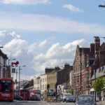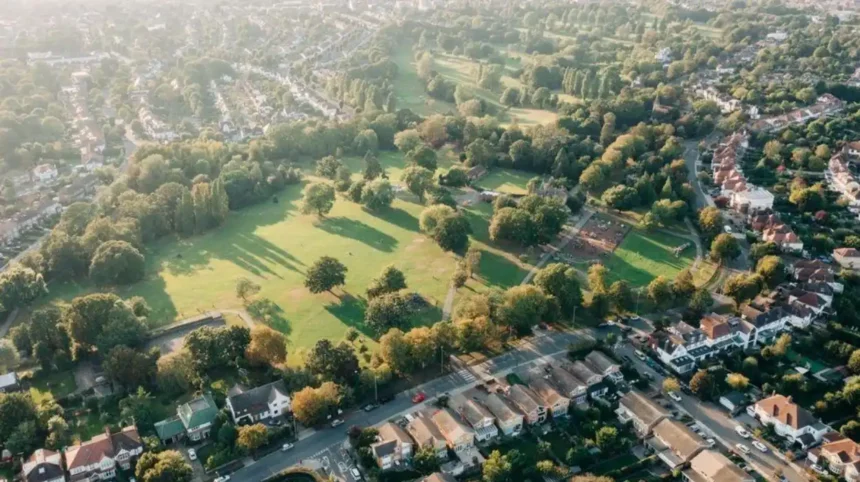
Barnet is one of North London’s largest boroughs and is well connected to central London by Underground, National Rail and bus services. Its combination of urban centres, historic villages, parks, open spaces, shopping areas and cultural attractions makes car-free travel practical for visitors.
- Is Barnet easy to visit without a car?
- Which Underground stations are useful for visiting Barnet?
- Can you reach Barnet by train instead of driving?
- How useful are buses for exploring Barnet without a car?
- What can you see in Barnet without a car?
- Is walking practical in Barnet after using public transport?
- How much does car-free travel in Barnet cost?
- Is Barnet suitable for a car-free weekend?
- What should you know before visiting Barnet without a car?
- Is visiting Barnet without a car better for a day trip?
- What is the best way to explore Barnet without a car?
For tourists, travelling without a car also simplifies journeys into central London and between neighbourhoods. The key is choosing accommodation and attractions close to a railway or Underground station, then using buses and walking for the final part of each journey.
Barnet’s transport network is centred on the Northern line, National Rail stations such as New Barnet and Mill Hill Broadway, and a large network of London buses. TfL also provides journey-planning information and contactless payment options across much of the network.
Is Barnet easy to visit without a car?
Yes, Barnet is straightforward to visit without a car because Underground, National Rail, bus, walking and cycling options connect its principal centres, residential areas, parks and attractions with wider London. The Northern line provides particularly useful access from High Barnet towards central London.
The most important factor is location. Barnet is a large borough rather than a single compact visitor district. Travel times therefore differ significantly between High Barnet, Mill Hill, Finchley, Hendon, Edgware, Whetstone and other neighbourhoods.
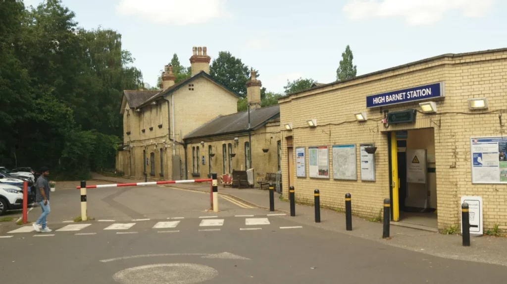
High Barnet has a Northern line Underground station at the northern end of the High Barnet branch. The line then serves Totteridge & Whetstone, Woodside Park, West Finchley, Finchley Central, East Finchley and Highgate before continuing towards central London.
National Rail provides another important option. New Barnet and Oakleigh Park are listed within the Thameslink station network, while Mill Hill Broadway also provides rail connections.
Buses fill the gaps between stations and destinations. They are particularly useful where an attraction sits away from a railway station or where travelling between two parts of the borough without entering central London is more convenient.
Walking also plays an important role. Many of Barnet’s town centres contain shops, cafés, restaurants, parks and local services within walking distance of public transport stops.
For visitors, this means a car is not a prerequisite for exploring Barnet. A well-planned itinerary based around one transport corridor is usually more efficient than attempting to cross the entire borough repeatedly.
Which Underground stations are useful for visiting Barnet?
The Northern line is the principal Underground route for car-free visitors, with High Barnet, Totteridge & Whetstone, Woodside Park, West Finchley, Finchley Central and East Finchley providing access to different parts of the borough and surrounding North London.
High Barnet is particularly useful for visitors interested in the historic centre around Barnet High Street, Barnet Hill and nearby green spaces. It also provides a direct Northern line connection towards central London.
Totteridge & Whetstone serves the southern part of the borough around Whetstone and Totteridge. Woodside Park provides access to North Finchley and surrounding residential and commercial areas.
West Finchley and Finchley Central are useful for exploring Finchley. Finchley Central is especially important because it sits within a well-established local centre containing shops, restaurants and everyday services.
East Finchley provides another Northern line access point and is well positioned for destinations towards Highgate and the southern part of the borough.
TfL’s published Northern line timetable demonstrates the sequence from High Barnet through Totteridge & Whetstone, Woodside Park, West Finchley, Finchley Central and East Finchley towards Highgate, Archway, Camden Town and Euston.
This makes the Underground particularly valuable for tourists staying elsewhere in London. A visitor does not need to arrange a private transfer to reach Barnet. The Tube provides a direct public transport framework for much of the journey.
Journey planning remains important because the Northern line has different branches and service patterns. Visitors should check the destination shown on the train and confirm the correct branch before boarding.
TfL station information also provides live service information, accessibility details and first and last service information.
Can you reach Barnet by train instead of driving?
Yes, National Rail provides an effective alternative to driving, particularly for visitors approaching Barnet from outside the immediate Underground corridor. New Barnet, Oakleigh Park and Mill Hill Broadway provide useful railway access and connections with wider London and regional destinations.
National Rail is particularly useful for travellers arriving from northern London, Hertfordshire and other parts of southeast England. The exact advantage depends on the visitor’s starting station.
New Barnet is an important railway station in the eastern part of the borough. Oakleigh Park provides another rail option around Whetstone and nearby neighbourhoods.
Mill Hill Broadway is especially relevant for visitors travelling towards Mill Hill. It sits on the Thameslink network and provides connections towards central London and destinations beyond the capital.
Thameslink’s station information lists New Barnet, Oakleigh Park and Mill Hill Broadway within its wider station network.
Rail travel also provides a useful option when accommodation is closer to a National Rail station than a Tube station. There is no requirement to travel through central London simply because Barnet is part of the capital.
Visitors arriving at a railway station can complete their journey on foot or by local bus. The best choice depends on the destination, luggage and walking distance.
For business travellers, National Rail can also reduce unnecessary transfers when a destination sits close to a railway station. For leisure travellers, it creates an alternative route when the Northern line is not the most direct option.
The practical lesson is simple: search for the nearest National Rail station as well as the nearest Underground station when planning a Barnet visit.
How useful are buses for exploring Barnet without a car?
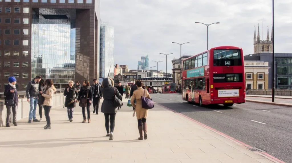
Buses are essential for car-free travel across Barnet because they connect Underground and railway stations with neighbourhoods, shopping centres, parks and destinations outside the immediate walking radius of major stations. They also provide flexible local journeys without requiring private transport.
London’s bus network is particularly valuable in a borough as geographically extensive as Barnet. Rail services concentrate on specific corridors, while buses connect areas between and beyond those corridors.
A visitor can therefore combine modes. A typical journey can involve an Underground train to High Barnet followed by walking. Another itinerary can involve National Rail to New Barnet followed by a local bus.
Buses are also useful for short journeys where taking the Underground would require travelling south before changing direction. This is especially relevant when visiting neighbouring districts.
TfL operates a cashless bus system. Visitors can pay using contactless payment, Oyster or relevant travel products. TfL also states that its Hopper fare allows unlimited bus journeys within one hour when eligible pay-as-you-go payment is used.
This fare mechanism is useful for visitors making short local connections. It also makes combining two bus journeys more practical when an itinerary involves a change of route.
Children and eligible concessionary travellers have additional fare arrangements. Barnet Council states that children under five travel free on TfL services when accompanied by an adult with a valid payment method or ticket, while specific Zip Oyster arrangements apply to older children.
For visitors, the best approach is to use TfL’s journey planner before leaving the accommodation. Check the departure point, destination, walking section and service status together rather than relying on a single transport mode.
Buses also provide useful access to parks and open spaces that are not directly adjacent to stations.
What can you see in Barnet without a car?
Car-free visitors can explore historic centres, parks, open spaces, shopping districts, cultural locations and local communities across Barnet by combining public transport with walking. High Barnet, Finchley, Whetstone and Mill Hill provide particularly useful bases for different visitor itineraries.
Barnet’s attractions are distributed across a large geographical area, so planning around clusters is more efficient than attempting to cover every neighbourhood in one day.
High Barnet is one of the strongest choices for a history-focused visit. The area contains historic streets, local landmarks, green spaces and connections to the wider history of the borough.
Visitors interested in the area’s heritage can combine High Barnet Underground station with a walking itinerary through the town centre and surrounding open spaces.
As you explore the modern town, you are crossing land with a deep heritage. Read about the full to understand its origins.
Barnet also contains a substantial collection of parks and open spaces. Barnet Council’s parks directory currently lists numerous sites across the borough, including Barnet Hill open space, Barnet Gate Wood, Highlands Gardens, Jubilee Gardens, King George’s Field and Monken Hadley Common.
Monken Hadley Common is particularly relevant for visitors seeking a green-space experience around High Barnet. It provides an opportunity to combine public transport with walking rather than relying on a car to reach countryside-style surroundings.
Mill Hill offers another useful visitor area. Its parks and open spaces provide a different environment from the denser central parts of London.
Finchley is also suitable for a car-free day because its town centres contain shops, cafés, restaurants and local services close to public transport.
The key principle is clustering. Choose one area, arrive by public transport, explore on foot, then use a bus or train for the next destination.
Is walking practical in Barnet after using public transport?
Walking is practical for completing many Barnet journeys because Underground and railway stations sit near town centres, parks, shops and local services. Visitors should expect longer walking distances when travelling between separate neighbourhoods and should combine walking with buses for wider exploration.
Walking is not simply a backup option in Barnet. It is an important part of the transport system for visitors.
High Barnet is particularly suitable for walking-based exploration because the Underground station provides a clear starting point for reaching the town centre and nearby destinations.
Finchley also provides several walkable local areas around its transport corridors. Whetstone benefits from access to both public transport and local commercial streets.
Walking becomes more important when visiting parks. Green spaces often have multiple entrances and paths rather than a single visitor entrance beside a station.
Barnet Council’s parks directory shows the geographical spread of green spaces, with listings covering areas including Mill Hill, High Barnet, East Finchley, North Finchley, Whetstone and Hadley.
This distribution supports a neighbourhood-based approach. Visitors can select a park close to their chosen transport corridor rather than attempting to cross the borough on foot.
Walking also makes sense for short journeys between cafés, shops and attractions. It avoids waiting for a bus when the destination is only a reasonable walk away.
However, Barnet’s size means visitors should not assume every destination is close together. Check walking distances before setting out, especially when carrying luggage or travelling with children.
Comfortable footwear is practical for sightseeing days that combine Underground travel, buses and walking.
How much does car-free travel in Barnet cost?
The cost of car-free travel depends on the combination of Tube, National Rail and bus journeys, the traveller’s age and ticket type. Contactless and Oyster payment simplify ordinary journeys, while Travelcards and concessionary products provide alternatives for eligible travellers.
TfL’s payment system allows visitors to use contactless payment and Oyster across relevant services. TfL provides journey and payment-history information through its Contactless and Oyster system.
For many short visits, pay-as-you-go travel is straightforward because the traveller pays for individual journeys rather than purchasing a large travel product in advance.
Daily and weekly fare capping also helps regular visitors control transport spending. TfL explains that contactless or Oyster pay-as-you-go travel uses capping arrangements that can provide value when several journeys are made during the same period.
Travelcards provide another option. TfL states that a Day Travelcard provides unlimited travel within its applicable zones for the relevant period.
The right choice depends on the itinerary. A visitor spending most of the day walking around High Barnet and making only two public transport journeys has different needs from someone travelling between several parts of North London.
Children also have specific concessions. Barnet Council confirms free TfL travel for children under five and provides information about Zip Oyster photocards for older children.
Visitors should therefore calculate the complete journey rather than comparing only the cost of a single train or bus.
The financial advantage of going car-free also extends beyond fares. A car-free itinerary avoids fuel, parking charges, parking restrictions and the practical difficulty of finding a space near busy destinations.
Is Barnet suitable for a car-free weekend?
Barnet is well suited to a car-free weekend when visitors organise each day around a transport corridor. A practical itinerary combines one main neighbourhood with nearby parks, restaurants, shops and heritage sites, using the Underground, National Rail or buses between areas.
A weekend itinerary works best when it avoids unnecessary cross-borough journeys.
The first day can focus on High Barnet and nearby green spaces. Arrive by Northern line, explore the town centre on foot, visit nearby parks and use local buses where a destination sits beyond the comfortable walking area.
The second day can focus on Finchley, Whetstone or Mill Hill. National Rail and Underground services provide different access points, while buses connect destinations that are not directly beside stations.
This approach reduces transport complexity. It also leaves more time for sightseeing.
Digital nomads and business travellers can apply the same principle during shorter stays. A visitor with several hours of downtime can select a neighbourhood near the accommodation, work from a suitable local venue, then explore nearby shops, parks or cultural locations on foot.
The transport network also makes Barnet suitable for visitors staying elsewhere in London. A tourist does not need accommodation inside Barnet to explore the borough.
Northern line services connect High Barnet with central London. TfL’s published timetable demonstrates connections from High Barnet through the Northern line corridor towards Euston and other central London locations.
This makes Barnet practical as a day-trip destination from central London as well as a base for exploring North London.
What should you know before visiting Barnet without a car?
The most important preparation is checking the exact destination, nearest station, walking distance and live service information before travelling. Barnet is highly connected but geographically large, so an efficient itinerary depends on matching each attraction with the correct transport corridor.
Start by identifying the neighbourhood rather than searching only for “Barnet”. The borough covers a large area, and High Barnet, Mill Hill, Finchley, Hendon and Whetstone have different transport patterns.
Next, identify the closest Underground or National Rail station. Then check whether the final section is easier on foot or by bus.
TfL station pages provide live service information and accessibility details.
Accessibility is also important. Travellers with mobility requirements should check individual station information before travelling because step-free access varies between stations and routes.
Visitors should also check the final train or Tube service when planning an evening itinerary. Timetables vary by route and date, while planned engineering works can alter normal services.
For buses, check the exact stop rather than relying only on the street name. London bus routes can serve different stops in opposite directions.
Contactless users should use the same card or device consistently when travelling under pay-as-you-go arrangements. Oyster is another option for visitors who prefer a dedicated travel card.
For longer journeys, avoid assuming that the fastest route on a map is the best route in practice. A direct bus can sometimes be easier than a multi-stage rail journey, particularly when travelling with luggage.
Finally, build walking time into the itinerary. Barnet’s attractions are spread across different neighbourhoods, and walking between a station and a destination forms an important part of many car-free journeys.
Explore More Area Guide
How Long Should You Spend in Barnet? North London 2026
Best Time to Visit Barnet: Seasonal Guide North London 2026
Is visiting Barnet without a car better for a day trip?
A car-free day trip to Barnet is practical because public transport provides direct access from central London while buses and walking support local exploration. The strongest itineraries concentrate on one or two connected areas rather than attempting to cover the entire borough.
For a first visit, High Barnet is a logical starting point because the Northern line reaches the area directly.
A visitor can arrive at High Barnet Underground station, explore the local centre, walk towards nearby historic and green locations, stop for food and continue to another nearby destination.
A second itinerary can concentrate on Finchley. The Northern line provides several stations along the Finchley corridor, allowing visitors to select the station closest to their planned activities.
Mill Hill provides another option for travellers who prefer open spaces and a quieter setting. Mill Hill Broadway adds National Rail access to the area’s transport choices.
The borough’s extensive parks network provides a strong reason to travel without a car. Barnet Council’s directory lists 160 park-related results, including open spaces, gardens, playgrounds and woodland sites across the borough.
A car is therefore unnecessary for many visitor itineraries. Public transport provides the long-distance connection, while walking provides the local connection.
The main limitation is not transport availability. It is geographical spread. Barnet is large enough that visitors need to plan around specific districts.
This is why the best car-free itinerary starts with the destination, identifies the closest station, checks the bus connection and then builds a walking route around it.
For tourists, this approach creates a predictable travel structure. For residents, it provides an easy way to explore different parts of the borough without driving. For business travellers, it allows limited free time to be used efficiently.
Barnet’s position within London’s public transport network means that car-free travel is not an exceptional way to visit. It is a normal and practical option supported by Underground, National Rail, bus, walking and cycling infrastructure.
What is the best way to explore Barnet without a car?
The best approach is to combine the Northern line or National Rail with local buses and walking. Use High Barnet for historic exploration, Finchley for urban amenities, Mill Hill for open spaces, and nearby stations as starting points for focused local itineraries.
The Northern line is the most useful backbone for visitors because it links several major Barnet areas with central London.
National Rail provides an alternative for visitors approaching from other parts of London and the wider southeast. New Barnet, Oakleigh Park and Mill Hill Broadway are important stations to consider when planning a route.
Buses then provide the local connections between stations, neighbourhoods and destinations away from railway corridors.
Walking completes the journey. It is particularly useful for town centres and parks where attractions are close together.
The result is a flexible transport system that does not depend on private cars. Visitors can arrive by train, travel locally by bus, walk between nearby attractions and return to the main transport network when needed.
Barnet’s scale means that no single route covers every attraction. The most efficient strategy is therefore geographical rather than purely transport-based: select an area, identify its nearest station, explore locally and then move to the next area.
For a short visit, High Barnet provides one of the clearest car-free starting points. For a longer weekend, combining High Barnet with Finchley, Mill Hill or another connected area provides broader coverage.
Barnet is therefore a realistic destination for tourists without a car. Its transport network supports independent sightseeing, short leisure trips, business downtime and local exploration while avoiding the cost and logistical demands of driving and parking.
Can you visit Barnet without a car?
Yes. Barnet is well connected by the London Underground, National Rail, buses and walking routes. The Northern line provides access to High Barnet, Finchley and several other areas, while buses connect destinations beyond railway stations.