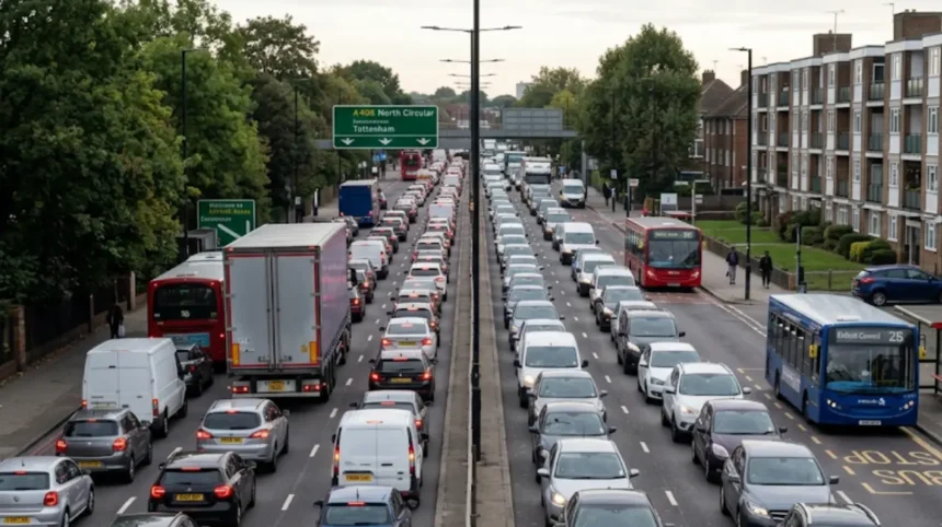
Traffic congestion on Enfield main roads is caused by high car dependency, heavy through‑traffic on strategic routes, limited road capacity, complex junctions, new housing growth, school and commuter peaks, freight movements, and disruption from road schemes and major incidents.
- What is the transport and road network context of Enfield’s main roads?
- How do land use, housing growth and car ownership contribute to congestion on Enfield’s main roads?
- How do junction design, traffic signals and road capacity affect congestion on Enfield’s main routes?
- How do low‑traffic neighbourhoods and local road schemes change congestion patterns on Enfield’s main roads?
- How do incidents, construction works and major events cause sudden congestion on Enfield’s main roads?
- What are the social, economic and environmental impacts of congestion on Enfield’s main roads?
- How are authorities and communities in Enfield addressing congestion on main roads and what is the future outlook?
Enfield is a North London borough with a mix of dense urban neighbourhoods and semi‑rural areas. This geography concentrates movement onto a limited number of strategic corridors. Roads such as the A10, A406 North Circular, A1010 Hertford Road and access points to the M25 at junction 25 carry both local journeys and regional through‑traffic, which increases pressure on main routes.
Car ownership and car use are higher than in inner London boroughs, so a large share of trips still happen by private vehicle, especially in areas with weaker rail or Tube access. Peak‑time congestion is intensified by school journeys, commuter trips and freight deliveries that cluster in morning and late afternoon periods. Junction layouts and signal timings on key corridors create recurring bottlenecks where traffic queues build faster than they can disperse.
New housing developments and intensification across North London increase trip demand. More residents mean more daily movements to schools, shops, health services and workplaces, and many of these trips still default to car use. Changes such as low‑traffic neighbourhoods in residential areas are designed to reduce traffic in side streets but also alter where vehicles travel, which can increase perceived congestion on surrounding main roads. Major incidents, including crashes and vehicle fires on the M25 and North Circular near Enfield, sometimes close lanes or entire sections and cause long queues that back up into local roads.
These structural factors mean that congestion in Enfield’s main roads is persistent and not limited to isolated events. Authorities therefore focus on long‑term strategies that address car dependency, road safety and alternative transport options.
What is the transport and road network context of Enfield’s main roads?
Enfield’s road network is structured around strategic corridors such as the A10, A406 North Circular, A1010 Hertford Road and M25 junction 25, which carry local, regional and long‑distance traffic, creating overlapping flows and congestion at key junctions and interchanges.
The London Borough of Enfield sits at the northern edge of Greater London and acts as a gateway between London and Hertfordshire and the wider South East. The borough contains town centres, residential suburbs and some rural areas, with congestion and public transport access varying between wards.
Main roads including the A10 running north–south, the A406 North Circular to the south of the borough, the A1010 Hertford Road and the approaches to M25 junction 25 are key arteries for residents and for transit traffic travelling across London or towards other counties. These corridors interact with local distributor roads, residential streets, bus routes, rail lines and cycling infrastructure.
Collision records cluster on main roads and larger junctions, highlighting safety pressures that interact with congestion because incidents frequently close lanes or reduce capacity. London research shows that main roads carry a high proportion of bus services, construction traffic, freight and servicing trips, so a single corridor often serves multiple functions. In Enfield, Hertford Road and Green Lanes illustrate this, as they carry bus flows, local shopping access and through‑traffic in the same constrained road space.
Enfield’s main roads also tie into orbital routes. The nearby stretches of the M25 experience substantial traffic and occasional severe disruption, such as lane closures following serious incidents. When these events occur, diversion routes send drivers onto Enfield’s local roads, increasing congestion beyond normal patterns. This network context explains why congestion is recurring and why local road discussions quickly become borough‑wide and even regional questions.
How do land use, housing growth and car ownership contribute to congestion on Enfield’s main roads?
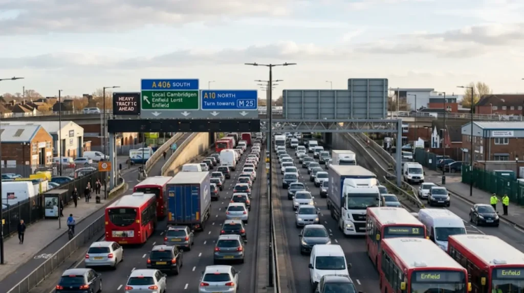
High car ownership, dispersed housing patterns and intensifying developments increase trip volumes on Enfield’s main roads by concentrating journeys onto a limited set of corridors, especially in areas with weaker rail and Tube coverage and limited alternatives to private cars.
Enfield’s land use combines town centres such as Enfield Town, Edmonton and Palmers Green with lower‑density residential suburbs and industrial or employment sites. This pattern produces a mix of local shopping, commuter and service trips that often rely on main roads to connect neighbourhoods to centres and workplaces.
Outer London locations like Enfield have higher levels of car ownership than inner London, reflecting housing types and the role of the borough as a commuter area. More household vehicles translate into more daily car trips feeding into the A10, the North Circular and other main routes. Housing growth and intensification increase population and trip demand. New flats and estates generate additional journeys for education, retail, health and leisure, and many of these journeys still rely on the road network.
Where new homes are not well integrated with high‑quality public transport, walking and cycling links, residents are more likely to depend on cars. On main roads, this growth shows up as longer peak‑time queues, more stop‑start movement at junctions and greater sensitivity to small disruptions. Traffic theory and London congestion studies show that once roads operate near capacity, modest increases in flow create disproportionate increases in delay.
Because car dependency is structurally embedded in land use and housing patterns, congestion persists over many years. Small road layout changes alone rarely remove congestion. Enfield therefore links housing and transport planning, emphasising sustainable access to new developments to reduce future pressure on main routes.
How do junction design, traffic signals and road capacity affect congestion on Enfield’s main routes?
Limited carriageway width, complex signalised junctions, pedestrian crossings, side‑road access and heavy bus movements constrain capacity on Enfield’s main roads, creating bottlenecks where queues form faster than they clear and minor incidents quickly trigger widespread congestion.
Critical junctions on main routes play a decisive role in how congestion forms. Intersections along the A10, junctions connecting to the A406 North Circular and major crossroads on the A1010 Hertford Road and Green Lanes are key examples. At these locations, capacity is limited by the number of lanes, the presence of turning pockets and the need to allocate green time for multiple movements, including buses, pedestrians and cyclists.
When traffic demand exceeds practical junction capacity, queues build up during each signal cycle and extend upstream along the route. High collision records on some main‑road junctions suggest that operational stress and complex layouts contribute both to safety problems and unreliable journey times. Signalised pedestrian crossings and bus stops near junctions improve accessibility and public transport, but they also require vehicles to slow or stop more often, reducing effective capacity during busy periods.
Side‑road access and turning movements interrupt flow, particularly where right turns cross oncoming traffic or share limited lane space with straight‑ahead movements. London congestion research shows that when a corridor runs close to capacity, small speed reductions or lane blockages sharply increase journey times. In Enfield, temporary works or minor incidents at junctions quickly extend queues, affect bus reliability and disrupt freight schedules.
Because drivers experience these bottlenecks daily, junctions become focal points in local debates about congestion. Residents call for changes to signal timings, turning restrictions or road widening, while transport authorities balance these requests against safety, environmental and budget considerations.
How do low‑traffic neighbourhoods and local road schemes change congestion patterns on Enfield’s main roads?
Low‑traffic neighbourhood schemes in Enfield reduce vehicle movements in residential streets by filtering through‑traffic, but they also redistribute traffic and have prompted claims that diverted journeys increase congestion and pollution on surrounding main roads.
Low‑traffic neighbourhoods (LTNs) are defined as clusters of residential streets where physical filters, camera‑controlled restrictions and layout changes limit non‑local vehicle access. Their main objectives are to improve safety, reduce traffic danger and cut pollution for people walking and cycling in those areas.
Enfield introduced LTNs in locations such as Fox Lane in Palmers Green. These schemes triggered vigorous local discussion. Supporters argue that LTNs remove through‑traffic from unsuitable residential streets, encourage active travel, improve air quality and reduce noise. Opponents argue that closing or filtering minor roads pushes vehicles onto main roads, increasing queues, emissions and journey times there.
In practice, LTNs change traffic distribution. Some drivers who previously cut through side streets switch to main roads such as Green Lanes, the A105 or parallel corridors. Residents living on these surrounding roads report longer queues and more difficulty turning into side roads, which they attribute to diverted traffic. Over time, travel patterns adjust as some trips change route, time or mode, but in the short term, visible impacts on main‑road congestion can be strong.
Monitoring data, traffic counts and consultation feedback are used to evaluate whether LTNs meet their objectives and how they affect main roads. The presence of LTNs means that congestion in Enfield is not only a question of total vehicle numbers but also of where those vehicles travel and how policy decisions redistribute movement.
How do incidents, construction works and major events cause sudden congestion on Enfield’s main roads?
Crashes, vehicle fires, emergency incidents, roadworks and closures on routes such as the M25, A10 and North Circular reduce capacity, block lanes and trigger long queues that spread onto Enfield’s main roads and local networks.
Beyond day‑to‑day traffic, sudden incidents create acute congestion. Traffic reports for Enfield and its surroundings frequently describe late‑night crashes, multi‑vehicle collisions, and emergency incidents that close roads or lanes for hours. A serious crash or fire on the M25 near Enfield, for example, often leads to lane closures and long queues that extend over several junctions.
When such incidents occur, drivers divert through Enfield to avoid closed motorway stretches, loading additional traffic onto already busy corridors. Similar effects arise from incidents on the A10 and A406 North Circular, where reduced lanes or full closures instantly cut capacity on routes that carry large volumes of traffic.
Construction and roadworks also change congestion patterns. Utility works, resurfacing, junction upgrades and development‑related works introduce temporary signals, narrow lanes or overnight closures. Even short‑term works can create notable delay when they take place on corridors operating close to capacity.
Heavy goods vehicles serving building sites, temporary access arrangements and parking changes near construction zones add friction to traffic flow. Freight and servicing trips are essential to economic activity, but when they occur during peak periods, they interact with commuter and school traffic to amplify congestion. Combined, these factors explain why residents experience both recurring daily congestion and sudden severe disruption linked to incidents and works.
Explore More Help & Resources
What to do about poor estate maintenance in Enfield?
How to Report Broken Street Lighting in Enfield Estates: Simple Steps
What are the social, economic and environmental impacts of congestion on Enfield’s main roads?
Congestion on Enfield’s main roads increases journey times and unreliability, imposes economic costs on businesses and freight, worsens air pollution and noise, contributes to road danger, and shapes political debates over housing, transport fairness and street design.
Congestion is not only a transport problem. Longer and less predictable journey times affect commuters, school pupils and people accessing health and social services. Bus passengers are particularly affected because many routes run along congested corridors and share road space with general traffic. Delays limit access to opportunities and create stress for people who rely on punctual services.
Businesses in town centres, industrial estates and logistics hubs face late deliveries, disrupted supply chains and higher operating costs. Freight operators and service providers must allow more time for journeys, reduce the number of trips completed in a day or face penalties for missed slots. These economic impacts are especially important on routes linking Enfield to the wider London economy and to motorway connections.
Congestion also worsens environmental conditions. Stop‑start traffic produces more emissions and noise than smooth flow at steady speeds. Pollutants such as nitrogen oxides and particulates concentrate along main roads and at junctions with high volumes and low speeds. Residents report concerns about health impacts, especially for children and vulnerable adults living near busy corridors.
Safety impacts are closely linked to traffic levels. Main roads and busy junctions record more collisions, and perceived danger discourages people from walking or cycling along or across these routes. High motor traffic reduces the attractiveness of active travel and contributes to continued car dependency, creating a feedback loop. Housing affordability, transport access and fairness debates intersect here, as some residents feel they must rely on cars due to limited alternatives, even while congestion harms their quality of life.
Community groups and residents’ associations focus on transport issues as part of wider campaigns for safer, healthier and more liveable streets. They raise concerns about rat‑running, speeding, pollution and parking and seek changes that balance movement needs with local wellbeing.
How are authorities and communities in Enfield addressing congestion on main roads and what is the future outlook?
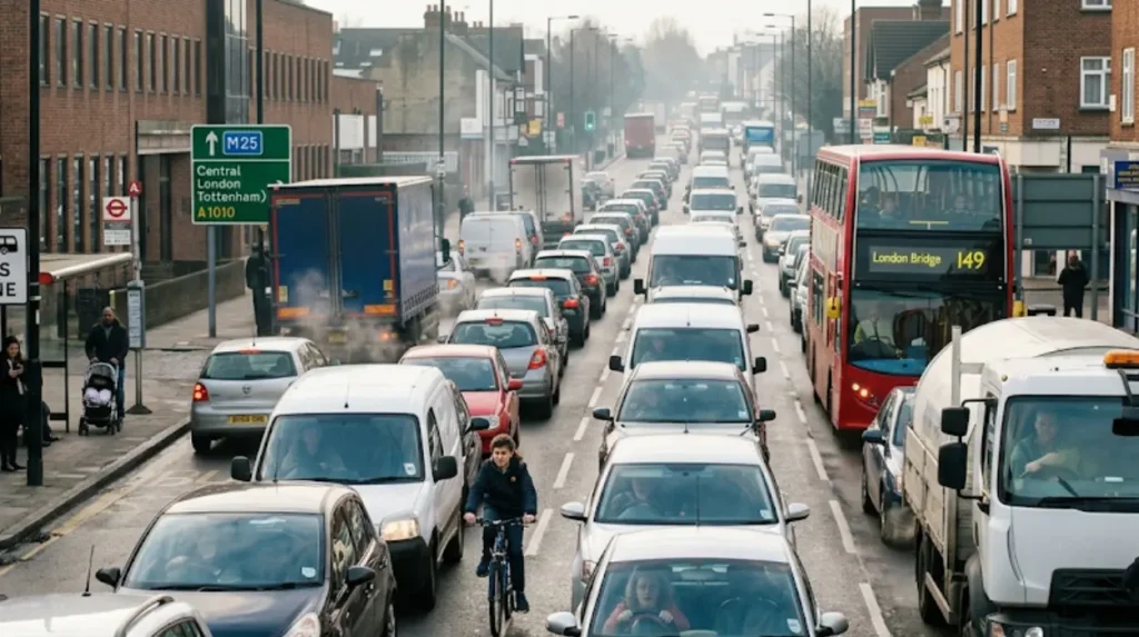
Authorities in Enfield and London address congestion through strategies that promote walking, cycling and public transport, improve safety and street design and manage traffic demand, while residents and councillors debate measures such as low‑traffic neighbourhoods, housing growth and capacity changes.
Enfield Council has adopted transport strategies that link congestion management with broader goals of safety, health and sustainability. These strategies prioritise public transport improvements, walking infrastructure and cycling routes to reduce reliance on private cars. They also focus on safer junction designs, speed management and public realm upgrades to make streets more attractive for short local trips.
At London level, congestion research and policies support demand management, better signal control, smarter freight planning and coordinating land use with transport. These principles filter down to borough projects in Enfield, including bus priority measures, junction optimisation and expansion of cycling networks. Authorities recognise that managing congestion involves changing how people travel, not simply adjusting road layouts.
Local politics and community engagement strongly influence how these ideas are applied. Measures such as LTNs, bus lanes and road filters attract support and opposition. Councillors balance evidence, consultation results and party positions when deciding whether to introduce, retain or remove schemes. Residents’ associations and campaign groups shape the debate by highlighting impacts on specific streets and communities.
The future of congestion on Enfield’s main roads depends on several interacting trends. If more journeys switch to rail, bus, walking and cycling and if new housing is planned around sustainable transport, pressure on main routes can stabilise or even reduce despite population growth. If car dependency remains high and housing intensification continues without parallel transport investment, congestion will remain a central issue in North London.
For planners, businesses and residents, understanding the causes of congestion in Enfield’s main roads helps design responses that address structure rather than symptoms. As the borough evolves, decisions about transport, streets and housing will determine whether these routes continue to function mainly as car corridors or become part of a more balanced, multi‑modal network.
What causes traffic congestion on Enfield’s main roads?
Traffic congestion on Enfield’s main roads is mainly caused by high car dependency, heavy through-traffic, limited road capacity, busy junctions, commuter and school travel, freight movements, housing growth, roadworks and major incidents. Strategic routes such as the A10, A406 North Circular, A1010 Hertford Road and M25 Junction 25 regularly operate close to capacity, making delays a recurring problem.