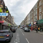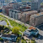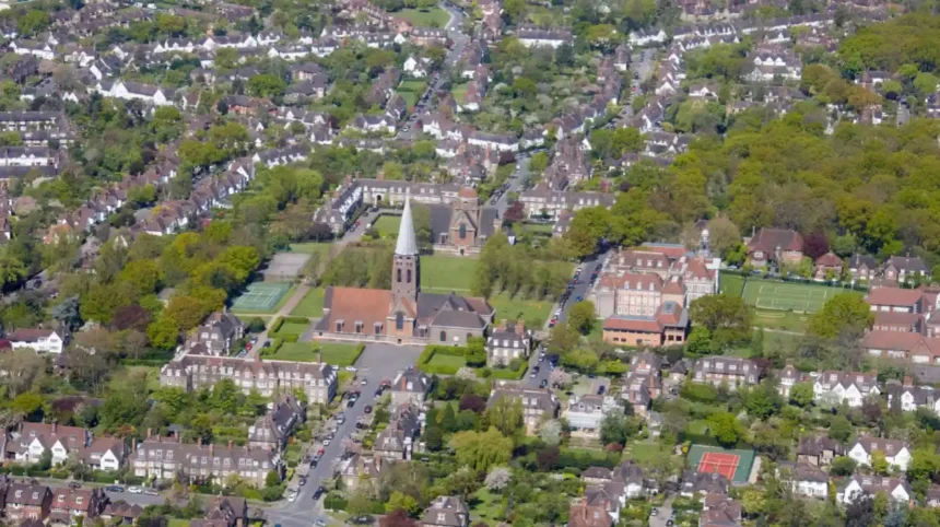
Barnet has undergone significant changes in its residential landscape over the past two centuries. Once characterised by market towns, rural villages, agricultural land and scattered settlements, the North London borough has developed into one of London’s largest suburban residential areas. Housing expansion has transformed its built environment, transport connections, population distribution and local economy.
- What Was Barnet’s Residential Landscape Like Before Major Housing Expansion?
- How Did Railways Transform Housing Development in Barnet?
- How Did Garden Suburbs Change Barnet’s Residential Architecture?
- How Did Post-War Housing Expansion Reshape Barnet?
- Why Did the Green Belt Influence Barnet’s Housing Landscape?
- Which Barnet Neighbourhoods Have Experienced the Biggest Housing Changes?
- How Has Modern Housing Changed Barnet’s Building Design and Urban Layout?
- How Has Housing Regeneration Changed Existing Barnet Estates?
- How Many New Homes Does Barnet Plan to Build?
- How Has Housing Development Affected Barnet’s Green Spaces and Natural Environment?
- How Have Housing Changes Influenced Barnet’s Population and Local Economy?
- How Does Barnet Protect Historic Residential Architecture During New Development?
- What Role Does Transport Infrastructure Play in Barnet’s Future Housing Growth?
- How Will Future Housing Development Continue to Change Barnet?
- What Can Visitors Explore to Understand Barnet’s Changing Housing Landscape?
- Why Is Barnet’s Housing History Important for Understanding Modern North London?
The arrival of railways during the nineteenth century accelerated suburban development. During the twentieth century, new housing estates, garden suburbs and post-war residential schemes extended the borough’s built-up areas. More recently, large regeneration programmes, apartment developments and mixed-use neighbourhoods have reshaped places such as Colindale, Brent Cross, Mill Hill East and West Hendon.
Housing development has also influenced Barnet’s relationship with green spaces, historic buildings and established communities. Planning policies, including Green Belt protection and conservation-area restrictions, continue to influence where and how new homes are built.
Understanding how housing has changed Barnet’s landscape provides insight into the borough’s history, architecture, neighbourhoods and future development.
What Was Barnet’s Residential Landscape Like Before Major Housing Expansion?
Before large-scale suburban expansion, Barnet consisted of historic market towns, rural villages, agricultural fields, woodland and scattered residential properties. Settlements developed around established roads, churches, local markets and transport routes, creating distinct communities separated by open countryside.
Barnet’s early residential landscape differed considerably from its modern suburban character. Much of the area that now forms the London Borough of Barnet contained farmland, pasture, woodland and small settlements.
Chipping Barnet developed as a historic market town along the Great North Road, an important route connecting London with northern England. Its High Street became a centre for trading, accommodation and local services. Inns and market-related businesses supported residents, travellers and agricultural communities.
Finchley, Hendon, Mill Hill, Totteridge and East Barnet also developed as individual settlements. Their buildings reflected local economic activities and the availability of land. Traditional houses, cottages, farmsteads and religious buildings formed important parts of the landscape.
The built environment remained relatively low-density. Houses generally occupied smaller groups around established streets rather than forming the extensive residential estates visible today.
Agriculture influenced land ownership and settlement patterns. Fields, pasture boundaries and rural tracks established physical structures that later influenced road layouts and property development.
The historical development of Chipping Barnet is particularly important because its original street network remains visible in the modern town centre. Academic research published in Heritage in 2021 examines how historic roads, land ownership and railway development influenced the area’s later suburban form. MDPI+1
How Did Railways Transform Housing Development in Barnet?
Railway expansion during the nineteenth century made Barnet more accessible to central London, encouraging residential construction beyond established villages. Improved commuting connections increased demand for suburban homes and supported the development of new streets, residential plots and railway-connected neighbourhoods.
Transport infrastructure played a central role in Barnet’s transformation from a collection of settlements into a major suburban residential borough.
The nineteenth-century railway expansion changed how people travelled between North London and central London. Railway stations connected previously rural communities with employment, shopping and educational opportunities across the capital.
Improved accessibility encouraged developers to purchase land and construct housing for households seeking residential space outside central London. Commuters increasingly viewed Barnet as a practical location because railway connections reduced the difficulty of travelling into the city.
The Northern Line subsequently strengthened this relationship between residential development and public transport. Its extension towards High Barnet and connections serving other parts of the borough supported further suburban growth.
Housing development increasingly followed transport corridors. Streets, shops and community facilities developed around stations, creating neighbourhoods with stronger connections to London.
The railway also influenced the architectural character of residential areas. Victorian and Edwardian houses, terraced properties and larger suburban homes became increasingly common in established neighbourhoods.
Chipping Barnet provides an example of how transport influenced settlement development without completely replacing its historic layout. Research into the town’s spatial development identifies the railway’s contribution to growth while highlighting the continued importance of its older street network. MDPI
For visitors, this relationship between transport and housing remains visible around historic railway stations, established shopping streets and residential roads throughout Barnet.
How Did Garden Suburbs Change Barnet’s Residential Architecture?
Garden suburb development introduced planned residential environments combining houses, landscaped streets, gardens and community facilities. Hampstead Garden Suburb became a particularly important example, establishing an architectural identity that continues to influence Barnet’s residential character and conservation policies.
The garden suburb movement introduced a different approach to residential development in North London. Rather than concentrating housing around dense streets, planners incorporated green spaces, gardens, architectural consistency and community facilities.
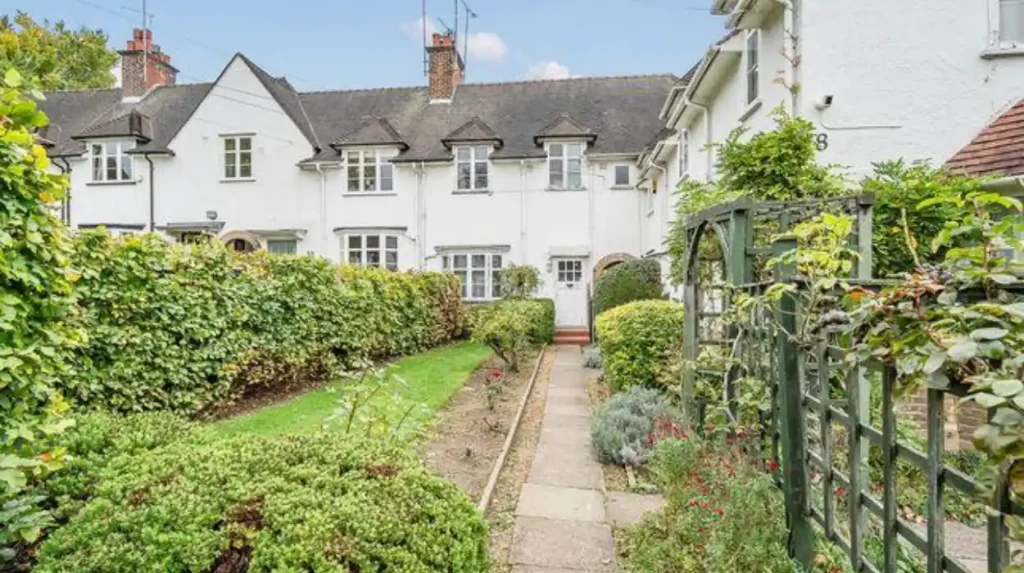
Hampstead Garden Suburb represents one of the most recognisable examples of this approach. Founded in the early twentieth century, it was developed through the vision of social reformer Henrietta Barnett and architect Raymond Unwin, among other contributors.
The neighbourhood incorporated a planned street layout, attractive residential buildings, gardens and communal spaces. Its design established a distinctive relationship between housing and the surrounding landscape.
Different architectural styles appear across the suburb, including Arts and Crafts influences and traditional domestic designs. The layout prioritises residential streets, pedestrian movement and landscaped surroundings.
The development also demonstrates how housing design can influence community identity. Houses, schools, churches, shops and public spaces were considered within a wider neighbourhood framework.
Garden suburb principles influenced residential expectations across Barnet. Houses with private gardens, tree-lined streets and access to open spaces became important characteristics of suburban living.
Hampstead Garden Suburb remains a significant architectural destination for visitors interested in early twentieth-century planning. Its protected historic environment also demonstrates how Barnet balances residential development with architectural preservation.
The wider history of these communities provides essential context for understanding modern housing patterns. Explore the [historical development of Barnet’s villages and suburban communities] to understand how earlier settlements shaped today’s residential landscape.
How Did Post-War Housing Expansion Reshape Barnet?
Post-war housing expansion introduced larger residential estates, new roads and modern housing developments across Barnet. Population growth and changing housing needs encouraged construction around Mill Hill, Edgware, Colindale and other neighbourhoods, permanently changing the borough’s suburban geography.
The period following the Second World War marked another important stage in Barnet’s residential transformation. Housing shortages, population changes and the need for modern accommodation encouraged local authorities and developers to expand residential provision.
New housing estates appeared around established settlements and on previously undeveloped land. Some developments replaced former agricultural areas, while others occupied land associated with military or aviation uses.
Mill Hill experienced residential growth around the former military facilities and surrounding land. Areas north of Edgware also experienced expansion through new housing schemes.
The development of larger estates changed the physical organisation of neighbourhoods. Residential buildings became arranged around planned access roads, communal facilities and open spaces.
One significant example was the development of Grahame Park in Colindale. The estate was constructed on the former Hendon Aerodrome site and became an important example of large-scale post-war residential planning.
The original estate reflected the post-war approach to providing substantial numbers of homes through planned residential development. Its later regeneration demonstrates how housing priorities have changed from estate construction towards mixed-tenure neighbourhoods and improved community facilities.
Barnet Council’s 2010 Characterisation Study records that the introduction of Green Belt protections from 1947 onwards restricted expansion around New Barnet and Chipping Barnet. It also identifies the 1970s as another major period of estate development, including Grahame Park.
These changes created the foundation of modern Barnet’s residential geography. Large estates, traditional suburban streets and historic village centres now exist within the same borough.
Why Did the Green Belt Influence Barnet’s Housing Landscape?
The Metropolitan Green Belt restricted uncontrolled outward expansion around Barnet and protected important areas of countryside from urban development. Its planning role encouraged more concentrated residential growth, particularly around established town centres, transport corridors and previously developed sites.
The Green Belt is a planning designation that protects open land around major urban areas. Its principal purpose is to prevent unrestricted urban sprawl and maintain separation between settlements.
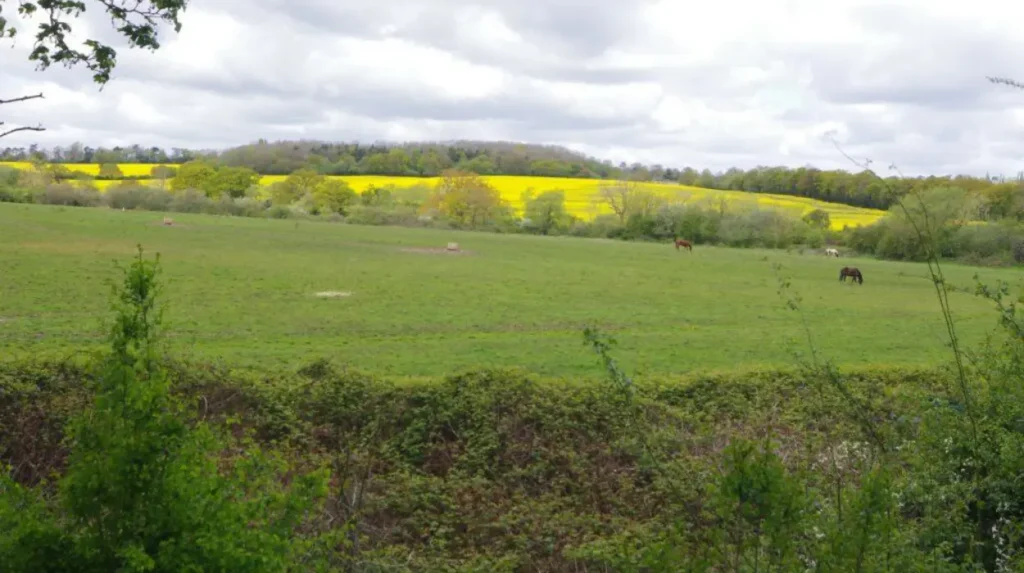
Barnet contains significant areas of Green Belt land, particularly around its northern and north-western neighbourhoods. These areas contribute to the borough’s countryside character and provide opportunities for recreation.
The designation has influenced the location and density of residential development for several decades.
Instead of allowing housing to expand continuously into surrounding countryside, planning restrictions have encouraged development within existing urban boundaries. Brownfield sites, town centres and areas with public transport connections have consequently become important locations for new housing.
Brownfield land means previously developed land that has the potential for redevelopment. Former industrial premises, underused commercial buildings and outdated residential estates are examples of sites that can accommodate new homes.
The Green Belt also contributes to the identity of neighbourhoods such as Totteridge and Mill Hill. Their relationship with open landscapes distinguishes them from more densely developed parts of the borough.
However, protecting open land creates challenges for housing delivery. Barnet must balance demand for additional homes with environmental protection, infrastructure capacity and the character of existing communities.
Green Belt restrictions do not mean that every form of development is automatically prohibited. National planning policy establishes specific circumstances in which development can be considered, subject to relevant planning requirements.
For visitors, the Green Belt provides an opportunity to experience a different side of Barnet. Countryside landscapes, walking routes and historic villages remain accessible within a borough that is otherwise strongly connected to metropolitan London.
Which Barnet Neighbourhoods Have Experienced the Biggest Housing Changes?
Colindale, Brent Cross, Cricklewood, West Hendon and Mill Hill East have experienced particularly significant residential transformation. Their development includes new apartment buildings, estate regeneration, mixed-use neighbourhoods and improved connections between homes, transport and local services.
Housing development has not occurred evenly across Barnet. Different neighbourhoods have experienced different forms of residential change according to land availability, transport infrastructure, planning policies and local regeneration programmes.
The most significant examples illustrate how the borough has moved towards higher-density and mixed-use development.
Colindale
Colindale has become one of Barnet’s most prominent residential growth areas. Former industrial, institutional and aviation-related sites have been redeveloped into modern housing neighbourhoods.
Colindale Gardens is an important example of this transformation. The development incorporates apartments, landscaped public spaces and facilities designed to support a growing residential population.
The wider area also benefits from Colindale Underground station, which provides Northern Line connections to central London.
Residential expansion has increased the importance of local shops, schools, healthcare facilities and pedestrian connections. Colindale illustrates how a neighbourhood can transition from an employment and institutional landscape into a substantial residential destination.
Brent Cross and Cricklewood
Brent Cross and Cricklewood form another major focus of Barnet’s regeneration strategy.
The wider Brent Cross Cricklewood programme aims to transform an extensive urban area through new homes, commercial premises, transport improvements and public spaces.
The development is particularly important because it connects residential construction with economic regeneration. New housing is planned alongside employment opportunities, retail facilities and transport infrastructure.
Brent Cross West railway station opened in December 2023, strengthening public transport connections for the regeneration area.
The wider development programme also includes plans for a new metropolitan town centre and a substantial regional park.
West Hendon
West Hendon demonstrates how estate regeneration has changed established residential environments.
The area includes the West Hendon Estate regeneration programme, which is transforming older social housing through phased redevelopment and replacement homes.
Its location near the Welsh Harp Reservoir creates a distinctive relationship between residential construction and open water landscapes.
The redevelopment approach combines new homes with improvements to public spaces and local facilities. It also raises important questions about maintaining community connections during long-term construction programmes.
Mill Hill East
Mill Hill East has experienced residential expansion through planned development around existing transport infrastructure.
The former Inglis Barracks site became an important location for new housing. Its redevelopment demonstrates how previously developed land can support residential growth without requiring expansion into entirely new countryside.
The neighbourhood’s Northern Line connection also makes it relevant to London’s wider commuter housing market.
Together, these developments show that Barnet’s modern housing landscape is increasingly shaped by regeneration, brownfield redevelopment and transport-connected residential growth.
How Has Modern Housing Changed Barnet’s Building Design and Urban Layout?
Modern housing has introduced higher-density apartment developments, mixed-tenure buildings, landscaped communal areas and integrated commercial facilities. These changes contrast with traditional detached and semi-detached suburban housing, creating a more varied residential environment across Barnet.
Barnet’s residential architecture reflects several periods of British housing development.
Traditional neighbourhoods contain Victorian terraces, Edwardian houses, detached homes and semi-detached properties. These buildings generally have individual gardens, established street patterns and relatively low residential density.
Modern developments use different architectural and planning approaches.
Apartment buildings have become increasingly visible in areas experiencing major redevelopment. They allow developers to accommodate more households on sites that previously contained fewer buildings or outdated commercial facilities.
Mixed-use development is another important feature. This approach combines residential accommodation with other functions, such as retail units, offices, restaurants and community facilities.
Some schemes also incorporate shared gardens, landscaped courtyards, pedestrian routes and cycle storage. These facilities aim to support everyday residential activities within larger developments.
Housing tenure has also become more varied. New schemes include private-sale properties, affordable housing, social rent and shared ownership.
Affordable housing refers to housing provided at below-market prices or rents under recognised housing programmes. Shared ownership allows eligible buyers to purchase a proportion of a property while paying rent on the remaining share.
This mixture of housing types influences the social and physical character of new neighbourhoods.
The changing architecture also creates a contrast between older residential streets and modern regeneration sites. Visitors exploring Colindale, Brent Cross and traditional parts of Finchley can observe these differences across relatively short distances.
How Has Housing Regeneration Changed Existing Barnet Estates?
Housing regeneration has replaced or improved ageing residential buildings while introducing new homes, public spaces and community facilities. Programmes in Grahame Park and West Hendon demonstrate how redevelopment addresses building conditions, housing supply and changing neighbourhood requirements.
Estate regeneration involves the redevelopment or improvement of existing housing areas. It often includes replacing outdated buildings, improving residential layouts and providing additional homes.
Barnet’s regeneration programmes reflect changes in housing standards and the need to make better use of existing urban land.
Grahame Park provides an important example. Its redevelopment seeks to transform a large post-war estate into a more connected residential neighbourhood.
The programme involves phased construction and changes to the estate’s physical layout. New housing, public spaces and community facilities form part of the wider regeneration approach.
West Hendon is another significant example. The redevelopment of the existing estate introduces replacement housing and additional residential accommodation.
These programmes affect more than the appearance of buildings. They influence how residents access local services, move through neighbourhoods and use communal spaces.
However, regeneration also requires careful management of existing communities. Residents affected by demolition, relocation or phased construction need appropriate housing arrangements and clear communication.
Social housing is particularly important in this context. It provides homes at below-market rents for eligible households and forms a significant part of Barnet’s housing responsibilities.
Barnet Council’s housing delivery programme includes new council homes and affordable accommodation. A council report covering 2025 also recorded the completion of 120 homes at Plot 12 within the Brent Cross Cricklewood regeneration programme, including social rent, shared equity and London Living Rent properties. Delivery a
Regeneration therefore represents a shift from simply constructing additional buildings towards improving the long-term quality and organisation of residential neighbourhoods.
How Many New Homes Does Barnet Plan to Build?
Barnet’s adopted Local Plan 2021–2036 establishes a minimum requirement of 35,460 new homes over 15 years. The strategy directs development towards sustainable locations, including regeneration areas, town centres, transport corridors and previously developed land.
Housing targets provide an important measure of how Barnet intends to manage future population and residential growth.
Barnet Council adopted its Local Plan on 4 March 2025. The document establishes the planning framework for development between 2021 and 2036, replacing the previous Local Plan dating from 2012.
The adopted plan sets a minimum requirement of 35,460 new homes during this period. This represents an average of approximately 2,364 homes annually.
The plan identifies several important locations for accommodating residential growth.
These include Colindale, Brent Cross Cricklewood, Mill Hill East and established town centres. Development around transport infrastructure also forms an important part of the borough’s spatial strategy.
The plan supports a broader approach to urban development. New homes are considered alongside employment, retail, transport, education and public facilities.
Barnet Council’s March 2025 announcement also described an ambition to deliver nearly 44,000 homes by 2036 across its wider growth programme. This wider figure should not be confused with the adopted Local Plan’s minimum housing requirement of 35,460 homes.
Housing delivery remains an important challenge. In July 2026, Barnet Council reported that the borough had averaged 2,157 new homes annually over the previous five years, compared with the existing London Plan target of 2,364 annually.
The council also reported a proposed 38% increase in its future housing target under the Greater London Authority’s draft London Plan. The proposed figure was 3,273 homes annually, an increase of 909 homes. This was a draft proposal rather than an adopted replacement target at the time of the announcement.
These figures demonstrate the scale of residential demand facing Barnet and the importance of long-term planning.
How Has Housing Development Affected Barnet’s Green Spaces and Natural Environment?
Residential expansion has changed the relationship between built-up neighbourhoods and Barnet’s natural environment. Development has increased pressure on some urban sites, while Green Belt protection, landscaping requirements and regeneration planning help preserve important green spaces and ecological connections.
Housing development influences the environment through land use, building density, transport demand and infrastructure requirements.
Barnet contains a mixture of urban neighbourhoods, landscaped residential streets, parks, woodland and countryside. These environments contribute to its distinctive position within North London.
The expansion of residential areas changes how land is used. Agricultural fields and former industrial sites become housing developments, roads, public spaces and community facilities.
Higher-density development also increases the importance of carefully designed outdoor environments. Landscaped courtyards, public gardens, tree planting and pedestrian routes help integrate new buildings into established neighbourhoods.
Three environmental considerations are particularly important.
First, biodiversity protection. Biodiversity means the variety of living organisms within an environment, including plants, insects, birds and mammals. Development planning must consider habitats and the ecological value of individual sites.
Second, sustainable drainage. New housing introduces additional roofs, roads and paved surfaces. Sustainable drainage systems, including rain gardens and permeable paving, help manage surface-water runoff.
Third, access to public green space. Parks and recreational areas provide opportunities for walking, exercise and community activities.
The Welsh Harp Reservoir, officially known as Brent Reservoir, is an important natural and recreational feature near West Hendon. Its surrounding landscape provides a contrast to the nearby residential regeneration areas.
The wider borough also contains open landscapes around Totteridge and Mill Hill, where housing development meets protected countryside.
These environmental considerations influence how Barnet accommodates additional homes without losing the green characteristics that distinguish many of its neighbourhoods.
How Have Housing Changes Influenced Barnet’s Population and Local Economy?
Housing expansion has supported population growth, increased residential demand and encouraged investment in local services. New neighbourhoods create demand for employment, education, healthcare, retail and transport, making housing development an important influence on Barnet’s wider economy.
Residential development changes the economic structure of an area because every additional household requires access to services and infrastructure.
Barnet’s population growth has increased demand for different types of accommodation, including family houses, flats, affordable housing and homes suitable for older residents.
New residential developments also create demand for local businesses. Shops, cafés, restaurants, supermarkets and personal services benefit from additional residents living nearby.
Colindale illustrates this relationship. Residential expansion has increased the importance of local commercial facilities and community infrastructure.
Brent Cross Cricklewood demonstrates an even wider economic connection. Its regeneration strategy combines residential construction with commercial development, employment opportunities, transport improvements and retail activity.
Barnet Council’s adopted Local Plan supports this broader approach. Its development strategy includes provision for up to 67,000 square metres of additional office space across the borough’s town centres and seeks to support 27,000 jobs.
Housing development also affects the local construction economy. Building projects generate employment in architecture, engineering, planning, construction, property management and related professional services.
However, increased housing demand creates challenges.
Growing populations place additional pressure on schools, healthcare facilities, public transport and road networks. Local authorities must coordinate infrastructure investment with residential construction.
Housing affordability is another important issue. Rising demand can make suitable accommodation difficult to access for households on lower and middle incomes.
Affordable housing provision, social rent and shared ownership therefore remain important elements of Barnet’s residential planning strategy.
How Does Barnet Protect Historic Residential Architecture During New Development?
Barnet protects historically important residential environments through conservation-area designations, planning controls and heritage assessments. These measures help retain distinctive architecture, historic street layouts and established neighbourhood character while allowing appropriate improvements and redevelopment.
Barnet’s residential landscape contains buildings and neighbourhoods with architectural and historical importance.
Conservation areas are designated locations recognised for their special architectural or historic interest. Their purpose is to protect the overall character of an area rather than only individual buildings.
Barnet Council identifies 16 conservation areas, including Hampstead Garden Suburb, Golders Green, Mill Hill, Monken Hadley, Totteridge, Finchley Garden Village and Hendon Church End.
These areas demonstrate the architectural diversity of the borough.
Hampstead Garden Suburb is recognised for its planned residential design and landscaped streets. Monken Hadley retains a historic village character, while Finchley Garden Village represents an important example of planned suburban housing.
Conservation-area controls influence building alterations, extensions and demolition. Certain works that normally fall under permitted development rights require planning consent in protected locations.
Article 4 Directions provide additional planning controls. They remove specified permitted development rights, meaning property owners need permission for certain alterations that would otherwise be allowed without a full planning application.
Barnet Council identifies 10 conservation areas covered by one or more Article 4 Directions. Trees within conservation areas also receive legal protection, and relevant works require permission.
These policies influence how modern development takes place near historic residential buildings.
Developers must consider building height, materials, architectural design, street patterns and the relationship between new construction and surrounding properties.
This approach helps preserve Barnet’s architectural identity while allowing its residential landscape to evolve.
What Role Does Transport Infrastructure Play in Barnet’s Future Housing Growth?
Transport infrastructure influences where residential development takes place and how successfully new neighbourhoods function. Barnet’s Northern Line stations, Thameslink connections, railway services and road network support housing growth by connecting residents with employment, education and services across London.
Transport accessibility remains one of the most important considerations in residential planning.
Barnet’s established railway and Underground connections have influenced housing patterns for more than a century. Modern developments continue to prioritise access to public transport.
The Northern Line serves important residential locations, including High Barnet, Mill Hill East and Colindale. These connections support commuting and access to central London.
Thameslink services also connect parts of Barnet with central London and destinations beyond the capital.
Brent Cross West is particularly important for the Brent Cross Cricklewood regeneration programme. The station opened in December 2023 and provides an additional railway connection for the growing development area.
Transport improvements influence the design of new neighbourhoods. Developers increasingly incorporate pedestrian routes, cycle storage and connections to nearby stations.
The relationship between housing and transport also affects residential density. Sites close to railway stations and major public transport routes are often considered suitable for higher-density development.
However, additional homes also increase demand on existing infrastructure.
Planning authorities must consider road capacity, bus services, pedestrian safety, cycling facilities and public transport accessibility when assessing major developments.
For residents and visitors, these connections make it easier to explore Barnet’s different neighbourhoods without relying entirely on private vehicles.
How Will Future Housing Development Continue to Change Barnet?
Future housing development will continue to reshape Barnet through regeneration, higher-density construction, affordable housing provision and improved infrastructure. The borough’s planning priorities focus on accommodating housing demand while protecting historic neighbourhoods, countryside and environmental quality.
Barnet’s residential landscape will continue to evolve as London experiences changing housing requirements and population pressures.
The adopted Local Plan 2021–2036 provides the main planning framework for this transformation. Its policies identify locations for residential development and establish expectations for infrastructure, employment and environmental protection.
Several priorities will influence future housing development.
Affordable housing provision: Increasing the supply of affordable homes remains important for households unable to access private-market accommodation. Social rent and shared ownership schemes form part of this approach.
Urban regeneration: Existing residential estates and previously developed sites provide opportunities for redevelopment. Grahame Park, West Hendon and Brent Cross Cricklewood demonstrate how regeneration can introduce additional homes while improving existing neighbourhoods.
Sustainable construction: New residential schemes increasingly need to address energy efficiency, drainage, biodiversity and carbon emissions. These considerations influence building materials, landscaping and infrastructure design.
Transport accessibility: Development around existing railway stations and public transport connections remains important for reducing dependence on private cars.
Community infrastructure: Additional housing requires investment in schools, healthcare facilities, public spaces and local services.
The proposed housing-target increase announced in July 2026 also demonstrates the growing pressure on Barnet’s planning system. Meeting higher housing requirements will require coordination between the council, developers, infrastructure providers and central government.
Future development will therefore involve more than increasing the number of residential buildings. It will influence the organisation, accessibility and environmental character of the borough.
Explore More Area Guide
Barnet Growth and Regeneration: How North London Is Changing
Which Barnet Streets Are Best for Street Photography?
What Can Visitors Explore to Understand Barnet’s Changing Housing Landscape?
Visitors can explore Barnet’s changing residential landscape through its historic villages, garden suburbs, modern apartment developments and regeneration areas. Hampstead Garden Suburb, Chipping Barnet, Colindale, Mill Hill and Brent Cross provide contrasting examples of architectural and suburban development.
Barnet offers several locations where visitors can observe different stages of residential expansion.
Chipping Barnet: The historic High Street provides an opportunity to explore the borough’s market-town origins. Traditional buildings and established commercial streets illustrate how early settlements developed before extensive suburban expansion.
Hampstead Garden Suburb: This neighbourhood offers examples of early twentieth-century garden suburb planning. Its residential architecture, gardens and communal spaces demonstrate an approach to housing that prioritised planned neighbourhood design.
Colindale: Visitors can observe modern apartment buildings, residential regeneration and the development of new community facilities. The area illustrates the transition from older land uses towards large-scale residential construction.
Mill Hill: The neighbourhood combines established suburban housing, railway connections and newer residential developments. Its relationship with surrounding green spaces provides another perspective on Barnet’s development.
Brent Cross: The regeneration area demonstrates how housing, commercial premises and transport infrastructure are being integrated into a wider urban development programme.
These locations are relevant to visitors interested in architecture, urban planning, local history and suburban development.
They also provide useful examples for digital nomads and business travellers exploring residential areas beyond central London. Local transport connections make it possible to combine neighbourhood visits with other North London activities.
Why Is Barnet’s Housing History Important for Understanding Modern North London?
Barnet’s housing history explains how rural settlements became interconnected suburban communities and modern regeneration centres. Its residential landscape reflects railway expansion, garden suburb planning, post-war estates, Green Belt protection and contemporary housing requirements.
Barnet’s transformation represents a significant part of North London’s wider urban development.
The borough’s residential character was shaped by several overlapping periods. Historic market towns established early settlement patterns. Railway expansion encouraged suburban construction. Garden suburb planning introduced landscaped residential environments, while post-war housing addressed changing accommodation requirements.
More recent developments have introduced higher-density apartment buildings, mixed-tenure neighbourhoods and large regeneration programmes.
These changes have influenced the borough’s architecture, transport network, local economy and environmental planning.
The adopted Local Plan provides a framework for accommodating future housing demand while recognising the importance of established communities and protected landscapes.
For visitors, Barnet’s residential environment offers an opportunity to understand how London’s suburbs have developed over time. Historic streets, planned garden communities, post-war estates and modern regeneration areas collectively reveal the borough’s changing identity.
Barnet is therefore not simply a residential extension of central London. It is a collection of historic and modern neighbourhoods whose development continues to influence the character of North London.
How has housing development changed Barnet over time?
Housing development transformed Barnet from a collection of rural villages, market towns and agricultural landscapes into a major suburban borough. Railway expansion, post-war housing estates and modern regeneration projects contributed to this transformation.