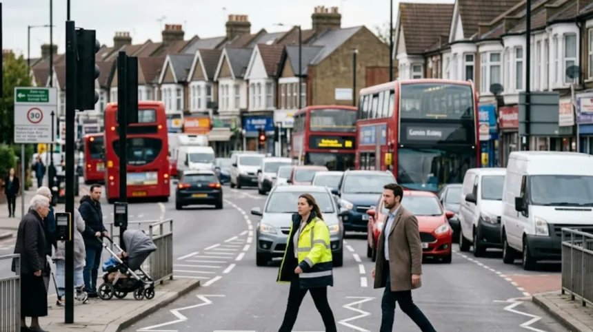
The London Borough of Enfield is an outer London local authority located in North London, encompassing 31 square miles and housing over 330,000 residents. Road safety data from the Department for Transport reveals that motor vehicle volume in Enfield reached 1.128 billion vehicle miles in 2025. High traffic density across major arterial routes, including the A10 Great Cambridge Road and the A406 North Circular Road, creates significant physical hazards for non-motorized road users. Pedestrian safety interventions systematically alter street architecture, regulate vehicle speeds, and reallocate public space to prevent collisions. Achieving long-term casualty reduction requires structural capital investments, regulatory enforcement, and spatial policy integration across all residential and commercial zones in North London.
- What is the current status of pedestrian safety in Enfield?
- How does Vision Zero reduce pedestrian casualties in North London?
- What infrastructure changes improve walking routes in Enfield town centres?
- How do Low Traffic Neighbourhoods protect pedestrians in residential areas?
- What role do 20mph speed limits play in reducing Enfield road danger?
- How do School Streets enhance safety for young pedestrians in Enfield?
- What enforcement measures prevent traffic violations across Enfield roads?
What is the current status of pedestrian safety in Enfield?
The London Borough of Enfield records hundreds of pedestrian casualties annually due to high motor vehicle volumes, major arterial road conflicts, and elevated vehicular speeds. Transport for London collision analysis identifies speed as a contributing factor in 61% of borough collisions.
Road Casualty Data and Urban Geography
Pedestrian danger in the London Borough of Enfield concentrates along high-volume vehicular corridors and congested town centers. The Department for Transport recorded 1.128 billion motor vehicle miles traveled within the borough in 2025, driven by passenger cars, light goods vehicles, and heavy freight vehicles. High-volume primary routes intersect densely populated urban neighborhoods, exposing pedestrians to continuous traffic exposure. Collision statistics collected by Transport for London, the statutory body governing London transport, demonstrate that pedestrian casualties occur predominantly at signalized intersections, uncontrolled side-road junctions, and high-footfall commercial corridors.
Transport for London collision analysis covering a five-year period established that police officers cited vehicle speed as a contributing factor in 61% of all recorded collisions in Enfield. Urban geography amplifies this risk. Eastern areas of Enfield, such as Edmonton and Enfield Highway, contain major freight networks where heavy vehicles share narrow carriageways with vulnerable pedestrians. Socioeconomic analysis published by Transport for London confirms that road danger disproportionately impacts deprived neighborhoods, where pedestrian reliance on walking is higher and access to off-street urban space is limited.
Factors Contributing to Pedestrian Vulnerability
Vehicular speed, carriageway width, and inadequate crossing infrastructure constitute the three primary factors causing pedestrian vulnerability in North London. High vehicle speeds directly lengthen vehicle stopping distances and increase impact force. A motor vehicle traveling at 30 miles per hour requires 23 meters to come to a complete stop, whereas a vehicle traveling at 20 miles per hour stops within 12 meters. Wide multi-lane carriageways without central refuge islands force pedestrians to traverse multiple lanes of traffic simultaneously, increasing exposure duration.
Incomplete footway networks and sightline obstructions further compound pedestrian vulnerability. Guardrails placed at junctions constrain pedestrian movement and force people to cross outside designated signal phases. Commercial delivery vehicles parking on footways obscure sightlines between drivers and pedestrians. Addressing these vulnerabilities requires systematic physical re-engineering of the public highway.

How does Vision Zero reduce pedestrian casualties in North London?
Vision Zero eliminates pedestrian deaths and serious injuries through safe street design, safe speeds, safe vehicles, and post-collision investigations. The policy targets zero transport fatalities across Greater London by 2041 using systematic engineering and strict enforcement protocols.
The Core Pillars of Vision Zero
Vision Zero is an international road safety framework adopted by the Mayor of London and Transport for London in the 2018 Mayor’s Transport Strategy. The framework operates on the principle that human life takes precedence over traffic throughput and that human error must not result in fatal or life-changing injuries. Vision Zero structures road danger reduction across four action areas: Safe Speeds, Safe Streets, Safe Vehicles, and Safe Behaviors.
- Safe Speeds: Implementation of lower speed limits supported by street design and camera enforcement to reduce impact energy in collisions.
- Safe Streets: Physical reallocation of carriageway space to protect vulnerable road users through wide footways and protected crossings.
- Safe Vehicles: Enforcement of direct vision standards for heavy commercial vehicles and mandatory Intelligent Speed Assistance technology on public transport.
- Safe Behaviors: Targeted police enforcement, community speed monitoring, and public education targeting high-risk driving behaviors.
Local Application in the London Borough of Enfield
Enfield Council implements Vision Zero through its statutory Local Implementation Plan, funded by Transport for London. The borough aligns infrastructure capital allocation with high-collision locations identified in Transport for London safety dashboards. Vision Zero targets eliminate the historical policy focus on optimizing vehicle capacity, replacing it with measurable casualty reduction goals.
The application of Vision Zero principles in Enfield involves retrofitting suburban roads built during the mid-twentieth century. The strategy replaces outdated pedestrian guardrails with flush kerbs, installs continuous side-road crossings, and lowers legal speed thresholds across residential and commercial sectors. Empirical data demonstrates that Vision Zero strategies deliver measurable reductions in severity; a study conducted by the London School of Hygiene and Tropical Medicine established that introducing 20mph zones reduces total road casualties by 42%.
What infrastructure changes improve walking routes in Enfield town centres?
Enfield Council improves pedestrian routes by installing raised crossings, widening pavements, reducing corner radii, and constructing continuous footways. Capital projects like the Enfield Town Liveable Neighbourhood reallocate carriageway space from motor vehicles directly to pedestrians.
Street Reconfiguration Techniques
Physical street design governs pedestrian safety by controlling vehicle speeds at point-of-conflict zones. Footway expansion provides dedicated physical clearance for high pedestrian volumes in commercial cores. Narrowing motor vehicle carriageways reduces pedestrian crossing distance and discourages illegal vehicle overtaking. Tightening corner radii at street intersections forces drivers to decelerate to under 10 miles per hour when turning across pedestrian pathways.
Engineers utilize four structural crossing types to secure pedestrian right-of-way, such as Zebra crossings, signalized Toucan crossings, signalized Pelican crossings, and raised continuous side-road crossings. Continuous side-road crossings, also known as Copenhagen crossings, extend the pavement surface directly across side-street entry points without dropping the kerb. This design maintains footway elevation, providing physical and visual priority to pedestrians under Rule 170 of the Highway Code.
The Enfield Town Liveable Neighbourhood Scheme
The Enfield Town Liveable Neighbourhood project represents a £6 million urban regeneration investment funded by Transport for London and Enfield Council. The scheme transforms the commercial centre of Enfield Town, focusing on Church Street, Cecil Road, and Market Square. Prior to intervention, Church Street processed over 10,000 motor vehicles daily, creating severe pedestrian severance between retail centers and public transport hubs.
Infrastructure modifications under the scheme execute specific physical interventions:
- Carriageway Narrowing: Reducing Church Street lanes to single-vehicle lanes in each direction to allocate 1,500 square meters of former road space back to footways.
- Market Square Integration: Eliminating cut-through motor traffic between Market Square and adjacent shopping centers to create an uninterrupted pedestrian plaza.
- Cecil Road Crossing Enhancements: Installing signalized crossings with pedestrian priority phases, replacing staggered refuge islands with single-stage straight-across crossings.
- Public Realm Restructure: Inserting high-grade granite paving, street trees, sustainable drainage systems (SuDS), and seating to calm ambient traffic speeds.
How do Low Traffic Neighbourhoods protect pedestrians in residential areas?
Low Traffic Neighbourhoods protect pedestrians by placing modal filters across residential streets to eliminate motorized cut-through traffic. This physical restriction reduces total vehicle volumes inside residential zones by over 40%, directly mitigating pedestrian injury risks.
Operational Mechanics of Low Traffic Neighbourhoods
Low Traffic Neighbourhoods (LTNs) are spatial traffic management schemes designed to eliminate rat-running in residential areas. Rat-running occurs when motor vehicles divert from primary arterial roads onto narrow residential streets to bypass traffic congestion. LTNs install physical or camera-enforced boundaries called modal filters at strategic street points.
Modal filters permit pedestrians, cyclists, mobility scooters, and emergency vehicles to pass through while preventing private motor vehicles from traversing the full length of the street. All residential properties inside an LTN retain full vehicular access via designated perimeter roads. By removing through-traffic, LTNs convert residential streets into low-volume environments where pedestrian activity occurs with minimal vehicular conflict.
Case Studies: Bowes and Fox Lane Schemes
Enfield Council introduced multiple LTN schemes under its Quieter Neighbourhoods program, including the Bowes Primary Quieter Neighbourhood and the Fox Lane LTN. The Bowes Primary scheme, situated adjacent to the A406 North Circular Road, previously experienced high volumes of commuter traffic bypassing major junction queues.
Enfield Council deployed three primary filter types across these zones, such as physical lockable bollards, green planters, and Automatic Number Plate Recognition (ANPR) enforcement cameras. ANPR cameras scan vehicle license plates, issuing Penalty Charge Notices (PCNs) under the Traffic Management Act 2004 to unauthorized drivers attempting entry, while permitting council services, emergency vehicles, and registered disabled blue-badge holders.
Traffic monitoring data published by Enfield Council demonstrated significant safety gains within the Fox Lane and Bowes intervention zones:
- Traffic Volume Reduction: Internal motor vehicle volumes dropped by 50% to 70% across residential roadways.
- Speed Reduction: Mean motor vehicle speeds inside the residential boundaries fell below 18 miles per hour.
- Casualty Reduction: Department for Transport regional reporting recorded zero fatal or serious pedestrian casualties within active Enfield LTN boundaries during post-implementation monitoring periods.
What role do 20mph speed limits play in reducing Enfield road danger?
Lowering speed limits to 20mph reduces vehicle kinetic energy, shortens braking distances, and enhances driver field of vision. Pedestrians hit by a car traveling at 20mph face a 2.5% mortality risk compared to 20% at 30mph.
Kinetic Physics and Pedestrian Impact Dynamics
The physical mechanics of vehicle-pedestrian collisions dictate that minor reductions in initial speed yield exponential reductions in impact severity. Kinetic energy transferred during an impact is calculated using the formula:
$$E_k = \frac{1}{2}m v^2$$
Where $E_k$ represents kinetic energy, $m$ equals vehicle mass, and $v$ represents impact velocity. Because kinetic energy scales quadratically with speed ($v^2$), a motor vehicle traveling at 30 miles per hour possesses 2.25 times the kinetic energy of the same vehicle traveling at 20 miles per hour.
| Speed Limit | Total Stopping Distance | Kinetic Energy Index | Pedestrian Mortality Risk |
| 20 mph | 12 meters | $1.0\times$ (Baseline) | ~2.5% |
| 30 mph | 23 meters | $2.25\times$ baseline | ~20.0% |
| 40 mph | 36 meters | $4.0\times$ baseline | ~85.0% |
Medical studies published by Transport for London demonstrate that a pedestrian struck by a vehicle traveling at 30 miles per hour is five times more likely to sustain fatal injuries than a pedestrian hit at 20 miles per hour. Furthermore, lowering vehicle speeds widens a driver’s peripheral field of vision from 40 degrees at 30 miles per hour to 100 degrees at 20 miles per hour, significantly improving driver detection of pedestrians stepping off kerbs.
Expansion of Borough-Wide 20mph Zones
Enfield Council expanded 20mph limits across all council-managed residential streets, shopping parades, and town centers. Approximately 27% of borough roads operated under a 20mph limit prior to major expansions initiated under Enfield Transport Strategy updates. The rollout focuses on high-footfall town centers, including Edmonton Green, Palmers Green, Winchmore Hill, and Southgate.
Enfield Council utilizes four traffic calming engineering structures to ensure driver compliance with 20mph zones, such as sinusoidal speed bumps, flat-top speed tables at intersections, speed cushions, and lateral road chicanes. Sinusoidal speed bumps feature a curved entry profile that provides a smooth transition for cyclists while compelling motor drivers to maintain speeds below 20 miles per hour. Flat-top speed tables elevate entire junction areas to footway level, forcing drivers to decelerate and prioritize pedestrians crossing the carriageway.
Explore More Help & Resources
What causes traffic congestion in Enfield main roads?
How to report unsafe bus stops in Enfield?
How do School Streets enhance safety for young pedestrians in Enfield?
School Streets restrict motor traffic outside school gates during peak drop-off and pick-up hours using temporary barriers or ANPR cameras. This intervention eliminates vehicular congestion, removes pedestrian conflict points, and reduces air pollution directly around primary schools.
Operational Framework of School Streets
School Streets are targeted traffic management schemes implemented under the Road Traffic Regulation Act 1984. They temporarily transform carriageways outside educational institutions into pedestrian-and-cycle-only zones during morning drop-off (08:15–09:15) and afternoon pick-up (14:45–15:45) periods. Motorized vehicle access is prohibited during operational hours, except for exempted permit holders such as resident drivers, emergency services, and mobility transport vehicles.
Enfield Council deployed School Streets across multiple primary schools, including St. Paul’s CE Primary School in Winchmore Hill, Oakthorpe Primary School in Palmers Green, and Bowes Primary School. The initiative directly targets child pedestrian casualties; historical data from Transport for London shows child road casualties spike during morning and afternoon school transit hours.
Measured Safety and Environmental Impacts
School Streets resolve pedestrian risk factors outside school gates by eliminating structural hazards:
- Pavement Crowding Relief: Clearing motor vehicles from the street provides additional space for families to walk safely without overflowing into active traffic lanes.
- Elimination of Hazardous Maneuvers: Prohibiting motor vehicles prevents dangerous three-point turns, u-turns, and footway parking outside school entrances.
- Air Quality Improvement: Removing idling motor vehicles lowers concentrations of toxic Nitrogen Dioxide ($NO_2$) and fine particulate matter ($PM_{2.5}$) at child head height.
Independent monitoring conducted across London School Street locations indicates that motor traffic around participating schools decreases by an average of 97% during operational hours. Over 80% of parents and carers consistently report feeling safer walking with their children following scheme installation.

What enforcement measures prevent traffic violations across Enfield roads?
Enfield Council and the Metropolitan Police Service enforce traffic safety using average speed cameras, red-light cameras, mobile speed enforcement units, and ANPR networks. Automated camera systems operating across Greater London reduce fatal and serious pedestrian injuries by 58%.
Automated Enforcement Technologies
Infrastructure re-engineering must be supported by legal enforcement to modify driver compliance. Transport for London and the Metropolitan Police Service operate fixed and mobile camera networks across North London. Safety camera networks exert a direct preventive effect on fatal road incidents. Research published by Transport for London confirms that locations equipped with safety enforcement cameras experience an average 58% reduction in killed or seriously injured (KSI) casualties.
Enfield utilizes four automated camera enforcement technologies to maintain safety compliance across its road network, such as fixed spot-speed cameras, continuous average speed camera networks (SPECS), automated red-light enforcement cameras, and ANPR school street monitoring cameras. Average speed cameras operate over long road corridors, calculating vehicle speed by logging timestamps between two fixed ANPR camera points. On major corridors such as the A10 Great Cambridge Road in Enfield, average speed camera installations prevent drivers from accelerating between individual camera points.
Community-Led Enforcement and Policy Integration
In addition to automated enforcement networks, local policy integrates community-led enforcement frameworks. Community Roadwatch is an operational initiative run jointly by Transport for London, the Metropolitan Police Service, and local residents. Local volunteers join Metropolitan Police officers on residential streets equipped with radar speed measuring devices. Drivers caught exceeding legal speed limits receive formal warning letters from the Metropolitan Police Service, with repeat offenders facing points on their license and financial penalties issued through magistrate courts.
Local authority enforcement powers expanded under Part 6 of the Traffic Management Act 2004 allow Enfield Council civil enforcement officers to issue Penalty Charge Notices for moving traffic violations. Enforcement officers target illegal vehicular maneuvers that put pedestrians at risk, including stopping on yellow zig-zag school entrance markings, driving through pedestrianized footways, ignoring mandatory turn restrictions, and stopping inside box junctions. Integrating physical street design, lower legal speed limits, and automated technology creates a comprehensive system that protects pedestrians across the London Borough of Enfield.
What is the current status of pedestrian safety in Enfield?
Pedestrian safety in Enfield remains a significant concern due to high traffic volumes, busy arterial roads and vehicle speeds. The borough records hundreds of pedestrian casualties each year, with Transport for London identifying speed as a contributing factor in many collisions. Risk is highest on major roads, busy junctions and commercial centres where pedestrians and vehicles interact most frequently.